Blackland TX · ← All the original surveys
John Bowie Survey, Abstract 63
- Granted to
- John Bowie
- Kind of grant
- Headright, first classLand for settlers who were in Texas before independence, 2 March 1836.
- Land Office file
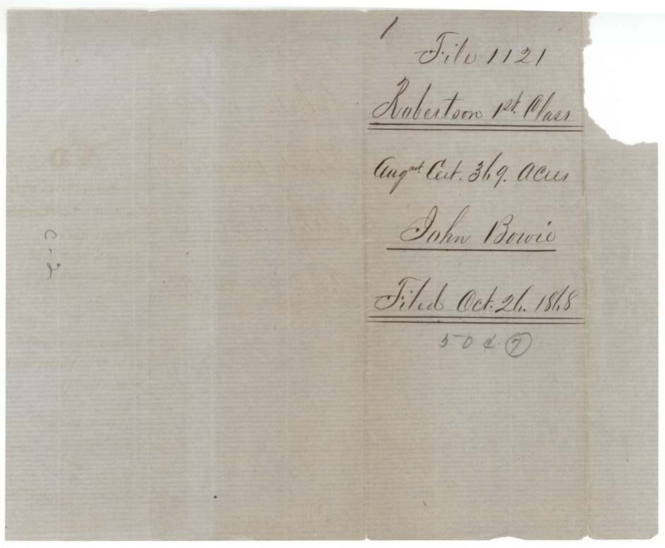
- Robertson 1st class, file 1121
- Certificate
- No. 135
- Acres
- 280
- Patented to
- John Bowie
- Patent
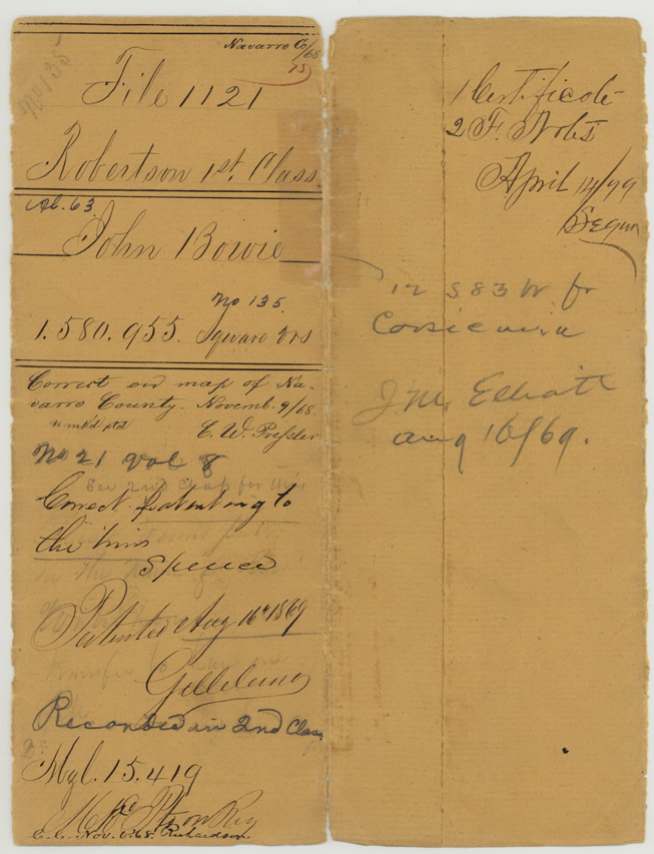
- 16 Aug 1869 · No. 21, Vol. 8
Tap a survey to open its page.
What the file shows
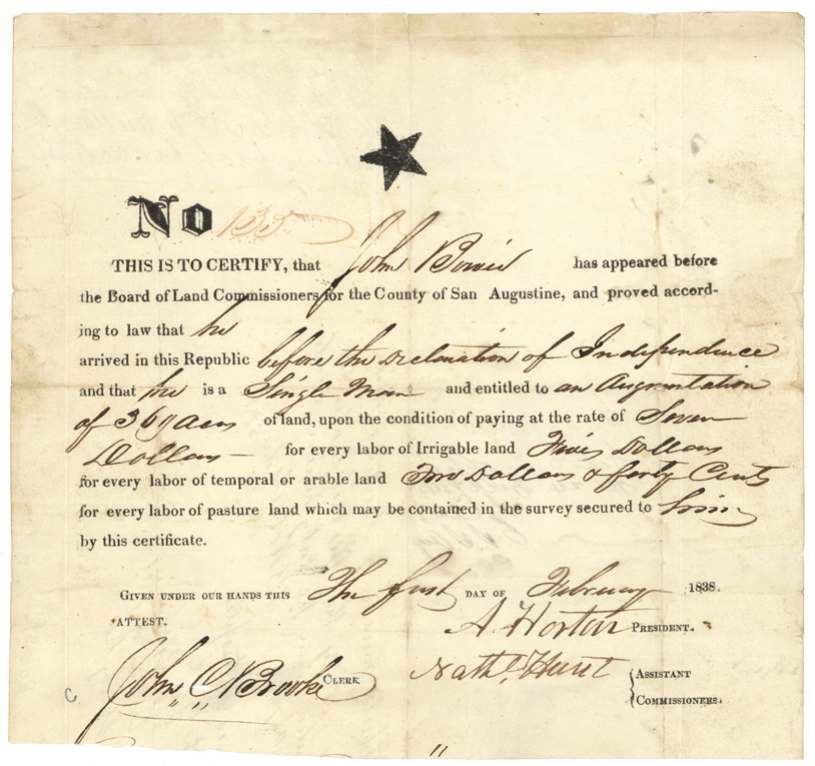
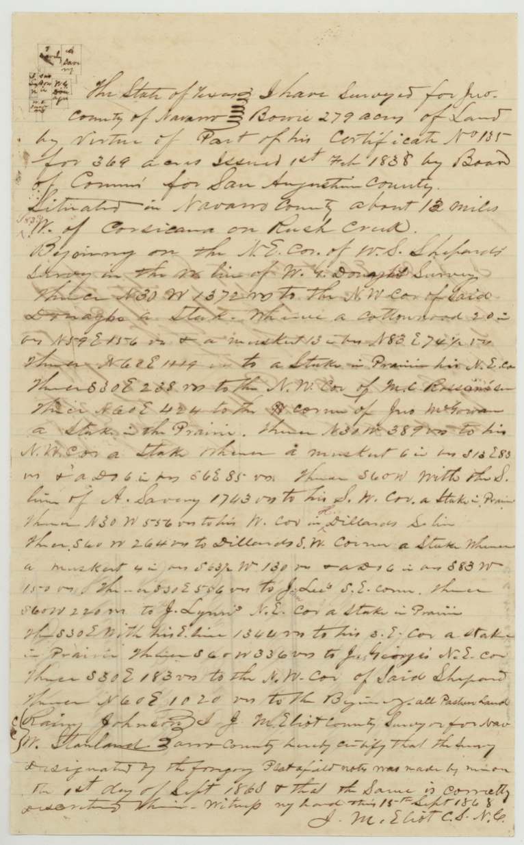
John Bowie proved to the San Augustine County land board that he had come to Texas before the Declaration of Independence as a single man, and on 1 February 1838 received augmentation certificate No. 135 for 369 acres. The certificate spent years in East Texas — notes from 1841, 1845 and 1848 show it was entered and withdrawn around San Augustine and Shelby counties. It was finally used in September 1868, when Navarro County surveyor J. M. Eliot laid off 279 acres on Rush Creek about 12 miles west of Corsicana, fitted between the Shepard, Donagho, Savery, Dillard, Lee, Lynn and George surveys. The General Land Office patented it on 16 August 1869 to Bowie's heirs, delivered to the surveyor J. M. Elliott.
The certificate
headright 1st class (augmentation certificate), No. 135, 369 (augmentation), Board of Land Commissioners for the County of San Augustine — A. Horton, President; Nath'l Hunt, Assistant Commissioner; attest John C. Brooke, Clerk, San Augustine County, 1 Feb 1838.
Proved he arrived in the Republic before the Declaration of Independence and is a single man; entitled to an augmentation of 369 acres
The survey
1868-09-01 (certified 1868-09-15), J. M. Eliot (Elliott).
Navarro County, about 12 miles W of Corsicana on Rush Creek (wrapper: '12 S 83 W fr Corsicana'); 279 acres, 'all pasture land'
Chain carriers: Rainy(?) Johnson, W. Stanland(?).
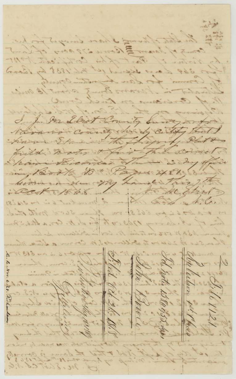
Book B, page 481(?), Navarro County surveyor's office
The patent
16 Aug 1869, No. 21, Vol. 8 (wrapper also: 'Recorded in 2nd Class Vol. 15, 419'), to the heirs (wrapper: 'Correct patenting to the heirs'); index names John Bowie, delivered to J. M. Elliott, Aug 16/69 (wrapper).
Also in the file
- The certificate was issued in 1838 but the land in Navarro County was not surveyed until 1868 — thirty years later, after the Civil War.
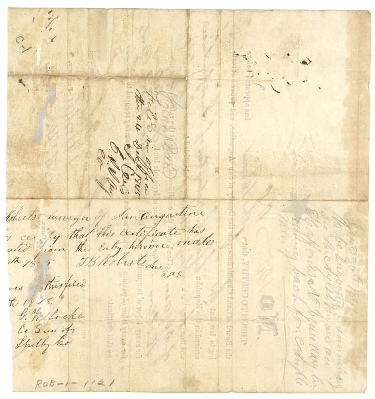
- Before Navarro, the certificate was apparently placed in East Texas: a pencil location from 1841 on a bayou, a San Augustine surveyor's endorsement of 1845, and a Shelby County surveyor's filing note of 1848 are all on its back.
- The wrapper says the patent was to go to 'the heirs', implying John Bowie had died by 1869, though the file holds no heirship proof.
- Only 279 of the 369 acres were used here; the rest of the certificate is not accounted for in this file.
- The patent is noted as recorded in the '2nd Class' volumes though the file is Robertson 1st Class.
- The 1868 survey is an irregular leftover tract fitted between at least nine older surveys, typical of late locations on vacant scraps.
Timeline
- 1 Feb 1838San Augustine County board issues augmentation certificate No. 135 for 369 acres to John Bowie, single man, arrived before the Declaration of Independence
- 30 Jun 1841Pencil note on certificate: to be surveyed on a bayou at Hafford's(?) north boundary
- 1845T. B. Roberts, San Augustine surveyor, endorses the certificate as released from its earlier entry (reading partly lost)
- 24 Dec 1845Certificate filed with the San Augustine county clerk
- 1848Shelby County surveyor G. W. Locke notes a filing on the certificate (date partly lost)
- 1 Sep 1868J. M. Eliot surveys 279 acres on Rush Creek about 12 miles W of Corsicana
- 7 Oct 1868Field notes recorded in Navarro County, Book B p. 481(?)
- 26 Oct 1868Papers filed in the General Land Office
- 9 Nov 1868Checked correct on the Navarro County map
- 16 Aug 1869Patented (No. 21, Vol. 8), to the heirs; delivered to J. M. Elliott
The papers in the file
Every page of the Land Office file, in the order the Land Office keeps them (6 pages). Tap a page to see it larger.
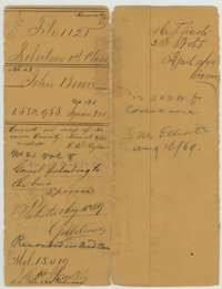 File jacketFile jacket for John Bowie's 279 acres on Rush Creek, Navarro County, Robertson 1st Class, with the patent entry of 16 August 1869.General Land Office, file 1121, page 1 · in the scan
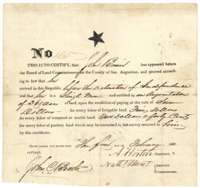 CertificateAugmentation certificate No. 135 for 369 acres, issued to John Bowie by the San Augustine County land board, 1 February 1838.General Land Office, file 1121, page 2 · in the scan
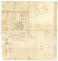 Back of the certificateBack of the Bowie certificate, with endorsements by county surveyors and the county clerk of San Augustine, 1845.General Land Office, file 1121, page 3 · in the scan
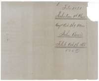 WrapperInner jacket for the Bowie augmentation certificate, marked File 1121, Robertson 1st Class, 369 acres, filed 26 October 1868.General Land Office, file 1121, page 4 · in the scan
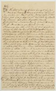 Field notesField notes and sketch of 279 acres on Rush Creek, Navarro County, surveyed for John Bowie by county surveyor J. M. Eliot, 1 September 1868.General Land Office, file 1121, page 5 · in the scan
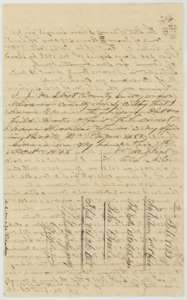 Surveyor's certificateContinuation of the Bowie field notes with county surveyor J. M. Eliot's certificate of October 1868 and the wrapper marked filed 26 October 1868.General Land Office, file 1121, page 6 · in the scan
Scans courtesy of the Texas General Land Office, Austin, from its Land Grant Database.
Neighbouring surveys
Sources
- Texas General Land Office, Land Grant Database: Navarro County, Abstract 63
- The Land Office file, scanned (PDF, at the General Land Office)
- 1924 map: courtesy of the Texas General Land Office, Austin, Map 73249, used under licence. Topo: U.S. Geological Survey, The National Map. Aerial photographs: U.S. Department of Agriculture, National Agriculture Imagery Program, 2012, 2018 and 2022. Survey outlines: Railroad Commission of Texas, Original Texas Land Survey. Grant records and files: Texas General Land Office.