Blackland TX · ← All the original surveys
Alberto Vaughan Survey, Abstract 814
- Granted to
- Alberto Vaughan
- Kind of grant
- Headright, second classLand for settlers who came between independence and 1 October 1837.
- Land Office file
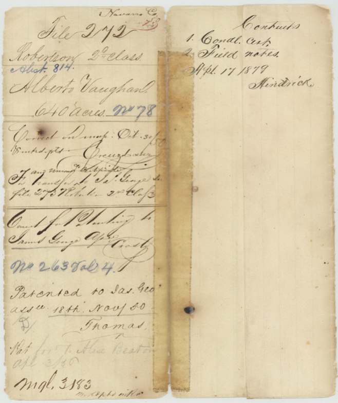
- Robertson 2nd class, file 272
- Certificate
- No. 78
- Acres
- 640
- Patented to
- James George
- Patent
- 18 Nov 1850 · No. 263, Vol. 4
Tap a survey to open its page.
What the file shows
Alberto Vaughan, a married man who arrived in Texas after the Declaration of Independence and before 1 October 1837, received second-class conditional certificate No. 48 for 1280 acres from the Robertson County Board at Franklin on 6 September 1838. Edward Davis surveyed 640 acres on it in October 1838. Deputy surveyor D. R. Mitchell located the 640-acre balance on 19 November 1845 on the head of Cottonwood Creek, a northern branch of Richland Creek, about 11 miles W by S of Corsicana, and recorded it in 1848. Vaughan's right passed to James George (the transfer is in Robertson 2nd file 273), who received the patent on 18 November 1850 (No. 263, Vol. 4); it was forwarded to Alex. Beaton.
The certificate
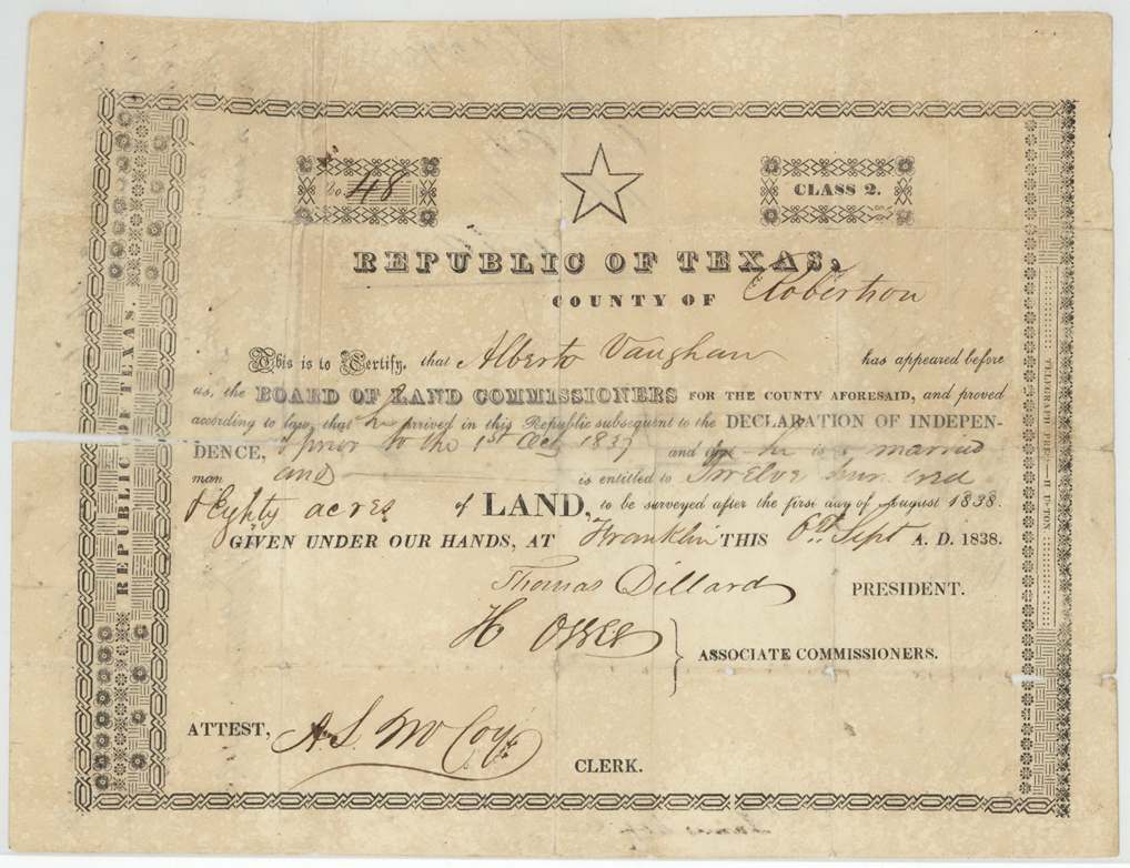
headright 2nd class, No. 48 (jacket reads 'No. 78'), 1280 (this file locates the 640-acre balance), Board of Land Commissioners for Robertson County - Thomas Dillard, President; H. Oseer(?), Associate Commissioner; attest A. S. McCoy(?), Clerk, Franklin, Robertson County, Republic of Texas, 6 Sep 1838.
Alberto Vaughan proved that he arrived in the Republic subsequent to the Declaration of Independence and prior to 1 Oct 1837, and that he is a married man; entitled to 1280 acres, to be surveyed after 1 Aug 1838.
Changes of hand
- not in this fileAlberto Vaughan → James George. Transfer is in Robertson 2nd Class file 273, per jacket.
The survey
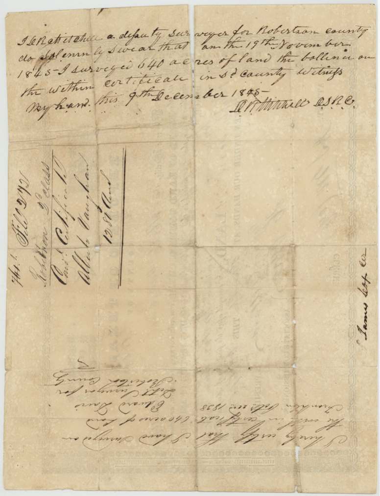
by 1838-10-02, Edward Davis.
640 acres on the certificate; location not given in this file
The survey
19 Nov 1845, D. R. Mitchell.
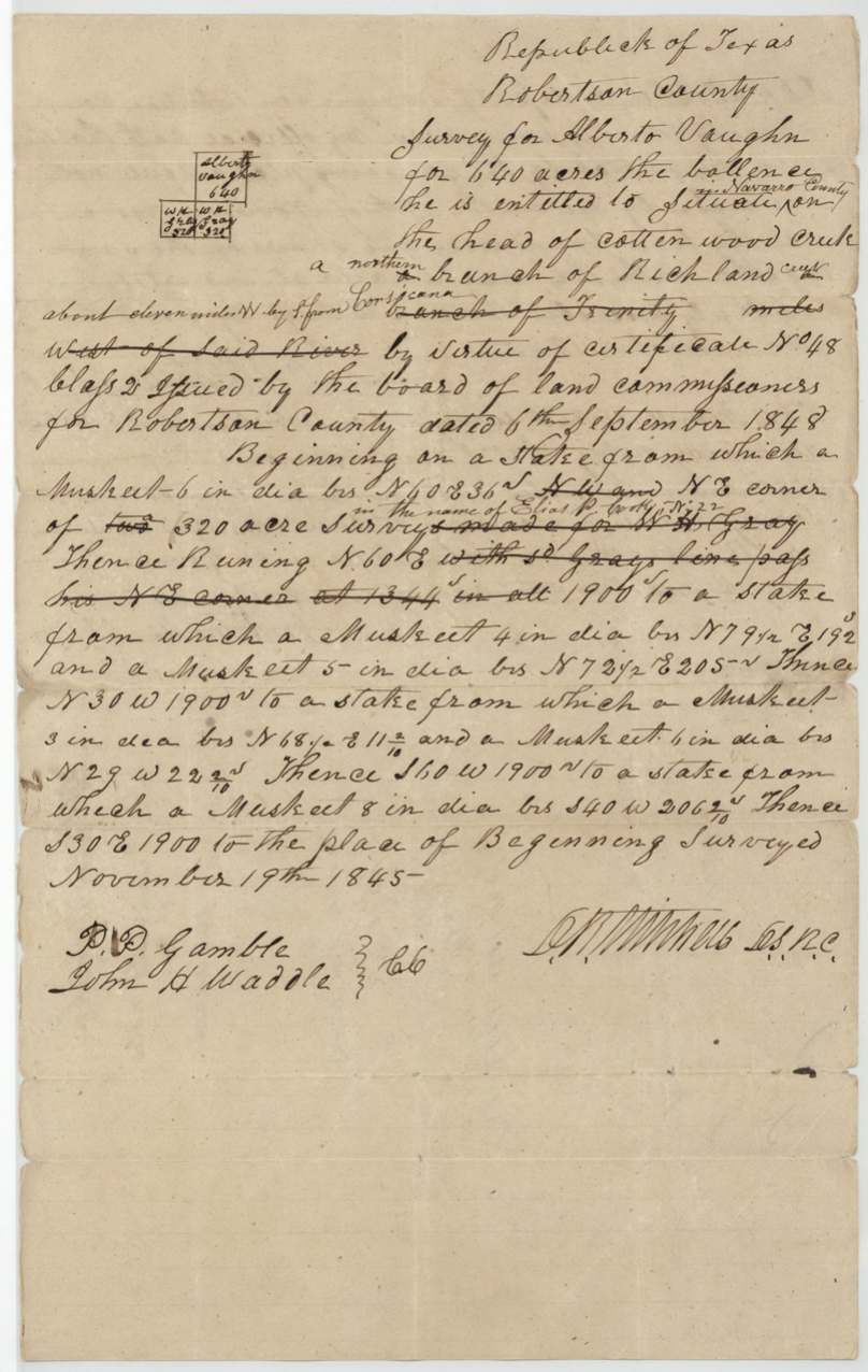
640 acres 'the balance he is entitled to, situated [in Navarro County] on the head of Cotton Wood Creek, a northern branch of Richland Creek, about eleven miles W by S from Corsicana' (struck: 'branch of Trinity ... miles west of said River'). Beginning on a stake (mesquite N 40 E 36 vrs), NE corner of a 320-acre survey in the name of Elias P. Cook(?) No. 22 [struck: 'made for W. H. Gray']; N 60 E [struck: with said Gray's line, pass his NE corner at 1344] in all 1900 vrs (mesquites); N 30 W 1900 vrs; S 60 W 1900 vrs; S 30 E 1900 vrs to beginning.
Chain carriers: P. D. Gamble(?), John H. Waddle.
Robertson District Book M p. 33
The patent
18 Nov 1850, No. 263, Vol. 4, to James George, assignee, delivered to Alex. Beaton ('Pat. fwd. to Alex. Beaton Apl 3/5_').
Also in the file
- Field notes misdate the certificate to 1848 (certificate is 1838).
- D. R. Mitchell surveyed in 1845 as deputy and then examined and recorded his own survey in 1848 as District Surveyor.
- Neighbour first written as W. H. Gray, struck and replaced by Elias P. Cook(?) No. 22.
- Transfer to James George is filed in another file (Robertson 2nd 273).
- Year on the forwarding-to-Beaton note is unclear; reads 'Apl 3/50' but the patent is Nov 1850, so probably 1851.
Timeline
- 1836-03-02/1837-10-01Alberto Vaughan arrives in Texas (per certificate: after Declaration, before 1 Oct 1837)
- 6 Sep 1838Robertson County Board issues 2nd-class certificate No. 48, 1280 acres, married man, at Franklin
- 2 Oct 1838Edward Davis surveys first 640 acres on the certificate
- 19 Nov 1845D. R. Mitchell surveys the 640-acre balance on head of Cottonwood Creek
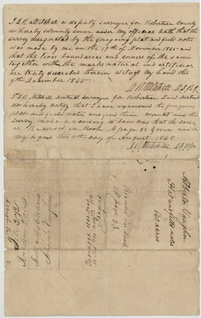
- 9 Dec 1845Mitchell swears to survey
- 8 Aug 1848Recorded Robertson District Book M p. 33
- 30 Oct 1850Map check correct (Creuzbaur)
- 18 Nov 1850Patent No. 263 Vol. 4 to James George, assignee
- 1851-04-03(?)Patent forwarded to Alex. Beaton
The papers in the file
Every page of the Land Office file, in the order the Land Office keeps them (5 pages). Tap a page to see it larger.
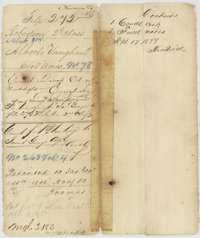 File jacketFile jacket for Alberto Vaughan's headright certificate, with the patent to James George, assignee, noted in November 1850.General Land Office, file 272, page 1 · in the scan
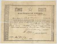 CertificateConditional headright certificate for 1,280 acres issued to Alberto Vaughan by the Robertson County land board at Franklin, 6 September 1838.General Land Office, file 272, page 2 · in the scan
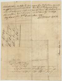 Back of the certificateBack of the Vaughan certificate, with a surveyor's endorsement of 2 October 1838 and D. R. Mitchell's oath of 9 December 1845 on the balance surveyed.General Land Office, file 272, page 3 · in the scan
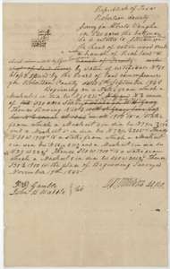 Field notesField notes for the 640-acre balance of Alberto Vaughan's certificate on the head of Cottonwood Creek, surveyed by deputy surveyor D. R. Mitchell, 19 November 1845.General Land Office, file 272, page 4 · in the scan
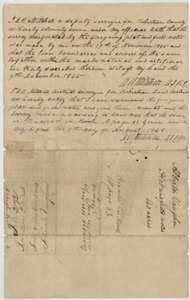 Surveyor's certificateMitchell's oath of 9 December 1845 and his certificate of 8 August 1848 that the Vaughan survey is correct and recorded in Book M, page 33.General Land Office, file 272, page 5 · in the scan
Scans courtesy of the Texas General Land Office, Austin, from its Land Grant Database.
Neighbouring surveys
Sources
- Texas General Land Office, Land Grant Database: Navarro County, Abstract 814
- The Land Office file, scanned (PDF, at the General Land Office)
- 1924 map: courtesy of the Texas General Land Office, Austin, Map 73249, used under licence. Topo: U.S. Geological Survey, The National Map. Aerial photographs: U.S. Department of Agriculture, National Agriculture Imagery Program, 2012, 2018 and 2022. Survey outlines: Railroad Commission of Texas, Original Texas Land Survey. Grant records and files: Texas General Land Office.