Blackland TX · ← All the original surveys
O. B. Munroe Survey, Abstract 596
- Granted to
- O. B. Munroe
- Kind of grant
- Bounty warrantLand paid for service in the army of the Republic.
- Land Office file
- Robertson Bounty, file 776
- Certificate
- No. 1660
- Acres
- 640
- Patented to
- O. B. Munroe
- Patent
- 10 Apr 1860 · No. 163, Vol. 12
Tap a survey to open its page.
What the file shows
O. B. Munroe's 1280-acre bounty certificate for five months' army service in 1837 was issued in July 1854 as a duplicate of lost warrant No. 1432. H. H. Allen, through his agent William M. Love, applied in May 1857 for two 640-acre locations, and deputy surveyor J. M. Eliot ran one on Chambers Creek and one on Richland Creek that summer. After the Commissioner of Claims approved the certificate in March 1860, the patents issued in April 1860 (Abst. 596) and September 1861 (Abst. 597), the second sent to Allen in 1862.
The certificate
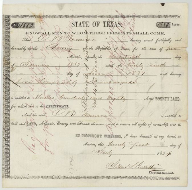
military bounty certificate (five months' service), a duplicate of lost warrant No. 1432, No. 1660, 1280 (located as two 640-acre surveys, Abst. 596 and Abst. 597), State of Texas; James S. Gillett, Adjutant-General, Austin, 21 Jul 1854.
Served faithfully and honourably in the Army of the Republic of Texas five months, 17 Jan 1837 to 29 Jun 1837, and was honourably discharged; entitled to 1280 acres of bounty land
The survey
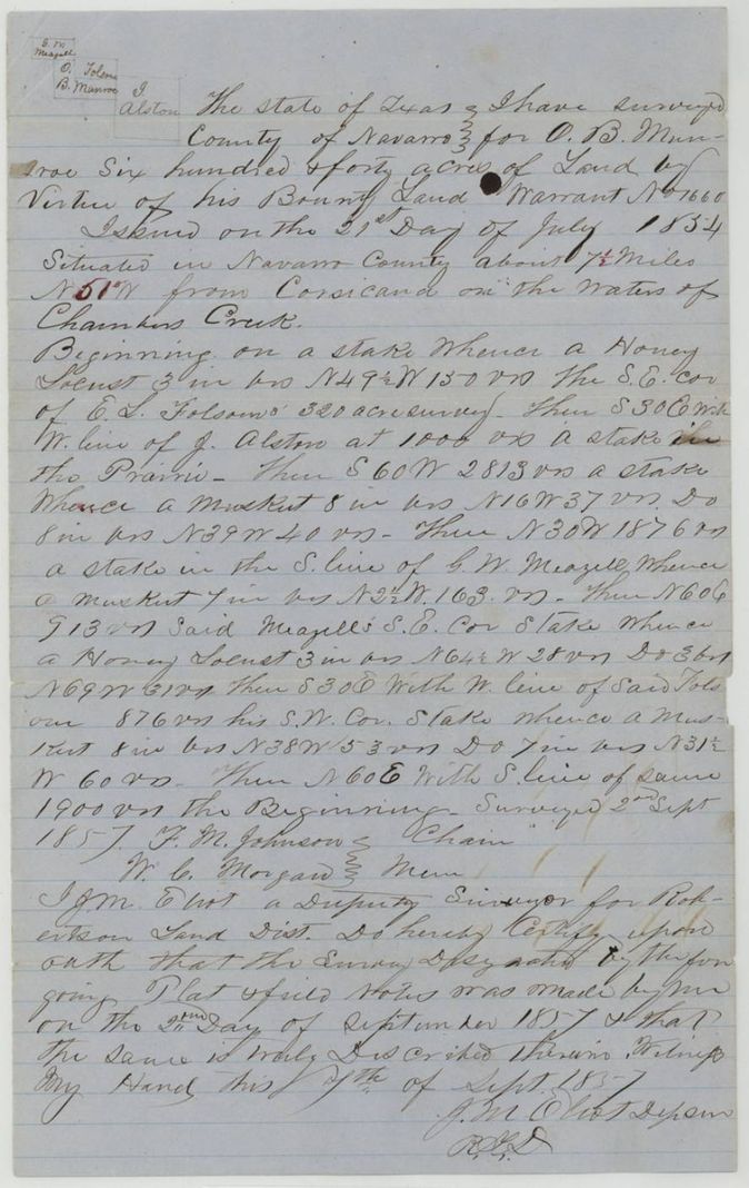
1857-09-02 (certified 1857-09-07), J. M. Eliot, Deputy Surveyor, Robertson Land District (Abst. 596).
Navarro County about 7 1/2 miles N 51(?) W from Corsicana on the waters of Chambers Creek
Chain carriers: F. M. Johnson, W. C. Morgan.
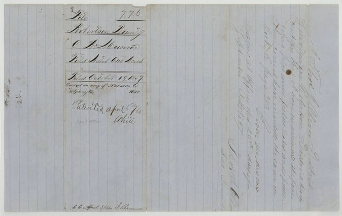
Book R, page 283
The survey
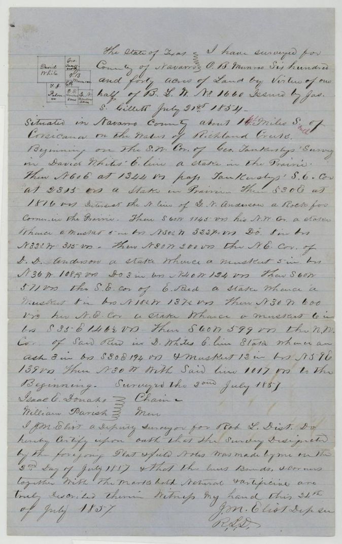
1857-07-02 (certified 1857-07-24), J. M. Eliot, Deputy Surveyor, Robertson Land District (Abst. 597).
Navarro County about 14 miles S of Corsicana on the waters of Richland Creek; red-ink clerk's insertions make it '14 1/2(?) miles S. west'
Chain carriers: Isaac E. Donaho(?), William Parish.
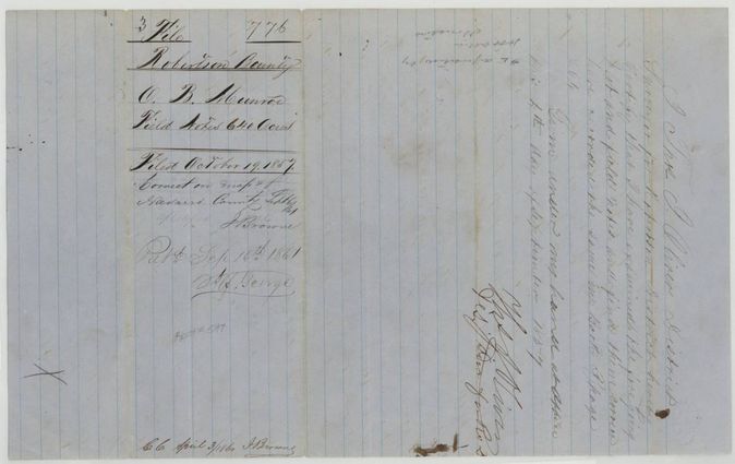
Book R, page 264
The patent
1860-04-10 for Abst. 596 (jacket: 'Patented April 6th 1860'); 1861-09-17 for Abst. 597 (jacket: 'Pat. Sept 16th 1861'), No. 163, Vol. 12 (Abst. 596); No. 557, Vol. 12 (Abst. 597), to O. B. Munroe (per index); the wrapper notes patent No. 557 Vol. 12 'forwarded to H. H. Allen March 6/62', delivered to H. H. Allen (patent 557, 6 Mar 1862); patent 163 'Refd H. H. Allen April 27th 1860'(?).
Also in the file
- Index says Abst. 596 patent 10 Apr 1860 No. 163 Vol. 12, and Abst. 597 patent 17 Sep 1861 No. 557 Vol. 12, both to O. B. Munroe; the jackets and wrappers say 'Patented April 6th 1860' and 'Pat. Sept 16th 1861'. Patent 557 was forwarded to H. H. Allen, and the old wrapper also notes H. H. Allen against April 1860.
- The certificate on file is a duplicate issued for warrant No. 1432, which was lost; it was approved by the Commissioner of Claims only on 29 March 1860, a week before the first patent.
- The patentee is Munroe, but the locating applicant was H. H. Allen through William M. Love, and the patent was sent to Allen; the transfer itself is not in the file ('No transfer Aug 13/58').
- Abst. 596 lies about 7 1/2 miles N 51 W of Corsicana on Chambers Creek; Abst. 597 lies about 14 miles south of Corsicana on Richland Creek - two widely separated tracts on one certificate.
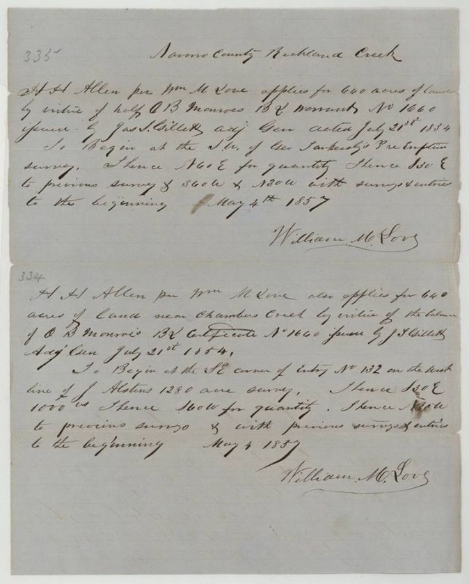
- The two applications match the two surveys: the Richland Creek application (No. 335) begins at Geo. Tankersly's pre-emption, and the 'near Chambers Creek' application (No. 334) begins at Entry No. 132 on J. Alston's 1280-acre survey.
- A note lists patent 557 as 'Sept 1864' in one place; the jacket and index give 1861.
Timeline
- 17 Jan 1837O. B. Munroe begins five months' army service
- 29 Jun 1837Honourably discharged
- 21 Jul 1854Bounty certificate No. 1660 for 1280 acres issued at Austin by Adjutant-General James S. Gillett
- 4 May 1857H. H. Allen, by Wm. M. Love, applies for two 640-acre locations on the certificate
- 2 Jul 1857J. M. Eliot surveys 640 acres on Richland Creek (Abst. 597)
- 2 Sep 1857J. M. Eliot surveys 640 acres near Chambers Creek (Abst. 596)
- 19 Oct 1857Warrant and field notes filed at the General Land Office
- 13 Aug 1858File noted 'No transfer'
- 29 Mar 1860Duplicate certificate approved by the Commissioner of Claims
- 10 Apr 1860Patent No. 163 Vol. 12 (Abst. 596)
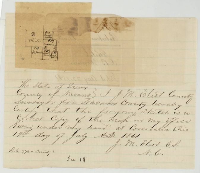
- 19 Jul 1861County Surveyor J. M. Eliot certifies a sketch copy of the map for H. H. Allen
- 17 Sep 1861Patent No. 557 Vol. 12 (Abst. 597)
- 6 Mar 1862Patent 557 forwarded to H. H. Allen
The papers in the file
Every page of the Land Office file, in the order the Land Office keeps them (12 pages). Tap a page to see it larger.
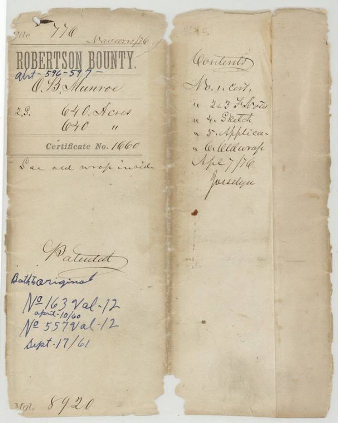
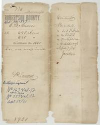 File jacketJacket and contents sheet for file 776, O. B. Munroe, two 640-acre surveys, certificate 1660, patents 163 and 557, Vol. 12.General Land Office, file 776, page 1 · in the scan
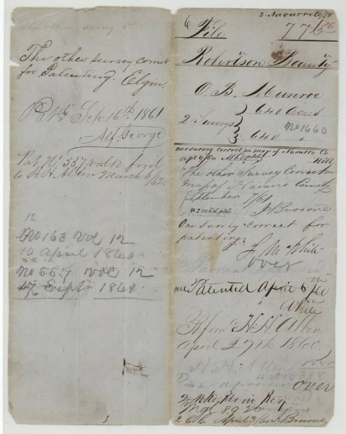
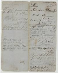 WrapperOld wrapper and notes recording both surveys correct for patenting, patent 557 forwarded to H. H. Allen in March 1862.General Land Office, file 776, page 2 · in the scan
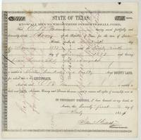 CertificateBounty certificate No. 1660 for 1280 acres to O. B. Munroe for five months' army service in 1837, a duplicate of lost warrant No. 1432, approved 29 March 1860.General Land Office, file 776, page 3 · in the scan
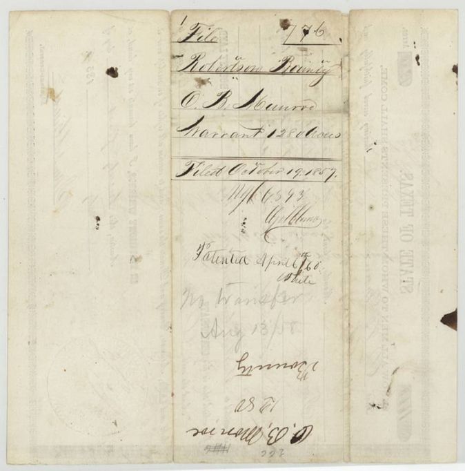
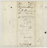 Back of the certificateBack of the certificate, filed 19 October 1857, marked 'No transfer Aug 13/58'.General Land Office, file 776, page 4 · in the scan
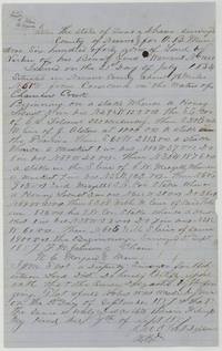 Field notesJ. M. Eliot's field notes for 640 acres on Chambers Creek, 7 1/2 miles from Corsicana (Abst. 596), surveyed 2 September 1857.General Land Office, file 776, page 5 · in the scan
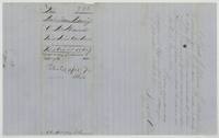 WrapperWrapper of the Chambers Creek field notes, filed 19 October 1857, with Thos. J. Oliver's record in Book R p. 283, 25 September 1857, and 'Patented April 6th 1860'.General Land Office, file 776, page 6 · in the scan
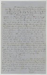 Field notesJ. M. Eliot's field notes and sketch for 640 acres on Richland Creek about 14 miles south of Corsicana (Abst. 597), surveyed 2 July 1857.General Land Office, file 776, page 7 · in the scan
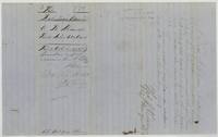 WrapperWrapper of the Richland Creek field notes, filed 19 October 1857, with Oliver's record in Book R p. 264, 4 September 1857, and 'Pat. Sept 16th 1861'.General Land Office, file 776, page 8 · in the scan
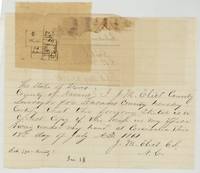 PlatSketch of the neighbouring surveys certified a true copy by County Surveyor J. M. Eliot, 19 July 1861.General Land Office, file 776, page 9 · in the scan
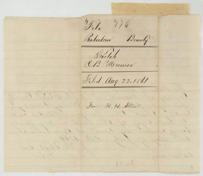
 WrapperBack of the sketch, filed 22 August 1861 for H. H. Allen.General Land Office, file 776, page 10 · in the scan
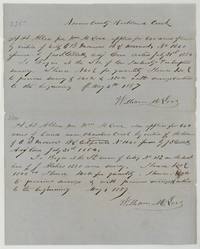 LetterTwo applications by H. H. Allen per Wm. M. Love, 4 May 1857: 640 acres on Richland Creek and 640 acres near Chambers Creek on Munroe's certificate 1660.General Land Office, file 776, page 11 · in the scan
 WrapperBack of the applications, endorsed 'Application' with the number 776.General Land Office, file 776, page 12 · in the scan
Scans courtesy of the Texas General Land Office, Austin, from its Land Grant Database.
On this ground today
- Historical markerEmhouse Baptist Church
Places that stand inside this survey’s lines as the state’s survey map draws them.
Neighbouring surveys
Sources
- Texas General Land Office, Land Grant Database: Navarro County, Abstract 596
- The Land Office file, scanned (PDF, at the General Land Office)
- 1924 map: courtesy of the Texas General Land Office, Austin, Map 73249, used under licence. Topo: U.S. Geological Survey, The National Map. Aerial photographs: U.S. Department of Agriculture, National Agriculture Imagery Program, 2012, 2018 and 2022. Survey outlines: Railroad Commission of Texas, Original Texas Land Survey. Grant records and files: Texas General Land Office.