Blackland TX · ← All the original surveys
Henry Klahn Survey, Abstract 459
- Granted to
- Henry Klahn
- Kind of grant
- Headright, third classLand for later settlers, including the colonists of Mercer’s Colony.
- Land Office file
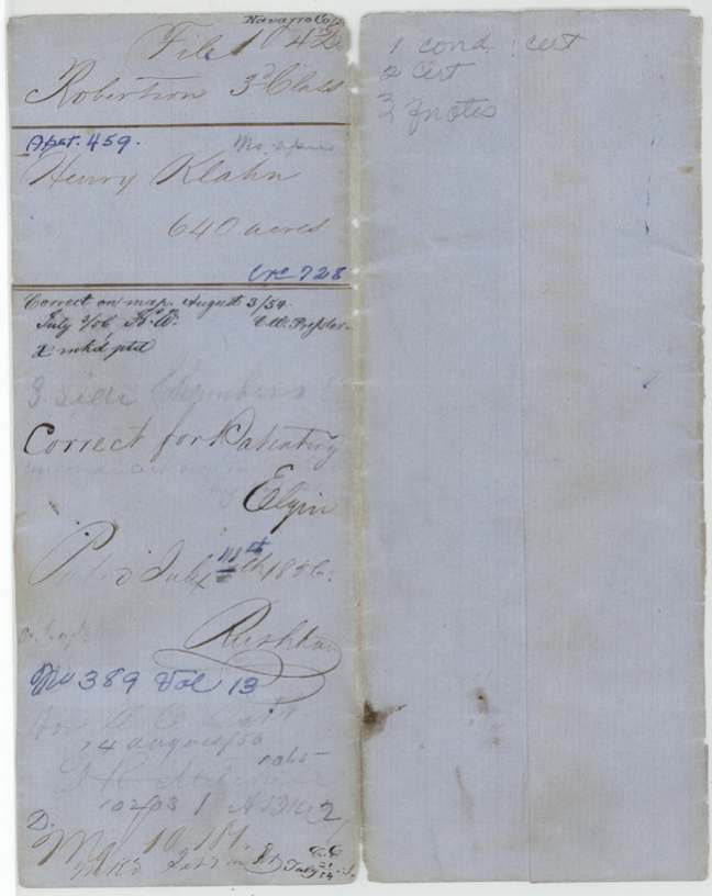
- Robertson 3rd class, file 1042
- Certificate
- No. 728
- Acres
- 640
- Patented to
- Henry Klahn
- Patent
- 11 Jul 1856 · No. 389, Vol. 13
Tap a survey to open its page.
What the file shows
Henry Klahn received a conditional second-class headright for 640 acres from the Galveston County board on 30 December 1839, under the 1839 act for emigrants. Robertson County deputy surveyor David R. Mitchell located it on 18 May 1846 on the south side of Chambers Creek, about 11 miles west of present Corsicana, adjoining the Alfred King, Jacob Blum and Jacob Baliman surveys, and recorded it as District Surveyor in Book M page 12 in 1848. The Travis County board issued his unconditional certificate (No. 114) in November 1850, and the papers reached the Land Office in 1853. The patent issued to Klahn himself in July 1856 (No. 389, Vol. 13).
The certificate
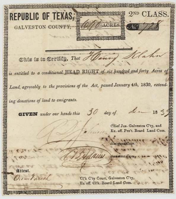
headright 2nd class, No. 728, 640 acres, Board of Land Commissioners, Galveston County: R. D. Johnson(?), Chief Justice and ex officio president; A. B. Adams(?), associate; attest Oscar Farish, clerk, Galveston County, 30 Dec 1839.
Conditional headright of 640 acres under the Act of 4 Jan 1839 extending donations of land to emigrants (Second Class form; 640 acres is the married man's quantity)
The survey
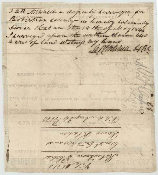
18 May 1846, David R. Mitchell, deputy surveyor, Robertson County.
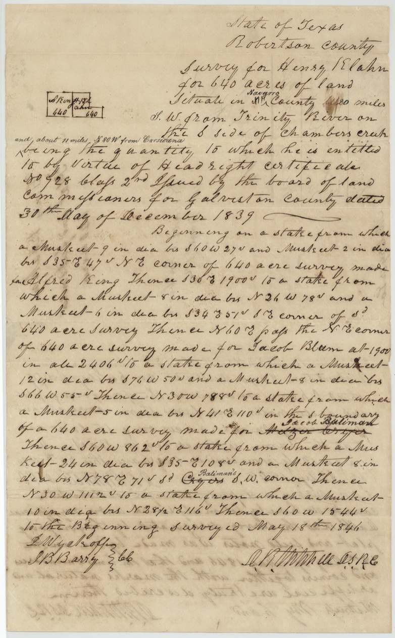
Navarro County (inserted over 'Rob.'), about 20 miles SW from the Trinity River on the south side of Chambers Creek, and about 11 miles N 80 W from Corsicana (added later)
Chain carriers: L.(?) Wyckoff, J. B. Barry.
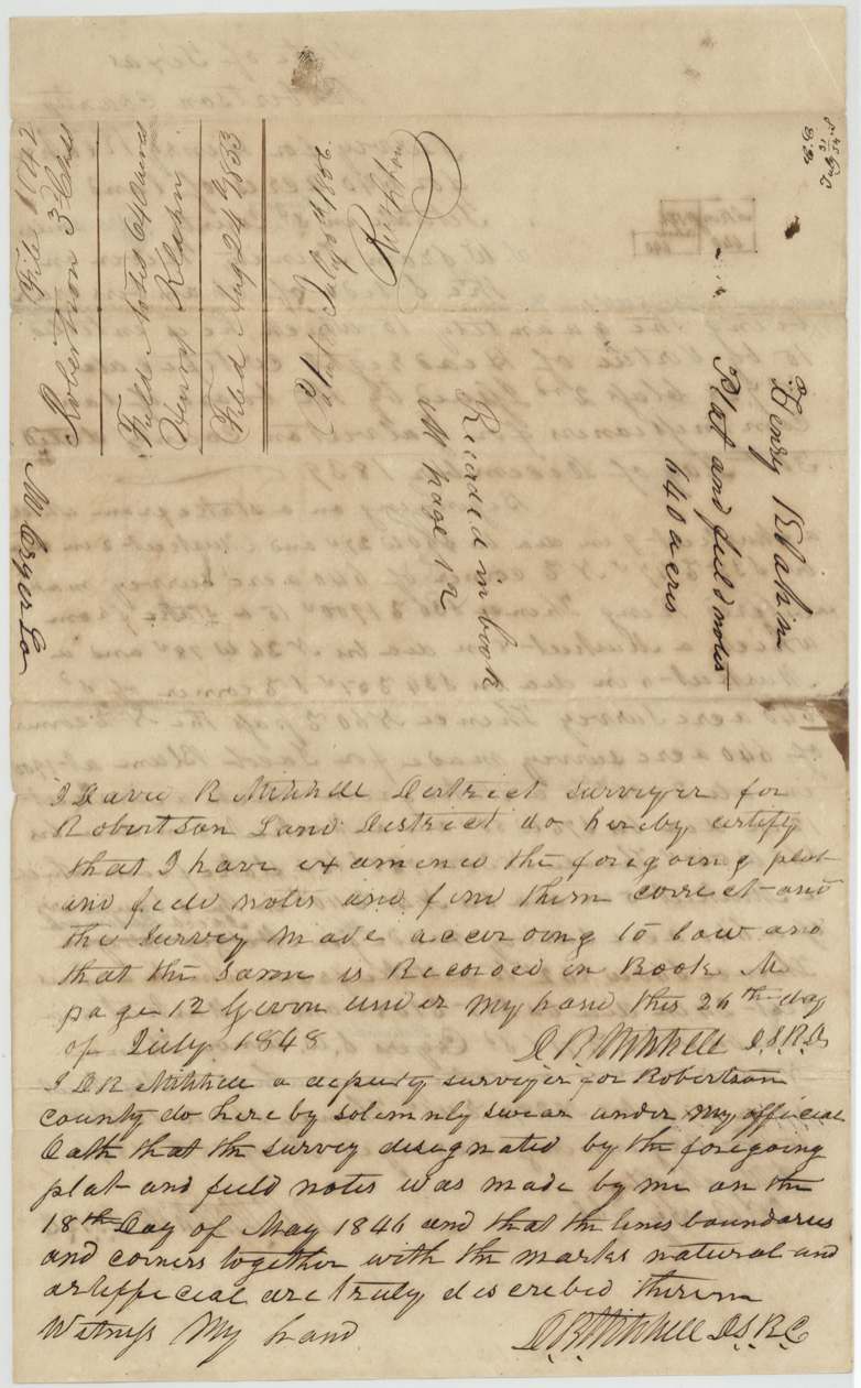
Book M, page 12
The patent
1856-07-11(?), No. 389, Vol. 13, to Henry Klahn, delivered to Hon. ? (illegible), 14 August 1856(?); 'J. H. Mitchell(?)' faint.
Also in the file
- Klahn's conditional certificate came from Galveston County, but his unconditional certificate came 11 years later from Travis County.
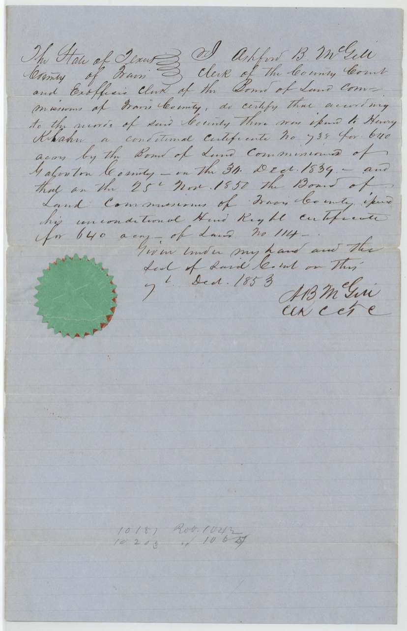
- The Travis County clerk gives the conditional certificate as No. 738, while the certificate itself and the field notes say No. 728.
- The surveyor David R. Mitchell made the survey as deputy and two years later examined and approved it himself as District Surveyor.
- A neighbour's name on the north line was struck out and replaced with Jacob Baliman.
- The land was surveyed in 1846 when this was still Robertson County; 'Navarro' and the distance from Corsicana were added later.
Timeline
- 30 Dec 1839Conditional 2nd-class headright No. 728, 640 acres, Galveston County
- 18 May 1846D. R. Mitchell surveys 640 acres on south side of Chambers Creek
- 26 Jul 1848Mitchell, as District Surveyor, examines and records Book M p. 12
- 25 Nov 1850Unconditional certificate No. 114, Travis County board
- 24 Aug 1853Field notes and certificate filed in GLO
- 7 Dec 1853Travis County clerk Ashford B. McGill certifies the record
- 3 Aug 1854Checked correct on map, C. W. Pressler
- 11 Jul 1856Patent No. 389, Vol. 13, to Henry Klahn (day uncertain)
The papers in the file
Every page of the Land Office file, in the order the Land Office keeps them (7 pages). Tap a page to see it larger.
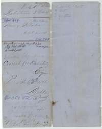 File jacketFile jacket for Henry Klahn's 640-acre headright survey in Navarro County, with map checks and the patent entry of July 1856.General Land Office, file 1042, page 1 · in the scan
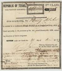 CertificateConditional second-class headright certificate for 640 acres issued to Henry Klahn by the Galveston County Board of Land Commissioners, 30 December 1839.General Land Office, file 1042, page 2 · in the scan
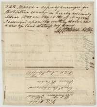 Back of the certificateBack of the certificate, with deputy surveyor D. R. Mitchell's sworn note that he surveyed 640 acres on the claim on 18 May 1846.General Land Office, file 1042, page 3 · in the scan
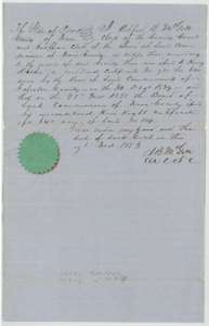 AffidavitTravis County clerk's certificate of 7 December 1853, under seal, that Henry Klahn received an unconditional certificate for 640 acres on 25 November 1850.General Land Office, file 1042, page 4 · in the scan
 WrapperFolded wrapper carrying the file number and title for Henry Klahn's Robertson third-class file.General Land Office, file 1042, page 5 · in the scan
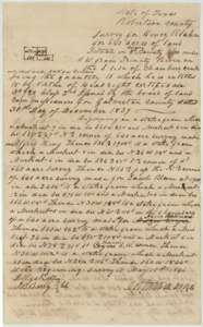 Field notesField notes and plat for 640 acres on the south side of Chambers Creek, surveyed for Henry Klahn by deputy surveyor David R. Mitchell, 18 May 1846.General Land Office, file 1042, page 6 · in the scan
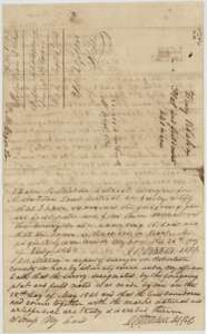 Surveyor's certificateDistrict surveyor David R. Mitchell's certificate of 26 July 1848 that the Klahn survey is correct and recorded in Book M, page 12, with the survey oath and docket.General Land Office, file 1042, page 7 · in the scan
Scans courtesy of the Texas General Land Office, Austin, from its Land Grant Database.
On this ground today
- CemeteryPruitt Cemetery
Places that stand inside this survey’s lines as the state’s survey map draws them.
Neighbouring surveys
Sources
- Texas General Land Office, Land Grant Database: Navarro County, Abstract 459
- The Land Office file, scanned (PDF, at the General Land Office)
- 1924 map: courtesy of the Texas General Land Office, Austin, Map 73249, used under licence. Topo: U.S. Geological Survey, The National Map. Aerial photographs: U.S. Department of Agriculture, National Agriculture Imagery Program, 2012, 2018 and 2022. Survey outlines: Railroad Commission of Texas, Original Texas Land Survey. Grant records and files: Texas General Land Office.