Blackland TX · ← All the original surveys
Alexander Eastwood Survey, Abstract 251
- Granted to
- Alexander Eastwood
- Kind of grant
- Headright, third classLand for later settlers, including the colonists of Mercer’s Colony.
- Land Office file
- Robertson 3rd class, file 3457
- Certificate
- No. 68
- Acres
- 320
- Patented to
- William W. Oliver
- Patent
- 01 Feb 1860 · No. 435, Vol. 28
Tap a survey to open its page.
What the file shows
Alexander Eastwood received Mercer Colony certificate No. 68 for 640 acres from the Kaufman County District Court on 11 May 1857 for emigrating to and settling in Charles Fenton Mercer's colony. Half of it, 320 acres, was surveyed by Isaac Walker on 20 Aug 1857 on the waters of Chambers Creek about 11 1/2 miles N 85 W of Corsicana and recorded in Book L p. 391. Eastwood's rights passed to Benjamin R. Tyus (transfer in file 3445), who sold this 320-acre half to Wm. W. Oliver for $50 at Austin on 29 Oct 1857. After a conflict with a forfeited J. Blum claim was noted, the land was patented to Oliver as assignee around 31 Jan / 1 Feb 1860 (No. 435, Vol. 28).
The certificate
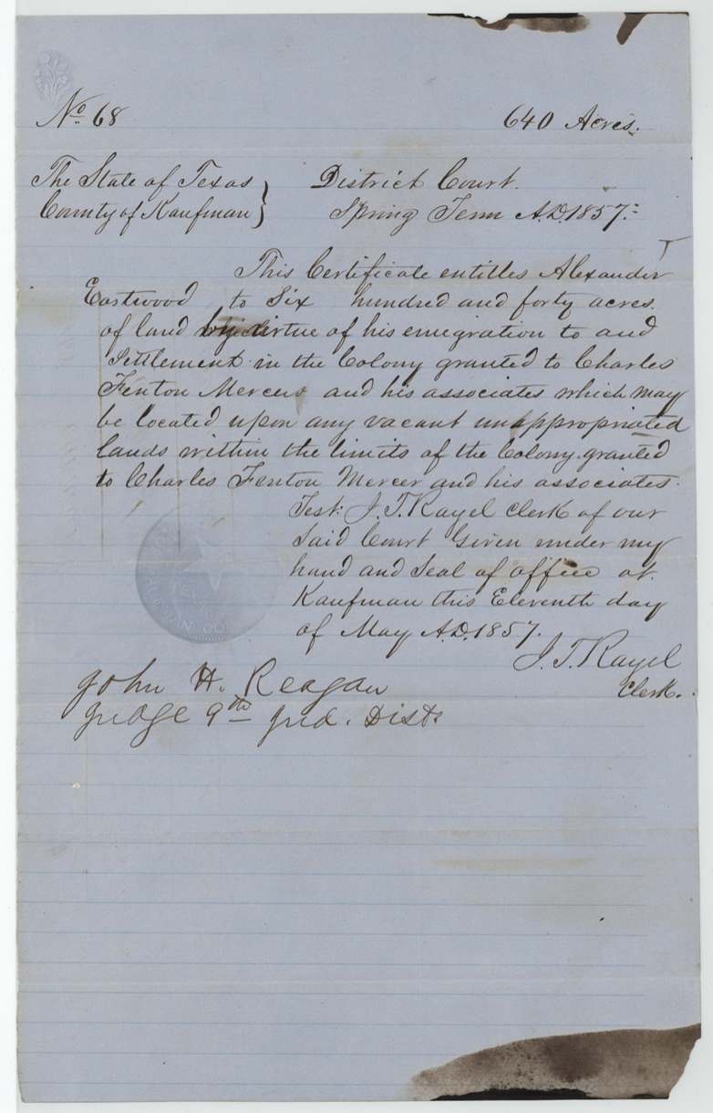
headright 3rd class (Mercer Colony certificate), No. 68, 640 (this file locates 320, the other half; see file 3445 Rob. 3rd), District Court of Kaufman County, Spring Term 1857; attested by J. T. Rayel(?), Clerk; signed John H. Reagan, Judge 9th Jud. Dist., Kaufman, 11 May 1857.
Entitles Alexander Eastwood to 640 acres 'by virtue of his emigration to and settlement in the Colony granted to Charles Fenton Mercer and his associates', to be located on any vacant unappropriated land within the limits of the Mercer Colony.
Changes of hand
- undatedAlexander Eastwood → B. R. Tyus. Not in this file; jacket says chain of transfer to B. R. Tyus and W. W. Oliver is in file 3445 Robertson 3rd.
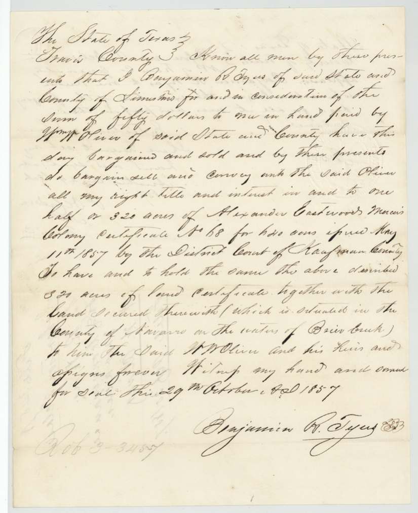
- 29 Oct 1857Benjamin R. Tyus, of Limestone County → Wm. W. Oliver, of Limestone County, $50, Austin, Travis County. Sells all right, title and interest in one half, or 320 acres, of Eastwood's Mercer Colony cert. No. 68 for 640 acres issued 11 May 1857 by Kaufman District Court, 'together with the land secured therewith (which is situated in the County of Navarro on the waters of Brier Creek)'. Filed GLO Oct 30 1857.
The survey
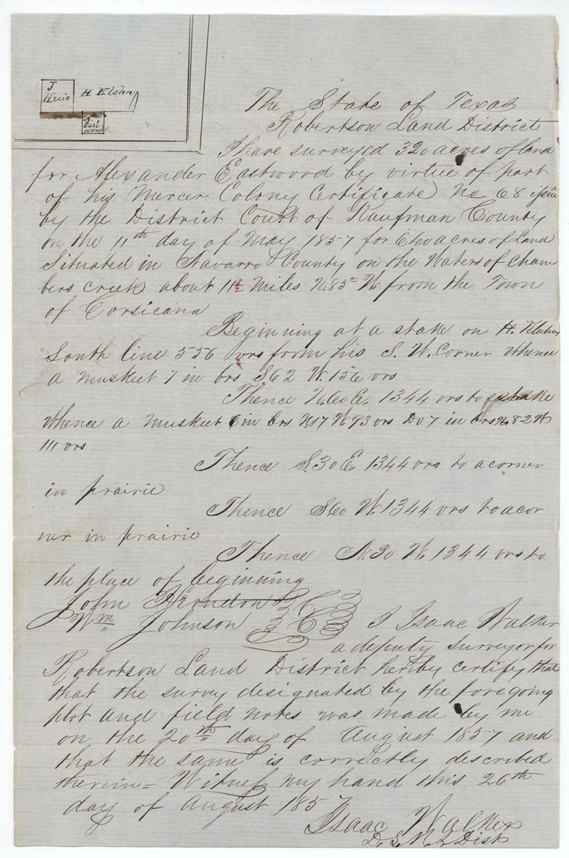
20 Aug 1857 (certified 26 Aug 1857), Isaac Walker.
320 acres situated in Navarro County on the waters of Chambers creek about 11 1/2 miles N 85 W from the Town of Corsicana. Beginning at a stake on H. W(?)lahn(?)'s south line 556 vrs from his S.W. corner; square 1344 vrs per side, corners in prairie.
Chain carriers: John Herndon(?) (name partly struck through), Wm. Johnson.
Book L, page 391
The patent
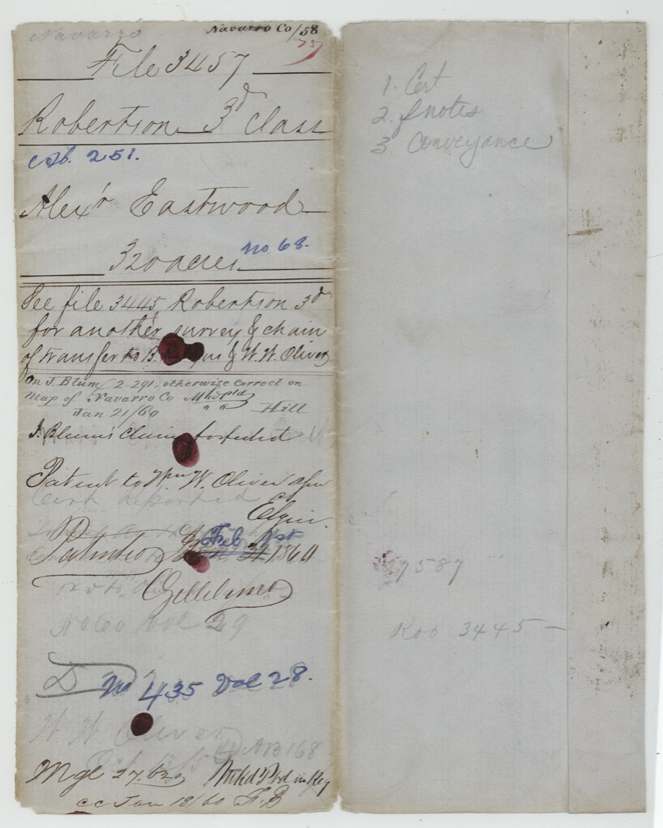
1 Feb 1860 on jacket (written over Jan 31 1860; field-note docket reads 'Pat'd Jan 31 1860'), No. 435, Vol. 28 (blue ink); faint earlier 'No. 60 Vol. 29' also visible, to Wm. W. Oliver, assignee.
Also in the file
- Survey conflicted with a J. Blum survey (map ref 2-291); the jacket notes J. Blum's claim was forfeited, which cleared the way for patent.
- Field notes put the land on the waters of Chambers Creek; the Tyus-Oliver deed says the waters of Brier Creek.
- The district surveyor who examined the survey (Thos. J. Oliver) shares a surname with the buyer/patentee (Wm. W. Oliver); the file does not state any relationship.
- Both seller and buyer are 'of Limestone County' but the deed was made and acknowledged in Austin, Travis County.
- Certificate issued 11 May 1857 and surveyed by 20 Aug 1857: a fast turnaround; Eastwood's own transfer to Tyus is in file 3445, not here.
- Patent date on jacket overwritten (Jan 31 to Feb 1st 1860) and two patent number/volume entries appear (No. 60 Vol. 29 faint; No. 435 Vol. 28).
Timeline
- 11 May 1857Kaufman County District Court issues Mercer Colony cert. No. 68 (640 ac) to Alexander Eastwood; Judge John H. Reagan
- 20 Aug 1857Isaac Walker surveys 320 acres on Chambers Creek waters, 11 1/2 mi N 85 W of Corsicana
- 26 Aug 1857Walker certifies field notes
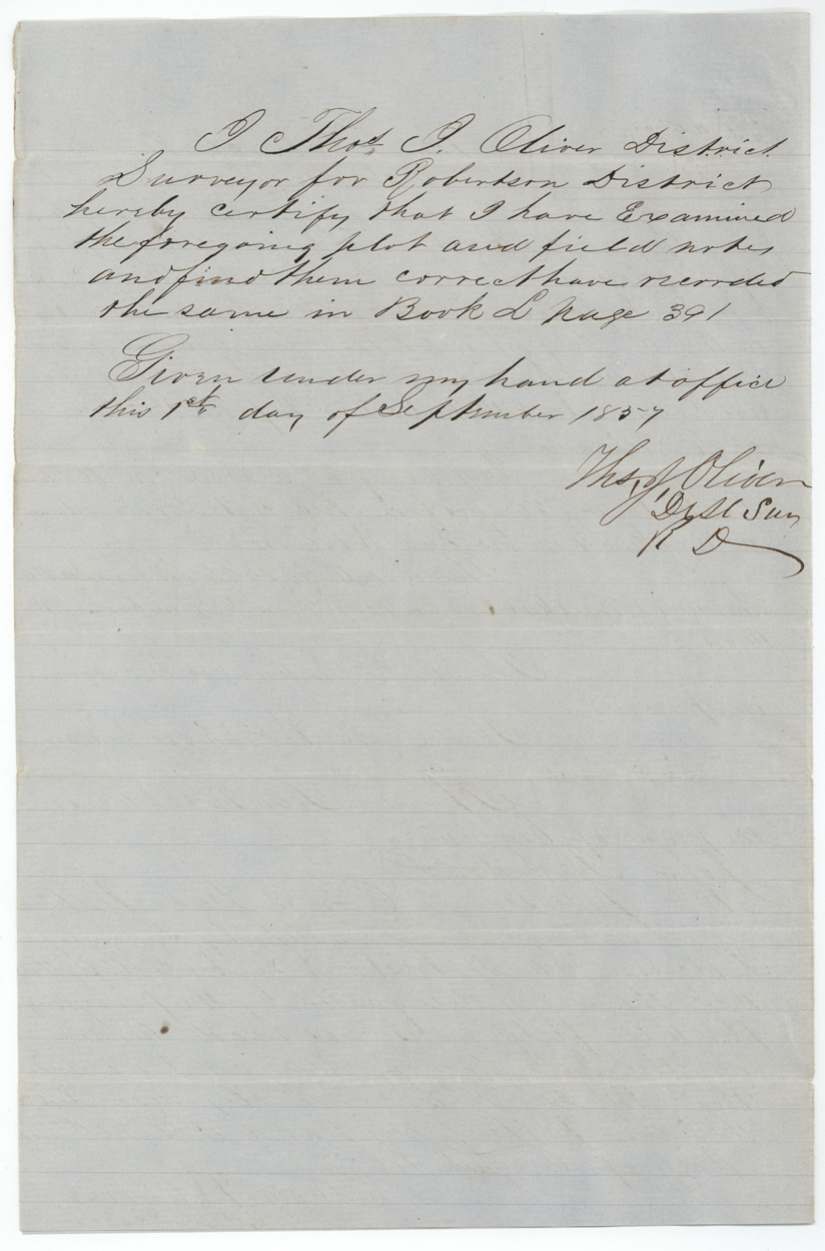
- 1 Sep 1857Thos. J. Oliver examines and records, Book L p. 391
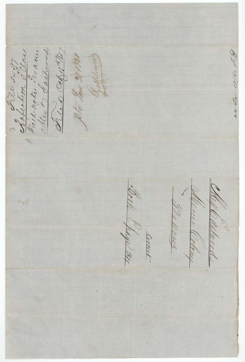
- 15 Oct 1857Certificate and field notes filed in GLO
- 29 Oct 1857B. R. Tyus sells the 320-acre half to Wm. W. Oliver for $50, at Austin before P. DeCordova
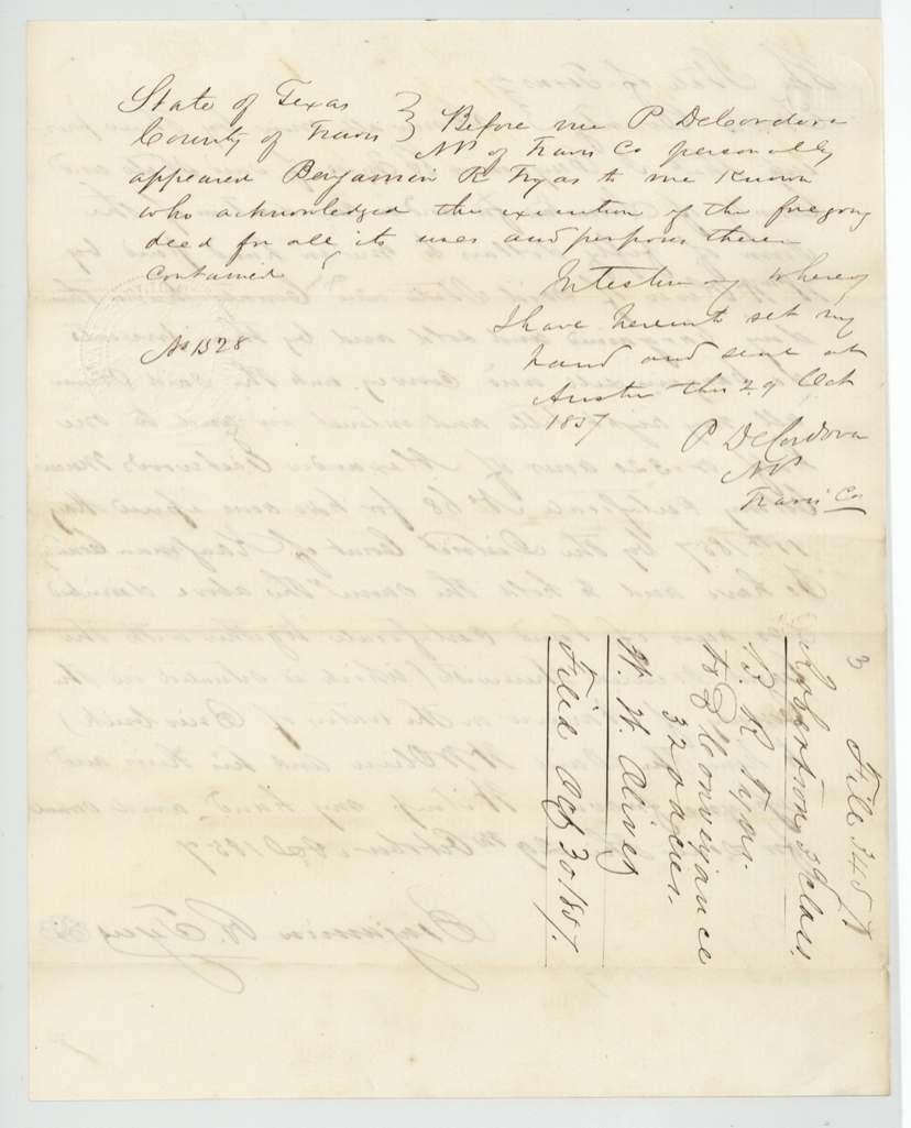
- 30 Oct 1857Conveyance filed in GLO
- 18 Jan 1860Checked (cc) F.B.
- 21 Jan 1860Map check: conflicts with J. Blum, otherwise correct
- 31 Jan 1860Patented to Wm. W. Oliver, assignee (jacket also reads Feb 1st 1860)
The papers in the file
Every page of the Land Office file, in the order the Land Office keeps them (8 pages). Tap a page to see it larger.
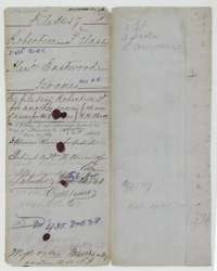 File jacketFile jacket for Alexander Eastwood's 320 acres, listing the certificate, field notes and a conveyance, patented in January 1860.General Land Office, file 3457, page 1 · in the scan
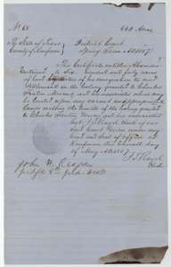 CertificateMercer Colony certificate No. 68 issued by the Kaufman County District Court on 11 May 1857, entitling Alexander Eastwood to 640 acres.General Land Office, file 3457, page 2 · in the scan
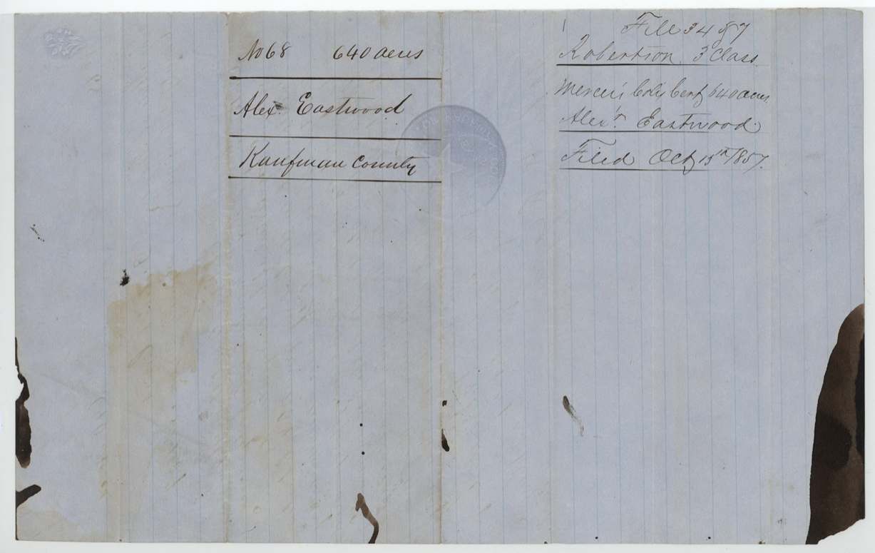
 Back of the certificateBack of the Mercer Colony certificate, with the Land Office filing note of 15 October 1857.General Land Office, file 3457, page 3 · in the scan
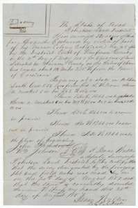 Field notesField notes and plat for 320 acres on Chambers Creek, surveyed for Alexander Eastwood by deputy surveyor Isaac Walker on 20 August 1857.General Land Office, file 3457, page 4 · in the scan
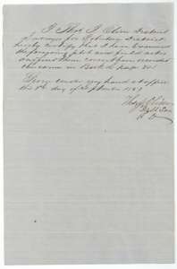 Surveyor's certificateDistrict surveyor Thomas J. Oliver's certificate of 1 September 1857 that the field notes are correct and recorded in Book L, page 391.General Land Office, file 3457, page 5 · in the scan
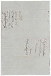 WrapperField-notes wrapper for Alexander Eastwood's 320 acres, filed 15 October 1857 and marked patented 31 January 1860.General Land Office, file 3457, page 6 · in the scan
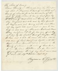 TransferDeed of 29 October 1857 in which Benjamin R. Tyus sold William W. Oliver half of Eastwood's certificate, 320 acres, for $50.General Land Office, file 3457, page 7 · in the scan
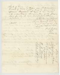 TransferNotary P. DeCordova's acknowledgment of the Tyus deed at Austin on 29 October 1857, with the Land Office filing note of 30 October 1857.General Land Office, file 3457, page 8 · in the scan
Scans courtesy of the Texas General Land Office, Austin, from its Land Grant Database.
Neighbouring surveys
Sources
- Texas General Land Office, Land Grant Database: Navarro County, Abstract 251
- The Land Office file, scanned (PDF, at the General Land Office)
- 1924 map: courtesy of the Texas General Land Office, Austin, Map 73249, used under licence. Topo: U.S. Geological Survey, The National Map. Aerial photographs: U.S. Department of Agriculture, National Agriculture Imagery Program, 2012, 2018 and 2022. Survey outlines: Railroad Commission of Texas, Original Texas Land Survey. Grant records and files: Texas General Land Office.