Blackland TX · ← All the original surveys
Jacob Baliman Survey, Abstract 91
- Granted to
- Jacob Baliman
- Kind of grant
- Headright, third classLand for later settlers, including the colonists of Mercer’s Colony.
- Land Office file
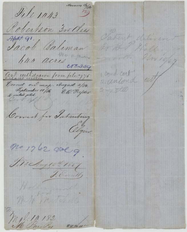
- Robertson 3rd class, file 1043
- Certificate
- No. 359
- Acres
- 640
- Patented to
- Jacob Baliman
- Patent
- 12 Aug 1857 · No. 1762, Vol. 9
Tap a survey to open its page.
What the file shows
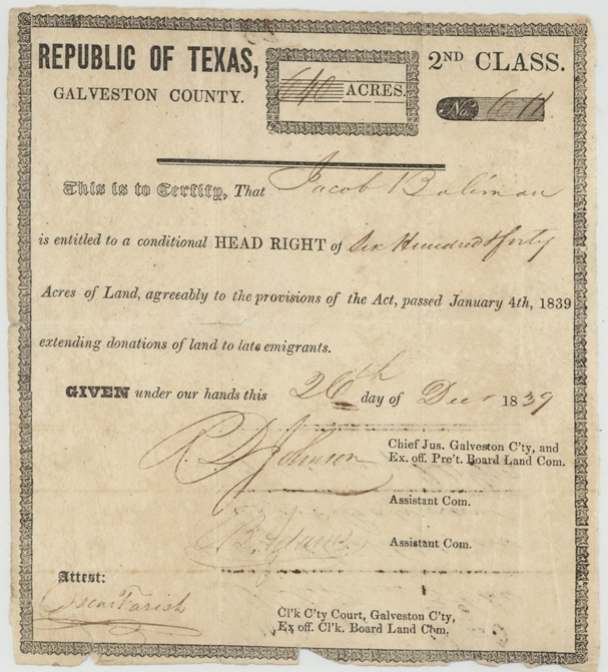
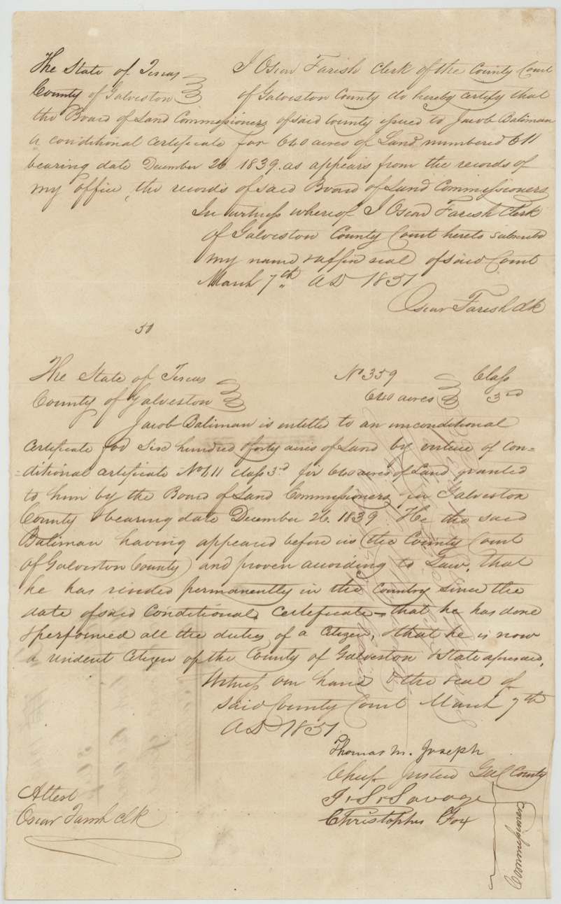
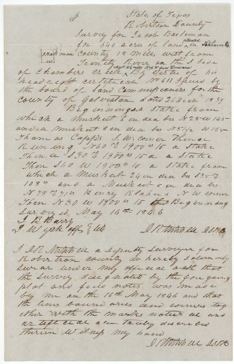
Jacob Baliman, a late immigrant living in Galveston County, received conditional third-class headright No. 611 for 640 acres from the Galveston County land board on 26 December 1839. Deputy surveyor D. R. Mitchell located it on 16 May 1846 on the south side of Chambers Creek, about 10 1/2 miles west-northwest of Corsicana, beginning at Thomas Capps's southwest corner. In March 1851 the Galveston County Court found he had lived in Texas and done a citizen's duties and issued unconditional certificate No. 359. The patent issued in Baliman's own name on 12 August 1857 (No. 1762, Vol. 9), with no assignee.
The certificate
headright 3rd class (conditional No. 611, made unconditional as No. 359), No. 611 (conditional); 359 (unconditional), 640 acres, Board of Land Commissioners of Galveston County: R. D. Johnson, Chief Justice and ex officio President; B.(?) Jones(?), Assistant Commissioner; attest Oscar Farish, clerk, Galveston County, 1839-12-26 (conditional); 1851-03-07 (unconditional).
Conditional headright of 640 acres under the Act of 4 January 1839 'extending donations of land to late emigrants'. In 1851 Baliman proved before the Galveston County Court that he had resided permanently in the country since the conditional certificate and performed all the duties of a citizen, and was then a resident citizen of Galveston County.
The survey
16 May 1846, D. R. Mitchell (David R. Mitchell), Deputy Surveyor Robertson County.
Navarro County, 18 miles west from Trinity River on the south side of Chambers Creek; office note 'about 10 1/2 miles N 76 W from Corsicana'
Chain carriers: J. R. Barry(?), J. Wyckoff(?).
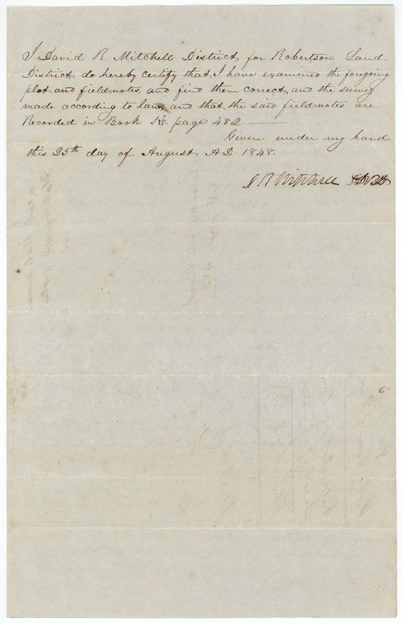
Book E(?), page 482
The patent
12 Aug 1857, No. 1762, Vol. 9, to Jacob Baliman (no assignee: 'no assee'), delivered to D. R.(?) P. Hollingsworth, Nov 10/57; also pencil 'Hollingsworth for W. H. Mitchell' (?).
Also in the file
- The certificate was at one time filed in another land office file (No. 775) and had to be withdrawn and placed in this one.
- The survey was made in 1846, years before the certificate was made unconditional (1851) -- surveyors routinely located conditional certificates in advance.
- Baliman lived in Galveston County; nothing in the file shows him ever living on the Navarro County land.
- His name is spelled Baliman, Baileman and in other ways across the papers.
- A 3rd-class headright was written on a printed 2nd-class form.
Timeline
- 26 Dec 1839Galveston County Board of Land Commissioners issues conditional headright No. 611 for 640 acres to Jacob Baliman
- 16 May 1846D. R. Mitchell surveys 640 acres on the south side of Chambers Creek, adjoining Thomas Capps
- 25 Aug 1848Field notes examined and recorded, page 482
- 7 Mar 1851Galveston County Court grants unconditional certificate No. 359 after proof of residence and citizenship
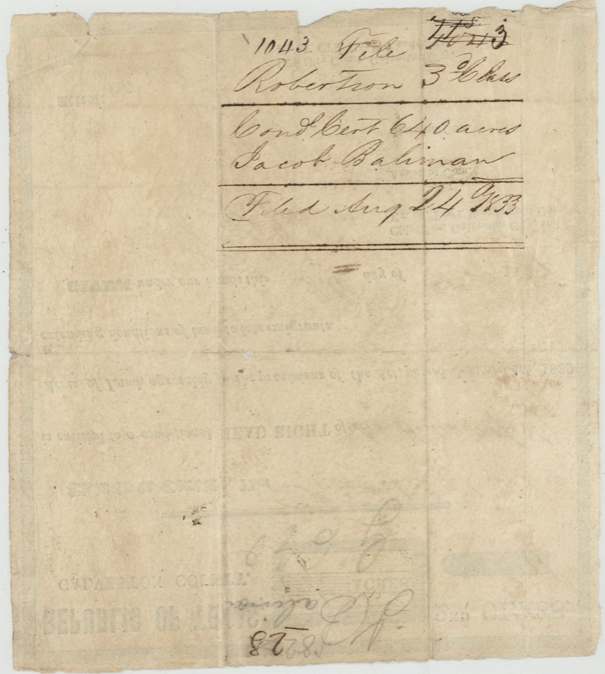
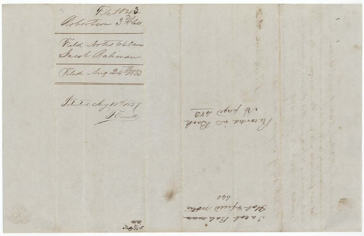
- 24 Aug 1853Certificate and field notes filed in the General Land Office
- 2 Aug 1854Checked correct on the map (also 11 Sep 1856), C. W. Pressler
- 12 Aug 1857Patent No. 1762 Vol. 9 issued to Jacob Baliman
- 10 Nov 1857Patent delivered to Hollingsworth
The papers in the file
Every page of the Land Office file, in the order the Land Office keeps them (7 pages). Tap a page to see it larger.
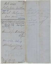 File jacketFile jacket for Jacob Baliman's 640-acre headright, certificate No. 359, patented 12 August 1857.General Land Office, file 1043, page 1 · in the scan
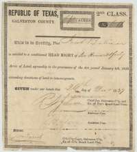 CertificateConditional headright certificate No. 611 issued by the Galveston County land board on 26 December 1839 to Jacob Baliman for 640 acres.General Land Office, file 1043, page 2 · in the scan
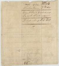 Back of the certificateBack of the conditional certificate, with the Land Office filing note of 24 August 1853.General Land Office, file 1043, page 3 · in the scan
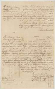 CertificateGalveston County clerk's certificate and unconditional headright certificate No. 359 for Jacob Baliman, both dated 7 March 1851.General Land Office, file 1043, page 4 · in the scan
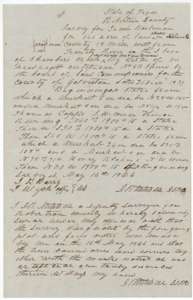 Field notesField notes for 640 acres on Chambers Creek, surveyed for Jacob Baliman by deputy surveyor D. R. Mitchell on 16 May 1846.General Land Office, file 1043, page 5 · in the scan
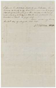 Surveyor's certificateDistrict surveyor David R. Mitchell's certificate of 25 August 1848 that the field notes are correct and recorded in Book E, page 482.General Land Office, file 1043, page 6 · in the scan
 WrapperField-notes wrapper for Jacob Baliman's 640 acres, filed 24 August 1853 and marked patented 12 August 1857.General Land Office, file 1043, page 7 · in the scan
Scans courtesy of the Texas General Land Office, Austin, from its Land Grant Database.
On this ground today
- CemeteryCryer Creek
Places that stand inside this survey’s lines as the state’s survey map draws them.
Neighbouring surveys
Sources
- Texas General Land Office, Land Grant Database: Navarro County, Abstract 91
- The Land Office file, scanned (PDF, at the General Land Office)
- 1924 map: courtesy of the Texas General Land Office, Austin, Map 73249, used under licence. Topo: U.S. Geological Survey, The National Map. Aerial photographs: U.S. Department of Agriculture, National Agriculture Imagery Program, 2012, 2018 and 2022. Survey outlines: Railroad Commission of Texas, Original Texas Land Survey. Grant records and files: Texas General Land Office.