Blackland TX · ← All the original surveys
Thomas Davlin Survey, Abstract 221
- Granted to
- Thomas Davlin
- Kind of grant
- Headright, third classLand for later settlers, including the colonists of Mercer’s Colony.
- Land Office file
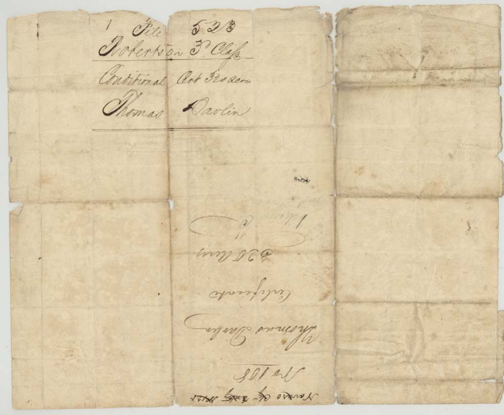
- Robertson 3rd class, file 523
- Certificate
- No. 451
- Acres
- 320
- Patented to
- Thomas Cook
- Patent
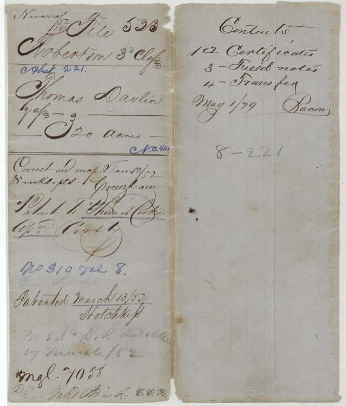
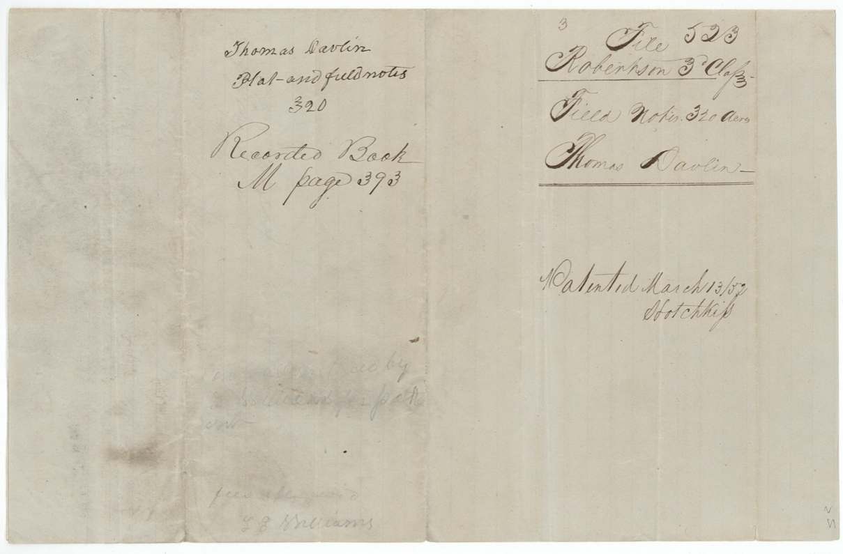
- 13 Mar 1852 · No. 310, Vol. 8
Tap a survey to open its page.
What the file shows
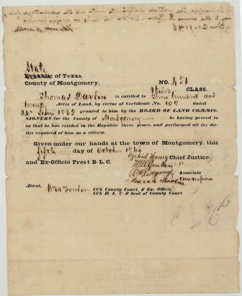
Thomas Davlin received a conditional 320-acre headright from the Montgomery County Board of Land Commissioners on 24 June 1839 as a late emigrant, and on 5 October 1846 the board made it unconditional (No. 451, third class) on proof of three years' residence. Deputy surveyor D. R. Mitchell had already surveyed the 320 acres on the north side of Richland Creek in Navarro County on 11 March 1846. On 28 October 1846 Davlin sold the certificate and land to Thomas Cooke for $50, naming him attorney to get the patent. The notes were recorded in 1851 and the patent (No. 310, Vol. 8) issued to Cooke as assignee on 13 March 1852 and was delivered to Mitchell.
The certificate
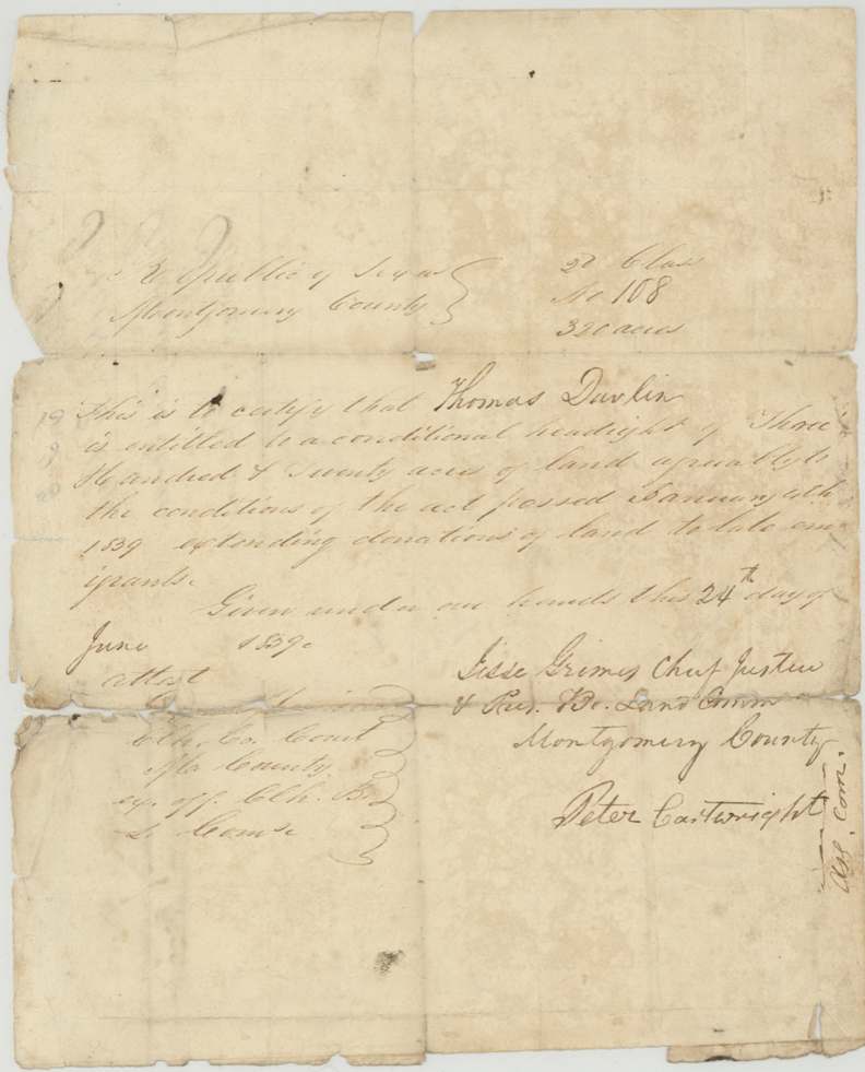
headright 3rd class, No. 108 (conditional); 451 (unconditional), 320 acres, Board of Land Commissioners, Montgomery County: conditional signed Jesse Grimes, Chief Justice & Pres. Bd. Land Comm., and Peter Cartwright, Assoc. Comr.; unconditional signed Ezekiel Henry, Chief Justice & ex-officio Pres. B.L.C., W. M. Rankin(?), P. Ridgway(?), Isaiah Harlan(?), Associate Commissioners; attest W. A. Fowler(?), Clk County Court, Montgomery County (town of Montgomery for the unconditional), conditional 1839-06-24; unconditional 1846-10-05.
Conditional headright of 320 acres 'agreeably to the conditions of the act passed January 4th 1839 extending donations of land to late emigrants'; unconditional issued because 'he having proved to us that he has resided in the Republic three years, and performed all the duties required of him as a citizen.'
Changes of hand
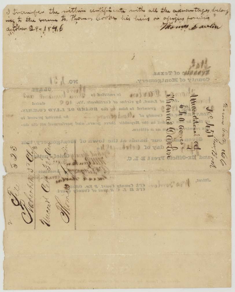
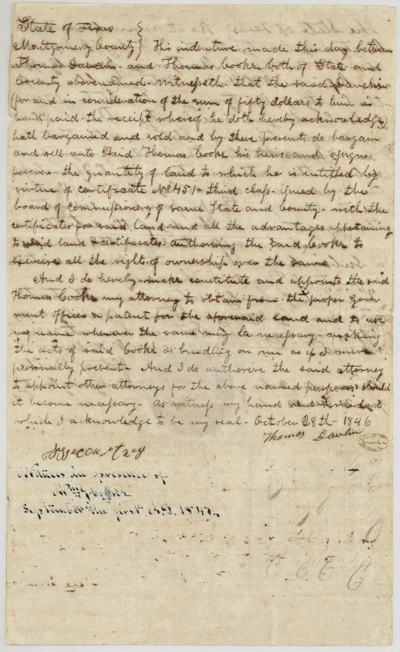
- 28 Oct 1846Thomas Davlin → Thomas Cooke (also spelled Cook in jacket), $50, Montgomery County. Indenture sells the land due under certificate No. 451 third class with the certificate, and appoints Cooke attorney to obtain the patent and to appoint other attorneys. Also a short assignment written on the face of the unconditional certificate, dated October 28, 1846, signed Thomas Davlin. A line 'September the first A.D. 1847' appears under the witnesses.
The survey
11 Mar 1846, D. R. Mitchell.
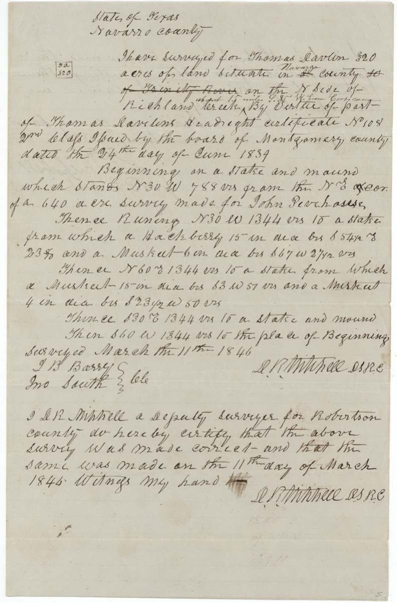
Navarro County (inserted over struck '[blank] county ... of Trinity River'), on the N side of Richland Creek, about 15 miles S 85 W(?) from Corsicana (later interlineation). Begins at a stake and mound N30W 788 vrs from the NE corner of a 640-acre survey made for John Peachouse(?); N30W 1344 vrs, N60E 1344 vrs, S30E 1344 vrs, S60W 1344 vrs.
Chain carriers: I. B. Barry(?), Jno South.
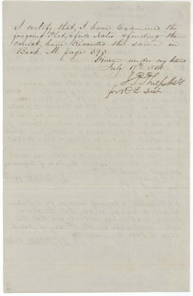
Book M page 393
The patent
13 Mar 1852, No. 310, Vol. 8, to Thomas Cooke, assignee, delivered to D. R. Mitchell, 17 March 1852.
Also in the file
- Class inconsistency: conditional certificate and field notes say 2nd class; the unconditional certificate and file say 3rd class.
- Survey was made 11 March 1846, before the certificate was made unconditional (5 Oct 1846) and before the sale to Cooke.
- Field notes were not examined and recorded until 19 July 1851, five years after the survey.
- Location bearing reads 'S 85 W' from Corsicana (unusual for land on Richland Creek); reading uncertain.
- Patentee spelled Cook on jacket, Cooke in the deed.
Timeline
- 24 Jun 1839Conditional headright certificate No. 108 for 320 acres issued to Thomas Davlin by Montgomery County board under act of 4 Jan 1839
- 11 Mar 1846D. R. Mitchell surveys 320 acres on the north side of Richland Creek
- 5 Oct 1846Unconditional certificate No. 451, third class, issued at Montgomery
- 28 Oct 1846Davlin sells to Thomas Cooke for $50 and makes him attorney
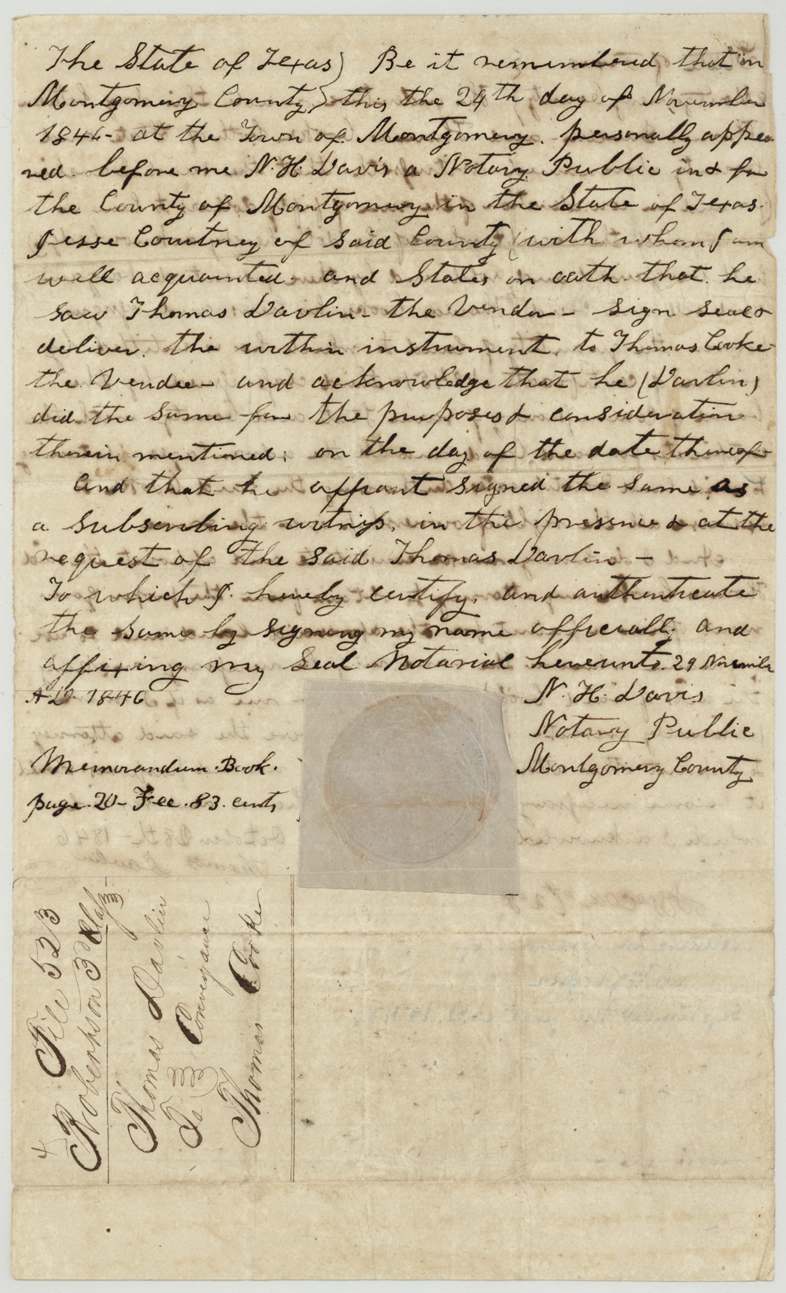
- 24 Nov 1846Jesse Courtney proves the deed before notary N. H. Davis
- 19 Jul 1851Field notes examined, recorded Book M p.393
- 12 Jan 1852Correct on map
- 13 Mar 1852Patent No. 310 Vol. 8 to Thomas Cooke, assignee
- 17 Mar 1852Patent delivered to D. R. Mitchell, the surveyor
The papers in the file
Every page of the Land Office file, in the order the Land Office keeps them (10 pages). Tap a page to see it larger.
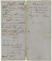 File jacketFile jacket for Thomas Davlin's 320 acres in Navarro County, Robertson 3rd Class, with the patent entry of March 1852.General Land Office, file 523, page 1 · in the scan
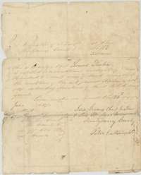 CertificateConditional headright certificate No. 108 for 320 acres, issued to Thomas Davlin by the Montgomery County land board, 24 June 1839.General Land Office, file 523, page 2 · in the scan
 WrapperWrapper for the conditional certificate, marked File 523, Robertson 3rd Class, Thomas Davlin.General Land Office, file 523, page 3 · in the scan
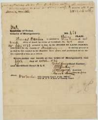 CertificateUnconditional headright certificate No. 451 for 320 acres, issued to Thomas Davlin at Montgomery by the county land board, 5 October 1846.General Land Office, file 523, page 4 · in the scan
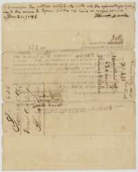 Back of the certificateBack of certificate No. 451, with Thomas Davlin's note of 28 October 1846 transferring it, and the land board's endorsements.General Land Office, file 523, page 5 · in the scan
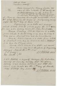 Field notesField notes and sketch of 320 acres on Richland Creek, Navarro County, surveyed for Thomas Davlin by deputy surveyor D. R. Mitchell, 11 March 1846.General Land Office, file 523, page 6 · in the scan
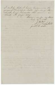 Surveyor's certificateDistrict surveyor J. P. Philpott's certificate that he examined the Davlin field notes and recorded them in Book M, page 393, July 1851.General Land Office, file 523, page 7 · in the scan
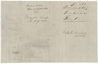 WrapperWrapper for the Davlin plat and field notes, recorded in Book M, page 393, with the patent note of March 1852.General Land Office, file 523, page 8 · in the scan
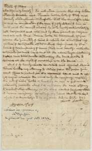 TransferIndenture of 28 October 1846 in which Thomas Davlin sells the land due on certificate No. 451 to Thomas Cooke for $50 and names him attorney to obtain the patent.General Land Office, file 523, page 9 · in the scan
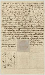 TransferNotary's proof at Montgomery, 24 November 1846, of the Davlin to Cooke indenture, with the file docket for the conveyance.General Land Office, file 523, page 10 · in the scan
Scans courtesy of the Texas General Land Office, Austin, from its Land Grant Database.
On this ground today
- CemeteryRose Hill Cemetery
Places that stand inside this survey’s lines as the state’s survey map draws them.
Neighbouring surveys
Sources
- Texas General Land Office, Land Grant Database: Navarro County, Abstract 221
- The Land Office file, scanned (PDF, at the General Land Office)
- 1924 map: courtesy of the Texas General Land Office, Austin, Map 73249, used under licence. Topo: U.S. Geological Survey, The National Map. Aerial photographs: U.S. Department of Agriculture, National Agriculture Imagery Program, 2012, 2018 and 2022. Survey outlines: Railroad Commission of Texas, Original Texas Land Survey. Grant records and files: Texas General Land Office.