Blackland TX · ← All the original surveys
Bolden G. Waites Survey, Abstract 867
- Granted to
- Bolden G. Waites
- Kind of grant
- Headright, third classLand for later settlers, including the colonists of Mercer’s Colony.
- Land Office file
- Robertson 3rd class, file 4913
- Certificate
- No. 93
- Acres
- 320
- Patented to
- Bolden G. Waites
- Patent
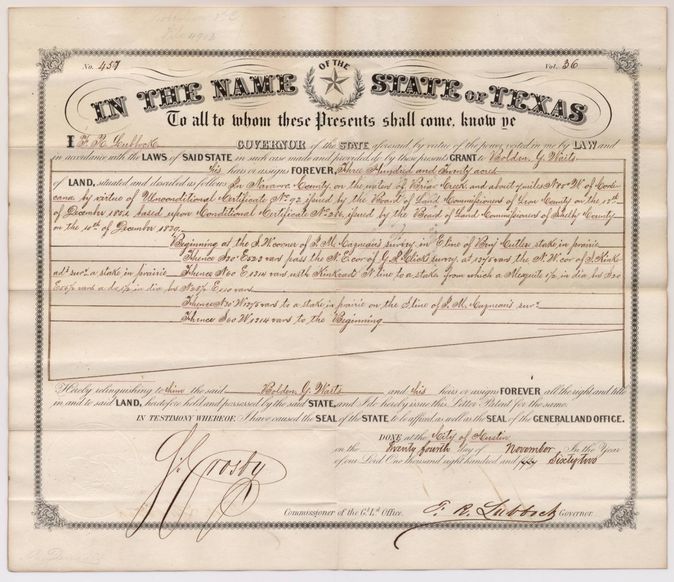
- 24 Nov 1862 · No. 457, Vol. 36
Tap a survey to open its page.
What the file shows
Bolden G. Waits, a single man arriving in Texas in 1839, got a conditional 320-acre headright certificate in Shelby County, sold it, and obtained an unconditional certificate in Leon County in 1851. Deputy surveyor J. M. Eliot located the 320 acres on Briar Creek near Corsicana in November 1857, and the patent issued to Waits on 24 November 1862.
The certificate
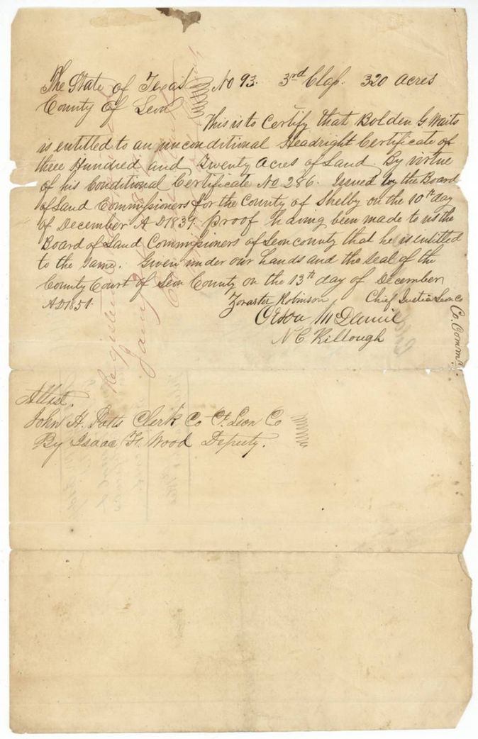
headright 3rd class (conditional, then unconditional), No. 286 (conditional, Shelby County); 93 (unconditional, Leon County), 320 acres, Board of Land Commissioners of Shelby County (Chief Justice and associate justices, incl. John Houston(?), clerk R. Lusk(?)); unconditional by Zoraster Robinson, Chief Justice, Leon County, with Orren M. Daniel(?) and N. C. Killough, County Commissioners, attested John H. Potts, Clerk, by Isaac H. Wood, Deputy, Shelby County; Leon County, 1839-12-10 (conditional); 1851-12-13 (unconditional).
Proved that he arrived in the Republic after the Declaration of Independence, in December 1839, and was a single man entitled to a conditional grant of 320 acres
Changes of hand
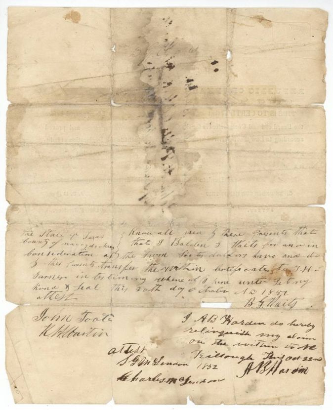
- 1851-10-20(?)Bolden G. Waits → J. H. S. Garner(?), sixty dollars, Nacogdoches County, Texas. Written on back of the conditional certificate
- 22 Oct 1852A. B. Harden(?) (Warden?) → N. C. Killough, not stated. 'I A. B. Harden do hereby relinquish my claim on the within to N. C. Killough' - written on the back of the conditional certificate below Waits's transfer; Killough was one of the Leon County commissioners who signed the unconditional certificate
The survey
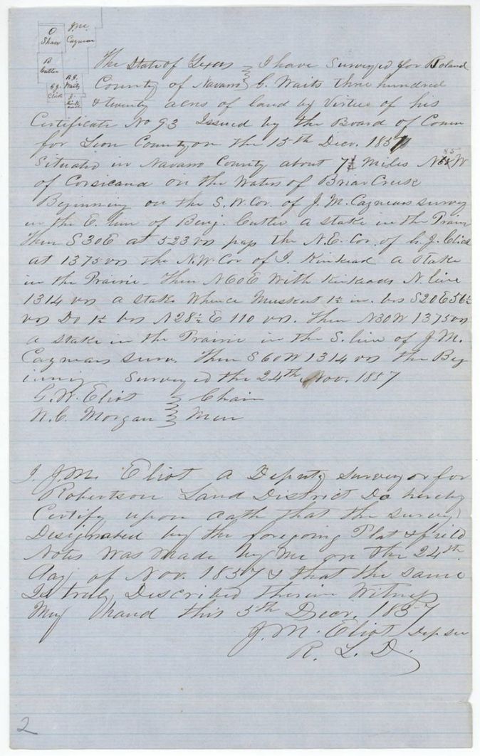
1857-11-24 (certified 1857-12-05), J. M. Eliot, Deputy Surveyor, Robertson Land District.
Navarro County on the waters of Briar Creek, about 7 1/2 miles N 85 W of Corsicana
Chain carriers: G. W. Eliot, N. C. Morgan.
Book W p. 102
The patent
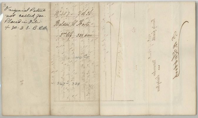
24 Nov 1862, No. 457, Vol. 36, to Bolden G. Waits, delivered to not stated; endorsed 'Original patent not called for. Placed in file'.
Also in the file
- The wrapper on p. 8 says 'Patented Nov 13th 1862' while the patent and jacket say 24 November 1862; index says 24 Nov 1862.
- The conditional certificate is dated 'December 1839' in the text but the unconditional certificate calls it 10 December 1839.
- The survey names Wm. M. Love as applying for relocation in 1859 (and his name is on the field-note wrapper) although the patent went to Waits.
- The wrapper spells the name Waites, Waits and Wait.
- The relinquishment on the back of the certificate runs from A. B. Harden(?) to N. C. Killough, one of the Leon County commissioners who issued the unconditional certificate ten months earlier; how Harden came to hold a claim is not shown, and the patent nonetheless issued in Waits's name.
Timeline
- 10 Dec 1839Shelby County land board issues conditional certificate 286 to Bolden G. Waits
- 20 Oct 1851Waits transfers the certificate for sixty dollars (date uncertain)
- 13 Dec 1851Leon County board issues unconditional certificate No. 93
- 22 Oct 1852A. B. Harden(?) relinquishes his claim on the certificate to N. C. Killough
- 24 Nov 1857J. M. Eliot surveys 320 acres on Briar Creek
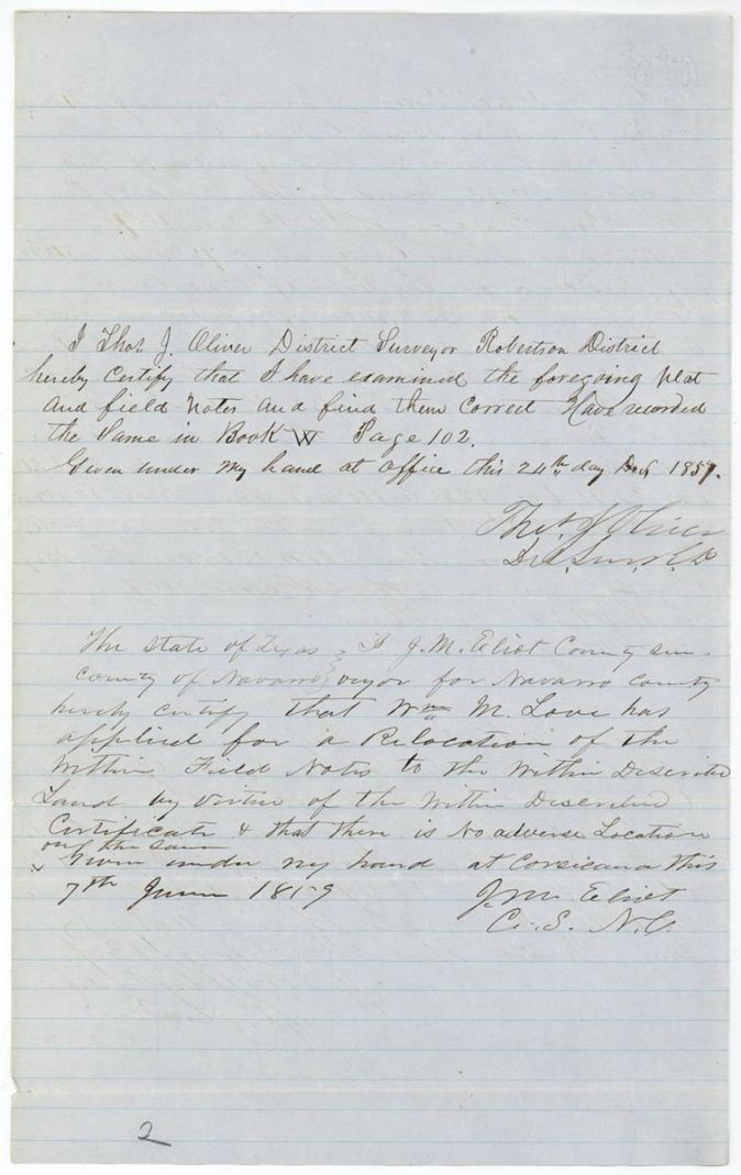
- 24 Dec 1857Survey examined and recorded Book W p. 102
- 7 Jun 1859Wm. M. Love applies for relocation of the field notes
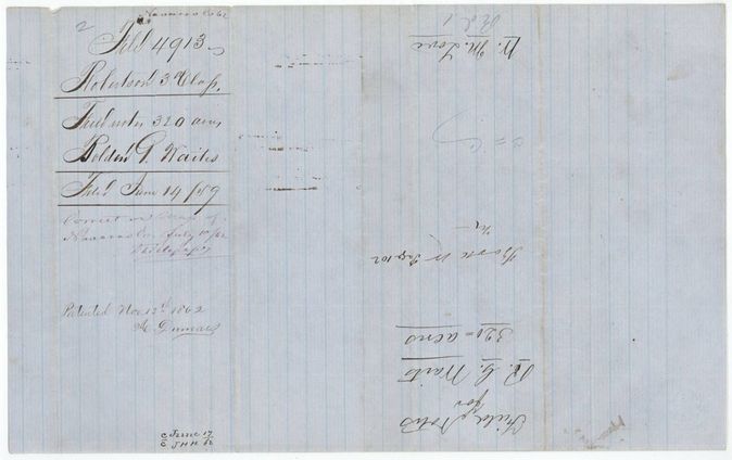
- 14 Jun 1859Field notes filed in the General Land Office
- 1 Mar 1860Certificates filed
- 10 Jul 1862Checked correct on Navarro County map
- 24 Nov 1862Patent No. 457 Vol. 36 issued
The papers in the file
Every page of the Land Office file, in the order the Land Office keeps them (10 pages). Tap a page to see it larger.
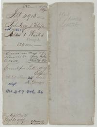 File jacketFile jacket, file 4913 Robertson 3rd Class, Bolden G. Waites 320 acres, with patent entry of 24 November 1862 and contents list: cert, field notes, patent.General Land Office, file 4913, page 1 · in the scan
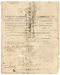 CertificateConditional headright certificate No. 286 from the Shelby County Board of Land Commissioners, December 1839, for 320 acres to Bolden G. Waits, a single man arrived after Independence.General Land Office, file 4913, page 2 · in the scan
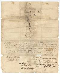 Back of the certificateBack of the conditional certificate: Waits transfers it to J. H. S. Garner(?) for sixty dollars, 20 October 1851(?); A. B. Harden(?) relinquishes his claim to N. C. Killough, 22 October 1852.General Land Office, file 4913, page 3 · in the scan
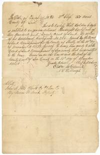 CertificateLeon County unconditional headright certificate No. 93, 3rd class, 320 acres to Bolden G. Waits, issued 13 December 1851 on conditional certificate No. 286.General Land Office, file 4913, page 4 · in the scan
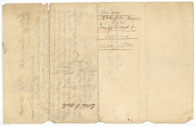
 WrapperWrapper for the conditional and unconditional certificates of B. G. Waits, 320 acres, filed 1 March 1860.General Land Office, file 4913, page 5 · in the scan
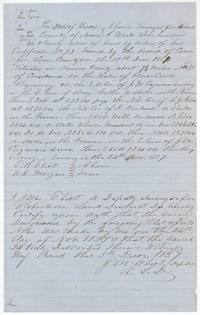 Field notesField notes for 320 acres for Bolden G. Waits on Briar Creek, 7 1/2 miles N 85 W of Corsicana, surveyed 24 November 1857 by J. M. Eliot, certified 5 December 1857.General Land Office, file 4913, page 6 · in the scan
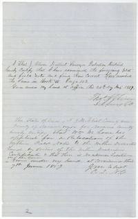 Surveyor's certificateThos. J. Oliver examines the field notes and records them in Book W p. 102 on 24 December 1857; J. M. Eliot certifies Wm. M. Love's relocation application, 7 June 1859.General Land Office, file 4913, page 7 · in the scan
 WrapperWrapper for the 320-acre field notes filed 14 June 1859, endorsed W. M. Love, correct on map of Navarro County 10 July 1862, 'Patented Nov 13th 1862'.General Land Office, file 4913, page 8 · in the scan
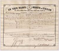 PatentLetter patent No. 457 Vol. 36 from Governor F. R. Lubbock granting Bolden G. Waits 320 acres on Briar Creek, Navarro County, dated 24 November 1862.General Land Office, file 4913, page 9 · in the scan
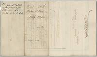 Patent backBack of the patent: abstract entry No. 457 Vol. 36, Bolden G. Waits, 3rd Class, 320 acres, and a note that the original patent was not called for and was placed in the file.General Land Office, file 4913, page 10 · in the scan
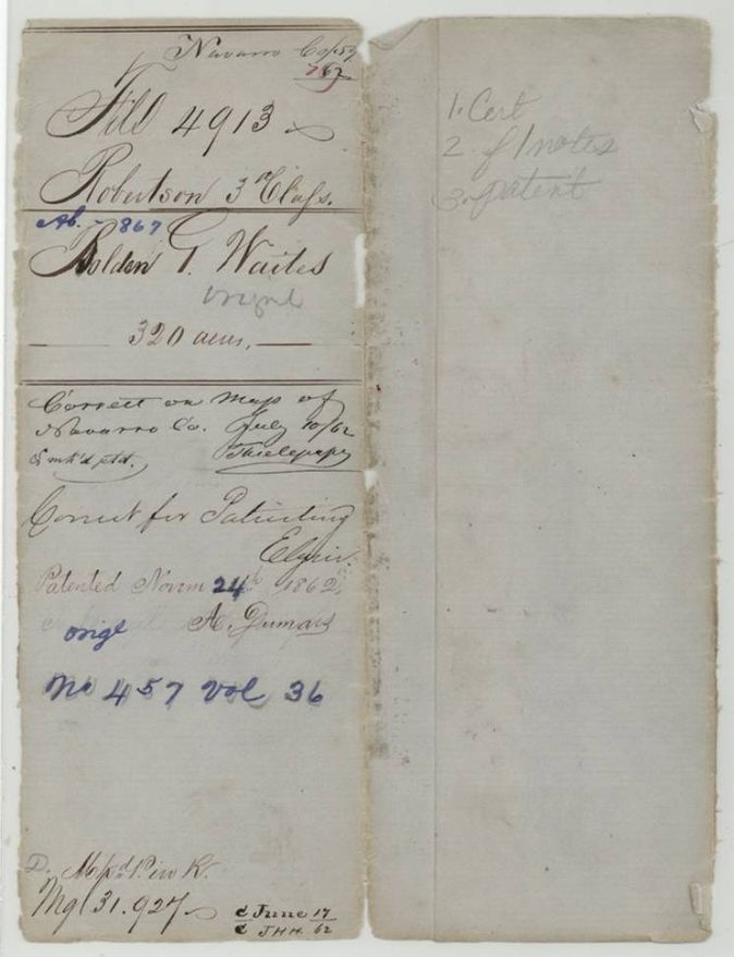
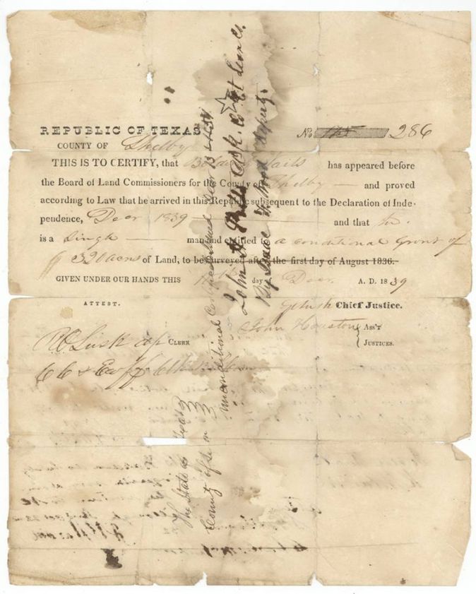
Scans courtesy of the Texas General Land Office, Austin, from its Land Grant Database.
Neighbouring surveys
Sources
- Texas General Land Office, Land Grant Database: Navarro County, Abstract 867
- The Land Office file, scanned (PDF, at the General Land Office)
- 1924 map: courtesy of the Texas General Land Office, Austin, Map 73249, used under licence. Topo: U.S. Geological Survey, The National Map. Aerial photographs: U.S. Department of Agriculture, National Agriculture Imagery Program, 2012, 2018 and 2022. Survey outlines: Railroad Commission of Texas, Original Texas Land Survey. Grant records and files: Texas General Land Office.