Blackland TX · ← All the original surveys
William P. Van Meter Survey, Abstract 816
- Granted to
- William P. Van Meter
- Kind of grant
- Headright, third classLand for later settlers, including the colonists of Mercer’s Colony.
- Land Office file
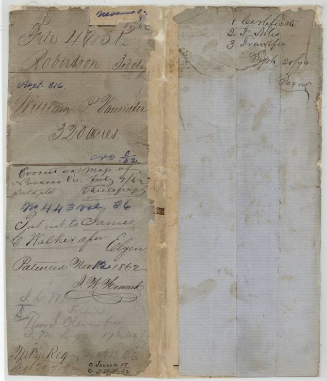
- Robertson 3rd class, file 4251
- Certificate
- No. 0/52
- Acres
- 320
- Patented to
- James C. Walker
- Patent
- 12 Nov 1862 · No. 443, Vol. 36
Tap a survey to open its page.
What the file shows
William P. Vanmeter proved in the Navarro County District Court in April 1857 that he was a single man and Mercer's Colony citizen, and was granted a 320-acre certificate. He sold it six weeks later to James C. Walker of Freestone County. J. M. Eliot surveyed it on Richland Creek about four miles southwest of Corsicana in November 1857, and the patent issued to Walker in November 1862.
The certificate
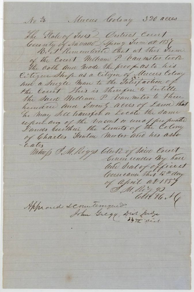
Mercer's Colony certificate (district-court certificate), 3rd class, No. 0/52 (written as a zero over 52), 320 acres, District Court of Navarro County, Spring Term 1857; J. M. Riggs, Clerk; approved and countersigned by John Gregg, District Judge, 13th District, Corsicana, 15 Apr 1857.
William P. Vanmeter took the oath and made proof of his citizenship as a citizen of Mercer's Colony and a single man; entitled to 320 acres to sell, transfer or locate on vacant or unappropriated land within the colony of Charles Fenton Mercer and his associates
Changes of hand
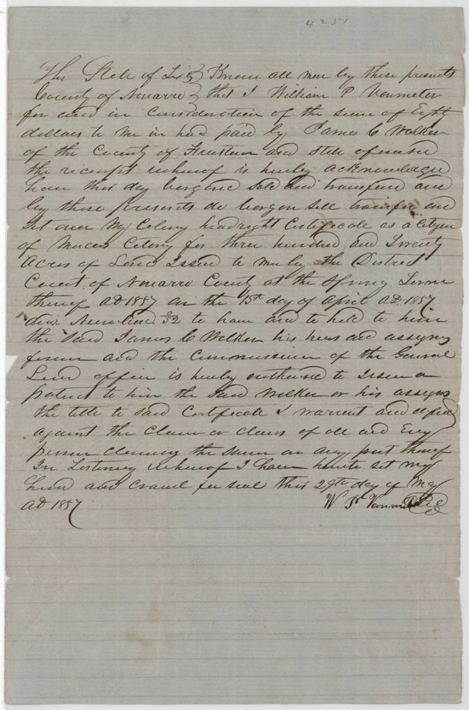
- 29 May 1857William P. Vanmeter (Van Meter) → James C. Walker, of the County of Freestone, $80 ('Eighty dollars'(?)), Navarro County, Texas. Sells and sets over his colony headright certificate for 320 acres (No. 0/52) and authorizes the Commissioner of the General Land Office to issue the patent to Walker or his assigns; docketed 'filed 17th May 58'
The survey
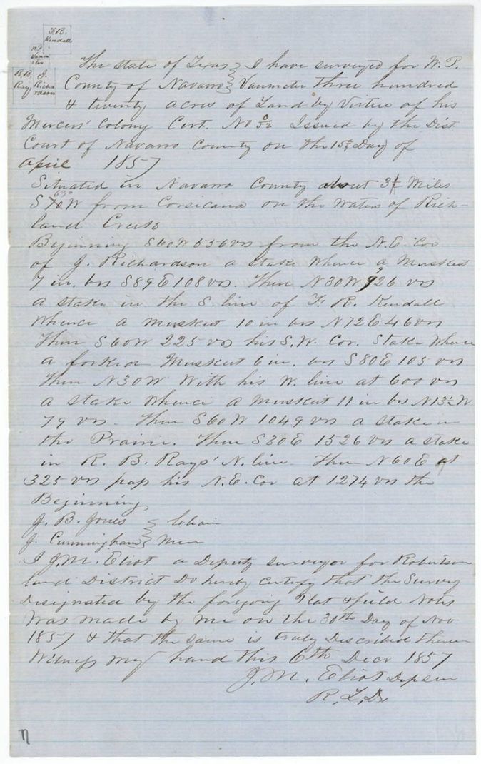
1857-11-30 (certified 1857-12-06), J. M. Eliot, Deputy Surveyor, Robertson Land District.
Navarro County, about 3 3/4(?) miles S 70 W from Corsicana, on the waters of Richland Creek; '63°' written above the bearing (a later bearing correction, not a distance)
Chain carriers: J. B. Jones, J. Cunningham.
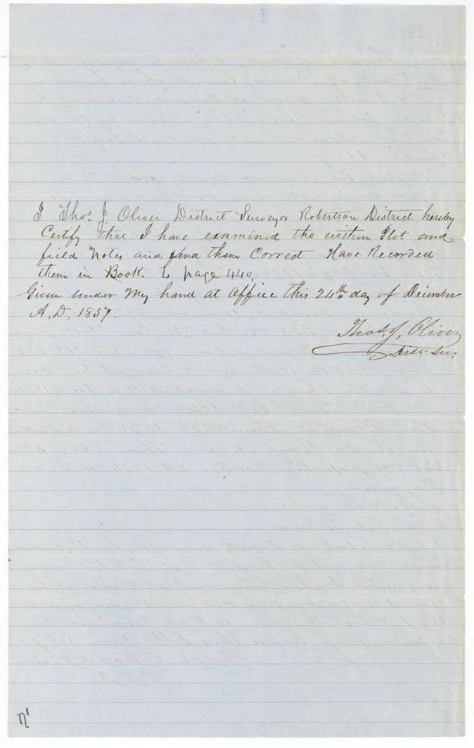
Book L, page 440
The patent
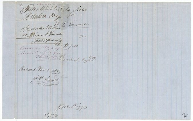
1862-11-12 (field-notes wrapper reads 'Patented Nov. 6 1862'), No. 443, Vol. 36, to James C. Walker, assignee, delivered to not stated.
Also in the file
- Patent date is 12 Nov 1862 on the jacket front and in the index, but the field-notes wrapper says 'Patented Nov. 6 1862'.
- Index lists patentee James C. Walker, original grantee William P. Van Meter; the file spells the name Vanmeter / Vanmeter / Van Meter.
- Certificate was sold to Walker of Freestone County six weeks after it was issued; the survey was then made in Vanmeter's name, as the land followed the certificate.
- Docket says the certificate was filed 17 May 1858, five months after the survey was recorded.
Timeline
- 15 Apr 1857Navarro County District Court certifies William P. Vanmeter as a Mercer's Colony citizen entitled to 320 acres
- 29 May 1857Vanmeter sells the certificate to James C. Walker of Freestone County
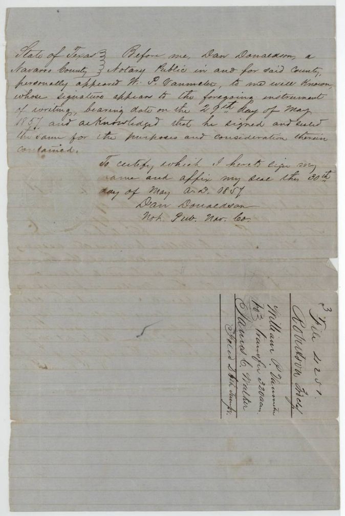
- 30 May 1857Transfer acknowledged before Dan Donaldson, notary
- 30 Nov 1857J. M. Eliot surveys 320 acres on Richland Creek
- 6 Dec 1857Eliot certifies the survey
- 24 Dec 1857Thos. J. Oliver examines and records it, Book L p. 440
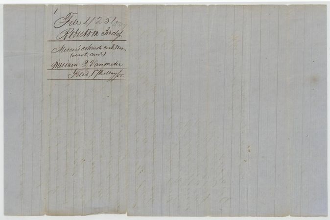
- 17 May 1858Papers filed in the Land Office
- 9 Jul 1862Checked correct on Navarro County map
- 12 Nov 1862Patent No. 443 Vol. 36 to James C. Walker, assignee
The papers in the file
Every page of the Land Office file, in the order the Land Office keeps them (8 pages). Tap a page to see it larger.
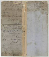 File jacketFile jacket 4251, Robertson 3rd Class, abstract 816, William P. Vanmeter 320 acres, patented to James C. Walker 12 November 1862 as No. 443 Vol. 36.General Land Office, file 4251, page 1 · in the scan
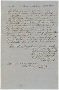 CertificateNavarro County District Court certificate entitling William P. Vanmeter to 320 acres in Mercer's Colony, 15 April 1857.General Land Office, file 4251, page 2 · in the scan
 Back of the certificateDocket on the back of the certificate: Mercer's Colony cert. 320 acres, William P. Vanmeter, filed 17 May 1858.General Land Office, file 4251, page 3 · in the scan
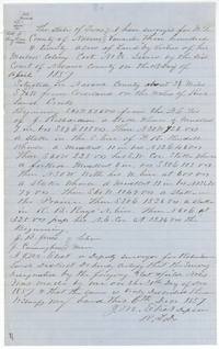 Field notesField notes and sketch plat by J. M. Eliot for 320 acres on Richland Creek southwest of Corsicana, chain carried by J. B. Jones and J. Cunningham.General Land Office, file 4251, page 4 · in the scan
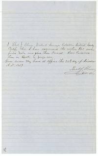 Surveyor's certificateThos. J. Oliver's certificate that he examined the plat and field notes and recorded them in Book L page 440, 24 December 1857.General Land Office, file 4251, page 5 · in the scan
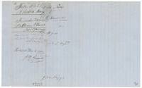 WrapperWrapper for the field notes, fee $9.00, recorded Book L page 440, filed 17 May 1858 and marked patented Nov. 6 1862.General Land Office, file 4251, page 6 · in the scan
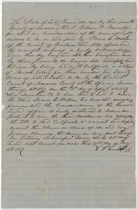 TransferTransfer by William P. Vanmeter to James C. Walker of Freestone County of his 320-acre Mercer's Colony certificate for eighty(?) dollars, 29 May 1857.General Land Office, file 4251, page 7 · in the scan
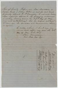 TransferNotary Dan Donaldson's acknowledgment of the Vanmeter transfer, 30 May 1857, with file docket naming Walker.General Land Office, file 4251, page 8 · in the scan
Scans courtesy of the Texas General Land Office, Austin, from its Land Grant Database.
Neighbouring surveys
Sources
- Texas General Land Office, Land Grant Database: Navarro County, Abstract 816
- The Land Office file, scanned (PDF, at the General Land Office)
- 1924 map: courtesy of the Texas General Land Office, Austin, Map 73249, used under licence. Topo: U.S. Geological Survey, The National Map. Aerial photographs: U.S. Department of Agriculture, National Agriculture Imagery Program, 2012, 2018 and 2022. Survey outlines: Railroad Commission of Texas, Original Texas Land Survey. Grant records and files: Texas General Land Office.