Blackland TX · ← All the original surveys
James O. Rice Survey, Abstract 714
- Granted to
- James O. Rice
- Kind of grant
- Bounty warrantLand paid for service in the army of the Republic.
- Land Office file
- Robertson Bounty, file 64
- Certificate
- No. 1147
- Acres
- 640
- Patented to
- M. Cavanaugh
- Patent
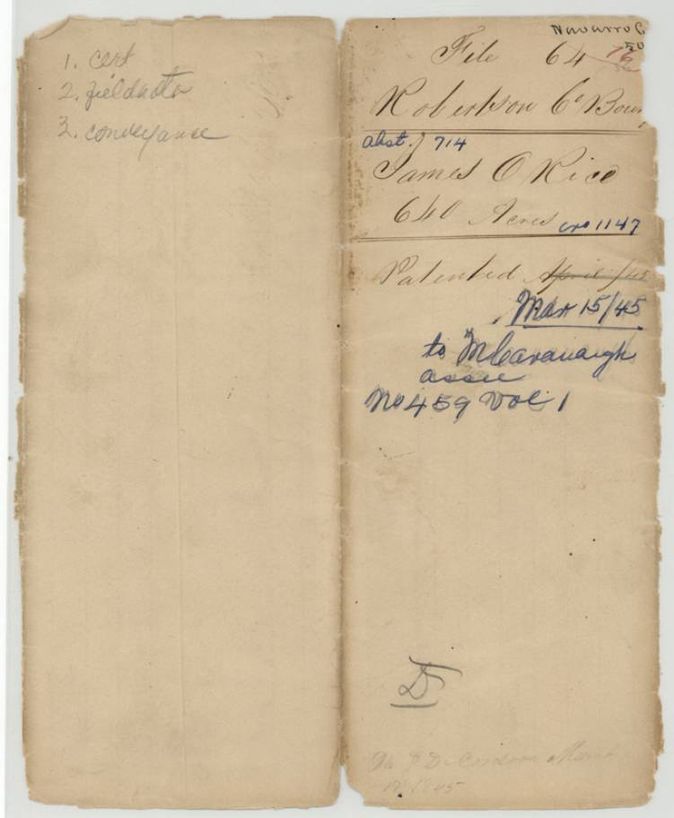
- 15 Mar 1845 · No. 459, Vol. 1
Tap a survey to open its page.
What the file shows
James O. Rice served six months in the Mounted Gun Corps in 1837 and received a 640-acre Republic of Texas bounty certificate, which he sold to Matthew Cavanagh at Houston for $150 in May 1838. B. J. Chambers surveyed the land on Chambers Creek in October 1840, and the patent, No. 459, Vol. 1, issued to Cavanaugh as assignee in March 1845.
The certificate
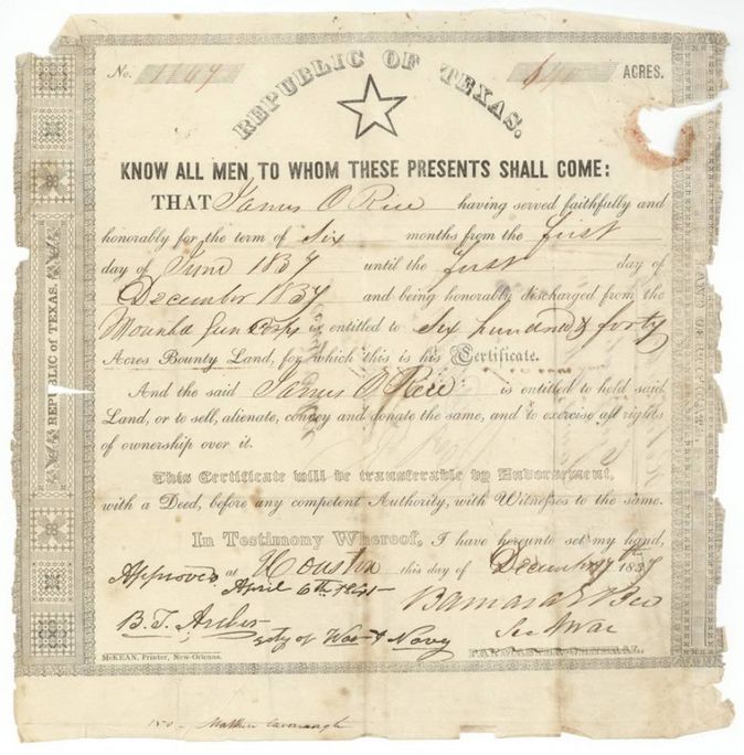
bounty land certificate (Republic of Texas, military service), No. 1147 (face reads 1147(?); the survey and transfer call it 1067 and 'ten hundred and fifty-seven'), 640 acres, Barnard E. Bee, Secretary of War; approved 6 April 1841 by B. T. Archer(?), Secretary of War and Navy, Houston, Republic of Texas, 17 Dec 1837.
James O. Rice served faithfully and honorably for six months from 1 June 1837 to 1 December 1837 and was honorably discharged from the Mounted Gun Corps; entitled to 640 acres bounty land
Changes of hand
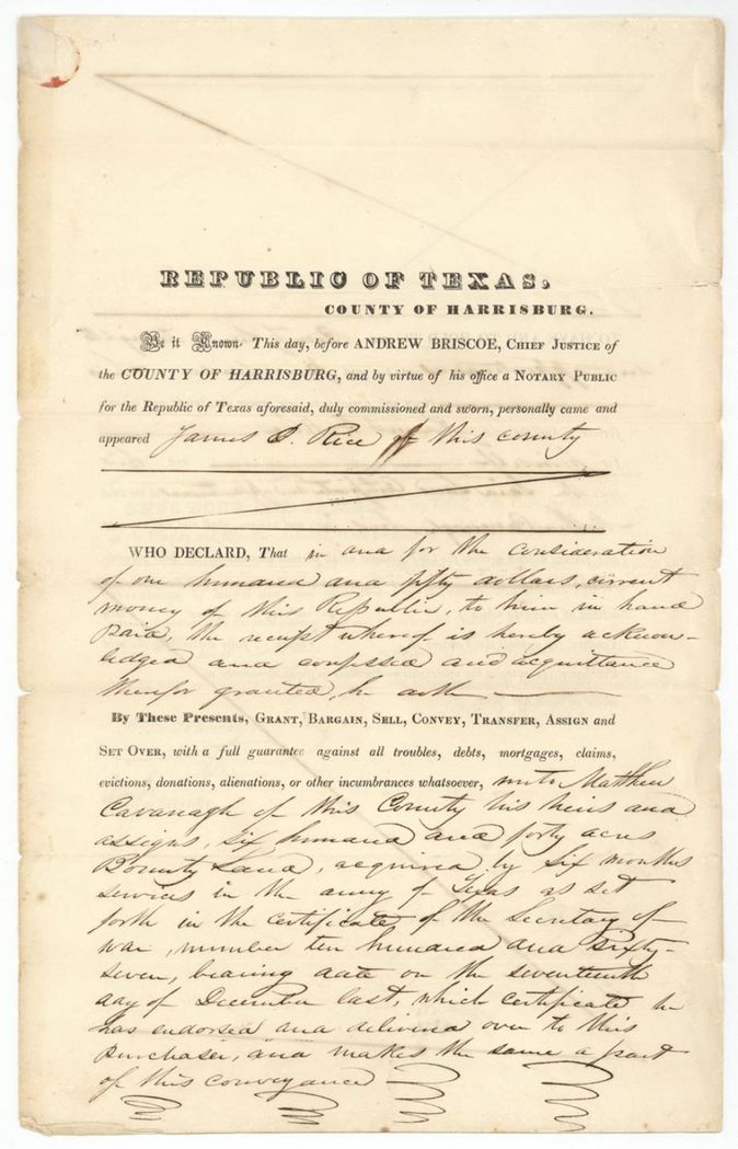
- 21 May 1838James O. Rice, of Harrisburg County → Matthew Cavanagh, of the same county, $150 current money of the Republic, Houston, Harrisburg County, Republic of Texas. Printed notarial form; sells 640 acres bounty land by certificate No. 1057(?) dated 17 December last, endorsed and delivered over to the purchaser
The survey
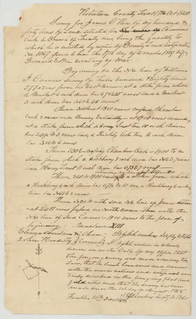
1840-10-17 (declared Franklin, 1840-11-10), B. J. Chambers, Deputy Surveyor, Robertson (Land District).
Robertson County, Texas (now Navarro), on Chambers Creek, a branch of the Trinity River
Chain carriers: Ebenezer Donaldson, John Hardisty.
Book B(?), page 116 (endorsement on back of field notes, initialled E. W.(?))
The patent
1845-03-15 (jacket also writes March 17, 1845), No. 459, Vol. 1, to M. Cavanaugh, assignee, delivered to J. D. Cordova(?) agent, 'Pat. d. to J. D. Cordova 1845' faint note on jacket.
Also in the file
- The certificate number is written 1147 on the face and jacket but 1067 in the survey and 'ten hundred and fifty-seven' in the transfer.
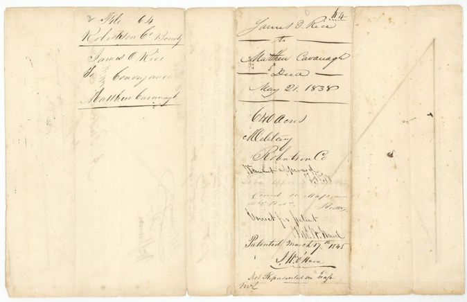
- The patent date appears twice on the jacket, 15 March 1845 on the front and 17 March 1845 on the wrapper; the index gives 15 Mar 1845.
- The survey was made in 1840 but the certificate was only 'approved' on 6 April 1841.
- Jacket marks the land 'Not represented on map' and then 'Correct on map'.
- The transfer was made about five months after the certificate issued, in May 1838, before the survey.
Timeline
- 1 Jun 1837Rice's six-month army service begins
- 17 Dec 1837Bounty certificate for 640 acres issued at Houston
- 21 May 1838Rice sells the certificate to Matthew Cavanagh for $150
- 17 Oct 1840B. J. Chambers surveys 640 acres on Chambers Creek
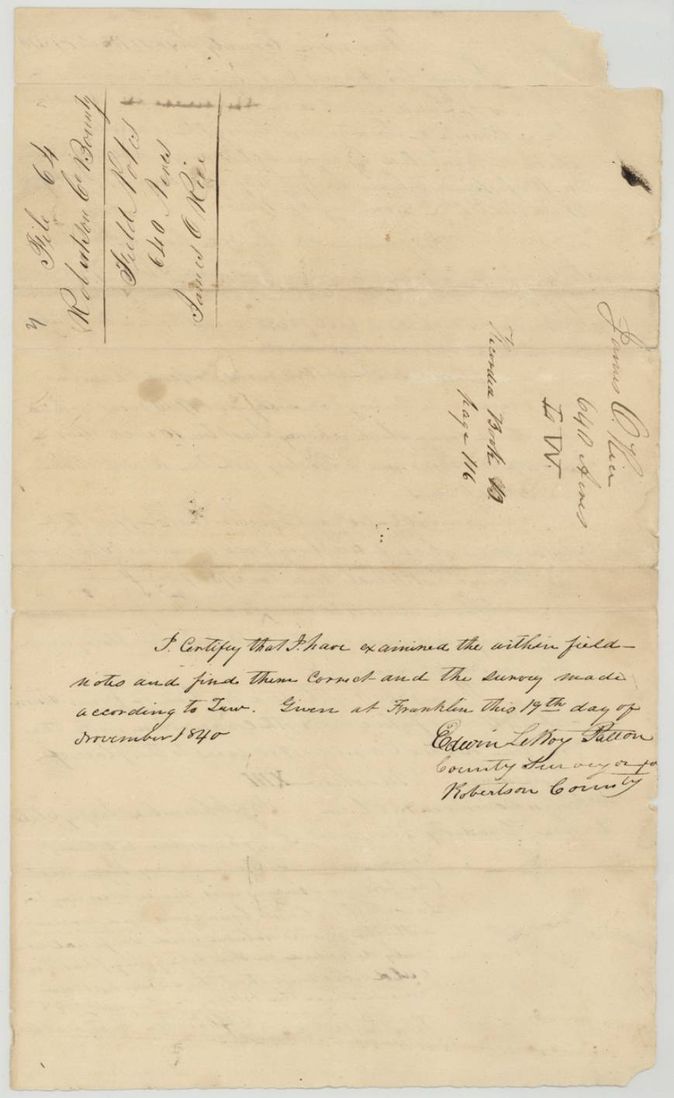
- 19 Nov 1840County Surveyor examines the field notes
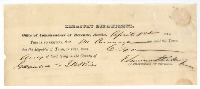
- 1 Apr 1841Cavanagh's taxes certified paid at Austin
- 6 Apr 1841Certificate approved
- 15 Mar 1845Patent No. 459, Vol. 1 to M. Cavanaugh, assignee
The papers in the file
Every page of the Land Office file, in the order the Land Office keeps them (10 pages). Tap a page to see it larger.
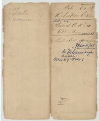 File jacketFile jacket 64 for James O. Rice's 640-acre bounty, abstract 714, patented to M. Cavanaugh, assignee, March 1845.General Land Office, file 64, page 1 · in the scan
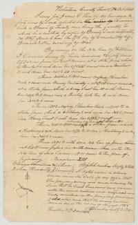 Field notesB. J. Chambers' field notes and plat of 640 acres on Chambers Creek for James O. Rice, 17 October 1840.General Land Office, file 64, page 2 · in the scan
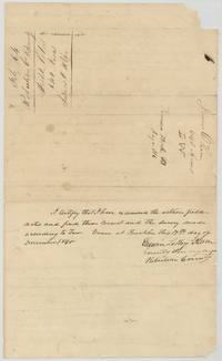 Surveyor's certificateCounty Surveyor's examination of the Rice field notes at Franklin, 19 November 1840.General Land Office, file 64, page 3 · in the scan
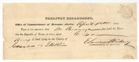 Other papersTreasury certificate, Austin, 1 April 1841, that M. Cavanagh paid the Republic's taxes on land granted to J. O. Rice.General Land Office, file 64, page 4 · in the scan
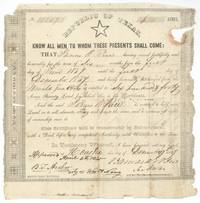 CertificateRepublic of Texas bounty certificate for 640 acres to James O. Rice, six months in the Mounted Gun Corps, approved 6 April 1841.General Land Office, file 64, page 5 · in the scan
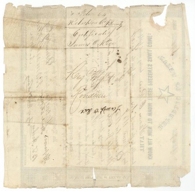
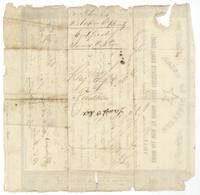 Back of the certificateBack of the Rice certificate with file label and registration endorsement.General Land Office, file 64, page 6 · in the scan
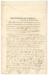 TransferJames O. Rice sells his 640-acre bounty certificate to Matthew Cavanagh for $150 before Andrew Briscoe at Houston.General Land Office, file 64, page 7 · in the scan
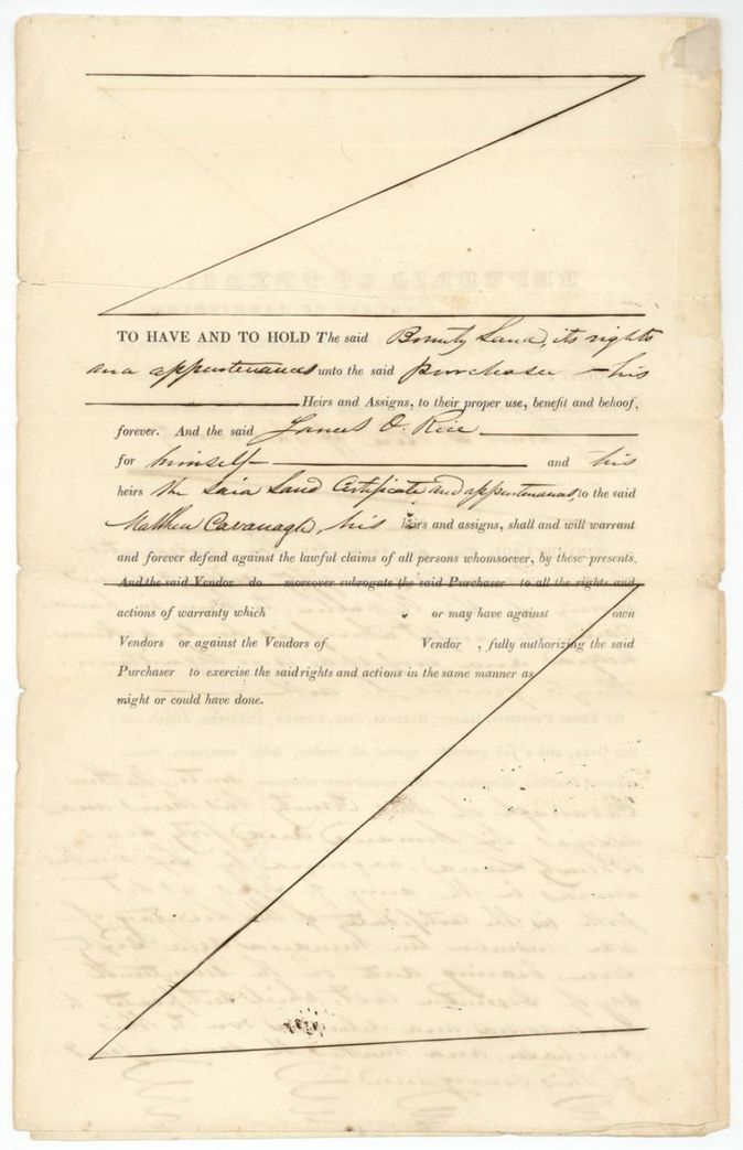
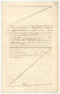 TransferHabendum and warranty clauses of the Rice to Cavanagh conveyance.General Land Office, file 64, page 8 · in the scan
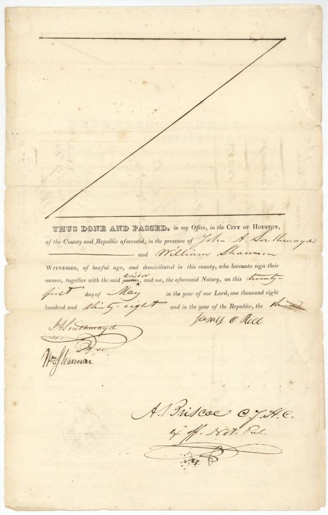
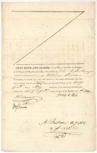 TransferConveyance signed by Rice before witnesses Southmayd and William Shannon and Notary Andrew Briscoe, 21 May 1838.General Land Office, file 64, page 9 · in the scan
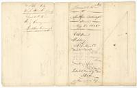 WrapperWrapper for the Rice to Cavanagh deed with patenting notes, patented 17 March 1845, not represented on map.General Land Office, file 64, page 10 · in the scan
Scans courtesy of the Texas General Land Office, Austin, from its Land Grant Database.
Neighbouring surveys
Sources
- Texas General Land Office, Land Grant Database: Navarro County, Abstract 714
- The Land Office file, scanned (PDF, at the General Land Office)
- 1924 map: courtesy of the Texas General Land Office, Austin, Map 73249, used under licence. Topo: U.S. Geological Survey, The National Map. Aerial photographs: U.S. Department of Agriculture, National Agriculture Imagery Program, 2012, 2018 and 2022. Survey outlines: Railroad Commission of Texas, Original Texas Land Survey. Grant records and files: Texas General Land Office.