Blackland TX · ← All the original surveys
Jesse H. Kuykendall Survey, Abstract 465
- Granted to
- Jesse H. Kuykendall
- Kind of grant
- Headright, third classLand for later settlers, including the colonists of Mercer’s Colony.
- Land Office file
- Robertson 3rd class, file 3346
- Certificate
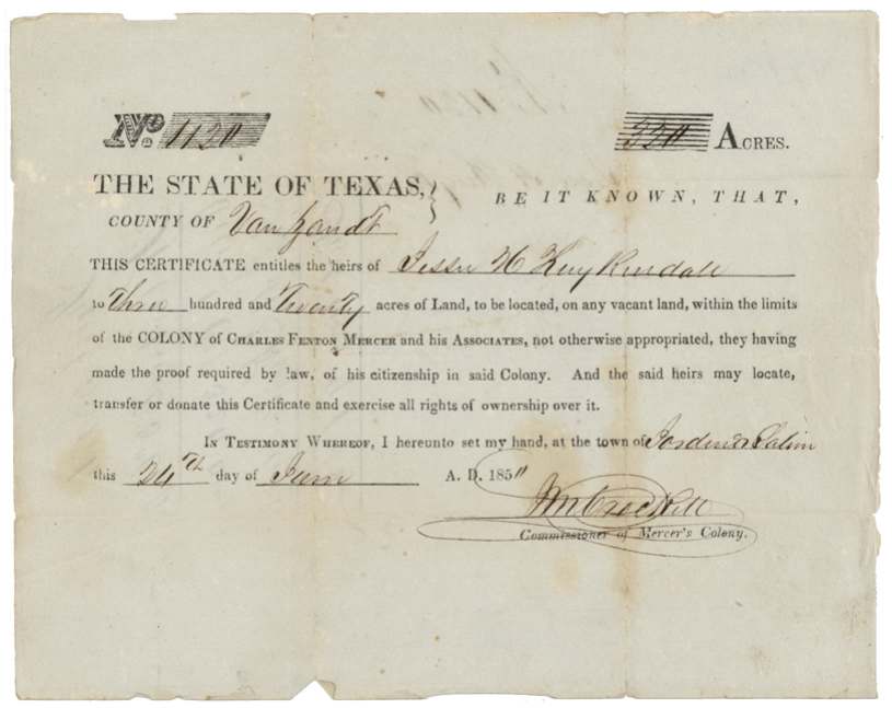
- No. 1120
- Acres
- 200
- Patented to
- Heirs of J. H. Kuykendall
- Patent
- 07 Apr 1860 · No. 335, Vol. 29
Tap a survey to open its page.
What the file shows
The heirs of Jesse H. Kuykendall received Mercer's Colony certificate No. 1120 for 320 acres in 1850 from commissioner J. M. Crockett at Jordan's Saline, Van Zandt County, on proof of his citizenship in the colony. In April 1857 deputy surveyor Milton Wright located 200 acres of it on the headwaters of Cottonwood Creek about 8.5 miles west of Corsicana, adjoining the John B. and Polly Ann Adams heirs' survey; Thos. J. Oliver recorded it in Book L page 361. The patent issued to the heirs on 7 April 1860 (No. 335, Vol. 29), but it was delivered only in 1871, to James E. Patton of Peoria, Hill County, after a transfer from Craig Wren. The other 120 acres of the certificate were handled under a separate file.
The certificate
No. 1120, 320 acres, J. M. Crockett, Commissioner of Mercer's Colony, Jordan's Saline, Van Zandt County, 1850-06-24 (year digit partly obscured; field notes read 24 June 1850).
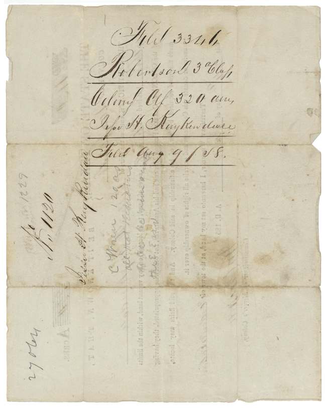
Mercer's Colony certificate entitling the heirs of Jesse H. Kuykendall to 320 acres within the limits of the colony of Charles Fenton Mercer and associates, 'they having made the proof required by law of his citizenship in said Colony'
Changes of hand
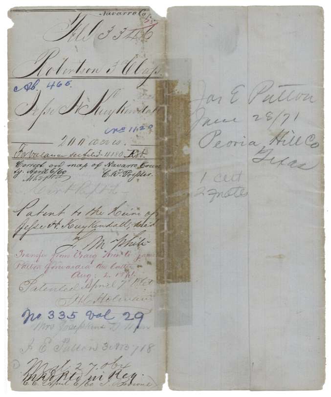
- forwarded 1871-08-02Craig Wren → James Patton. Red-ink wrapper note: 'Transfer from Craig Wren to James Patton forwarded the latter Aug 2 1871.' Transfer document itself is not in this file. Wrapper also names 'Mrs Josephine D. Wren' in pencil.
The survey
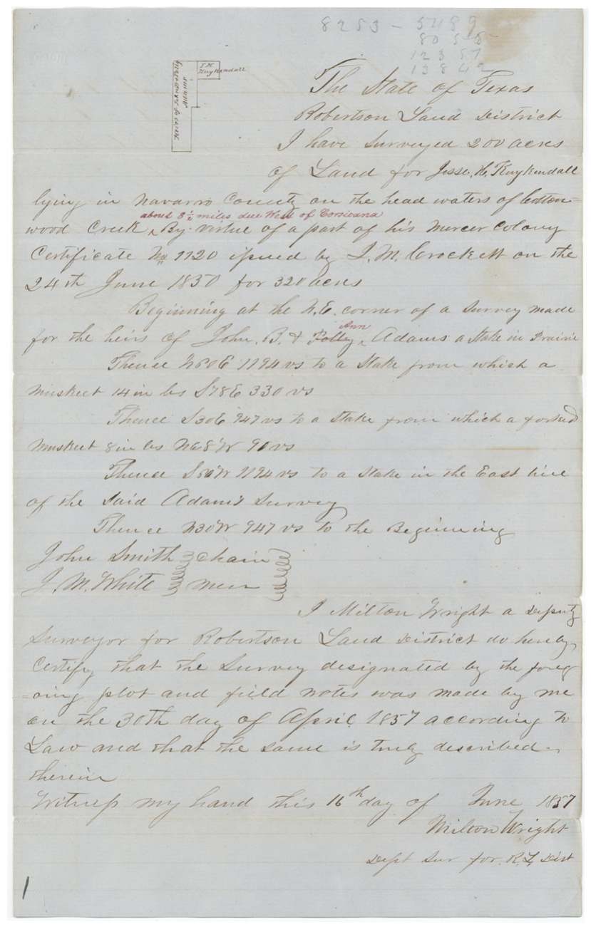
1857-04-30 (certified 1857-06-16), Milton Wright, deputy surveyor, Robertson Land District.
Navarro County, on the head waters of Cottonwood Creek, about 8 1/2 miles due west of Corsicana; begins at the NE corner of a survey made for the heirs of John B. & Polly Ann Adams, a stake in prairie
Chain carriers: John Smith, J. M. White.
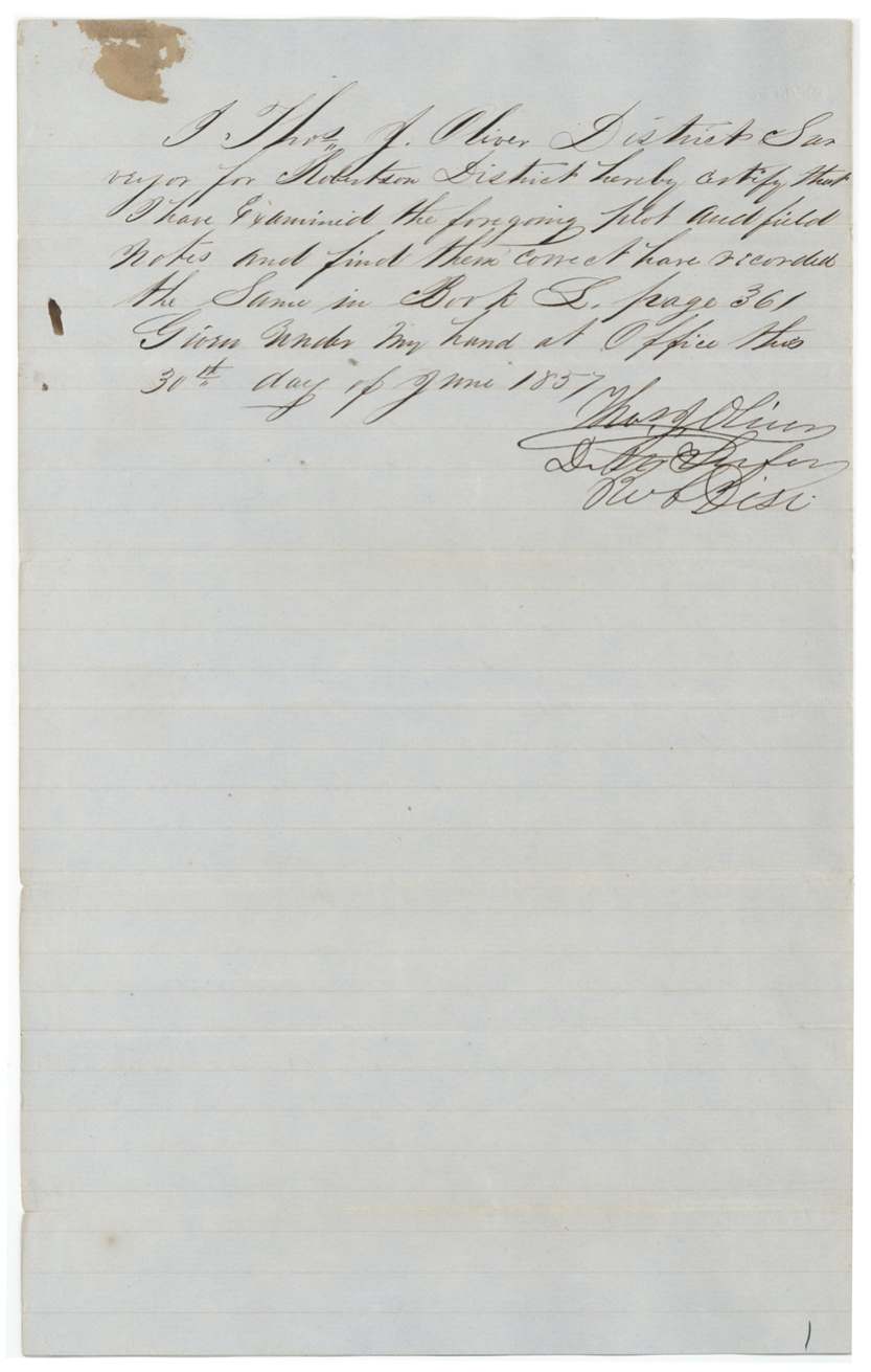
Book L, page 361
The patent
7 Apr 1860, No. 335, Vol. 29, to the Heirs of Jesse H. Kuykendall, deceased, delivered to Jas. E. Patton, Peoria, Hill County, Texas, 28 June 1871 (flap note).
Also in the file
- The certificate is a Mercer's Colony certificate, yet the file is classed Robertson 3rd Class; the land lay in the Robertson Land District, which explains the indexing.
- Only 200 of the 320 acres were located here; the remaining 120 acres were tracked separately (wrapper points to file 3-4180 Rob.).
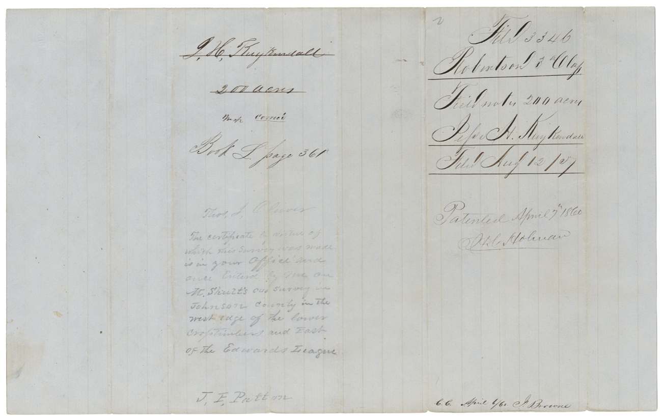
- A pencil note from J. E. Patton says the same certificate had once been entered on an old survey in Johnson County, in the west edge of the Lower Cross Timbers east of the Edwards league, before (or apart from) this Navarro location.
- The patent issued in 1860 but was not delivered until 1871, to James E. Patton of Peoria, Hill County, who had acquired an interest from Craig Wren.
Timeline
- 24 Jun 1850Mercer's Colony certificate No. 1120 for 320 acres issued to heirs of Jesse H. Kuykendall at Jordan's Saline (year partly obscured)
- 30 Apr 1857Milton Wright surveys 200 acres on Cottonwood Creek headwaters, ~8.5 mi W of Corsicana
- 16 Jun 1857Wright certifies field notes
- 30 Jun 1857Thos. J. Oliver examines and records, Book L p. 361
- 12 Aug 1857Field notes filed in GLO
- 9 Aug 1858Certificate filed in GLO
- 6 Apr 1860Checked correct on Navarro County map by C. W. Pressler
- 7 Apr 1860Patent No. 335, Vol. 29, to heirs of Jesse H. Kuykendall
- 28 Jun 1871Patent delivered to Jas. E. Patton, Peoria, Hill County
- 2 Aug 1871Transfer from Craig Wren to James Patton forwarded to Patton
The papers in the file
Every page of the Land Office file, in the order the Land Office keeps them (6 pages). Tap a page to see it larger.
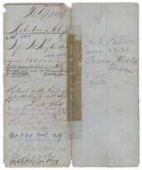 File jacketFile jacket for 200 acres surveyed for the heirs of Jesse H. Kuykendall in Navarro County, patented 7 April 1860, with notes on the 1871 delivery of the patent.General Land Office, file 3346, page 1 · in the scan
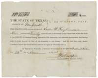 CertificateMercer's Colony certificate No. 1120, issued 24 June 1850 at Jordan's Saline, entitling the heirs of Jesse H. Kuykendall to 320 acres of vacant land.General Land Office, file 3346, page 2 · in the scan
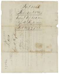 Back of the certificateBack of the Kuykendall certificate, endorsed Robertson Class 3, colony certificate for 320 acres, filed in the General Land Office 9 August 1858.General Land Office, file 3346, page 3 · in the scan
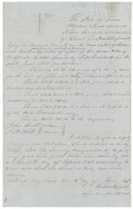 Field notesField notes for 200 acres on the head waters of Cottonwood Creek, about 8 miles west of Corsicana, surveyed for Jesse H. Kuykendall by deputy surveyor Milton Wright.General Land Office, file 3346, page 4 · in the scan
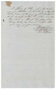 Surveyor's certificateDistrict Surveyor Thomas J. Oliver's certificate of 30 June 1857 that the Kuykendall field notes are correct and recorded in Book L, page 361.General Land Office, file 3346, page 5 · in the scan
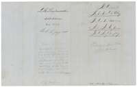 WrapperWrapper for the Kuykendall field notes, 200 acres, recorded in Book L, page 361, filed 12 August 1857 and patented 7 April 1860.General Land Office, file 3346, page 6 · in the scan
Scans courtesy of the Texas General Land Office, Austin, from its Land Grant Database.
Neighbouring surveys
Sources
- Texas General Land Office, Land Grant Database: Navarro County, Abstract 465
- The Land Office file, scanned (PDF, at the General Land Office)
- 1924 map: courtesy of the Texas General Land Office, Austin, Map 73249, used under licence. Topo: U.S. Geological Survey, The National Map. Aerial photographs: U.S. Department of Agriculture, National Agriculture Imagery Program, 2012, 2018 and 2022. Survey outlines: Railroad Commission of Texas, Original Texas Land Survey. Grant records and files: Texas General Land Office.