Blackland TX · ← All the original surveys
George A. Davis Survey, Abstract 248
- Granted to
- George A. Davis
- Kind of grant
- Donation warrantLand given for the battles of 1835–36: Bexar, the Alamo, San Jacinto.
- Land Office file
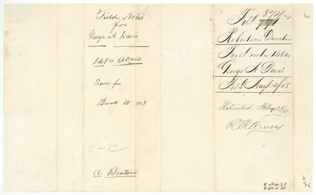
- Robertson Donation, file 874
- Acres
- 148
- Patented to
- Heirs of George A. Davis
- Patent
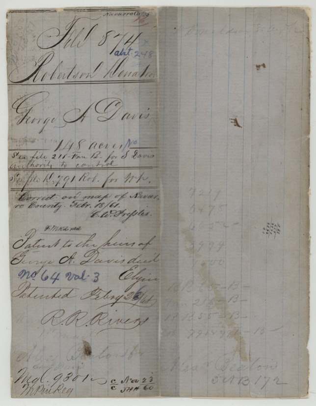
- 26 Feb 1861 · No. 64, Vol. 3
Tap a survey to open its page.
What the file shows
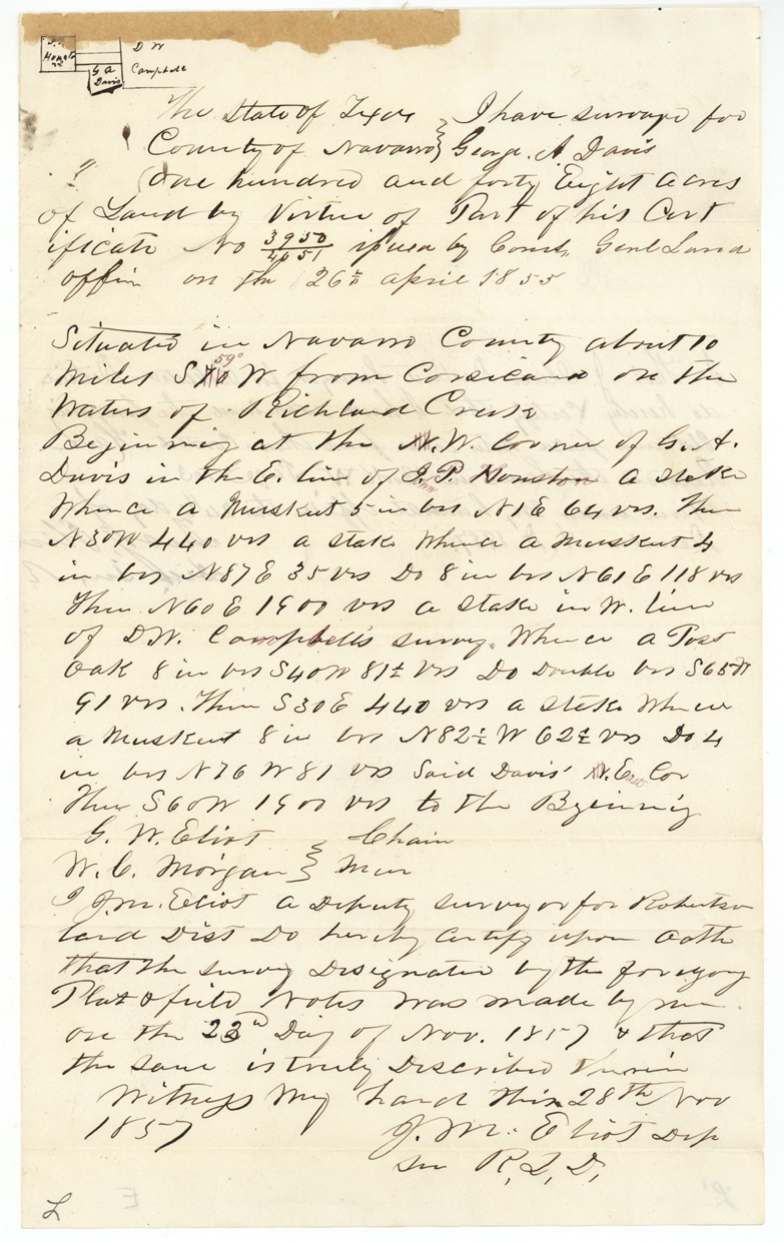
George A. Davis held a donation certificate (No. 3950/4051) issued by the General Land Office on 26 April 1855; the warrant itself is in another file. Deputy surveyor J. M. Eliot used part of it for 148 acres on the waters of Richland Creek, about 10 miles southwest of Corsicana, next to J. P. Houston and D. W. Campbell, in November 1857. When the Land Office doubted that there was room for Davis's small surveys, Eliot wrote in January 1861 to show the neighbours' dimensions left the space. The land was found correct on the county map and patented to the heirs of George A. Davis, deceased (No. 64, Vol. 3) in February 1861.
The certificate
donation, No. 3950/4051, 148 acres used here, as 'part of his certificate', Commissioner of the General Land Office, Austin (implied), 26 Apr 1855.
Not stated in this file. The class is Robertson Donation and the jacket refers to file 12,791 Rob. 'for Wt.' (the warrant). The battle or service behind the donation is not given here.
The survey
23 Nov 1857, J. M. Eliot, Deputy Surveyor, Robertson Land District.
Navarro County, about 10 miles S 40 W (corrected in red to S 59 W) from Corsicana, on the waters of Richland Creek
Chain carriers: G. W. Eliot, W. C. Morgan.
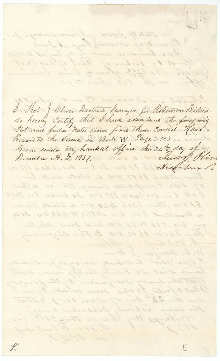
Book W page 103
The patent
1861-02-26 (jacket figure altered; field-note docket reads Feb 23/61), No. 64, Vol. 3, to The heirs of George A. Davis, deceased, delivered to Alex.(?) Beaton for S.(?) Davis (faint).
Also in the file
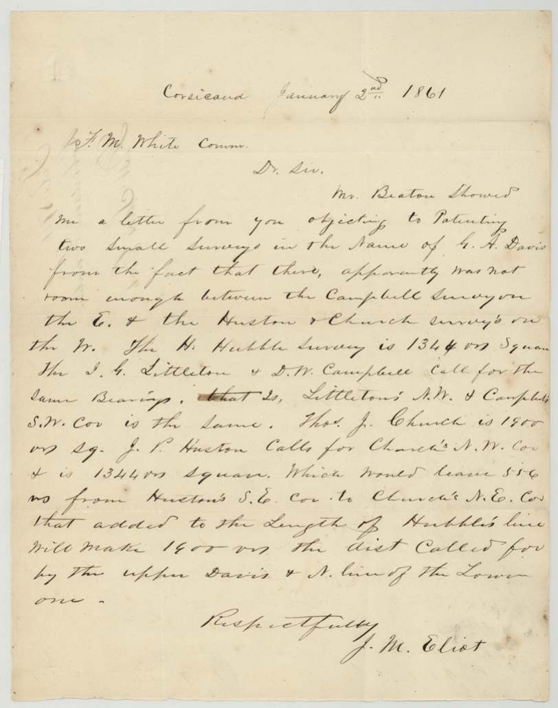
- The Land Office doubted that there was room for Davis's two small surveys between the Campbell, Houston and Church surveys; the surveyor argued it out from the neighbours' dimensions, and the land was passed.
- The patent went to the 'heirs of George A. Davis, deceased' - he died before the land was patented.
- One chain carrier, G. W. Eliot, shares the surveyor's surname.
- The direction from Corsicana was later corrected in red ink from S 40 W to S 59 W.
Timeline
- 26 Apr 1855Donation certificate 3950/4051 issued by the Commissioner of the GLO
- 23 Nov 1857J. M. Eliot surveys 148 acres on Richland Creek waters
- 24 Dec 1857Field notes examined and recorded, Book W p. 103
- 2 Aug 1858Field notes filed in GLO
- 2 Jan 1861Eliot writes Commissioner F. M. White defending the room for the Davis surveys
- 18 Feb 1861Map check: correct on Navarro County map
- 26 Feb 1861Patent No. 64 Vol. 3 to the heirs of George A. Davis
The papers in the file
Every page of the Land Office file, in the order the Land Office keeps them (6 pages). Tap a page to see it larger.
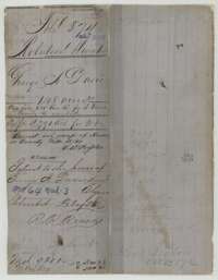 File jacketFile jacket for George A. Davis, 148 acres, Robertson donation, marked as patented to his heirs on 26 February 1861.General Land Office, file 874, page 1 · in the scan
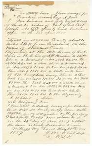 Field notesField notes for 148 acres on the waters of Richland Creek, surveyed for George A. Davis by deputy surveyor J. M. Eliot, 23 November 1857.General Land Office, file 874, page 2 · in the scan
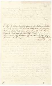 Surveyor's certificateCertificate of district surveyor Thos. J. Oliver, 24 December 1857, that the Davis field notes were examined and recorded in Book W, page 103.General Land Office, file 874, page 3 · in the scan
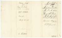 DocketField-notes wrapper for George A. Davis, 148 acres, filed in the Land Office on 2 August 1858 and patented in February 1861.General Land Office, file 874, page 4 · in the scan
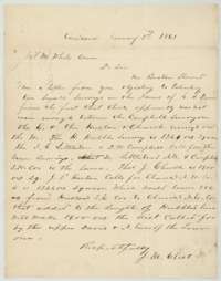 LetterLetter from J. M. Eliot at Corsicana to Commissioner F. M. White, 2 January 1861, giving the survey distances to show there was room for the Davis surveys.General Land Office, file 874, page 5 · in the scan
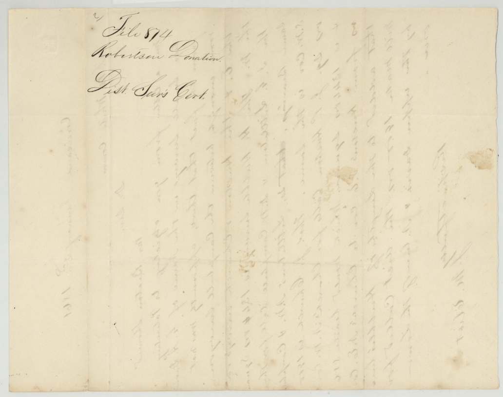
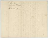 DocketBack of the Eliot letter, with the Land Office filing note for file 874, Robertson donation.General Land Office, file 874, page 6 · in the scan
Scans courtesy of the Texas General Land Office, Austin, from its Land Grant Database.
Neighbouring surveys
Sources
- Texas General Land Office, Land Grant Database: Navarro County, Abstract 248
- The Land Office file, scanned (PDF, at the General Land Office)
- 1924 map: courtesy of the Texas General Land Office, Austin, Map 73249, used under licence. Topo: U.S. Geological Survey, The National Map. Aerial photographs: U.S. Department of Agriculture, National Agriculture Imagery Program, 2012, 2018 and 2022. Survey outlines: Railroad Commission of Texas, Original Texas Land Survey. Grant records and files: Texas General Land Office.