Blackland TX · ← All the original surveys
George A. Davis Survey, Abstract 245
- Granted to
- George A. Davis
- Kind of grant
- Donation warrantLand given for the battles of 1835–36: Bexar, the Alamo, San Jacinto.
- Land Office file
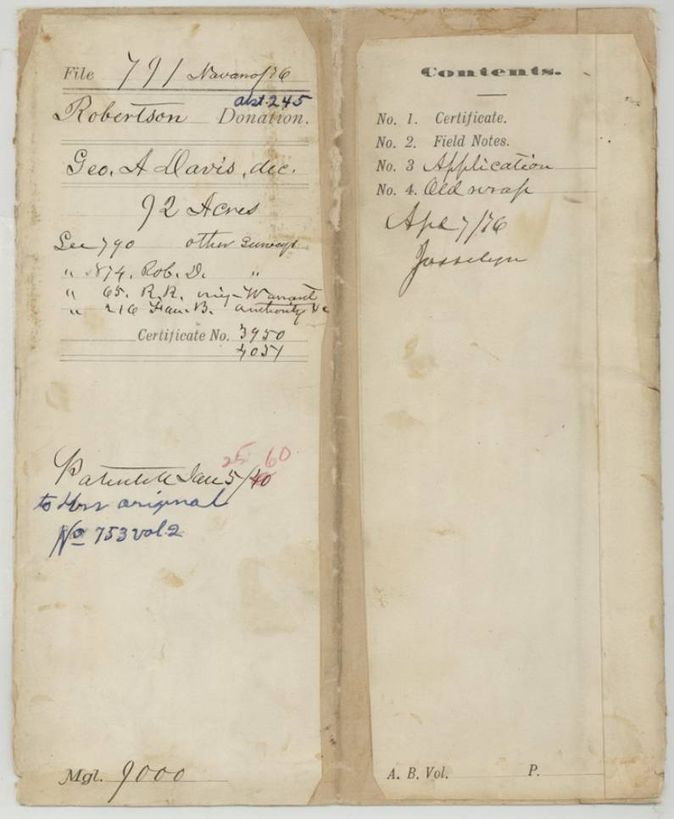
- Robertson Donation, file 791
- Certificate
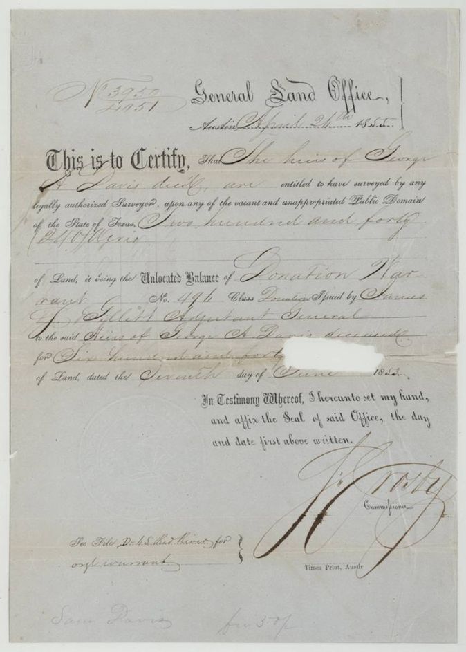
- No. 3950/4051
- Acres
- 92
- Patented to
- Heirs of George A. Davis
- Patent
- 25 Jan 1860 · No. 753, Vol. 2
Tap a survey to open its page.
What the file shows
George A. Davis's heirs held an unlocated balance certificate (No. 3950/4051, 240 acres) from Donation Warrant No. 494, issued 26 April 1855. Locator Alex. Beaton applied for it in 1857, and deputy surveyor J. M. Eliot laid out 92 acres on Richland Creek, about six miles S 80 W (nearly due west) of Corsicana, on 1 September 1857. The patent (No. 753 Vol. 2) issued to the heirs on 25 January 1860 and was sent to Beaton for Sam Davis.
The certificate
donation warrant, unlocated balance certificate, No. 3950/4051 (balance certificate); original Donation Warrant No. 494, 240 (92 acres located in this file), General Land Office, Commissioner S. Crosby; original warrant issued by James S. Gillett, Adjutant General, Austin, 1855-04-26 (original warrant dated 1853-06-07(?)).
The heirs of George A. Davis, deceased, are entitled to have surveyed 240 acres, the unlocated balance of Donation Warrant No. 494 (class donation) for 640 acres issued by the Adjutant General. Note: 'See file D-4 S. Red River for original warrant.'
The survey
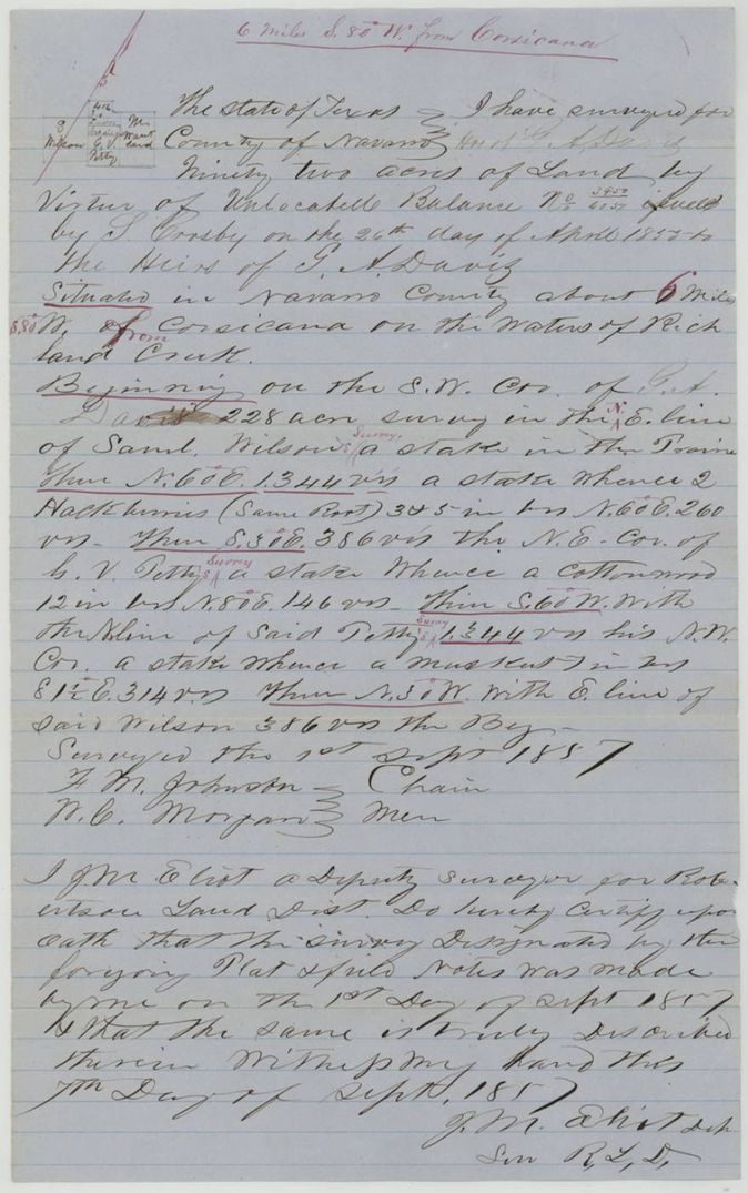
1857-09-01 (certified 1857-09-07), J. M. Eliot, Deputy Surveyor, Robertson Land District.
Navarro County, about 6 miles S 80 W from Corsicana on the waters of Richland Creek
Chain carriers: F. M. Johnson, N. C. Morgan.
Book R, page 28(?)
The patent
25 Jan 1860, No. 753, Vol. 2, to the Heirs of George A. Davis, deceased, delivered to Alex. Beaton for Sam Davis (forwarded 1860-02-21).
Also in the file
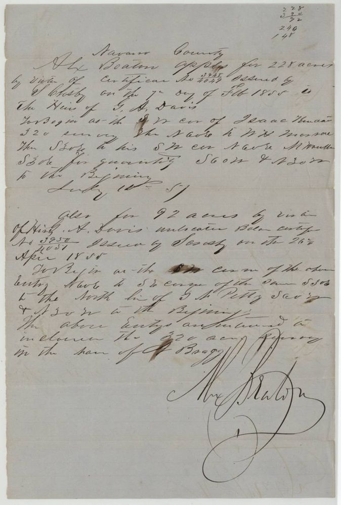
- The survey was made 1 Sept 1857 and is dated just after Beaton's July 1857 application, but the application says the entries were meant to enclose a 320-acre survey in the name of A. Bragg (Henry Bragg 3-1065), which the map checker flagged as a conflict on 5 Nov 1859.
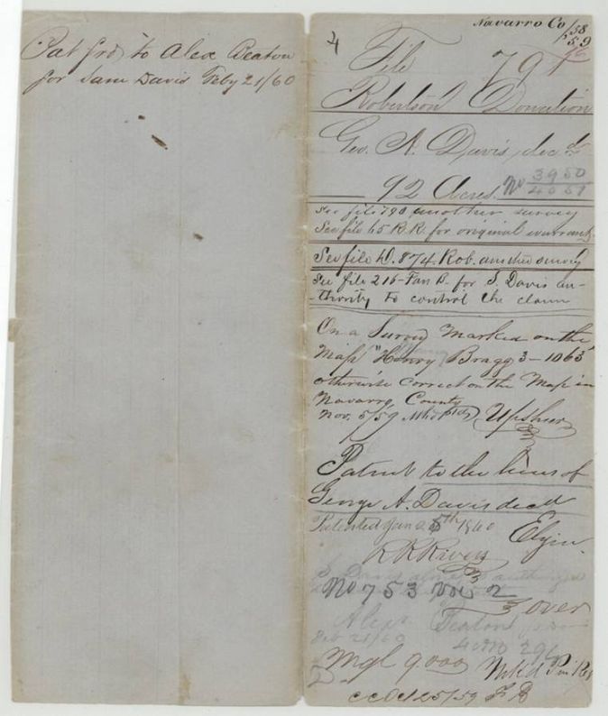
- The patent went to the heirs of George A. Davis but was forwarded to Alex. Beaton on the authority of Sam Davis, who alone is said to control the claim (file 216). There is no deed in the file; this is a delivery instruction, not a transfer.
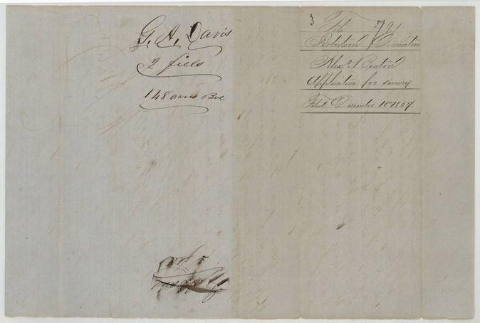
- The balance certificate number reads 3950/4051 while the sister certificate for the 228 acres is 3948/4049; the 92 acres were surveyed from the 240-acre balance, leaving 148 acres (the wrapper notes '2 fields 148 acres above').
- The date on the balance certificate is hard to read; the field notes and application both give 26 April 1855.
- Index says patent date 25 Jan 1860, No. 753 Vol. 2, 92 acres. The jacket first wrote 'Jan 5/60' with a red 25 over it, the old wrapper has the 2 squeezed in before '5th', and the field-notes wrapper reads 'January 24th(?)'.
Timeline
- 7 Jun 1853Adjutant General James S. Gillett issues Donation Warrant No. 494 for 640 acres to the heirs of George A. Davis (date read, uncertain)
- 26 Apr 1855General Land Office issues unlocated balance certificate 3950/4051 for 240 acres
- 15 Jul 1857Alex. Beaton applies for the 228-acre and 92-acre locations
- 1 Sep 1857J. M. Eliot surveys 92 acres on Richland Creek
- 7 Sep 1857Eliot certifies the survey
- 10 Dec 1857Field notes, certificate and application filed in the General Land Office
- 5 Nov 1859Survey checked on map of Navarro County, noted as conflicting with the Henry Bragg survey
- 25 Jan 1860Patent No. 753 Vol. 2 to the heirs of George A. Davis
- 21 Feb 1860Patent forwarded to Alex. Beaton for Sam Davis
The papers in the file
Every page of the Land Office file, in the order the Land Office keeps them (8 pages). Tap a page to see it larger.
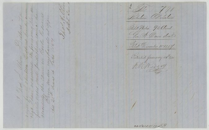
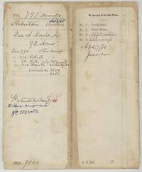 File jacketFile jacket 791 Robertson Donation for the heirs of George A. Davis, 92 acres, patented January 1860, with cross-references to other Davis files.General Land Office, file 791, page 1 · in the scan
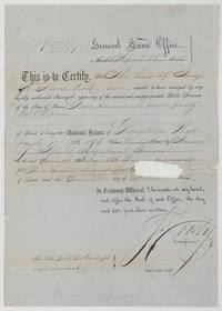 CertificateGeneral Land Office balance certificate 3950/4051 for 240 acres to the heirs of George A. Davis, from Donation Warrant No. 494.General Land Office, file 791, page 2 · in the scan
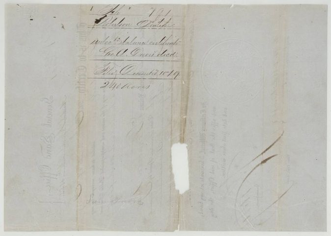
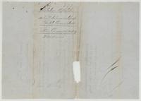 Back of the certificateBack of the certificate, endorsed file 791 Robertson Donation, unlocated balance certificate, Geo. A. Davis dec'd, 240 acres, filed 10 December 1857.General Land Office, file 791, page 3 · in the scan
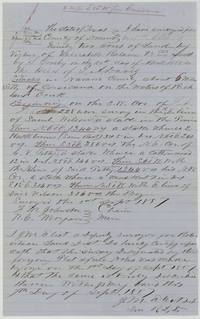 Field notesJ. M. Eliot's field notes and plat of 92 acres for the heirs of G. A. Davis on Richland Creek, surveyed 1 September 1857.General Land Office, file 791, page 4 · in the scan
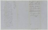 Surveyor's certificateThos. J. Oliver certifies the notes correct and recorded in Book R, 25 September 1857; wrapper filed 10 December 1857, patented January 1860 (R. K. Rivers).General Land Office, file 791, page 5 · in the scan
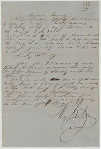 Other papersAlex. Beaton's application for 228 acres on certificate 3948/4049 and 92 acres on certificate 3950/4051 for the G. A. Davis heirs.General Land Office, file 791, page 6 · in the scan
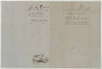 WrapperWrapper for Beaton's application, G. A. Davis, 2 fields, 148 acres above, filed 10 December 1857.General Land Office, file 791, page 7 · in the scan
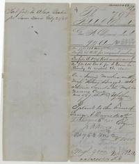 WrapperOld wrapper with the Upshur map check of 5 Nov 1859 against the Henry Bragg survey, the patent to the heirs, and its forwarding to Alex. Beaton for Sam Davis, 21 Feb 1860.General Land Office, file 791, page 8 · in the scan
Scans courtesy of the Texas General Land Office, Austin, from its Land Grant Database.
Neighbouring surveys
Sources
- Texas General Land Office, Land Grant Database: Navarro County, Abstract 245
- The Land Office file, scanned (PDF, at the General Land Office)
- 1924 map: courtesy of the Texas General Land Office, Austin, Map 73249, used under licence. Topo: U.S. Geological Survey, The National Map. Aerial photographs: U.S. Department of Agriculture, National Agriculture Imagery Program, 2012, 2018 and 2022. Survey outlines: Railroad Commission of Texas, Original Texas Land Survey. Grant records and files: Texas General Land Office.