Blackland TX · ← All the original surveys
John H. Singleton Survey, Abstract 773
- Granted to
- John H. Singleton
- Kind of grant
- Bounty warrantLand paid for service in the army of the Republic.
- Land Office file
- Robertson Bounty, file 142
- Certificate
- No. 1848
- Acres
- 640
- Patented to
- John H. Singleton
- Patent
- 08 Oct 1846 · No. 153, Vol. 3
Tap a survey to open its page.
What the file shows
John H. Singleton earned a 640-acre Republic of Texas bounty certificate for six months' army service in 1836. Deputy surveyor B. J. Chambers located it on Chambers' Creek in 1840 beside the New York firm Rawdon, Wright and Hatch, and the patent issued to Singleton on 8 October 1846 despite endorsements to other buyers. In 1876 County Surveyor B. F. Marchbanks re-ran the lines for the Land Office.
The certificate
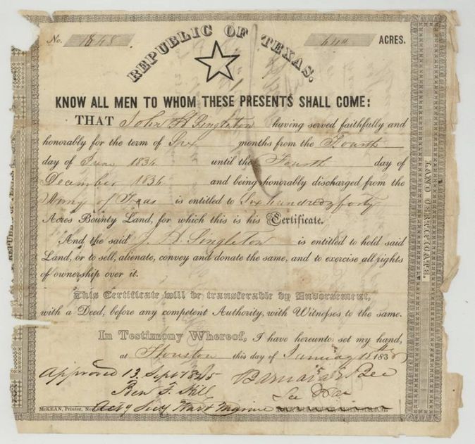
bounty land certificate (Republic of Texas), No. 1848, 640 acres, Barnard E. Bee, Secretary of War, Republic of Texas; approved 13 Sept 1845 by Ben F. Hill, Acting Secretary of War and Marine, Houston, 15 Jan 1838.
John H. Singleton served faithfully and honorably for six months, from 4 June 1836 until 4 December 1836, and was honorably discharged from the Army of Texas; entitled to 640 acres of bounty land.
Changes of hand
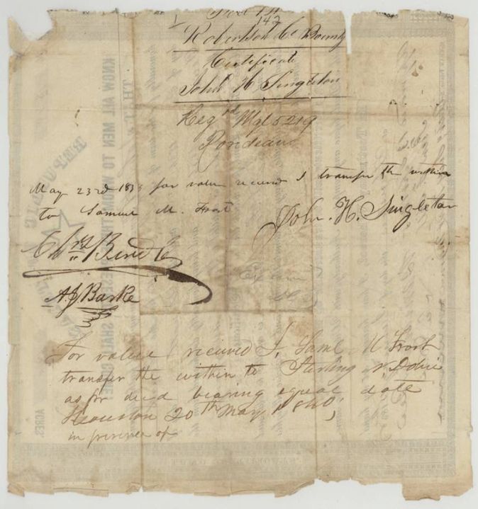
- 1838-05-23(?)John H. Singleton → Samuel M. Frost(?), 'for value received', not stated. Endorsement on the back of the certificate.
- 20 May 1840Samuel M. Frost(?) → Sterling W. Dobie(?), 'for value received', Houston. Second endorsement 'as per deed bearing equal date, Houston 20th May 1840'; the patent nevertheless went to Singleton.
The survey
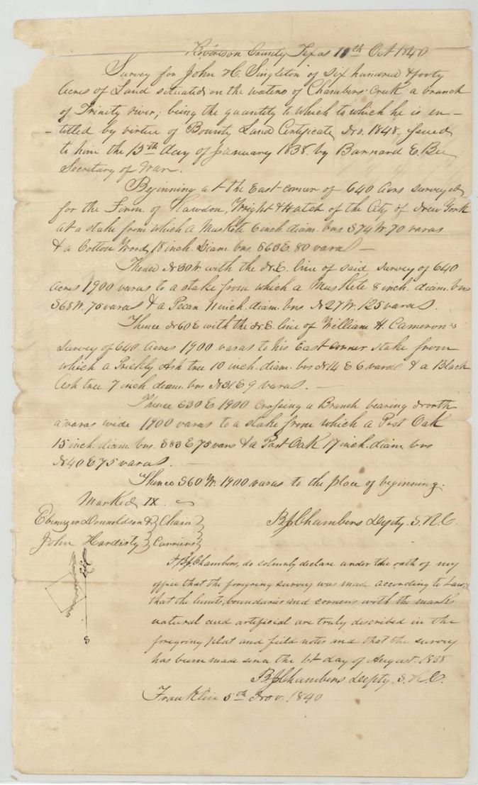
1840-10-18(?) (certified 1840-11-05), B. J. Chambers, Deputy Surveyor, Robertson County.
Robertson County (now Navarro), on the waters of Chambers' Creek, a branch of the Trinity River
Chain carriers: Ebenezer Donaldson, John Hardisty.
Book B, page 143
The patent
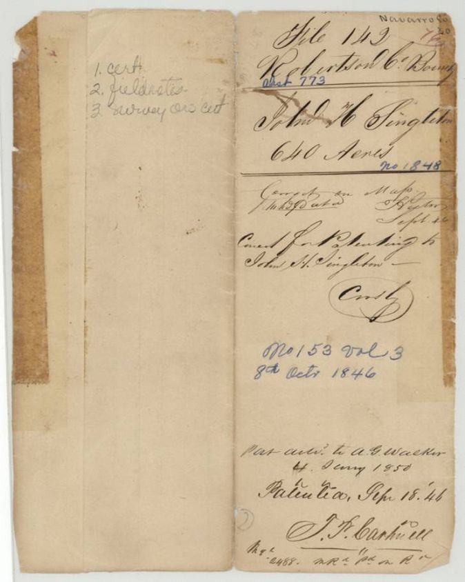
8 Oct 1846, No. 153, Vol. 3, to John H. Singleton, delivered to A. G. Walker, 4 January 1850.
Also in the file
- The certificate was sold twice by endorsement (to Frost(?), then to Dobie(?) in 1840) yet the patent went to John H. Singleton, the original soldier; the jacket records delivery to A. G. Walker in 1850.
- Jacket date 'Patented Sep 18 '46' differs from the 8 Oct 1846 patent date written in blue; index says 08 Oct 1846.
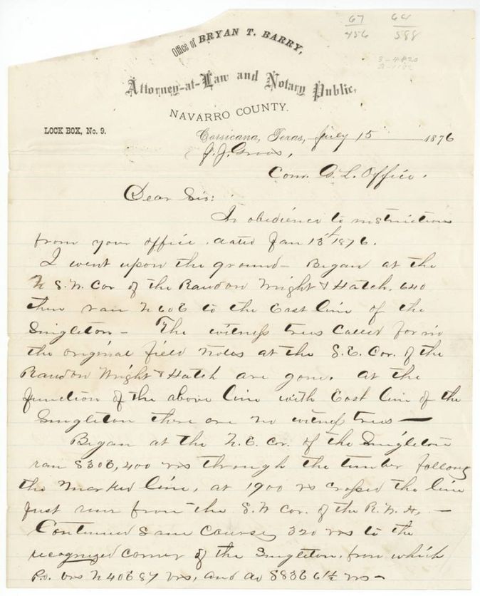
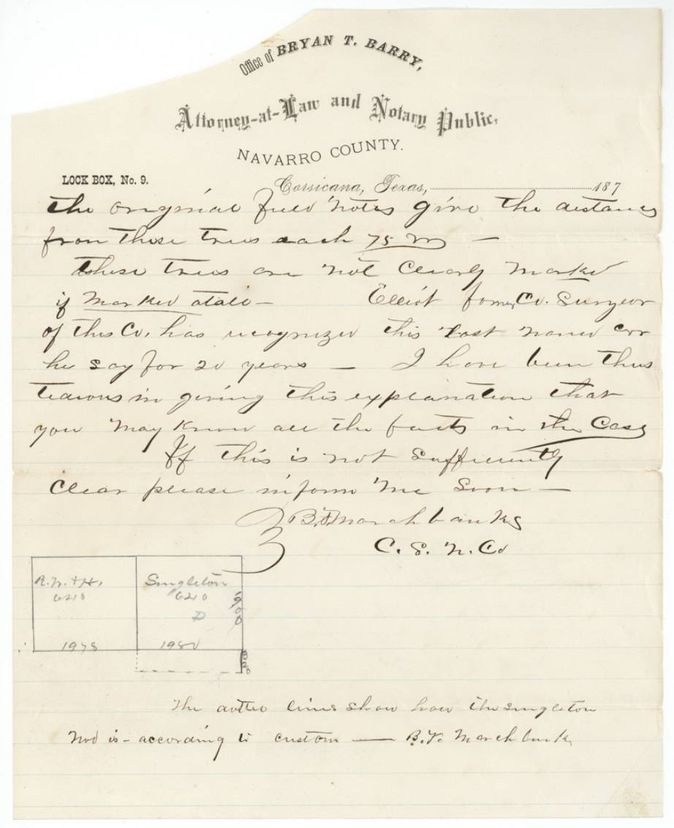
- The 1876 letter reports that the witness trees called for in the original field notes at the S.E. corner of the Rawdon, Wright and Hatch 640 are gone, and that Eliot, former county surveyor, says he has recognised the Singleton's corner for 20 years.
- Marchbanks' 1876 sketch shows the Singleton and the Rawdon, Wright and Hatch 640 side by side, with lines of 1900 and 1981 varas on the Singleton and 1978 on the R. W. & H.
- The 1876 report is on attorney Bryan T. Barry's letterhead but is written and signed by County Surveyor B. F. Marchbanks.
Timeline
- 4 Jun 1836John H. Singleton begins six months' army service
- 4 Dec 1836Singleton honorably discharged
- 15 Jan 1838Bounty certificate No. 1848 for 640 acres issued at Houston
- 20 May 1840Certificate endorsed over to Sterling W. Dobie(?) at Houston
- 5 Nov 1840B. J. Chambers certifies the survey on Chambers' Creek
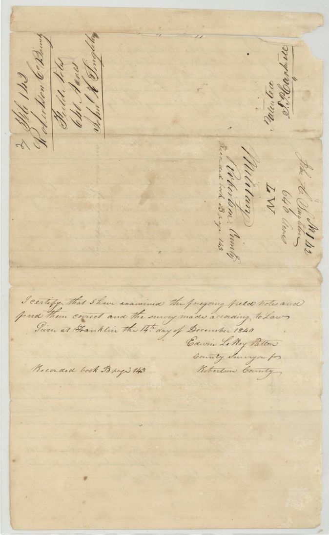
- 14 Dec 1840County Surveyor Patton examines the notes, recorded Book B p143
- 13 Sep 1845Certificate approved by Acting Secretary of War and Marine Ben F. Hill
- 8 Oct 1846Patent No. 153 Vol. 3 to John H. Singleton
- 4 Jan 1850Patent delivered to A. G. Walker
- 13 Jan 1876General Land Office instructs a resurvey of the Singleton corners
- 15 Jul 1876County Surveyor B. F. Marchbanks reports his resurvey of the Singleton corners to Commissioner J. J. Groos (under instructions of 13 Jan 1876)
The papers in the file
Every page of the Land Office file, in the order the Land Office keeps them (8 pages). Tap a page to see it larger.
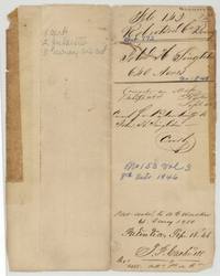 File jacketFile jacket 143, Robertson Co Bounty, abst 773, John H. Singleton 640 acres, patented 8 Oct 1846, No. 153 Vol 3, delivered to A. G. Walker in 1850.General Land Office, file 142, page 1 · in the scan
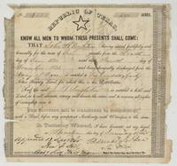 CertificateRepublic of Texas bounty certificate No. 1848 for 640 acres to John H. Singleton for six months' service in 1836, signed Barnard E. Bee.General Land Office, file 142, page 2 · in the scan
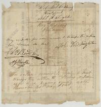 Back of the certificateBack of the certificate with Singleton's endorsement to Samuel M. Frost(?) and Frost's transfer to Sterling W. Dobie(?) at Houston, 20 May 1840.General Land Office, file 142, page 3 · in the scan
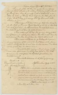 Field notesField notes and plat of 640 acres for John H. Singleton on Chambers' Creek beside the Rawdon, Wright and Hatch survey, by B. J. Chambers.General Land Office, file 142, page 4 · in the scan
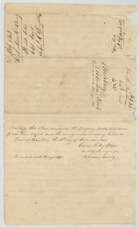 Surveyor's certificateCounty Surveyor Edwin LeRoy Patton examines the Singleton field notes at Franklin on 14 Dec 1840, Book B page 143, with wrapper.General Land Office, file 142, page 5 · in the scan
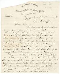 LetterCounty Surveyor B. F. Marchbanks, writing on Bryan T. Barry's letterhead, reports to Commissioner Groos on 15 July 1876 his resurvey of the Singleton corners and missing witness trees.General Land Office, file 142, page 6 · in the scan
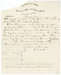 LetterEnd of Marchbanks' letter: former surveyor Eliot has recognised the corner 20 years; sketch of the Singleton against the Rawdon, Wright and Hatch 640.General Land Office, file 142, page 7 · in the scan
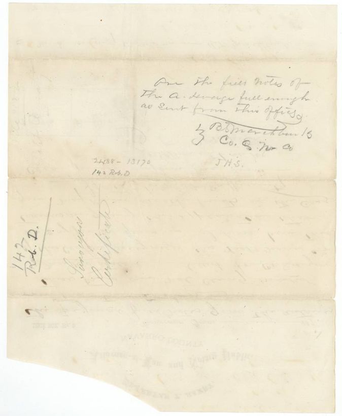
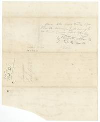 Other papersBack of the letter with Marchbanks' pencil query whether the field notes of the A. Hodge(?) are full enough as sent, docketed 142 Rob. D., Surveyor's Certificate.General Land Office, file 142, page 8 · in the scan
Scans courtesy of the Texas General Land Office, Austin, from its Land Grant Database.
Neighbouring surveys
Sources
- Texas General Land Office, Land Grant Database: Navarro County, Abstract 773
- The Land Office file, scanned (PDF, at the General Land Office)
- 1924 map: courtesy of the Texas General Land Office, Austin, Map 73249, used under licence. Topo: U.S. Geological Survey, The National Map. Aerial photographs: U.S. Department of Agriculture, National Agriculture Imagery Program, 2012, 2018 and 2022. Survey outlines: Railroad Commission of Texas, Original Texas Land Survey. Grant records and files: Texas General Land Office.