Blackland TX · ← All the original surveys
William R. Bowen Survey, Abstract 68
- Granted to
- William R. Bowen
- Kind of grant
- Headright, first classLand for settlers who were in Texas before independence, 2 March 1836.
- Land Office file
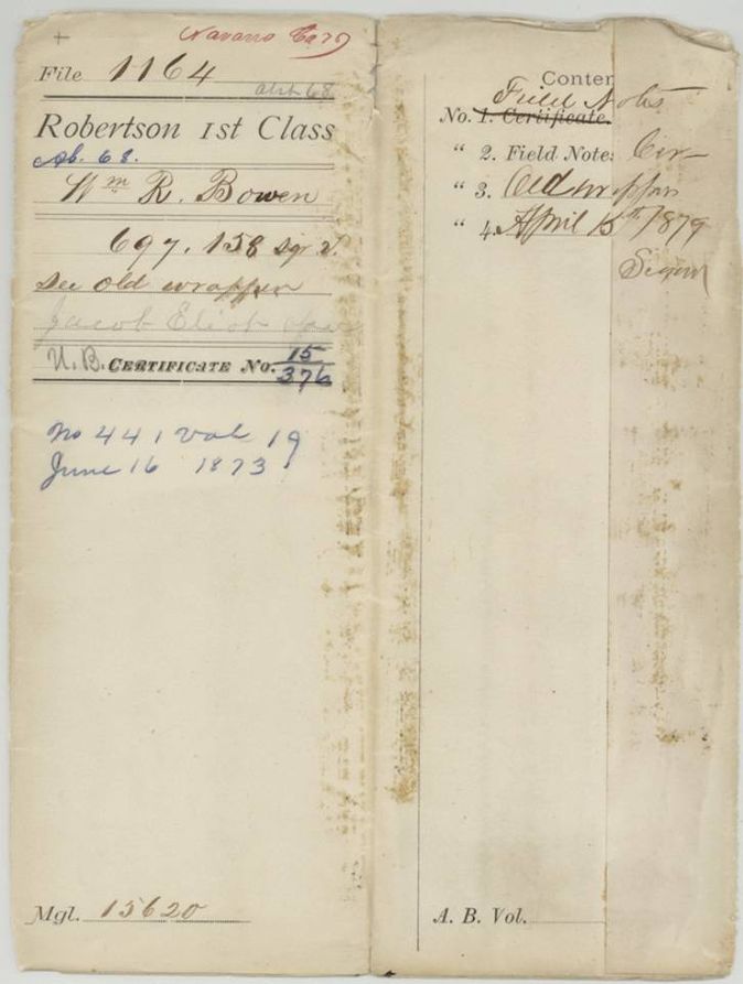
- Robertson 1st class, file 1164
- Certificate
- No. 15/376
- Acres
- 123.49
- Patented to
- Jacob Eliot
- Patent
- 16 Jun 1873 · No. 441, Vol. 19
Tap a survey to open its page.
What the file shows
W. R. Bowen held an unlocated balance of an old Montgomery County headright, reissued by the Land Office in February 1868. Navarro County surveyor B. W. Bailey located 146 acres of it southwest of Corsicana in June 1870, and after a 1872 correction cut it to about 123.5 acres. The patent issued to Jacob Eliot as assignee in June 1873.
The certificate
unlocated balance of a headright certificate, issued by the General Land Office, No. 15/376 on jacket (balance certificate for 17,365,561 sq. varas; original certificate No. 149, Montgomery County), 123.49 acres (697,158 sq. varas located here), Joseph Spence, Commissioner of the General Land Office (balance certificate); original certificate No. 149 issued by the Board of Commissioners for Montgomery County, Austin, 22 Feb 1868.
The survey is made 'by virtue of part of his unlocated Balance for 17,365,561 sq. varas issued by Joseph Spence, Commissioner G.L. Office, the 22nd Feby 1868 (original certificate No. 149 issued by Board of Commissioners for Montgomery County)'. The certificate itself is not in the file (contents slip has 'Certificate' struck out).
The survey
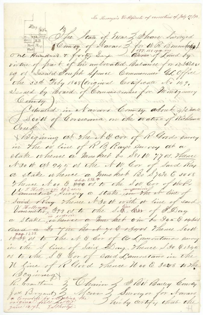
8 Jun 1870, B. W. Bailey, County Surveyor of Navarro County.
Navarro County, about 4 1/2 miles S 60 W of Corsicana on the waters of Richland Creek
Chain carriers: R. Grantham, Jas. Bryant.
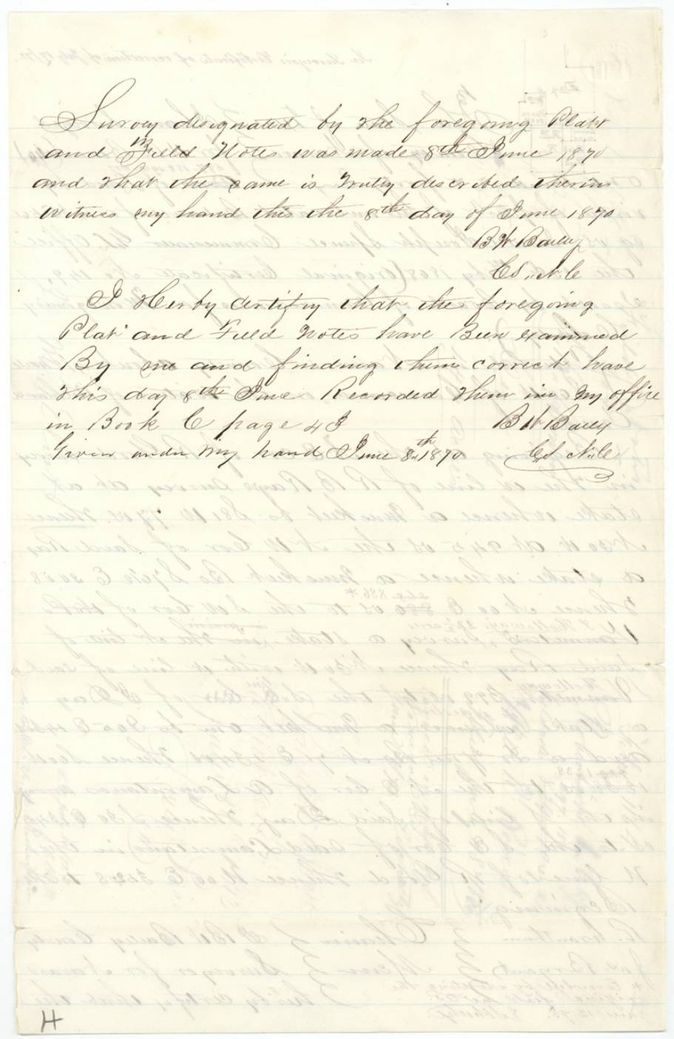
Book C, page 43
The patent
16 Jun 1873, No. 441, Vol. 19, to Jacob Eliot, assignee, delivered to not stated.
Also in the file
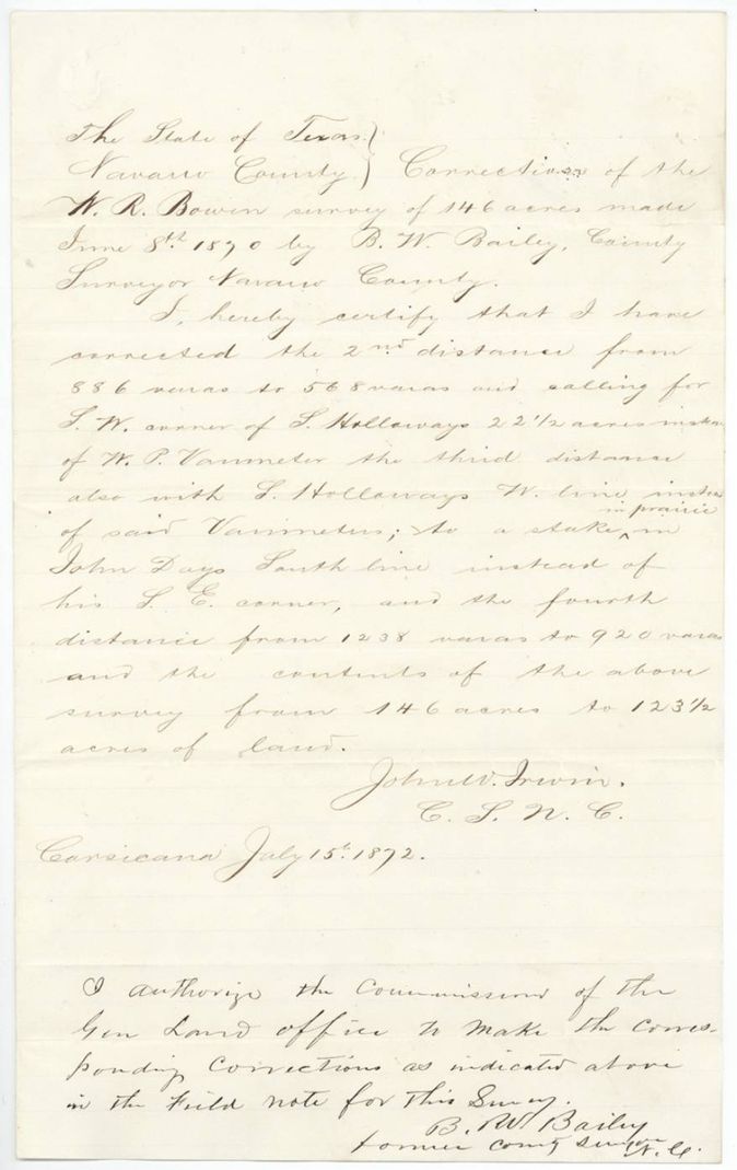
- The field notes first said 146 acres; correction reduced it to 123.5 acres (123.49 in the index) and changed the second distance from 886 to 568 varas.
- A pencil note by E. Schutze (13 Sept 1872) says the adjoining surveys give the distance from R. Ray's NW corner to S. Holloway's SW corner as 865 varas, not the 568 varas called for.
- The survey covers a 22 1/2-acre survey in the name of S. Holloway (Bounty file 1031), which the 1872 correction substituted for W. P. Vanmetre as the neighbour.
- On 12 June 1873 E. Schutze restored the original 886 and 1238 vara distances ('Corrected by adopting the original field notes'), after noting in Sept 1872 that the adjoining surveys put Holloway's SW corner 865 varas from Ray's NW corner; yet the patent kept the reduced 697,158 sq. varas (123.49 acres).
- The certificate is not in the file; the jacket calls it a balance of an old Montgomery County certificate, and the assignment from Bowen to Jacob Eliot is not in the file either.
- Jacket acreage: 146 acres, 697,158 sq. varas as patented (equals about 123.49 acres); index shows 123.49 acres.
- Index matches the jacket: patent 16 Jun 1873, No. 441, Vol. 19.
Timeline
- 22 Feb 1868Commissioner Joseph Spence issues the unlocated-balance certificate to W. R. Bowen
- 8 Jun 1870B. W. Bailey surveys 146 acres for Bowen near Corsicana and records it, Book C p. 43
- 18 Jul 1870Field notes filed in the General Land Office
- 11 Jul 1872Condition furnished (jacket note)
- 15 Jul 1872Corrections to the Bowen survey certified, reducing it to 123 1/2 acres
- 17 Jul 1872Corrections filed in the General Land Office
- 13 Sep 1872E. Schutze notes the adjoining surveys give 865 varas, not 568
- 12 Jun 1873Survey checked correct on the Navarro County map
- 16 Jun 1873Patent No. 441, Vol. 19 to Jacob Eliot, assignee
The papers in the file
Every page of the Land Office file, in the order the Land Office keeps them (7 pages). Tap a page to see it larger.
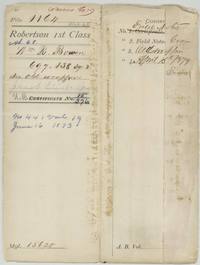 File jacketFile jacket for W. R. Bowen's 697,158 sq. varas, Robertson 1st class, patented to Jacob Eliot, assignee, 16 June 1873, No. 441 Vol. 19.General Land Office, file 1164, page 1 · in the scan
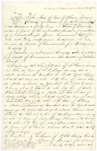 Field notesField notes and plat of 146 acres for W. R. Bowen on Richland Creek SW of Corsicana, by B. W. Bailey, with red corrections and Schutze's 1873 restoration note.General Land Office, file 1164, page 2 · in the scan
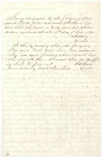 Surveyor's certificateCounty Surveyor B. W. Bailey certifies the survey of 8 June 1870 and records the field notes in Book C page 43.General Land Office, file 1164, page 3 · in the scan
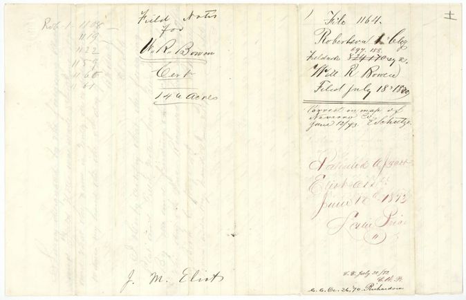
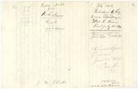 WrapperWrapper no. 1 for the field notes of W. R. Bowen, filed 18 July 1870, with note that it was patented to Jacob Eliot on 16 June 1873.General Land Office, file 1164, page 4 · in the scan
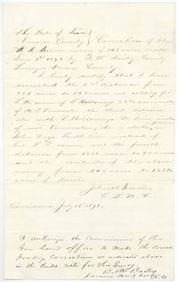 Surveyor's certificateCorrections of the Bowen survey by County Surveyor John W. Irwin, cutting it from 146 to 123 1/2 acres, with Bailey's authorisation, Corsicana, 15 July 1872.General Land Office, file 1164, page 5 · in the scan
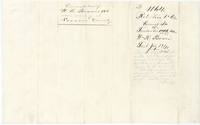 WrapperWrapper no. 2 for the corrections of Bowen's 146-acre survey, filed 17 July 1872, with a Land Office note on the 568 versus 865 vara distance.General Land Office, file 1164, page 6 · in the scan
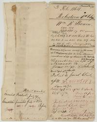 WrapperWrapper no. 3 summarizing the Bowen file: covers a 22 1/2-acre Holloway survey, correct on map June 1873 and patented to Jacob Eliot 16 June 1873.General Land Office, file 1164, page 7 · in the scan
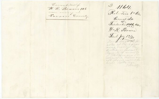
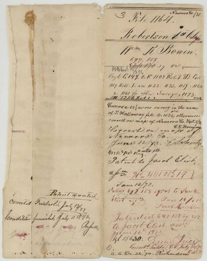
Scans courtesy of the Texas General Land Office, Austin, from its Land Grant Database.
Neighbouring surveys
Sources
- Texas General Land Office, Land Grant Database: Navarro County, Abstract 68
- The Land Office file, scanned (PDF, at the General Land Office)
- 1924 map: courtesy of the Texas General Land Office, Austin, Map 73249, used under licence. Topo: U.S. Geological Survey, The National Map. Aerial photographs: U.S. Department of Agriculture, National Agriculture Imagery Program, 2012, 2018 and 2022. Survey outlines: Railroad Commission of Texas, Original Texas Land Survey. Grant records and files: Texas General Land Office.