Blackland TX · ← All the original surveys
Jacob Hedrick Survey, Abstract 390
- Granted to
- Jacob Hedrick
- Kind of grant
- Bounty warrantLand paid for service in the army of the Republic.
- Land Office file
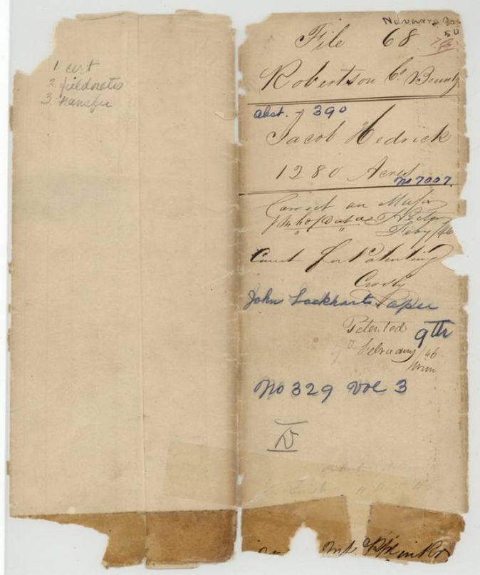
- Robertson Bounty, file 68
- Certificate
- No. 7007
- Acres
- 1280
- Patented to
- John Lockhart
- Patent
- 09 Feb 1846 · No. 329, Vol. 3
Tap a survey to open its page.
What the file shows
Jacob Hedrick's 1280-acre bounty certificate for 32 months' service from 1836 to 1839 was issued at Houston in January 1839 and sold within two weeks to John Lockhart for $200. Deputy surveyor B. J. Chambers located the land on Chambers Creek in Robertson County (now Navarro) in October 1840, next to John B. Boyer's survey. The patent issued to Lockhart as assignee on 9 February 1846.
The certificate
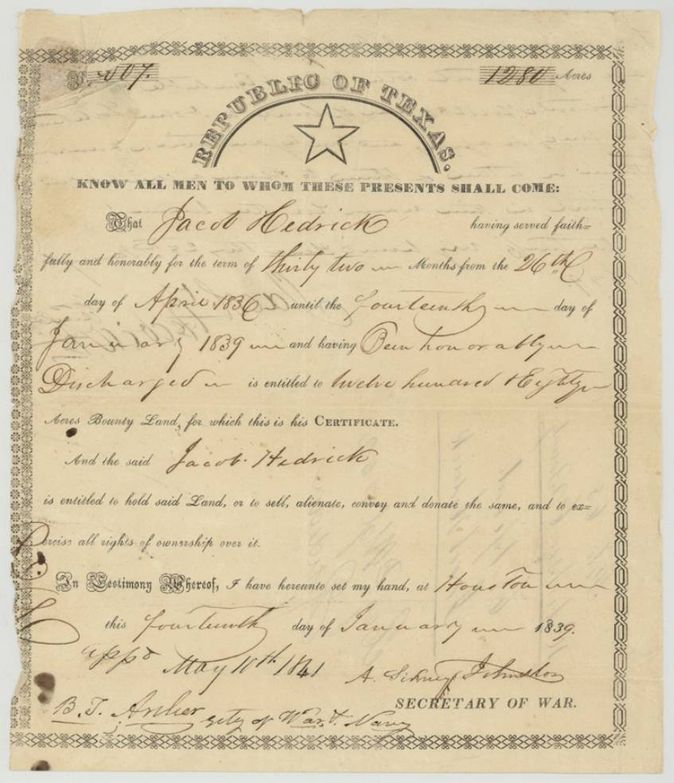
military bounty (32 months' service), No. 7007, 1280 acres, Republic of Texas; A. Sidney Johnston(?), Secretary of War; approved 11 May 1841 by B. T. Archer, Secretary of War and Navy, Houston, 14 Jan 1839.
Served faithfully and honourably thirty-two months, from 26 April 1836 to 14 January 1839, and honourably discharged; entitled to 1280 acres of bounty land
Changes of hand
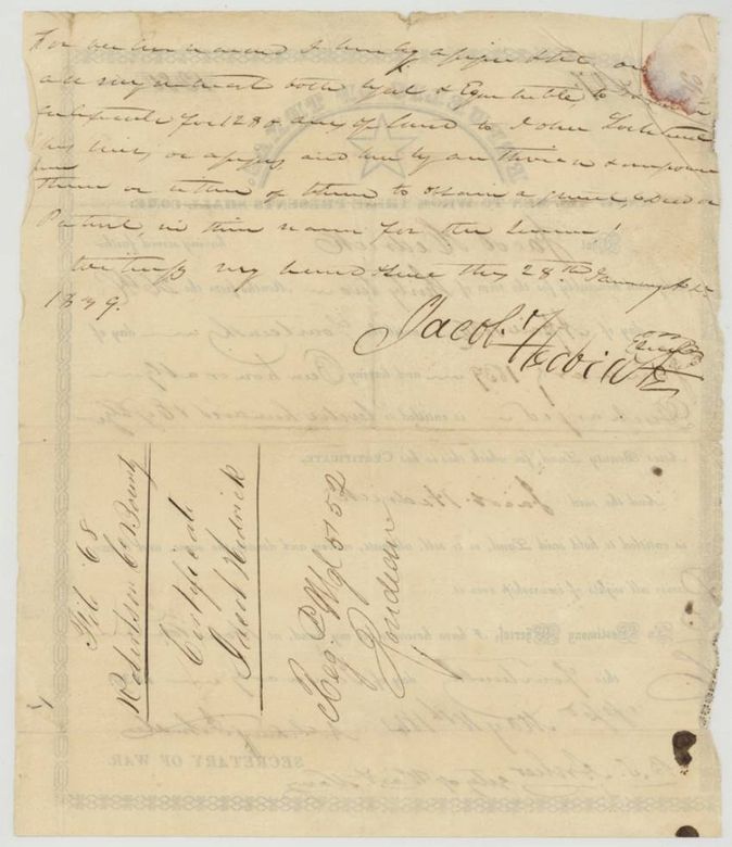
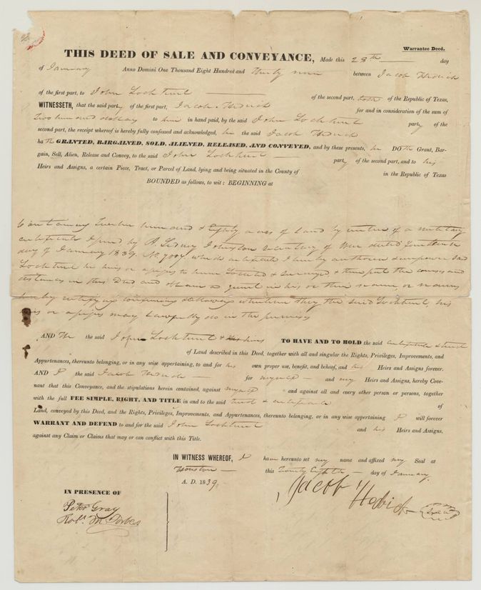
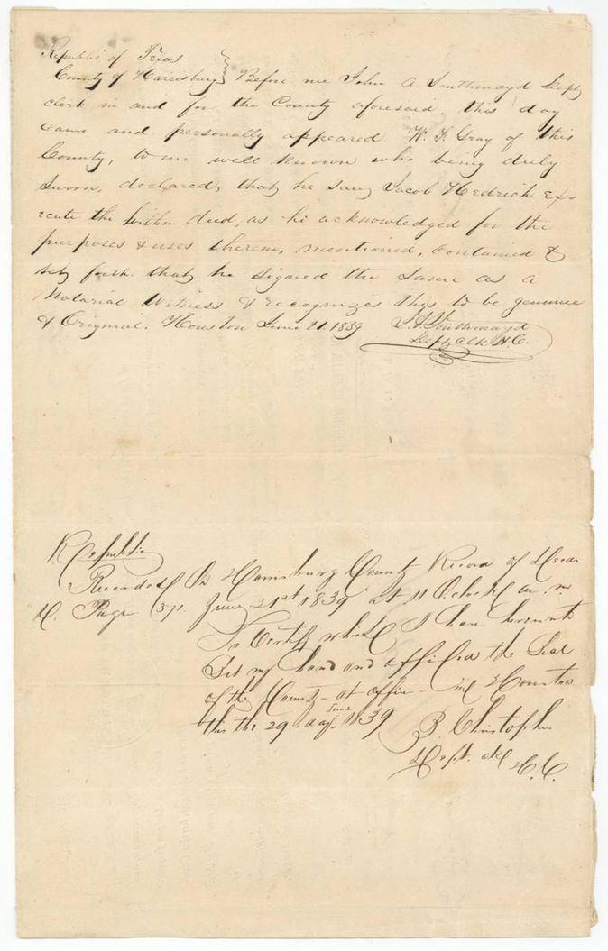
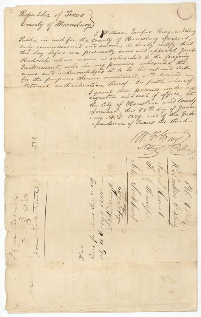
- 28 Jan 1839Jacob Hedrick → John Lockhart, of the Republic of Texas, $200, Houston. Printed warranty deed form conveying 1280 acres by virtue of military certificate No. 7007 dated 14 Jan 1839; authorises Lockhart to locate and survey and obtain a grant. Recorded in the Harrisburg County Records of Deeds, Book H(?), page 37, 21 June 1839; certified 29 June 1839 by B. Christopher(?), Clerk. Also written assignment on the back of the certificate, 28 Jan 1839.
The survey
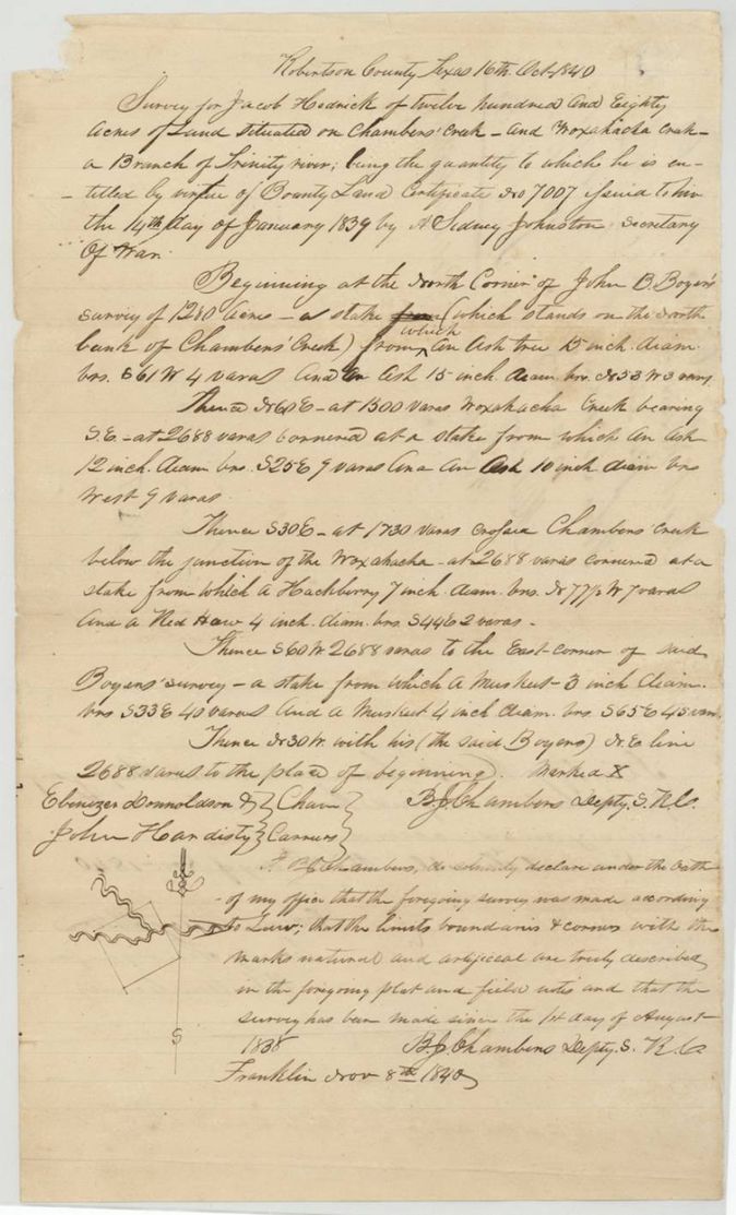
16 Oct 1840, B. J. Chambers, Deputy Surveyor, Robertson County (signs 'Depty. S. R. C.').
Robertson County (now Navarro County) on Chambers' Creek and Woxahacha (Waxahachie) Creek, a branch of the Trinity River
Chain carriers: Ebenezer Donnoldson(?), John Hardisty(?).
Book B, page 121
The patent
9 Feb 1846, No. 329, Vol. 3, to John Lockhart, assignee, delivered to not stated.
Also in the file
- Index says patent 09 Feb 1846, No. 329, Vol. 3, 1280 acres to John Lockhart (original grantee Jacob Hedrick); the jacket agrees.
- The certificate was assigned to John Lockhart on 28 January 1839, two weeks after it was issued, long before the land was surveyed in October 1840, so the patent issued to the assignee.
- The assignment is written twice: on the back of the certificate and in a notarised warranty deed of the same date for $200.
- The same B. J. Chambers survey party (Donnoldson and Hardisty) and the same date, 16 October 1840, appear in the neighbouring Lapton file (Abst. 509); John B. Boyer's 1280-acre survey is the neighbour here.
Timeline
- 26 Apr 1836Jacob Hedrick begins 32 months' service
- 14 Jan 1839Bounty certificate No. 7007 for 1280 acres issued at Houston
- 28 Jan 1839Hedrick sells and assigns the certificate to John Lockhart for $200 at Houston
- 21 Jun 1839Deed recorded in Harrisburg County
- 16 Oct 1840B. J. Chambers surveys 1280 acres on Chambers Creek
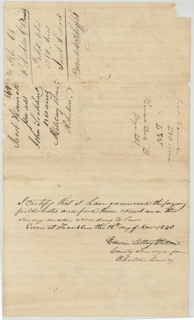
- 18 Nov 1840County surveyor Patton examines the field notes; recorded Book B page 121
- 11 May 1841Certificate approved by Secretary of War and Navy B. T. Archer
- 9 Feb 1846Patent No. 329 Vol. 3 to John Lockhart
The papers in the file
Every page of the Land Office file, in the order the Land Office keeps them (8 pages). Tap a page to see it larger.
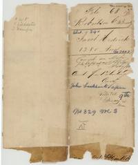 File jacketJacket for file 68, Jacob Hedrick, 1280 acres, patented to John Lockhart 9 February 1846, No. 329 Vol. 3.General Land Office, file 68, page 1 · in the scan
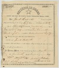 CertificateRepublic of Texas bounty certificate No. 7007 for 1280 acres to Jacob Hedrick for 32 months' service, issued at Houston.General Land Office, file 68, page 2 · in the scan
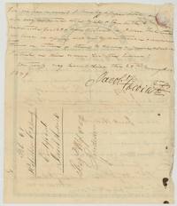 Back of the certificateBack of the certificate: Hedrick assigns all his interest in the 1280 acres to John Lockhart, 28 January 1839.General Land Office, file 68, page 3 · in the scan
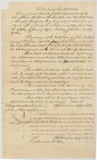 Field notesB. J. Chambers' field notes and plat for 1280 acres on Chambers' Creek and Woxahacha Creek next to John B. Boyer's survey, 16 October 1840.General Land Office, file 68, page 4 · in the scan
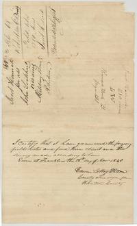 Surveyor's certificateCounty surveyor Patton's examination of the Hedrick field notes at Franklin, 18 November 1840, with the wrapper recorded Book B page 121.General Land Office, file 68, page 5 · in the scan
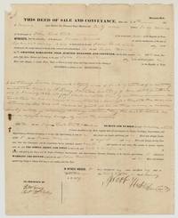 TransferPrinted warranty deed in which Jacob Hedrick sells certificate 7007 to John Lockhart for $200 at Houston.General Land Office, file 68, page 6 · in the scan
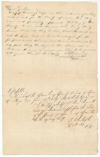 TransferProof of the Hedrick deed before the Harrisburg County deputy clerk and recording certificate, June 1839.General Land Office, file 68, page 7 · in the scan
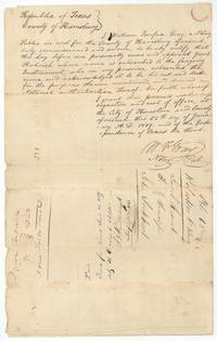 TransferNotary William Fairfax Gray's acknowledgment of the Hedrick deed, 28 January 1839, with the filing endorsement of 21 June 1839.General Land Office, file 68, page 8 · in the scan
Scans courtesy of the Texas General Land Office, Austin, from its Land Grant Database.
Neighbouring surveys
Sources
- Texas General Land Office, Land Grant Database: Navarro County, Abstract 390
- The Land Office file, scanned (PDF, at the General Land Office)
- 1924 map: courtesy of the Texas General Land Office, Austin, Map 73249, used under licence. Topo: U.S. Geological Survey, The National Map. Aerial photographs: U.S. Department of Agriculture, National Agriculture Imagery Program, 2012, 2018 and 2022. Survey outlines: Railroad Commission of Texas, Original Texas Land Survey. Grant records and files: Texas General Land Office.