Blackland TX · ← All the original surveys
Thomas J. Church Survey, Abstract 193
- Granted to
- Thomas J. Church
- Kind of grant
- Bounty warrantLand paid for service in the army of the Republic.
- Land Office file
- Robertson Bounty, file 364
- Certificate
- No. 1396
- Acres
- 640
- Patented to
- Robert Matthews
- Patent
- 09 Apr 1851 · No. 55, Vol. 6
Tap a survey to open its page.
What the file shows
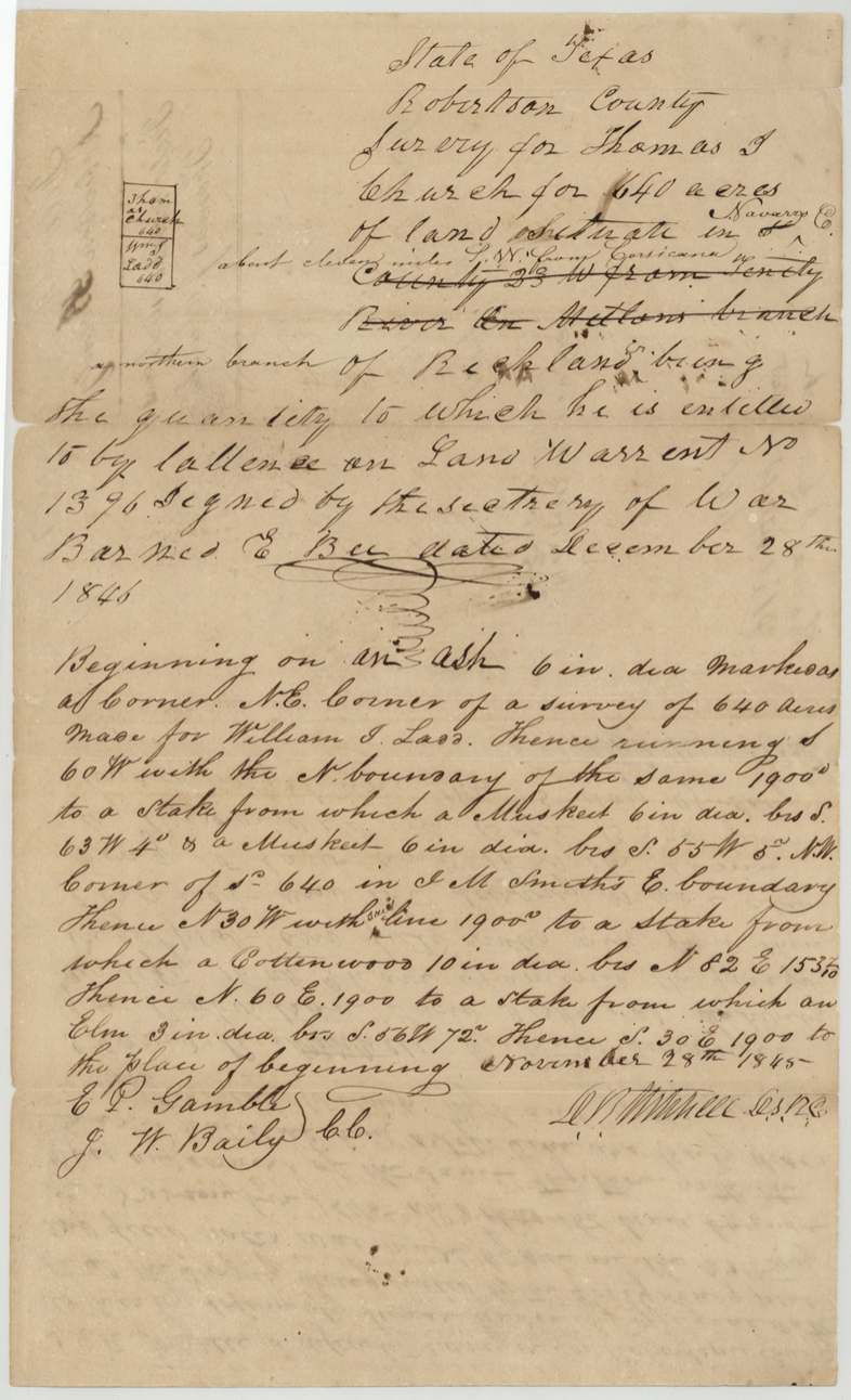
Thomas J. Church held Republic bounty warrant No. 1396 for 640 acres, signed by Secretary of War Barnard E. Bee. Deputy surveyor D. R. Mitchell located it on a northern branch of Richland Creek about eleven miles southwest of Corsicana on November 28, 1845, next to the William J. Ladd survey. Church's right passed to Robert Matthews (the papers are in file 360), and the patent issued to Matthews as assignee on April 9, 1851, delivered to Mitchell three days later.
The certificate
bounty, No. Land Warrant No. 1396, 640 acres, Barnard E. Bee, Secretary of War, not stated, 1846-12-28 as written in the field notes ('December 28th 1846') — but the survey is dated Nov 28, 1845, so the year is probably a slip for 1836 or similar (see oddities).
bounty land warrant for military service (service dates not in this file)
Changes of hand
- not in this fileThomas J. Church → Robert Matthews. Inferred only from wrapper 'Ord. for patenting to Robert Matthews, assignee'; transfer papers are in file 360 Robertson Bounty.
The survey
28 Nov 1845, D. R. Mitchell, Deputy Surveyor, Robertson County (signed 'D R Mitchell D.S.R.C.').
Navarro Co., about eleven miles S.W. from Corsicana, on a northern branch of Richland (Creek). Original wording 'Robertson County, 23 W from Trinity River on Mellons(?) branch' struck out and replaced.
Chain carriers: E. P. Gamble, J. W. Baily.
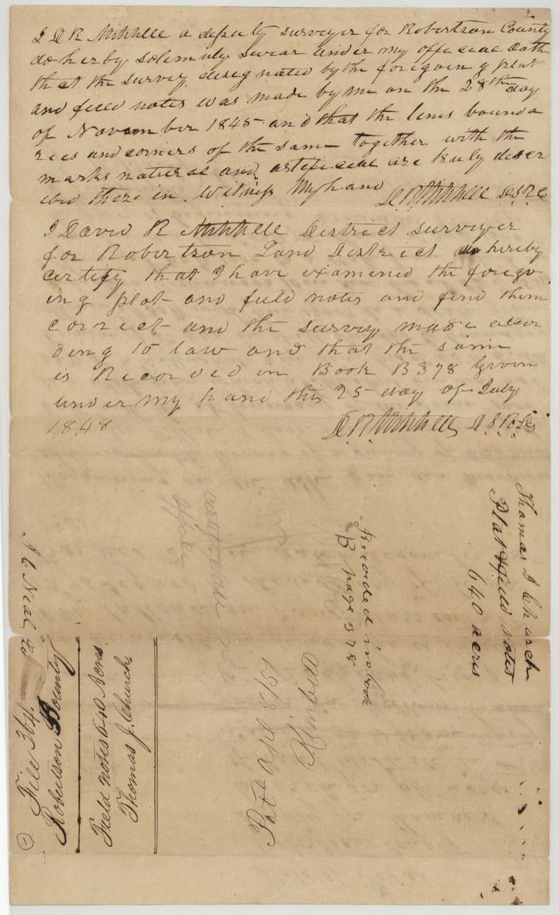
Book B, page 378
The patent
9 Apr 1851, No. 55, Vol. 6, to Robert Matthews, assignee of Thomas J. Church, delivered to D. R. Mitchell, April 12th 1851.
Also in the file
- The warrant is said to be dated December 28, 1846, but the survey was run on November 28, 1845 — a year before. Either the warrant date or the survey date has been miswritten; Barnard Bee's term as Secretary of War points to the warrant date being earlier (see story leads).
- The surveyor first wrote that the land lay in Robertson County, 23 miles west of the Trinity on 'Mellons(?) branch', then struck that out and wrote 'Navarro Co., about eleven miles S.W. from Corsicana, on a northern branch of Richland'.
- D. R. Mitchell ran the survey as a deputy and later certified his own work as district surveyor; the patent was also handed to him.
Timeline
- 28 Nov 1845D. R. Mitchell surveys 640 acres for Thomas J. Church on a northern branch of Richland Creek
- 28 Dec 1846Date given in the field notes for Bounty Warrant No. 1396 signed by Barnard E. Bee (year doubtful)
- 25 Jul 1848Mitchell, as district surveyor, certifies the survey; recorded Book B p. 378
- 8 Apr 1851Checked correct on the GLO map (Creuzbaur)
- 9 Apr 1851Patent No. 55, Vol. 6, issued to Robert Matthews, assignee
- 12 Apr 1851Patent delivered to D. R. Mitchell
The papers in the file
Every page of the Land Office file, in the order the Land Office keeps them (3 pages). Tap a page to see it larger.
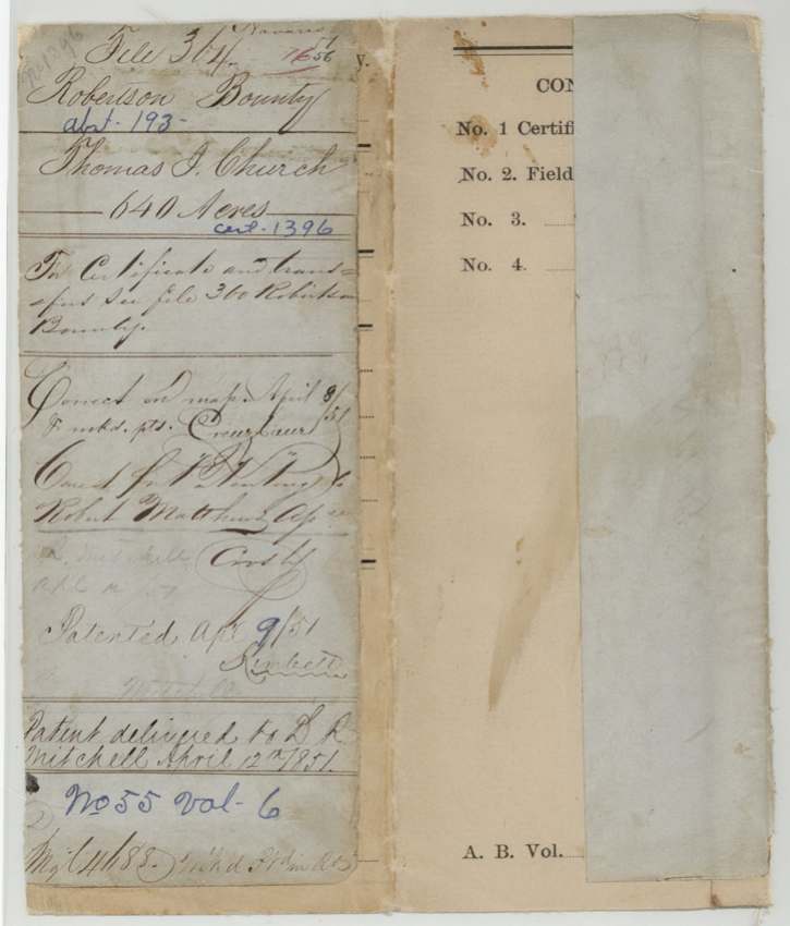
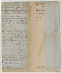 File jacketFile jacket for Thomas J. Church's 640-acre bounty land survey in Navarro County, with the patent entry of 9 April 1851 to Robert Matthews, assignee.General Land Office, file 364, page 1 · in the scan
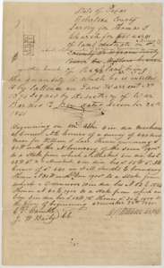 Field notesField notes and plat for 640 acres on a northern branch of Richland Creek, surveyed for Thomas J. Church by deputy surveyor D. R. Mitchell, 28 November 1845.General Land Office, file 364, page 2 · in the scan
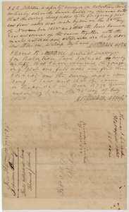 Surveyor's certificateDistrict surveyor David R. Mitchell's oath and certificate that the Church survey is correct, dated 25 July 1848, with the docket noting it is recorded in Book B, page 378.General Land Office, file 364, page 3 · in the scan
Scans courtesy of the Texas General Land Office, Austin, from its Land Grant Database.
Neighbouring surveys
Sources
- Texas General Land Office, Land Grant Database: Navarro County, Abstract 193
- The Land Office file, scanned (PDF, at the General Land Office)
- 1924 map: courtesy of the Texas General Land Office, Austin, Map 73249, used under licence. Topo: U.S. Geological Survey, The National Map. Aerial photographs: U.S. Department of Agriculture, National Agriculture Imagery Program, 2012, 2018 and 2022. Survey outlines: Railroad Commission of Texas, Original Texas Land Survey. Grant records and files: Texas General Land Office.