Blackland TX · ← All the original surveys
John S. Beal Survey, Abstract 103
- Granted to
- John S. Beal
- Kind of grant
- Headright, third classLand for later settlers, including the colonists of Mercer’s Colony.
- Land Office file
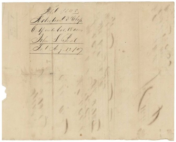
- Robertson 3rd class, file 3348
- Certificate
- No. 2539/2640
- Acres
- 18
- Patented to
- W. D. Dillon
- Patent
- 11 Mar 1887 · No. 148, Vol. 46
Tap a survey to open its page.
What the file shows
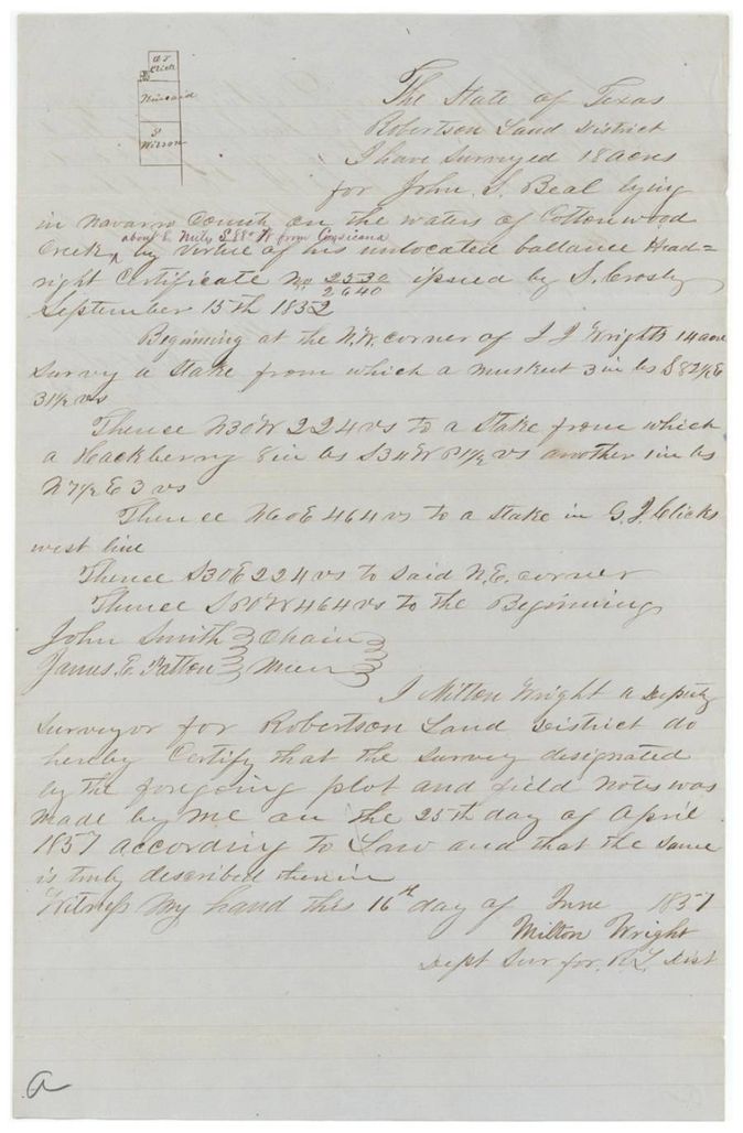
John S. Beal's 320-acre Liberty County headright of 1838 left an unlocated balance of 18 acres, certified by the General Land Office on 15 September 1852. Deputy surveyor Milton Wright located it on Cottonwood Creek, about six miles west of Corsicana, on 25 April 1857, but the patent did not issue until 11 March 1887, to assignee Wm. D. Dillon.
The certificate
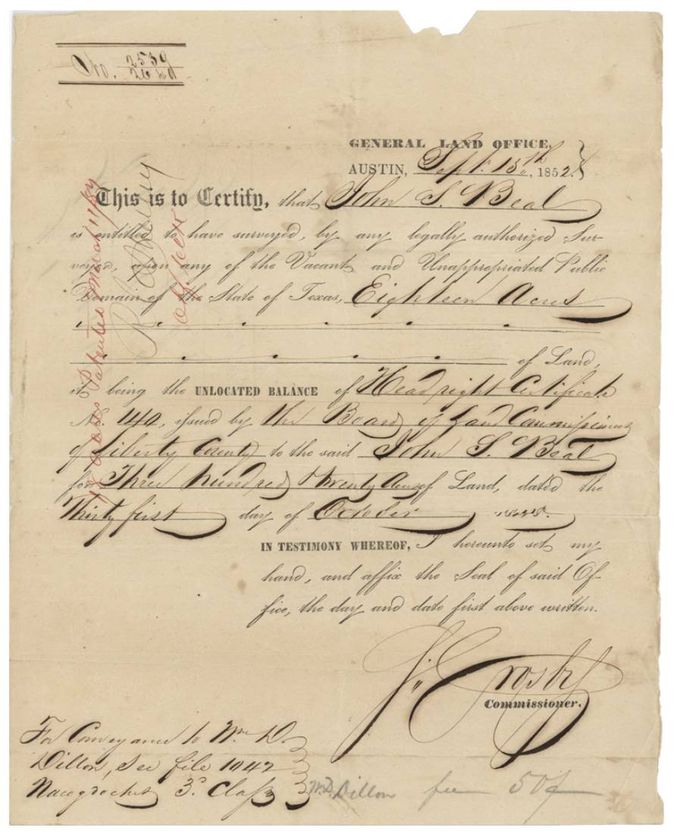
headright (unlocated balance certificate), No. 2539/2640 (balance certificate); original Liberty County headright certificate No. 140, 18 (balance of 320), General Land Office, Commissioner S. Crosby; original certificate by the Board of Land Commissioners of Liberty County, Austin, 1852-09-15 (original certificate dated 31 October, year not clear, 1838(?)).
John S. Beal is entitled to have surveyed 18 acres, the unlocated balance of Headright Certificate No. 140 issued by the Board of Land Commissioners of Liberty County for 320 acres, dated 31 October. Margin note: 'For conveyance to Wm D. Dillon, see file 1042 Nacogdoches 3 Class'.
Changes of hand
- undatedJohn S. Beal → Wm. D. Dillon. No deed in this file; the conveyance is in file 1042 (Nacogdoches 3rd Class). The patent was made to Wm. D. Dillon as assignee.
The survey
1857-04-25 (certified 1857-06-16), Milton Wright, Deputy Surveyor, Robertson Land District.
Navarro County on the waters of Cottonwood Creek, about 6 miles S 88 W from Corsicana (red-ink addition)
Chain carriers: John Smith, James E. Patton.
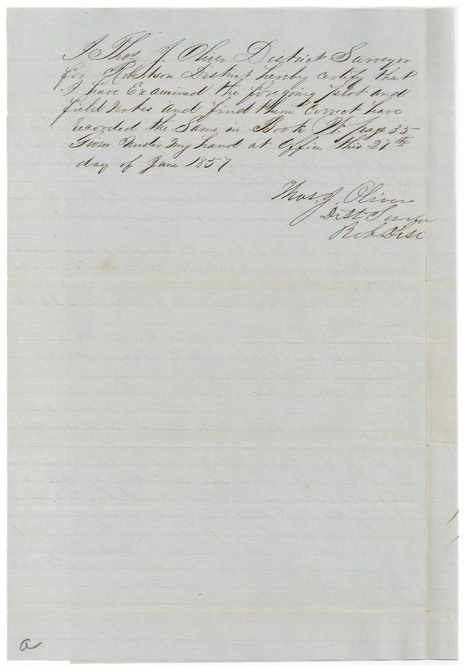
Book B(?), page 35 (district surveyor's certificate reads 'Book R(?)'; wrapper 'Book B page 35')
The patent
11 Mar 1887, No. 148, Vol. 46, to Wm. D. Dillon, assignee, delivered to not stated; pencil on jacket 'W. F. Seale(?), Corsicana, Tex' (possibly where the patent was sent).
Also in the file
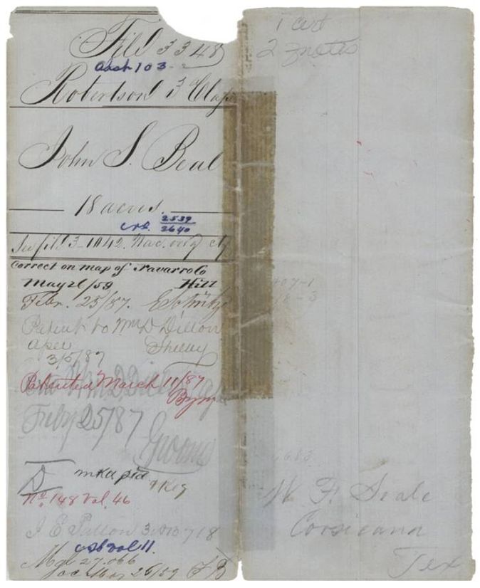
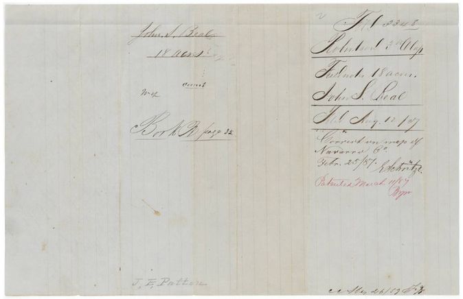
- Field notes and certificate were filed in the General Land Office on 12 August 1857, but the patent did not issue until 11 March 1887, a gap of nearly thirty years; the jacket shows a map check (Hill) on 26 May(?) 1859 and another on 25 Feb 1887 before patenting.
- The patent went to W. D. Dillon as assignee, but no transfer from Beal is in this file; the conveyance is in file 1042 (Nacogdoches 3rd class).
- The survey is 18 acres cut from a 320-acre Liberty County headright, long after the original certificate of 1838(?); the title passed through at least a Beal-to-Dillon sale.
- A reference to a 'Wright 14-acre survey' (a tiny adjoining tract) suggests a cluster of small balance surveys.
- Index says patent 11 Mar 1887, No. 148, Vol. 46, 18 acres, patentee W D Dillon, which agrees with the jacket.
- A pencil 'J. E. Patton' on the jacket and field-notes wrapper may be the chain carrier James E. Patton taking an interest in the file later.
Timeline
- 31 Oct 1838Liberty County Board of Land Commissioners issues headright certificate No. 140 to John S. Beal for 320 acres (year read as uncertain)
- 15 Sep 1852General Land Office issues unlocated balance certificate 2539/2640 for 18 acres
- 25 Apr 1857Milton Wright surveys 18 acres on Cottonwood Creek
- 16 Jun 1857Wright certifies the survey
- 27 Jun 1857Thos. J. Oliver examines and records it, Book (B?) p. 35
- 12 Aug 1857Certificate and field notes filed in the General Land Office
- 26 May 1859Survey checked correct on map of Navarro County (Hill); month read as May(?)
- 25 Feb 1887Survey marked correct on map of Navarro County
- 11 Mar 1887Patent No. 148 Vol. 46 to Wm. D. Dillon, assignee
The papers in the file
Every page of the Land Office file, in the order the Land Office keeps them (6 pages). Tap a page to see it larger.
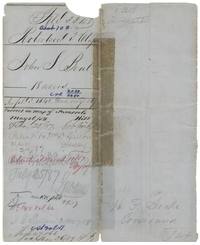 File jacketFile jacket 3348 for John S. Beal's 18 acres, patented to Wm. D. Dillon as assignee on 11 March 1887, No. 148 Vol. 46.General Land Office, file 3348, page 1 · in the scan
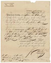 CertificateGeneral Land Office balance certificate 2539/2640 for 18 acres to John S. Beal from Liberty County headright No. 140, to be conveyed to Wm. D. Dillon.General Land Office, file 3348, page 2 · in the scan
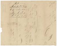 Back of the certificateBack of the certificate, endorsed file 3348, Robertson 3rd class, unlocated balance 18 acres, John S. Beal, filed 12 August 1857.General Land Office, file 3348, page 3 · in the scan
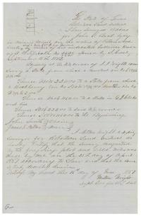 Field notesMilton Wright's field notes and plat of 18 acres for John S. Beal on Cottonwood Creek, surveyed 25 April 1857.General Land Office, file 3348, page 4 · in the scan
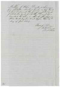 Surveyor's certificateDistrict Surveyor Thos. J. Oliver certifies the field notes correct and records them in Book B(?) page 35, 27 June 1857.General Land Office, file 3348, page 5 · in the scan
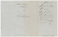 WrapperWrapper for the 18-acre field notes, filed 12 Aug 1857, correct on the map 25 Feb 1887, patented 11 March 1887.General Land Office, file 3348, page 6 · in the scan
Scans courtesy of the Texas General Land Office, Austin, from its Land Grant Database.
Neighbouring surveys
Sources
- Texas General Land Office, Land Grant Database: Navarro County, Abstract 103
- The Land Office file, scanned (PDF, at the General Land Office)
- 1924 map: courtesy of the Texas General Land Office, Austin, Map 73249, used under licence. Topo: U.S. Geological Survey, The National Map. Aerial photographs: U.S. Department of Agriculture, National Agriculture Imagery Program, 2012, 2018 and 2022. Survey outlines: Railroad Commission of Texas, Original Texas Land Survey. Grant records and files: Texas General Land Office.