Blackland TX · ← All the original surveys
Chauncey Richardson Survey, Abstract 690
- Granted to
- Chauncey Richardson
- Kind of grant
- Headright, third classLand for later settlers, including the colonists of Mercer’s Colony.
- Land Office file
- Robertson 3rd class, file 422
- Certificate
- No. 328
- Acres
- 640
- Patented to
- Chauncey Richardson
- Patent
- 18 Sep 1851 · No. 893, Vol. 3
Tap a survey to open its page.
What the file shows
Chauncey Richardson received a conditional headright certificate, No. 328, from the Bastrop County land board in July 1839, and the unconditional certificate for 640 acres on 25 December 1842 after proving three years' residence. Deputy surveyor David R. Mitchell laid out the 640 acres on Briar Creek about four miles north-northwest of Corsicana on 3 March 1846, next to Harvey Homan's 1280-acre survey. In August 1851 Richardson swore in Harris County that his conditional certificate had been lost when a surveyor was killed by Indians, and the patent issued to him on 18 September 1851.
The certificate
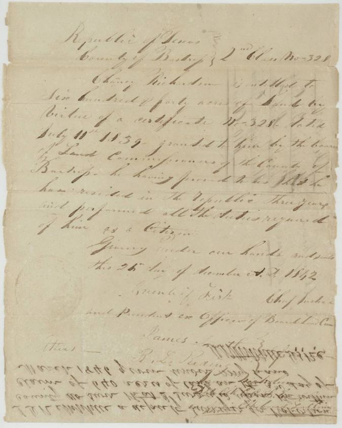
headright, unconditional certificate (written '2nd Class'; jacket and index 3rd class) issued on conditional certificate No. 328, No. 328 (conditional certificate No. 328 dated 10 July 1839; this certificate headed '2nd Class No. 328'; jacket Mc-328), 640 acres, Board of Land Commissioners of Bastrop County; Gerard(?) Fisk(?), Chief Justice and President ex officio, with James Smith(?) and R. L. Reaving(?), Bastrop County, Republic of Texas, 25 Dec 1842.
Chauncey Richardson is entitled to 640 acres by virtue of certificate No. 328 dated 10 July 1839 granted by the Bastrop board, having proved that he resided in the Republic three years and performed all the duties required of him as a citizen.
The survey
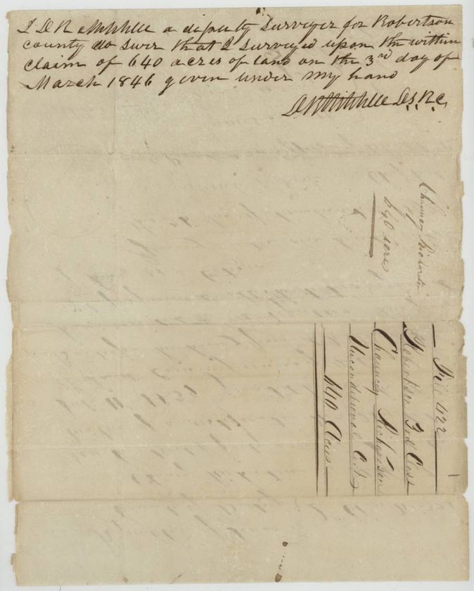
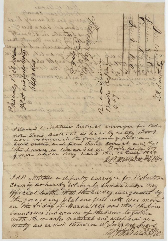
1846-03-03 (sworn); examined 1848-07-13, David R. Mitchell, Deputy Surveyor, Robertson County / Land District (signs 'D. R. Mitchell D.S.R.C.').
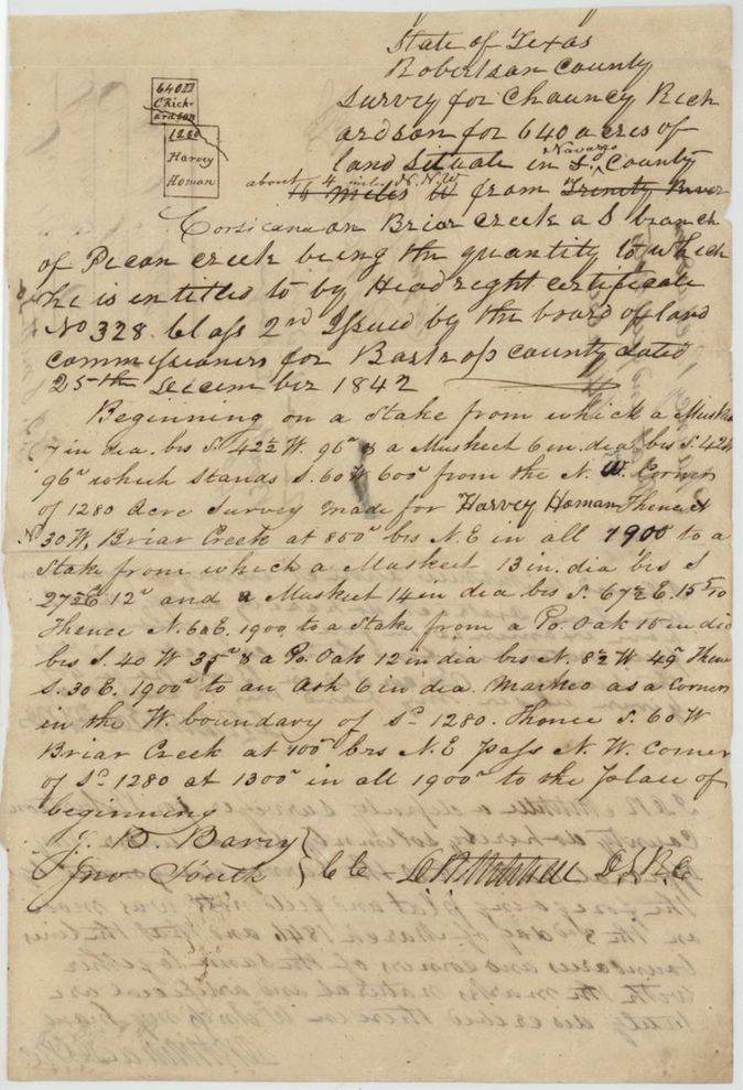
Navarro County, about 4(?) miles N.N.W. from Corsicana, on Briar (Brier) Creek, a branch of Pecan Creek. An earlier line 'about 14 miles W from Trinity River' is struck out.
Chain carriers: J. B. Barry, Jno South.
Book B, page 407(?)
The patent
1851-09-18 (the 18th written over another date), No. 893, Vol. 3, to Chauncey Richardson, delivered to not stated.
Also in the file
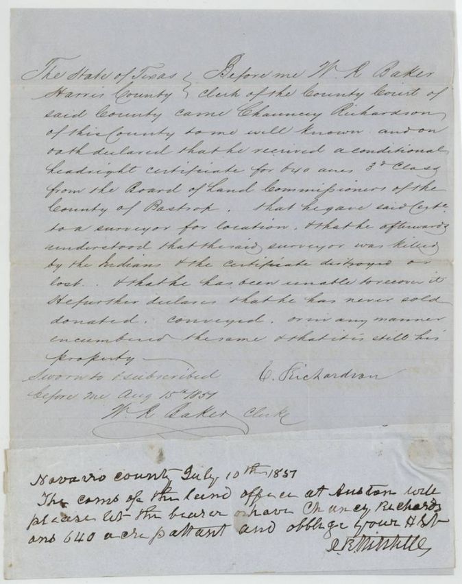
- Affidavit of loss (15 Aug 1851) says the surveyor who held the certificate was killed by Indians and the certificate lost; yet the survey was made in March 1846 and recorded in 1848, long before the affidavit.
- The cover note asking that the bearer receive the patent is dated 10 July 1851, five weeks before the affidavit was sworn (15 Aug 1851); date may be 1851 misread.
- The 1842 certificate is headed '2nd Class No. 328' and the field notes call it 'class 2nd', though the jacket, the affidavit and the index call it 3rd class.
- Survey title strikes through 'about 14 miles W from Trinity River' and inserts the Corsicana distance.
- Index agrees with jacket on patent date and number (18 Sep 1851, No. 893, Vol. 3).
Timeline
- 10 Jul 1839Bastrop County Board of Land Commissioners grants conditional certificate No. 328 to Chauncey Richardson
- 25 Dec 1842Bastrop board issues the unconditional certificate for 640 acres on conditional No. 328, after proof of three years' residence
- 3 Mar 1846D. R. Mitchell surveys 640 acres on Briar Creek, Navarro County (as sworn)
- 13 Jul 1848Mitchell, as district surveyor, examines the plat and notes; recorded Book B p. 407(?)
- 9 Apr 1851Marked correct on the map
- 10 Jul 1851D. R. Mitchell writes from Navarro County asking that the bearer have Richardson's 640-acre patent
- 15 Aug 1851Richardson swears affidavit of loss of the conditional certificate in Harris County
- 18 Sep 1851Patent No. 893 Vol. 3 to Chauncey Richardson
The papers in the file
Every page of the Land Office file, in the order the Land Office keeps them (7 pages). Tap a page to see it larger.
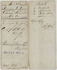 File jacketFile jacket for Chauncey Richardson's 640 acres, Ab. 690, with patent entry 18 September 1851, No. 893 Vol. 3, and the list of contents.General Land Office, file 422, page 1 · in the scan
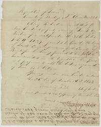 CertificateBastrop County board certifies Chauncey Richardson entitled to 640 acres on conditional certificate No. 328 of 10 July 1839, headed 2nd Class, 25 December 1842.General Land Office, file 422, page 2 · in the scan
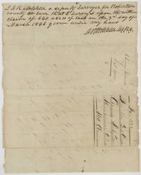 Surveyor's certificateD. R. Mitchell, deputy surveyor, swears he surveyed Richardson's 640 acres on 3 March 1846; endorsed File 422 Robertson 3rd Class.General Land Office, file 422, page 3 · in the scan
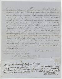 AffidavitChauncey Richardson swears in Harris County that his conditional certificate was lost when the surveyor was killed by Indians, with D. R. Mitchell's note asking for the patent.General Land Office, file 422, page 4 · in the scan
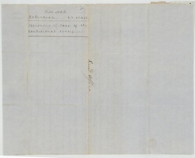
 WrapperWrapper for the affidavit of loss of the conditional certificate, marked File 422 Robertson 3rd class and Land Office.General Land Office, file 422, page 5 · in the scan
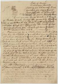 Field notesField notes and sketch plat of 640 acres for Chauncey Richardson on Briar Creek beside Harvey Homan's 1280-acre survey, chain carried by J. B. Barry and Jno South.General Land Office, file 422, page 6 · in the scan
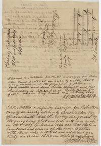 Surveyor's certificateBack of the field notes with District Surveyor D. R. Mitchell's examination of 13 July 1848, recording in Book B page 407(?), and his oath of survey.General Land Office, file 422, page 7 · in the scan
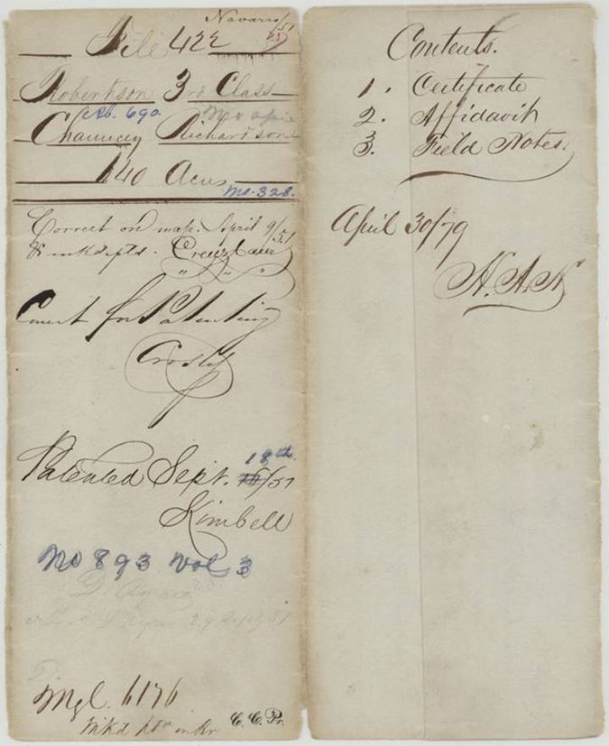
Scans courtesy of the Texas General Land Office, Austin, from its Land Grant Database.
Neighbouring surveys
Sources
- Texas General Land Office, Land Grant Database: Navarro County, Abstract 690
- The Land Office file, scanned (PDF, at the General Land Office)
- 1924 map: courtesy of the Texas General Land Office, Austin, Map 73249, used under licence. Topo: U.S. Geological Survey, The National Map. Aerial photographs: U.S. Department of Agriculture, National Agriculture Imagery Program, 2012, 2018 and 2022. Survey outlines: Railroad Commission of Texas, Original Texas Land Survey. Grant records and files: Texas General Land Office.