Blackland TX · Historic maps
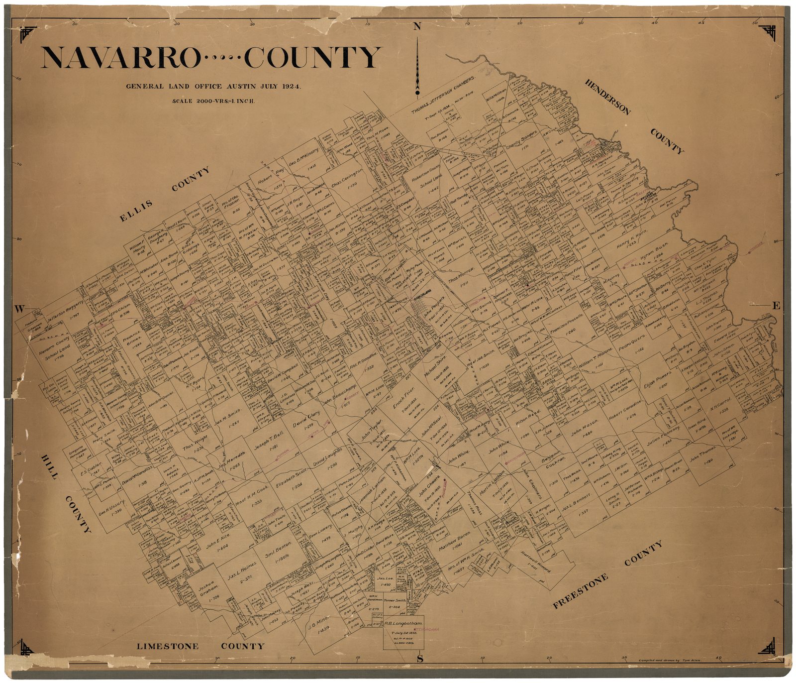
Navarro County, 1924
In July 1924 the General Land Office in Austin drew Navarro County as it was first granted: every original survey with the name of the person it was granted to, the creeks, the railroads, and the towns in red. Every land title in the county begins with one of these surveys.
The large name on each tract is the grantee. The number under it is the Land Office file: 1-, 2- and 3- are headright grants by class, B a bounty grant for military service, D a donation grant to veterans of the Texas Revolution or the heirs of those who died in it, and S a grant made with scrip. “ptd.” means the grant was patented.
Then and now: Dresden and Blooming Grove
The 1924 map laid over today’s map around Dresden and Blooming Grove. Slide to move between them. Every original survey on this ground is outlined. The four in colour are the grants the Melton story turns on: E. Melton (Eliel Melton’s Alamo donation land), B. Melton (his brother Buckner’s), N. T. Byars and John Smith. Dresden Cemetery and Melton’s Garden lie on the Byars survey, and Dresden sits where the Byars, Smith and B. Melton surveys meet. Each survey has its own page under The original surveys.
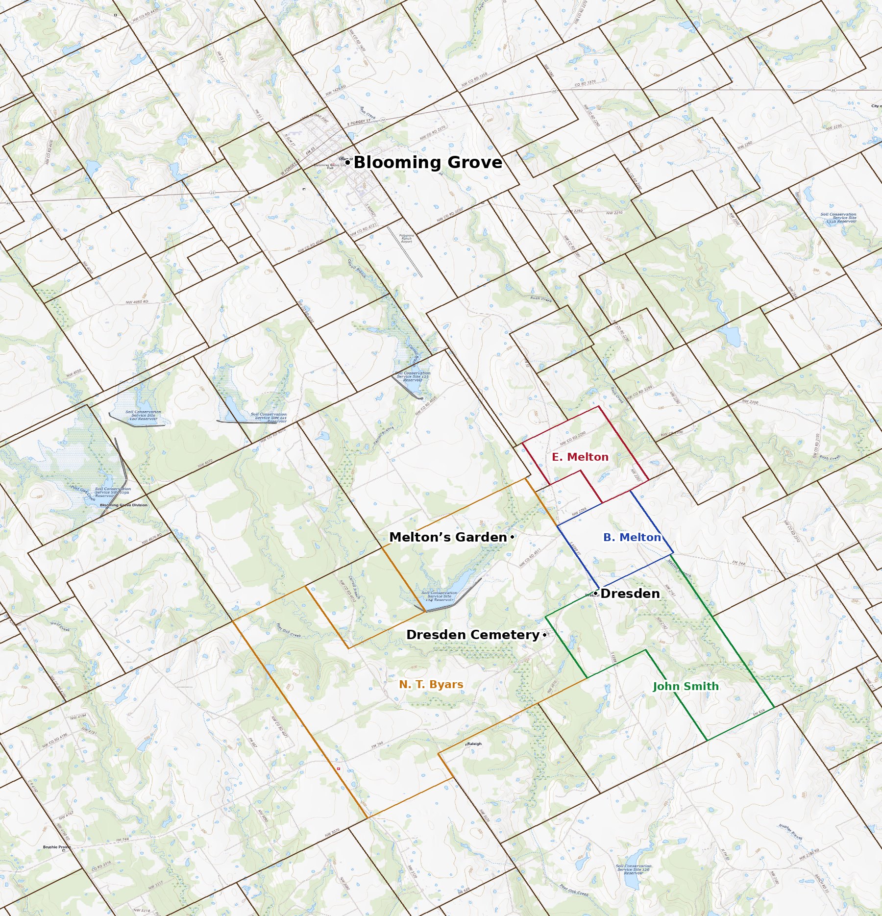
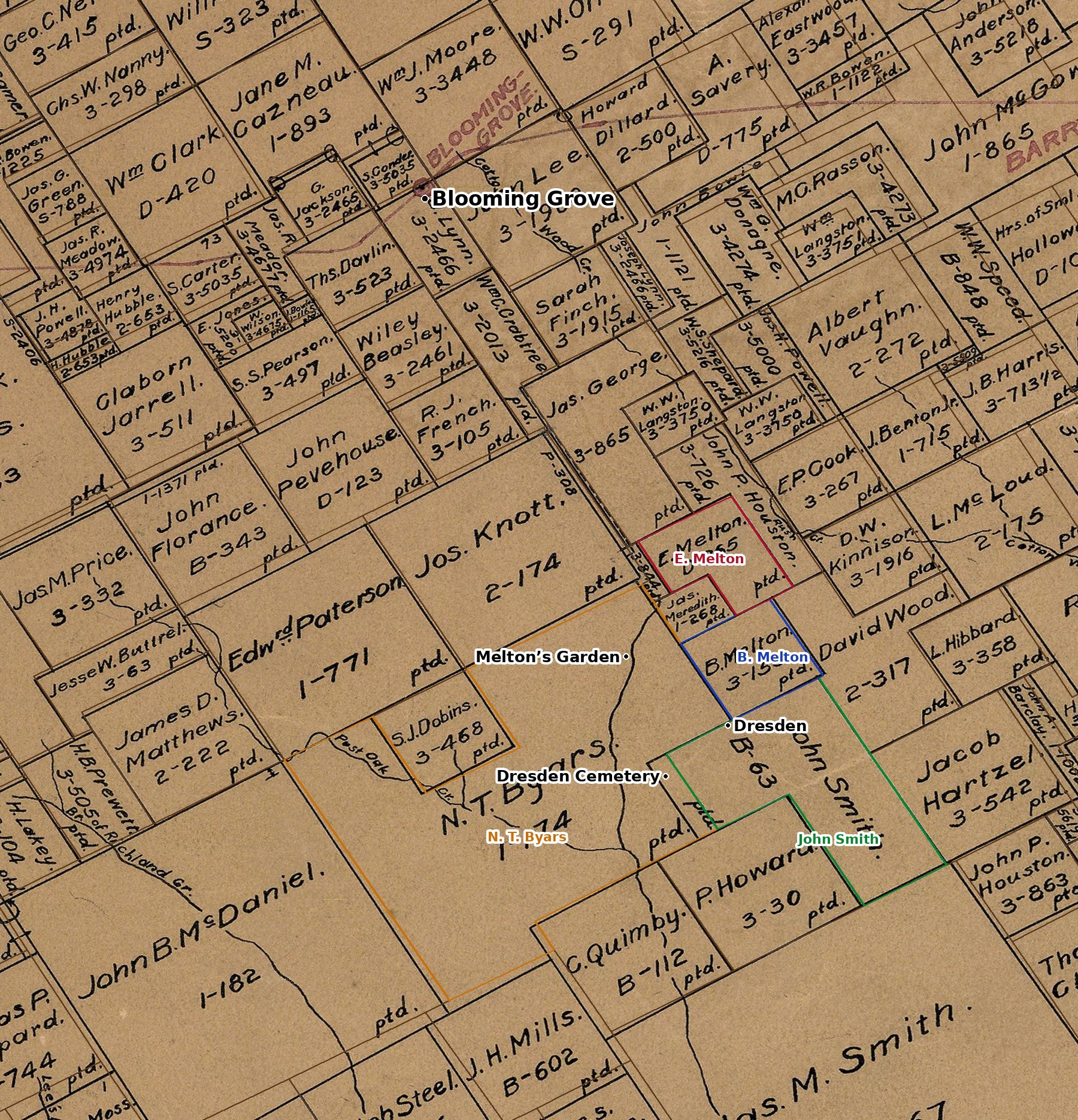
Today’s map: U.S. Geological Survey, The National Map. Tract outlines: Railroad Commission of Texas, Original Texas Land Survey. 1924 map: courtesy of the Texas General Land Office, Austin, Map 73249, used under licence.
Courtesy of the Texas General Land Office, Austin. Map 73249, Navarro County, July 1924. Used under licence.