Blackland TX · Historic maps
Blooming Grove
1900
Population 850
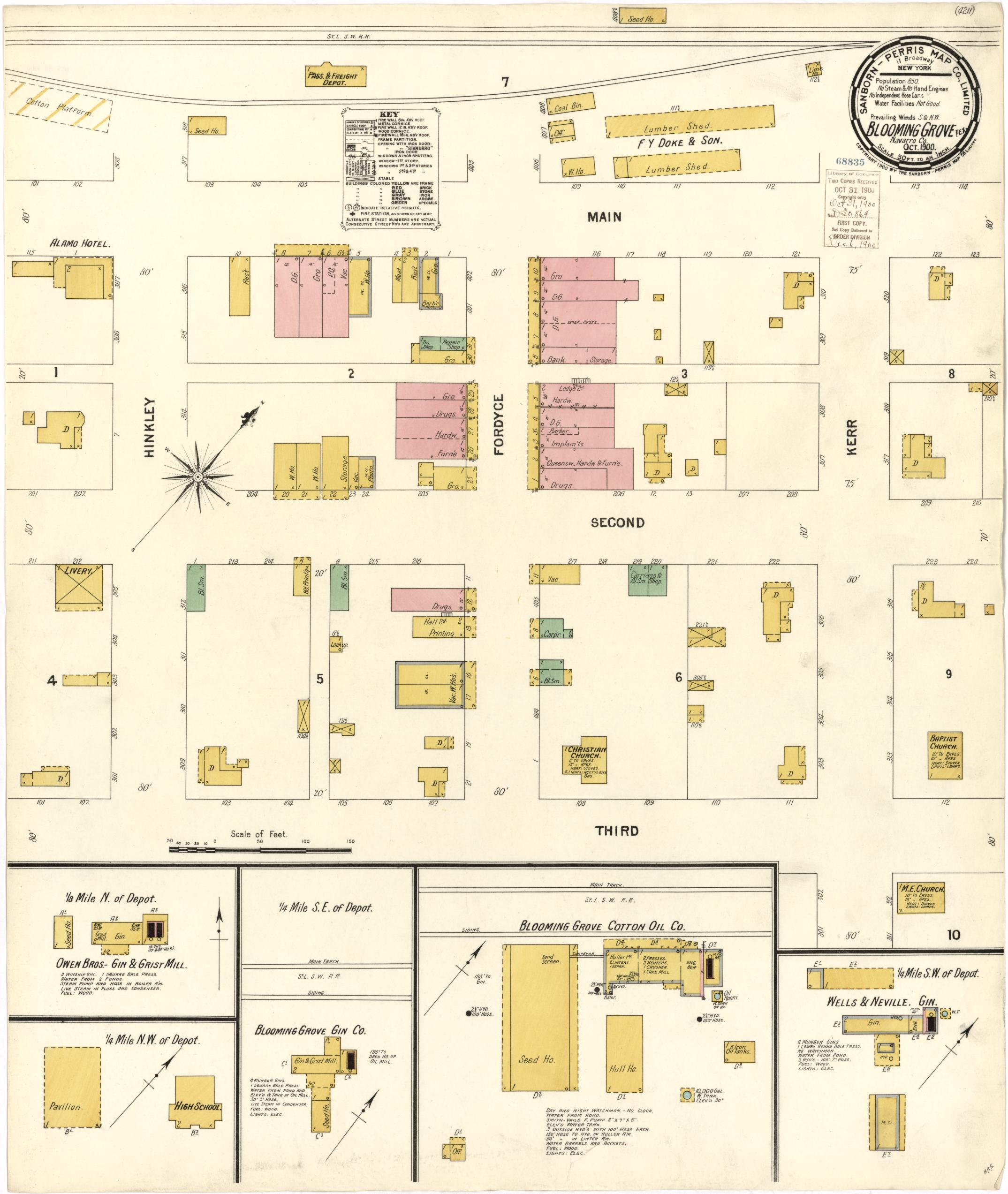
The town's earliest sheet in this set: one page, Bank and Printing on the Main/Fordyce and Second/Third blocks, the Alamo Hotel, a livery, the Baptist, Christian and M.E. churches, the High School, the Pavilion, Blooming Grove Cotton Oil Co. and three cotton gins — Owen Bros. Gin & Grist Mill, Blooming Grove Gin Co., and Wells & Neville Gin. Streets: Fordyce, Hinkley (no c), Kerr, Main, Second, Third.
1905
Population 1,000
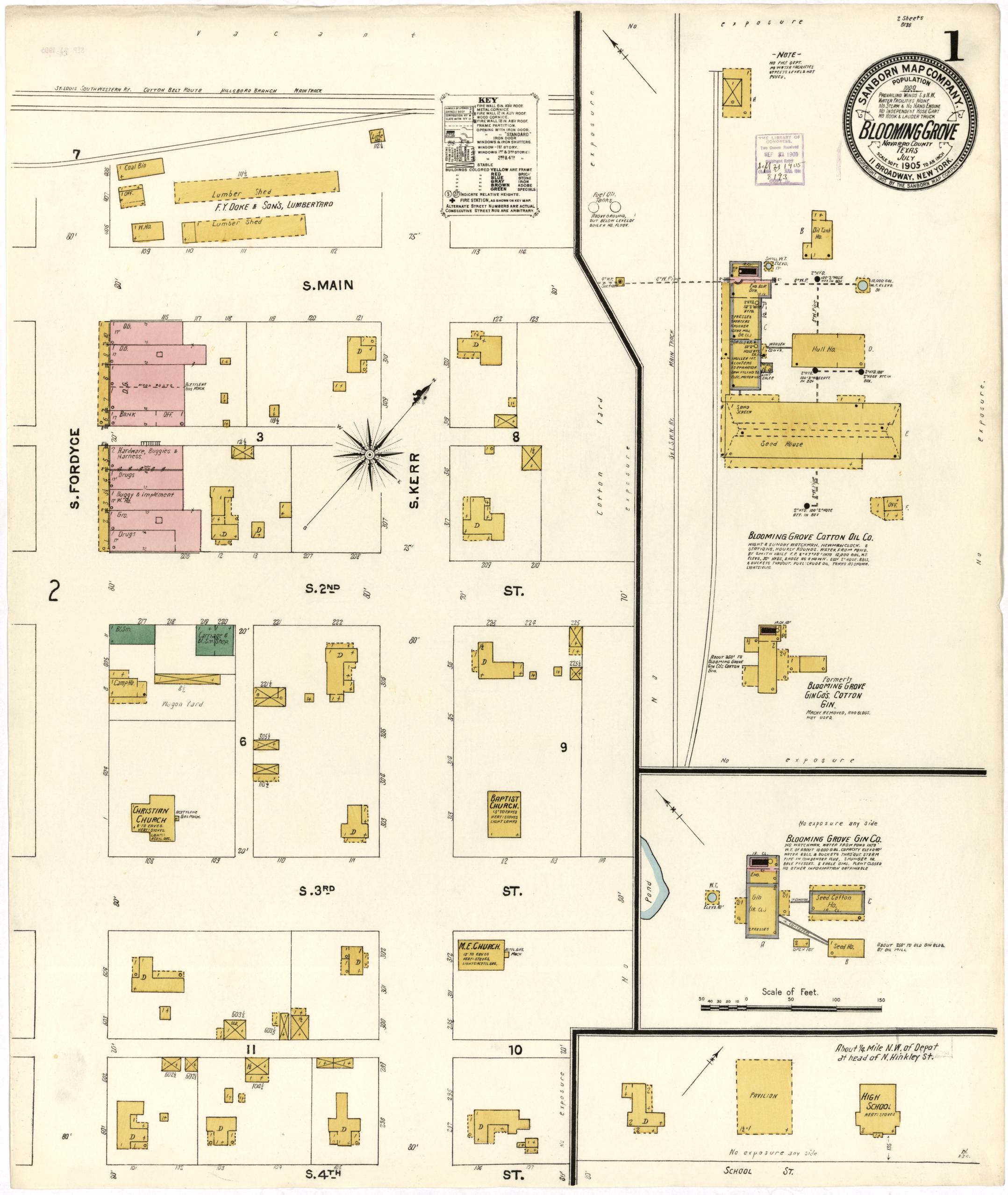
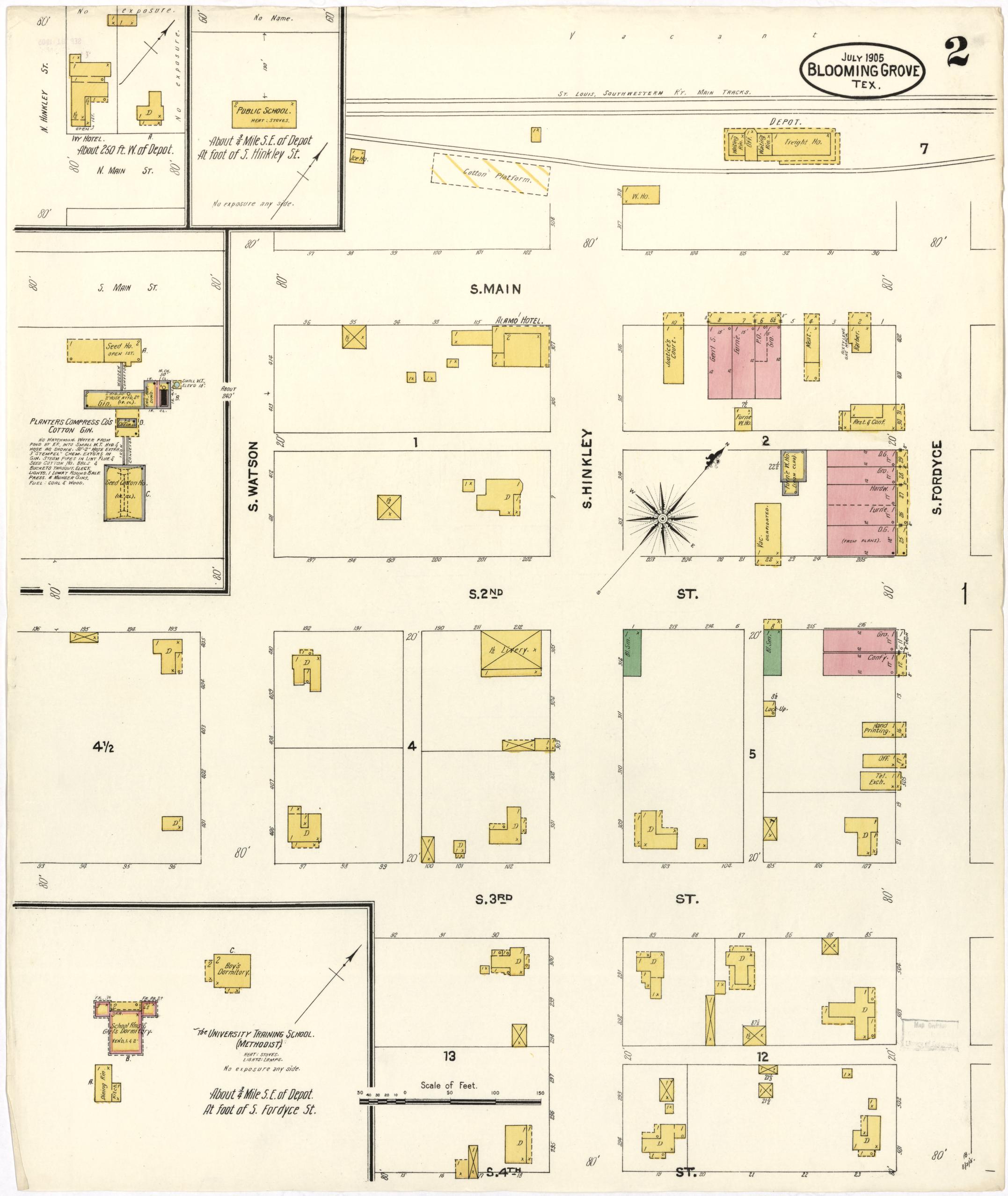
Population had grown by a sixth in five years. The S. Fordyce block now carries a Bank and an Office alongside Hardware, Buggies & Harness, two Drug stores and a general store; the Cotton Oil Co. is drawn in full — hull house, seed house, gin. Two hotels stand, the Alamo and the Ivy. The University Training School (Methodist), with a Boys' and a Girls' Dormitory, sits at the foot of S. Fordyce — the direct predecessor of Central Texas College, named on the later sheets.
1910
Population 1,500
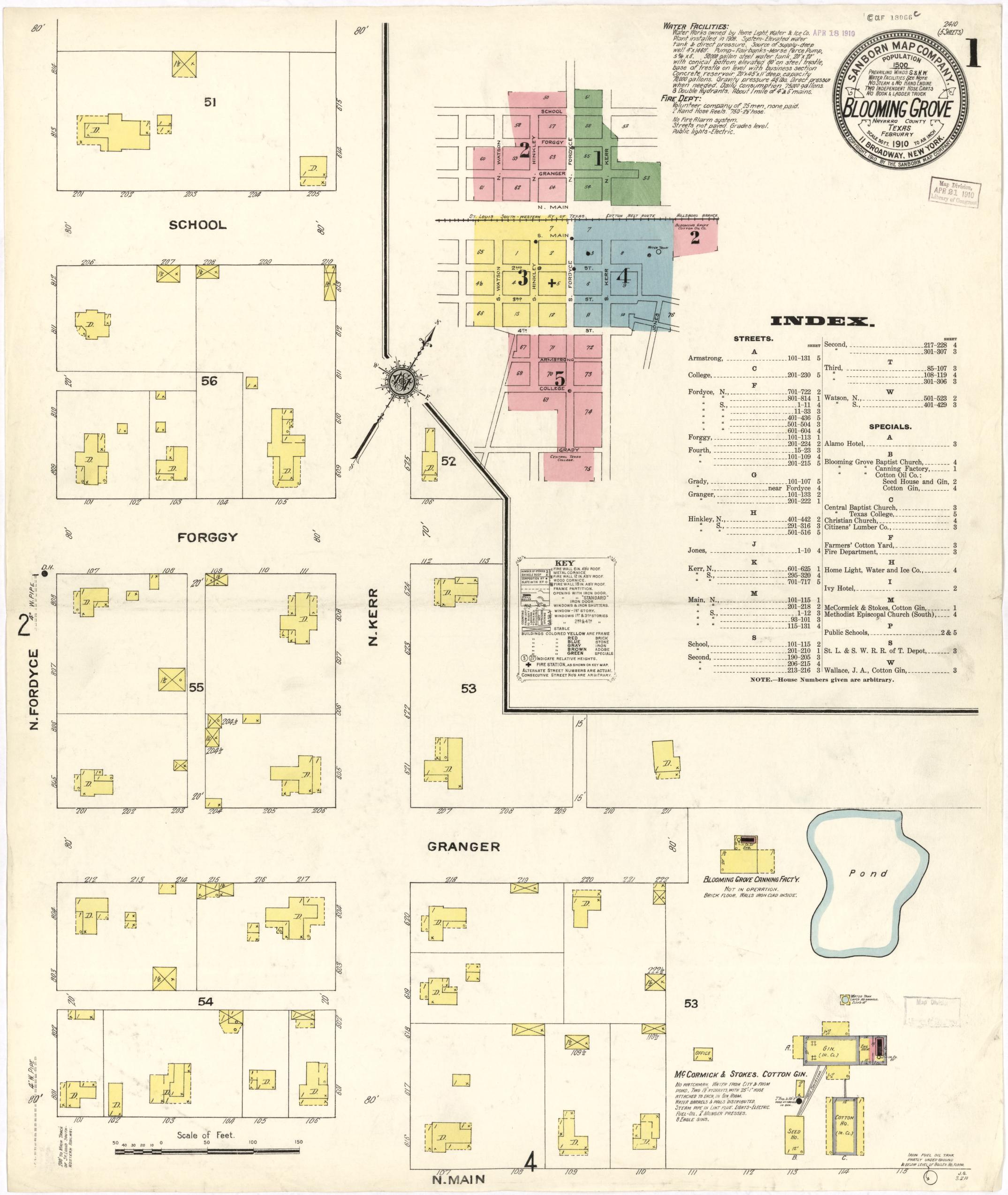
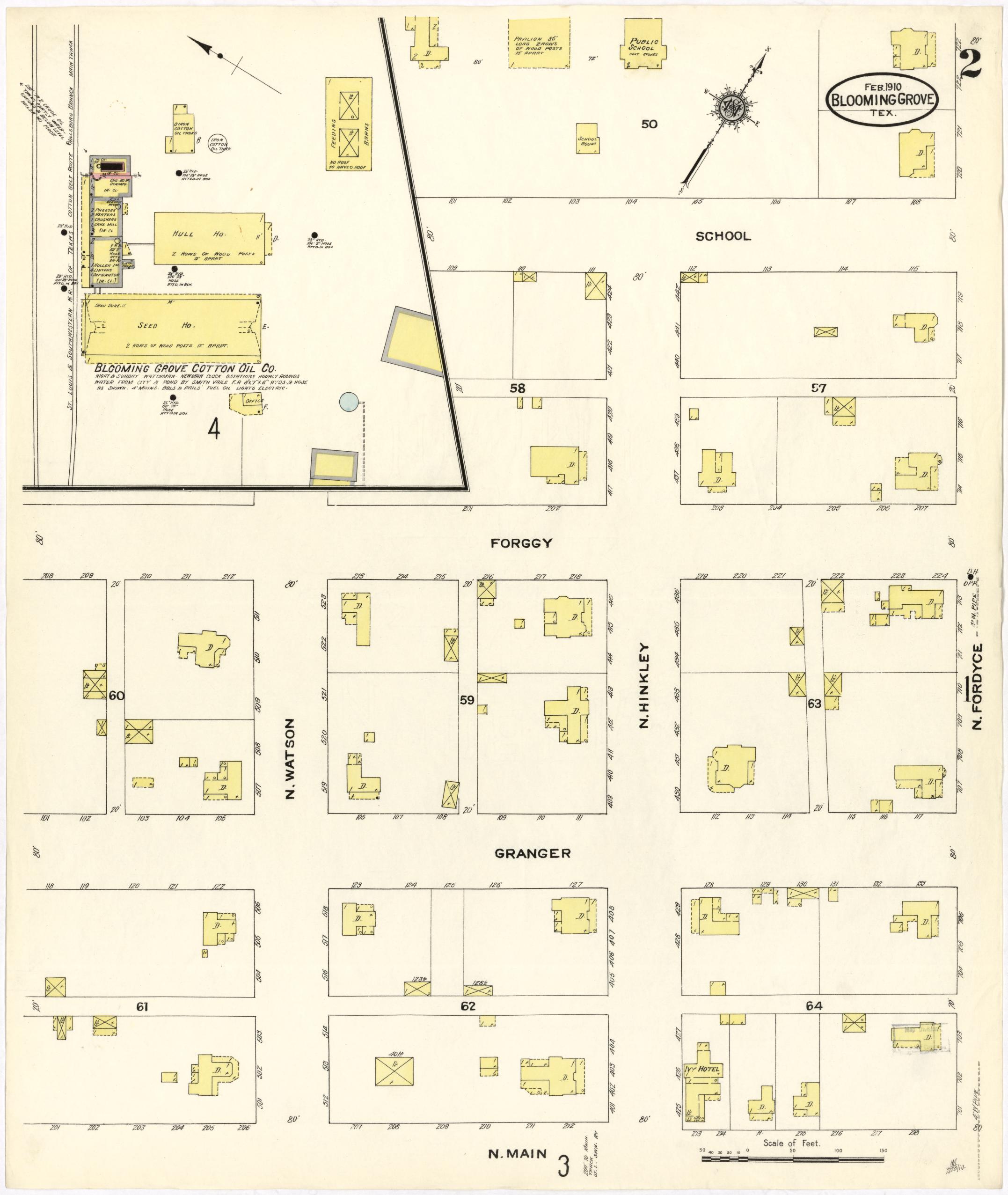
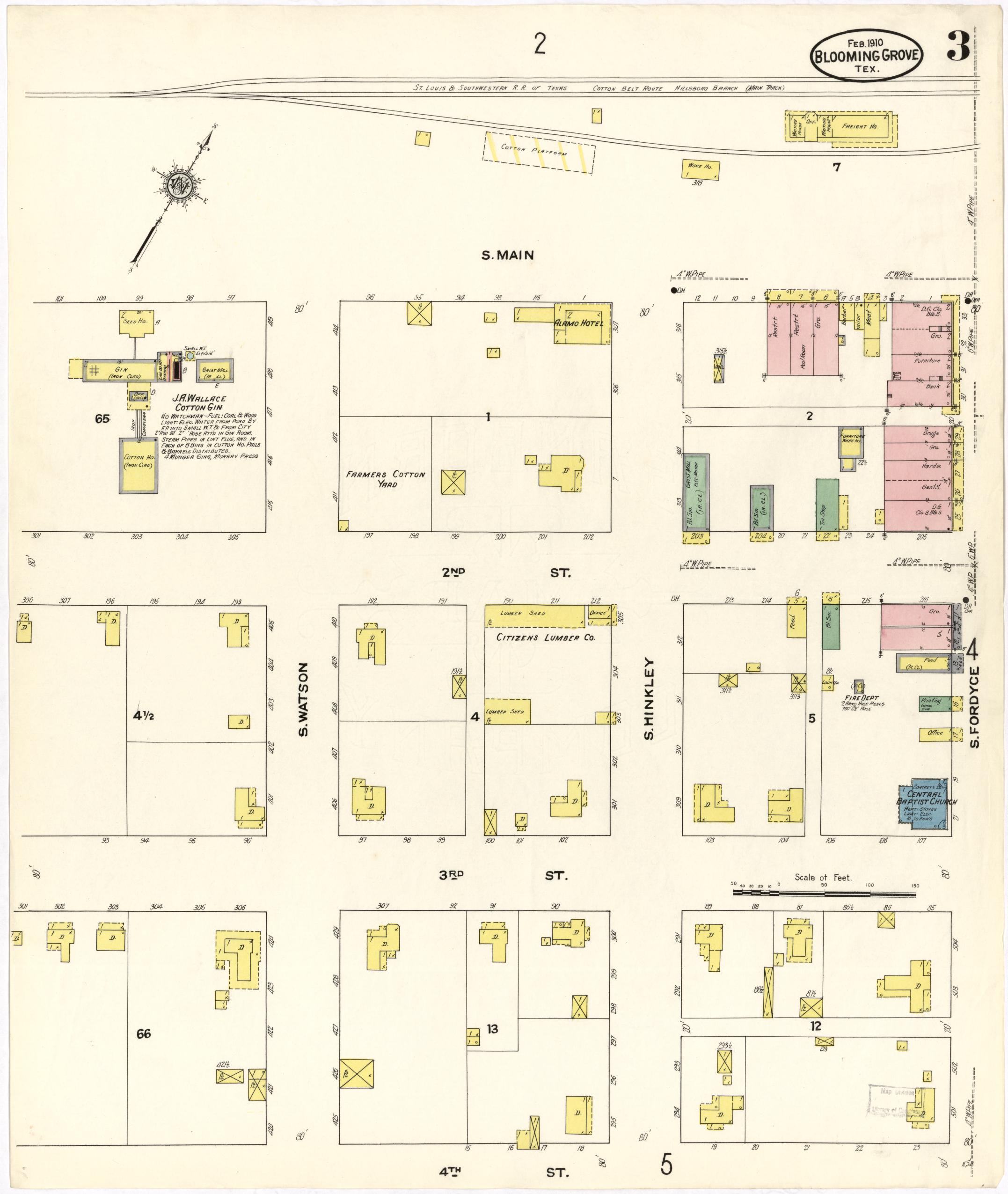
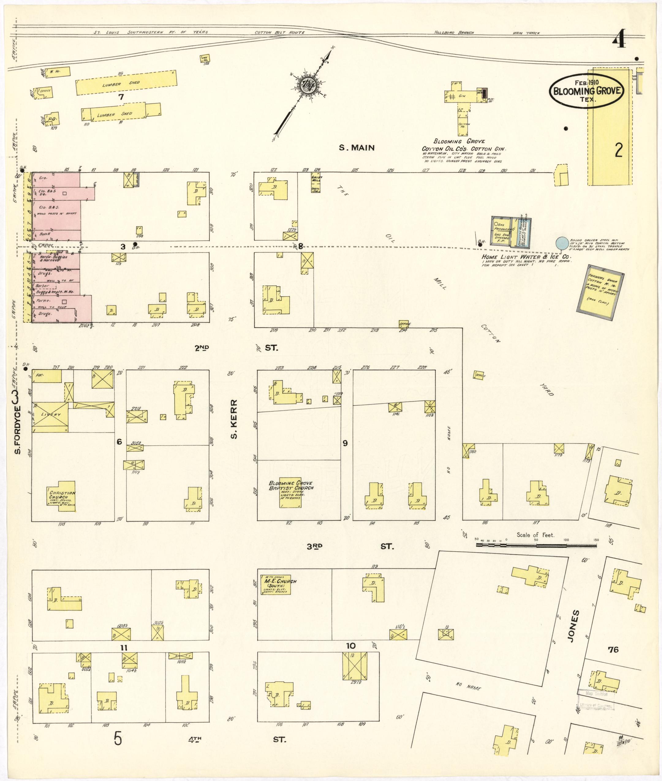
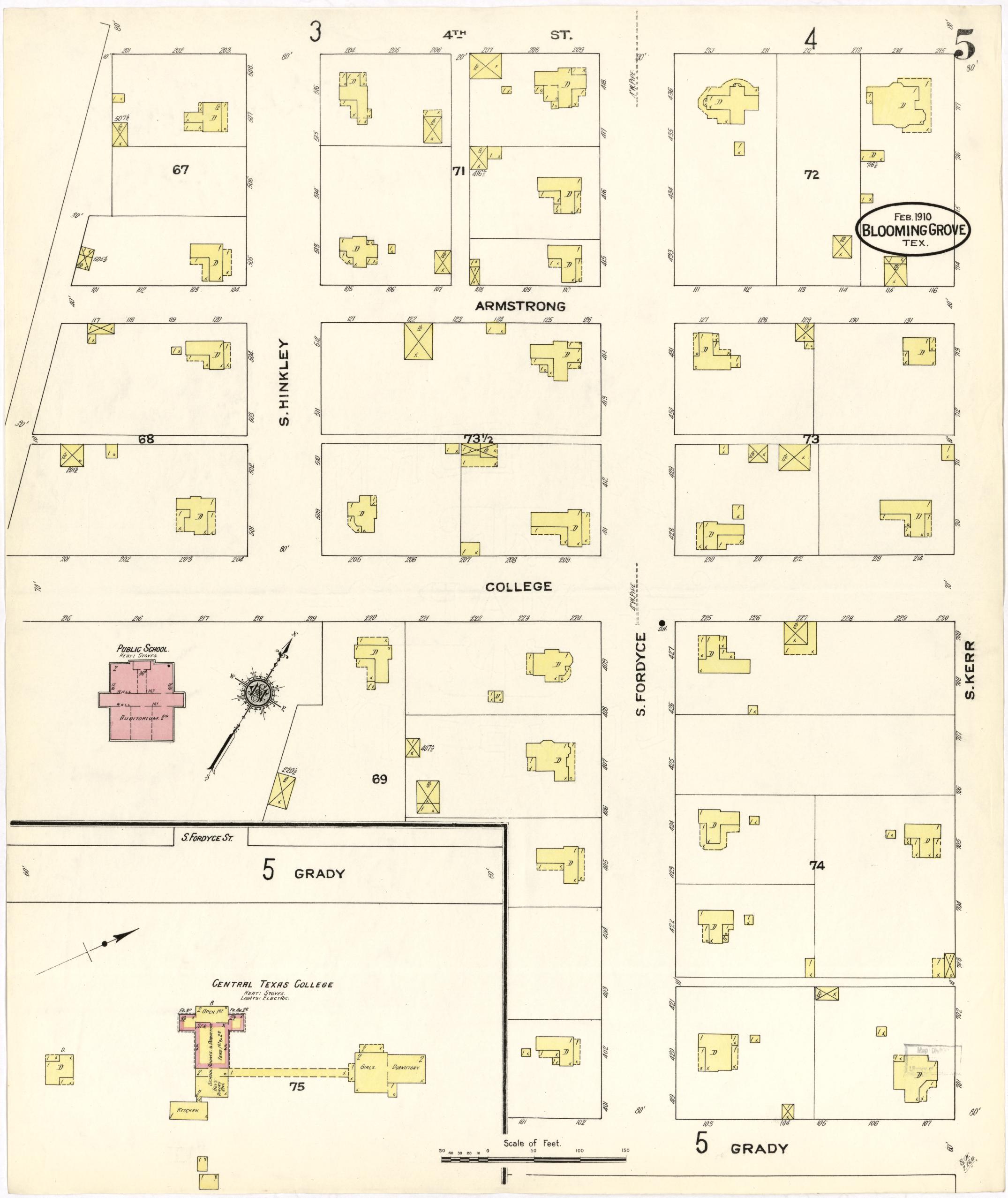
The fullest index sheet of the set. The Fire Department: a volunteer company of 25 men, none paid, two hand hose reels and 750 feet of hose, no alarm system, streets not paved. The Home Light, Water & Ice Co. plant, installed 1906: a 50,000-gallon steel tank on a 90-foot trestle, a 70,000-gallon concrete reservoir, eight double hydrants. Central Texas College is named directly — block 75, a Girls' Dormitory and a Kitchen joined by a covered walk. A Bank sits at the corner of the S. Fordyce trades block.
1921
Population 1,799
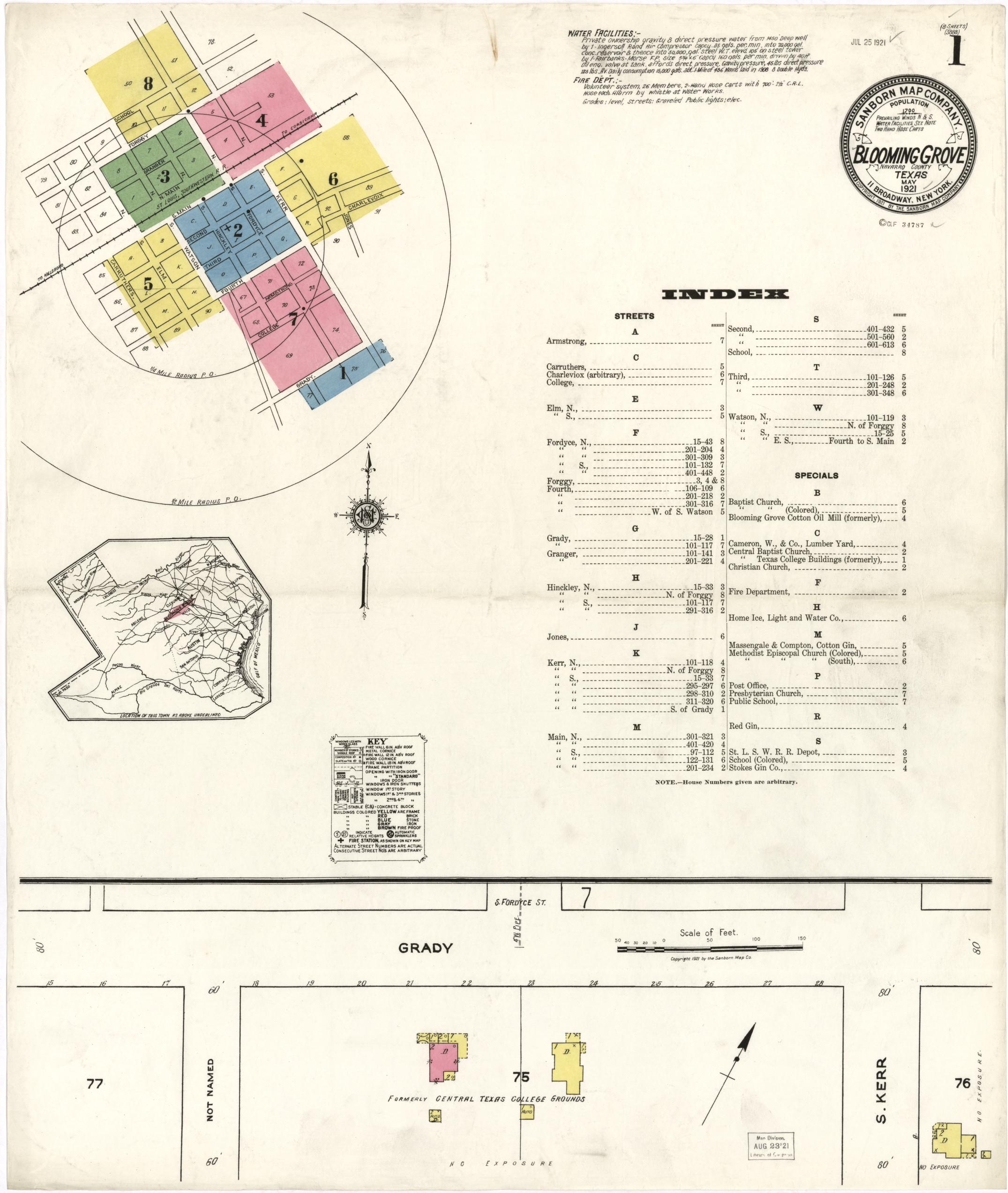
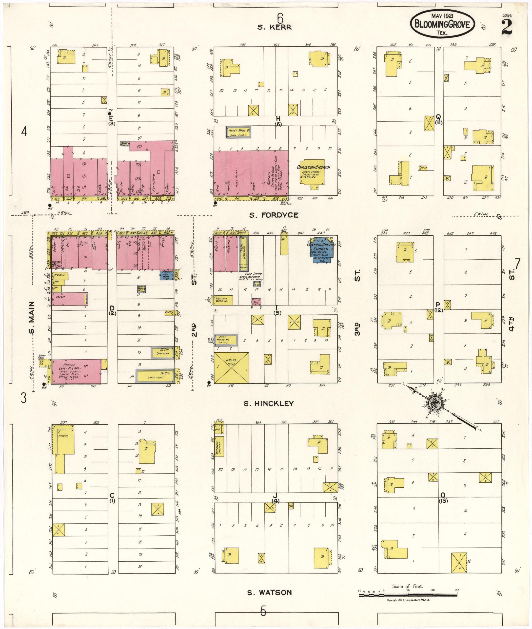
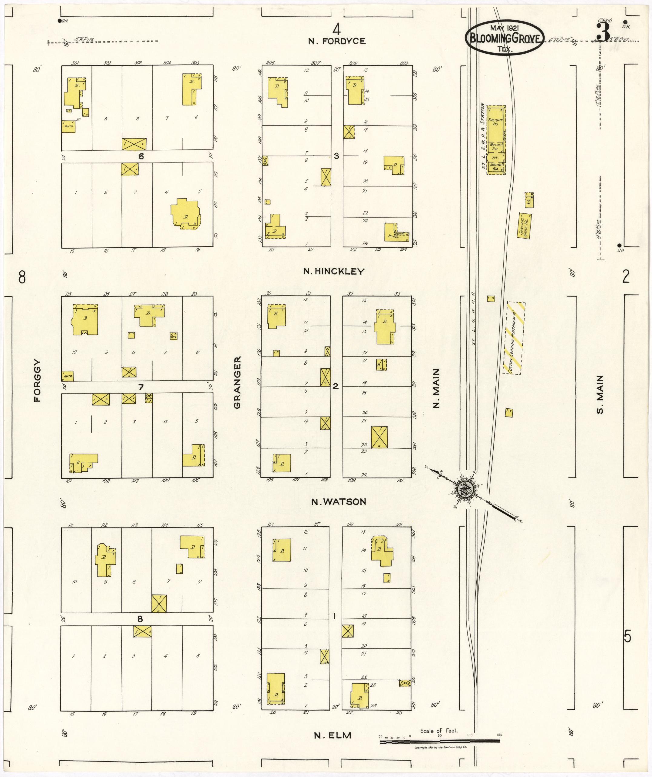
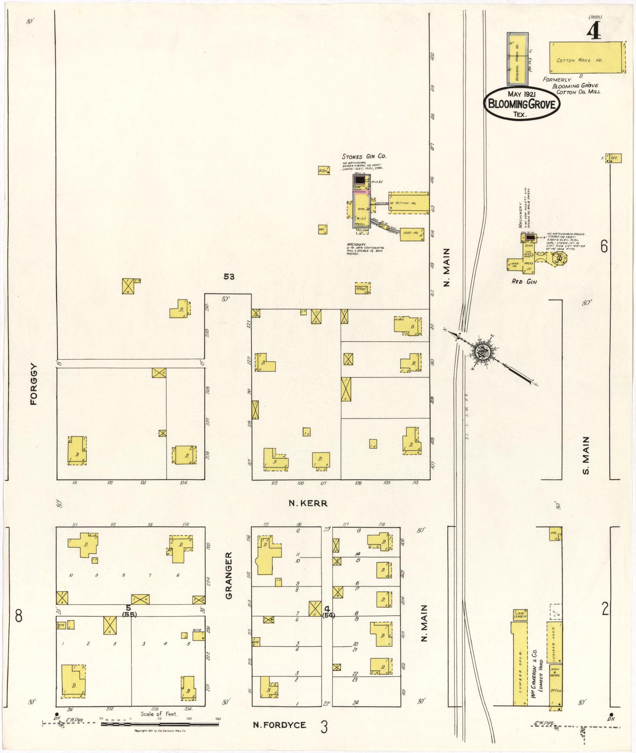
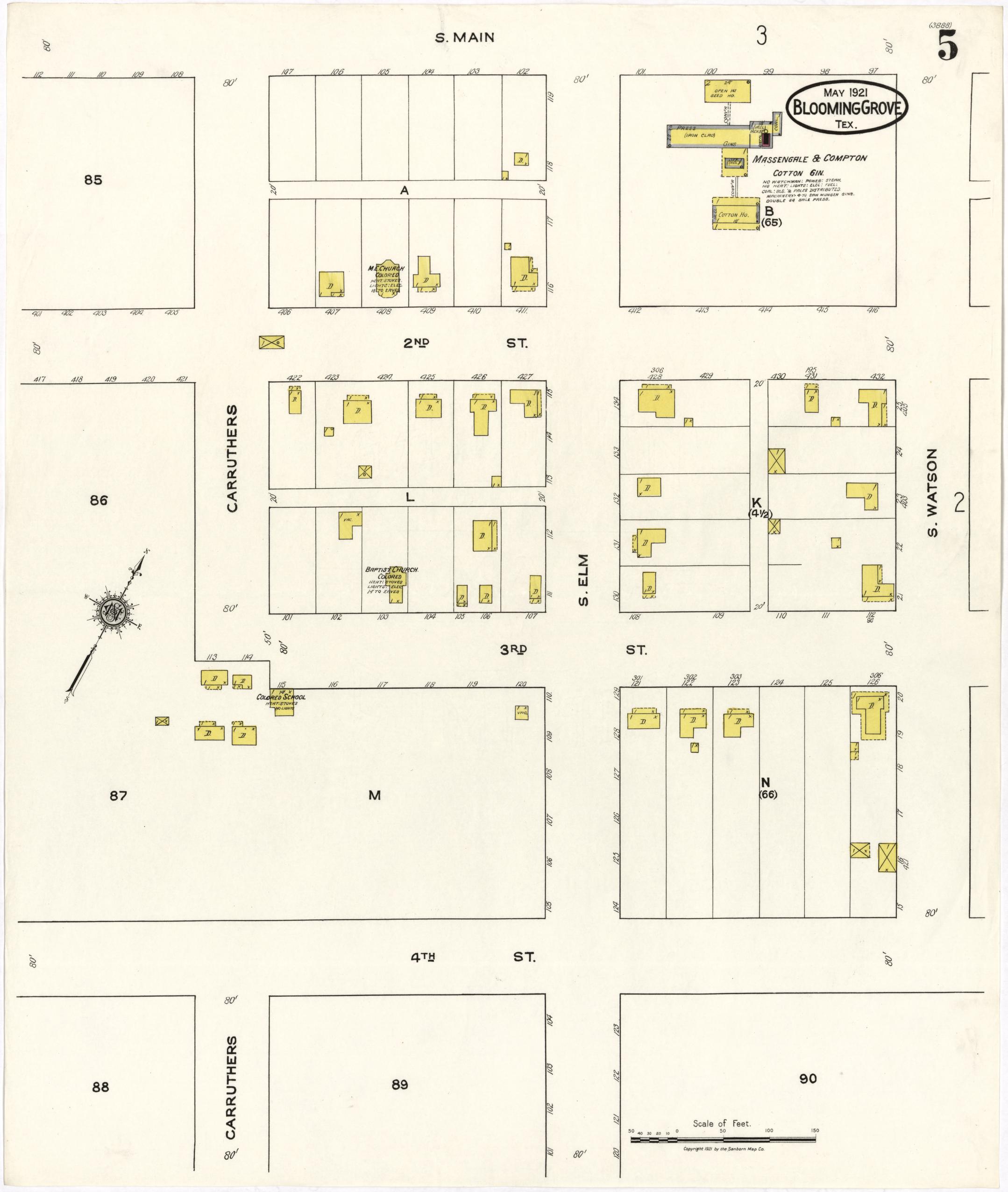
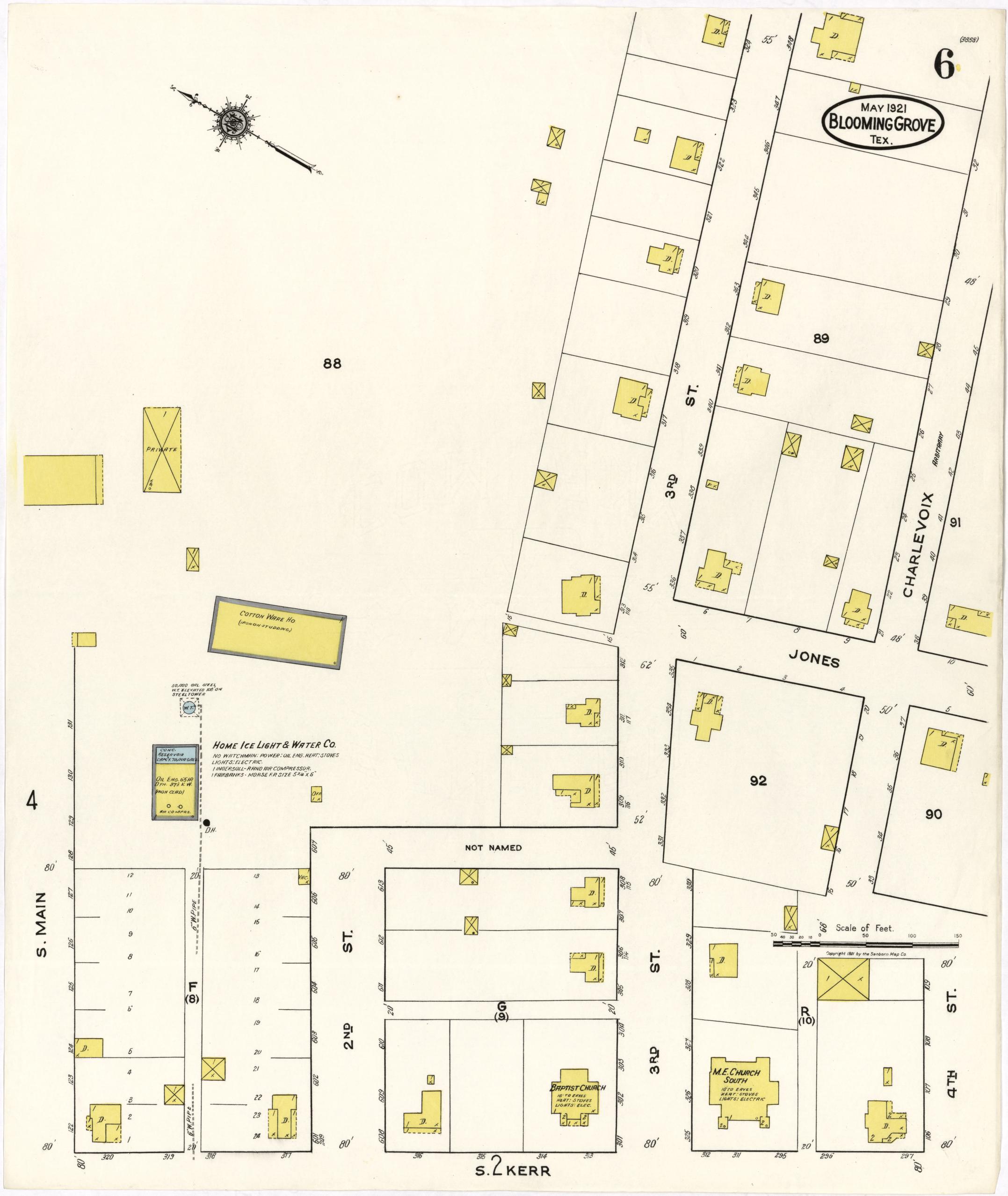
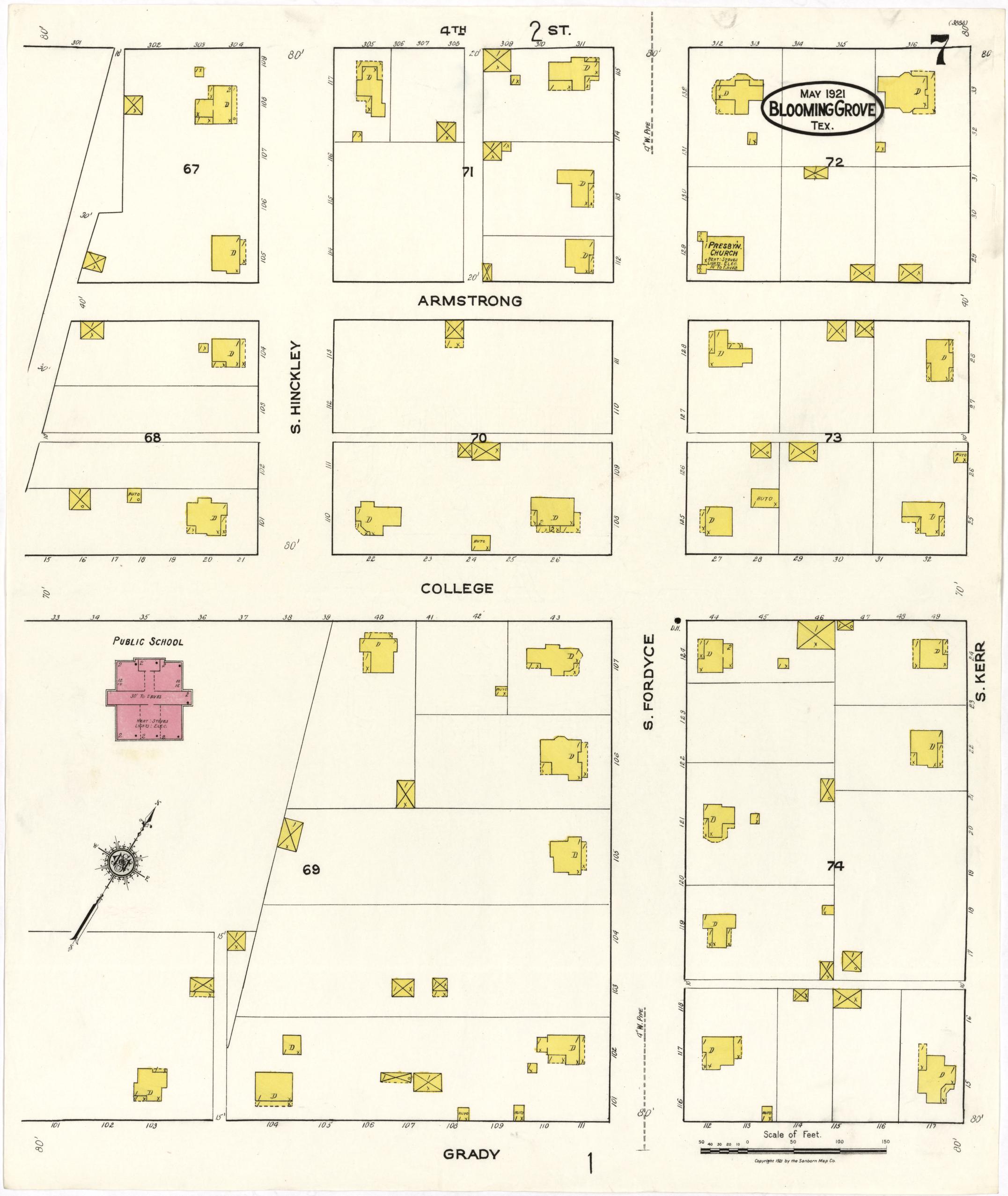
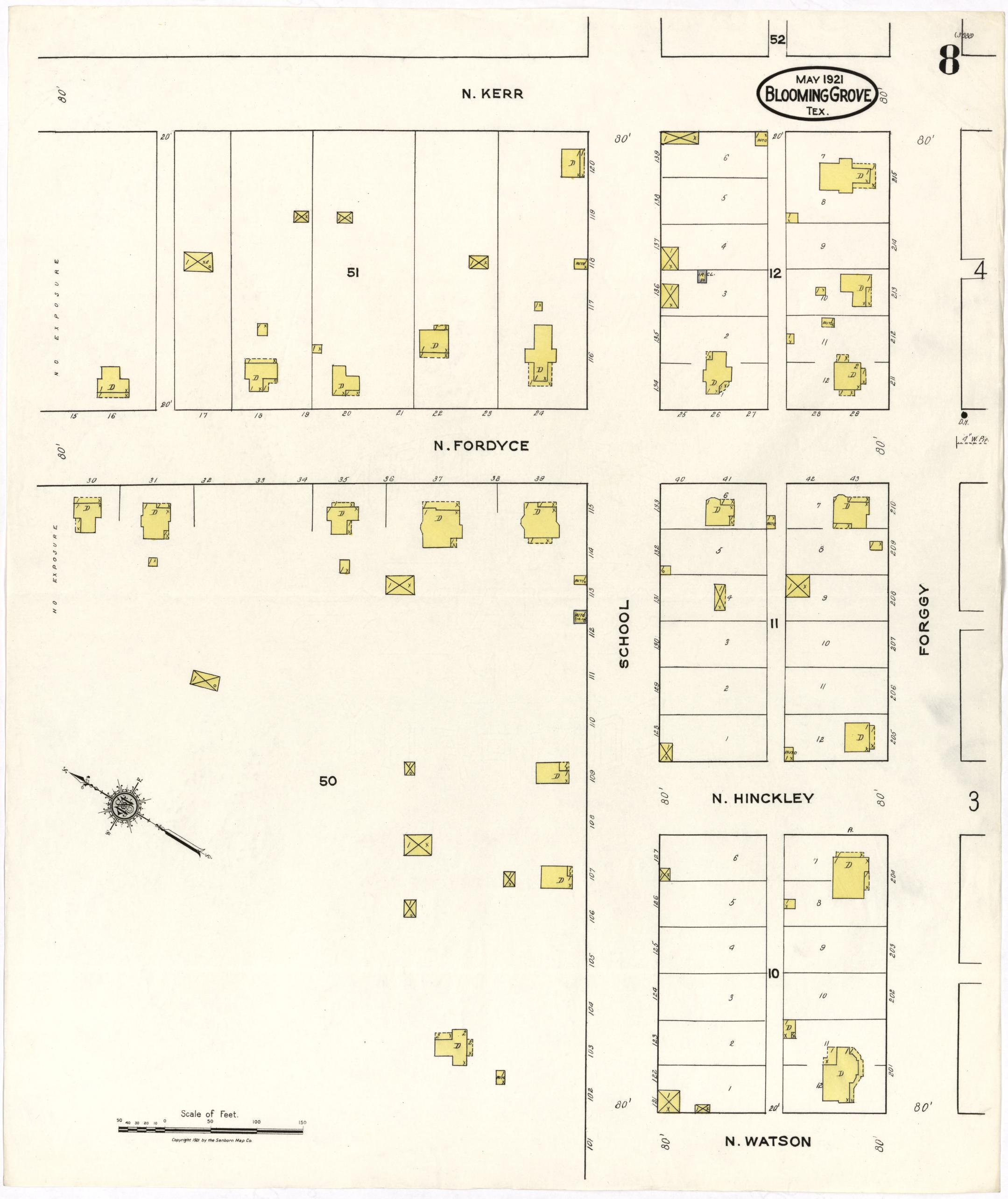
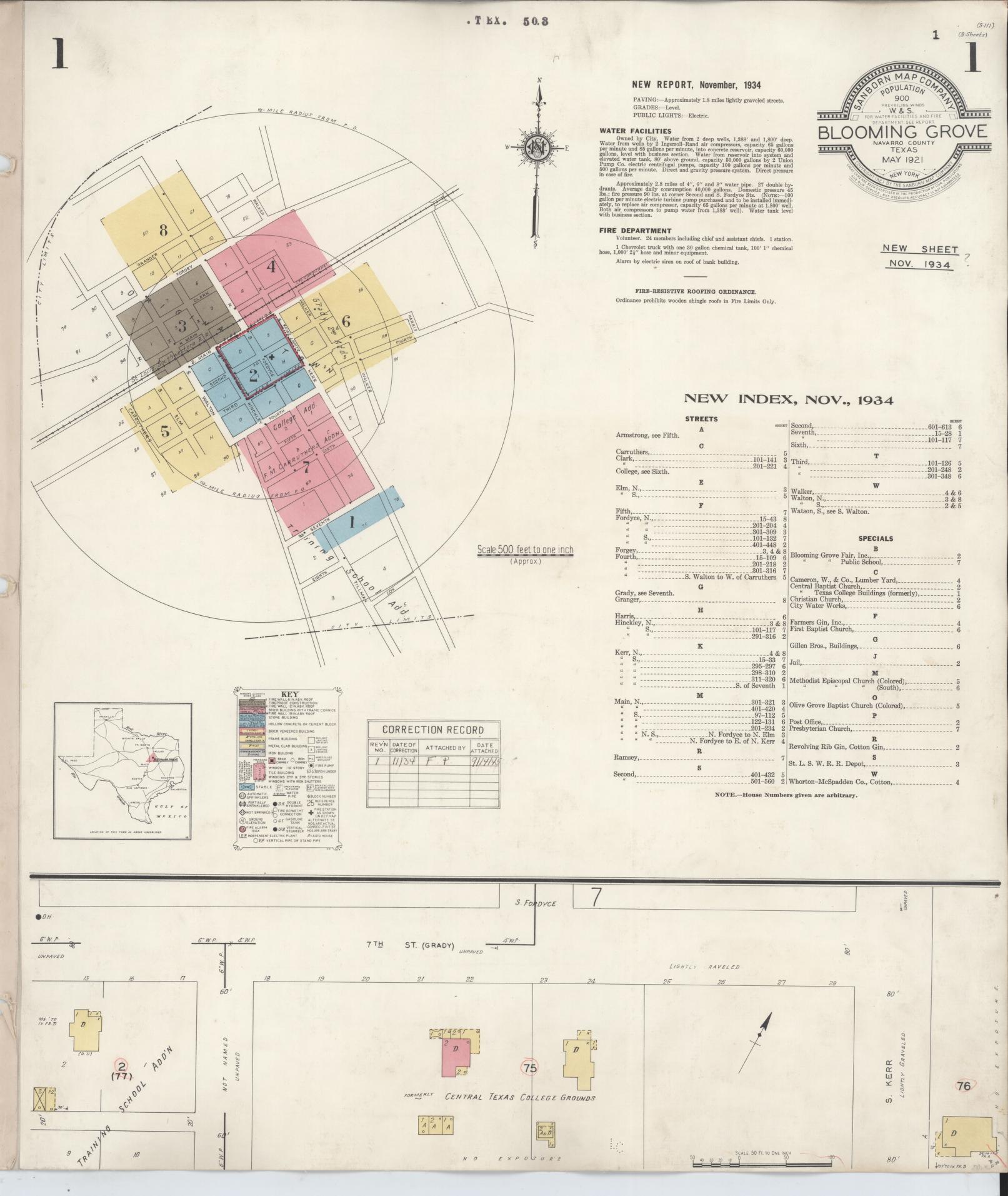
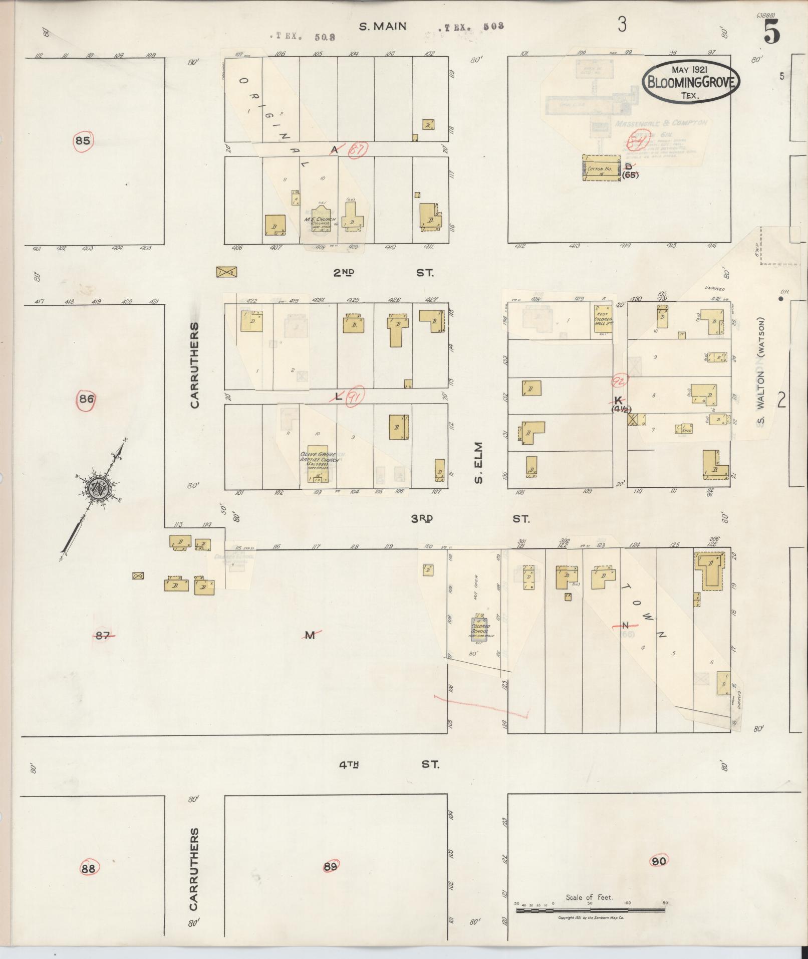
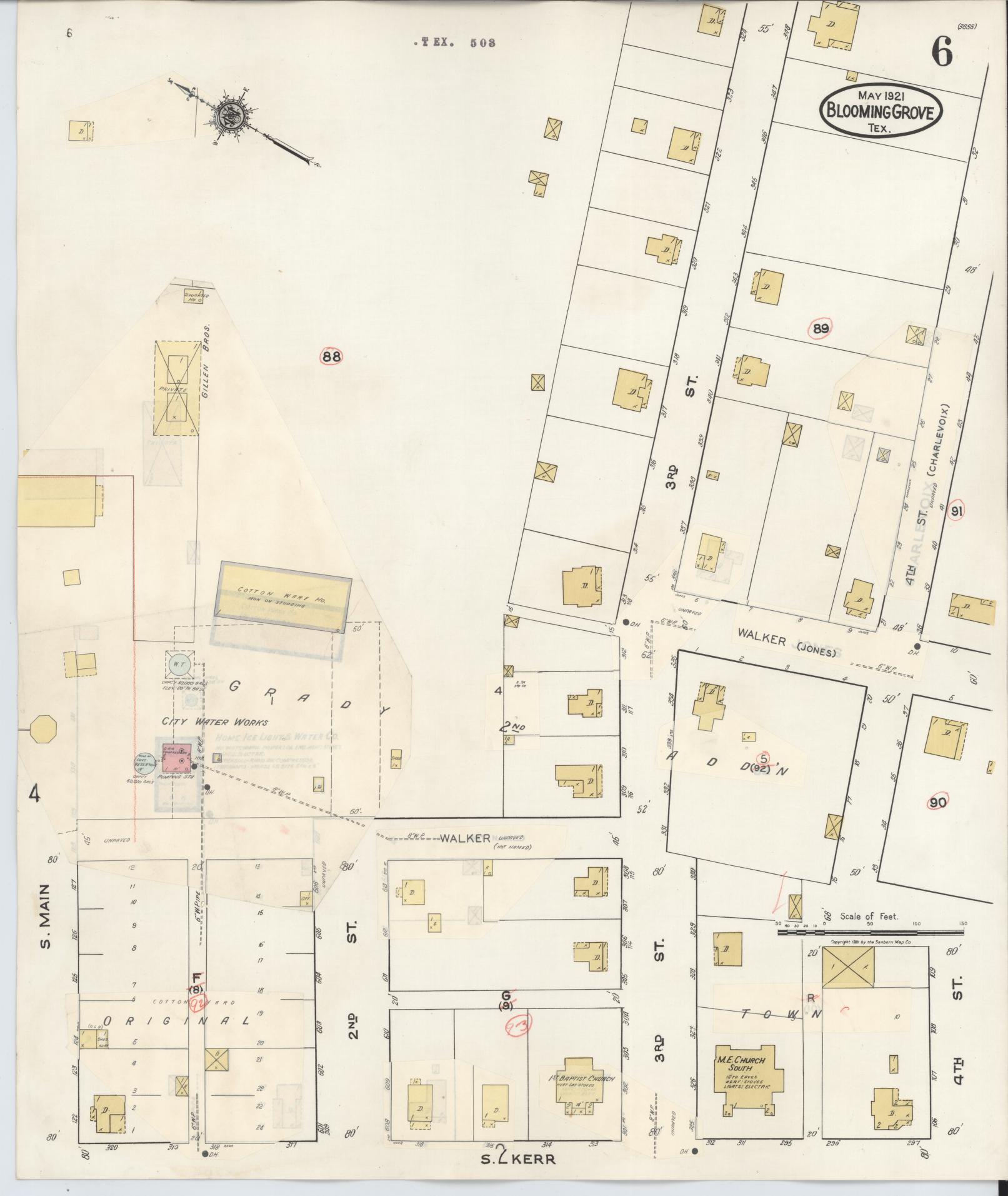
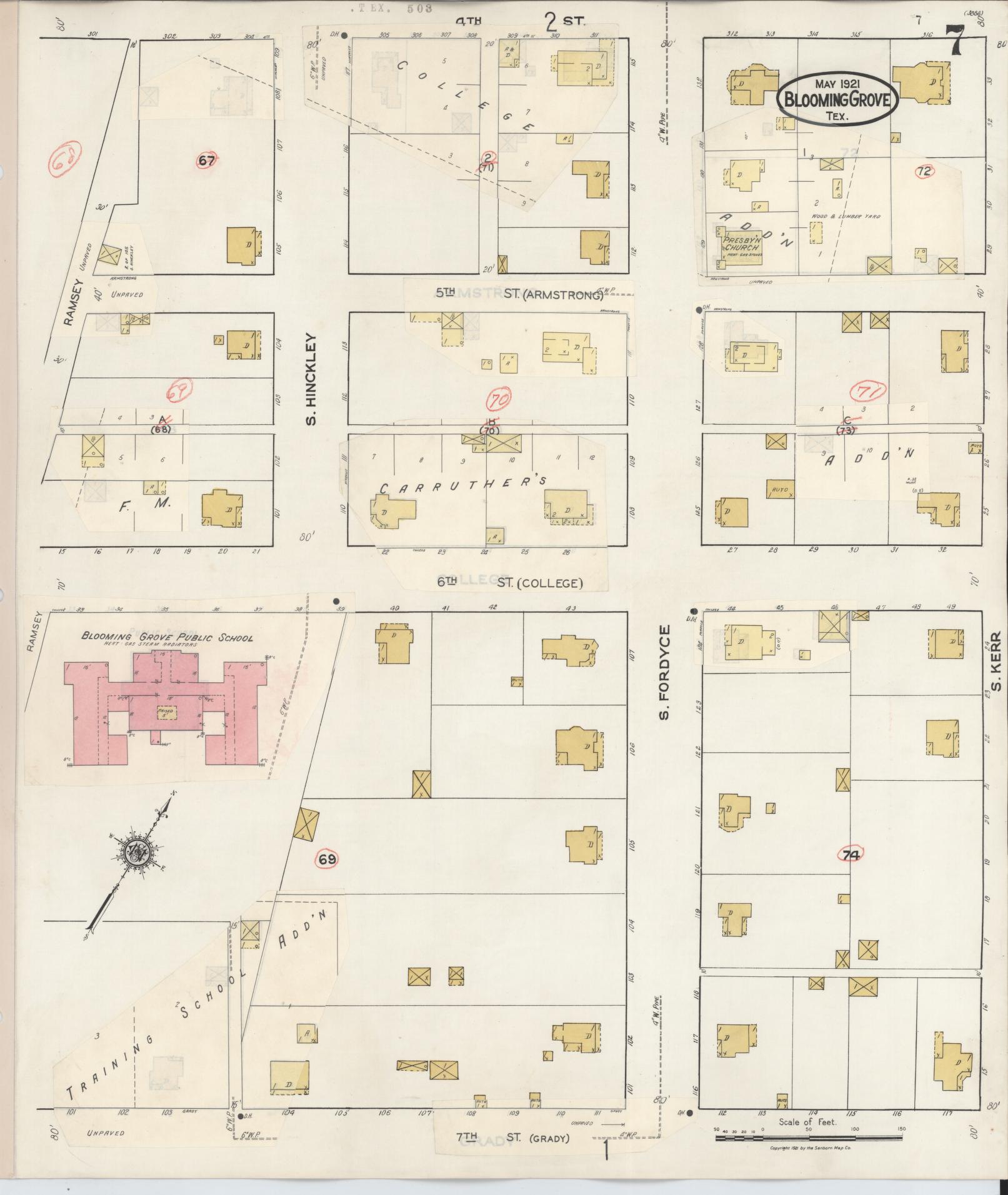
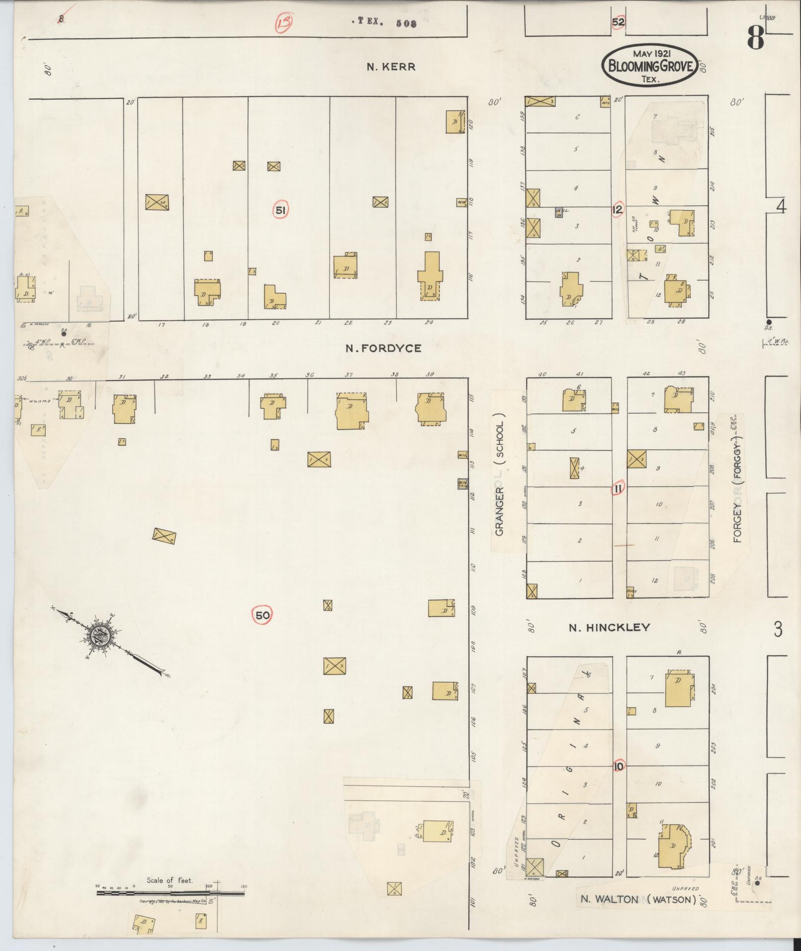
The richest single page in the set — population peaks at 1,799, and a radius map shows the town's own quarter- and half-mile Post Office rings. Central Texas College's block is now labelled "Formerly Central Texas College Grounds": it closed between 1910 and this edition. Three segregated institutions appear for the first time — a Colored M.E. Church, a Colored Baptist Church and a separate Colored School — distinct from the Public School and the white congregations of the same denominations. Garages marked "Capacity 30 Cars" and "Capacity 40 Cars" show the automobile has reached downtown.
1934
Population 900
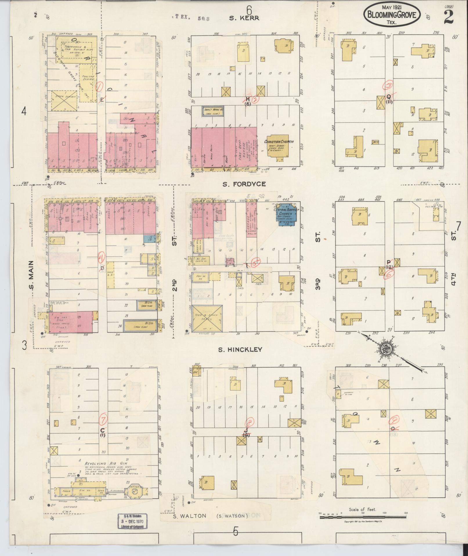
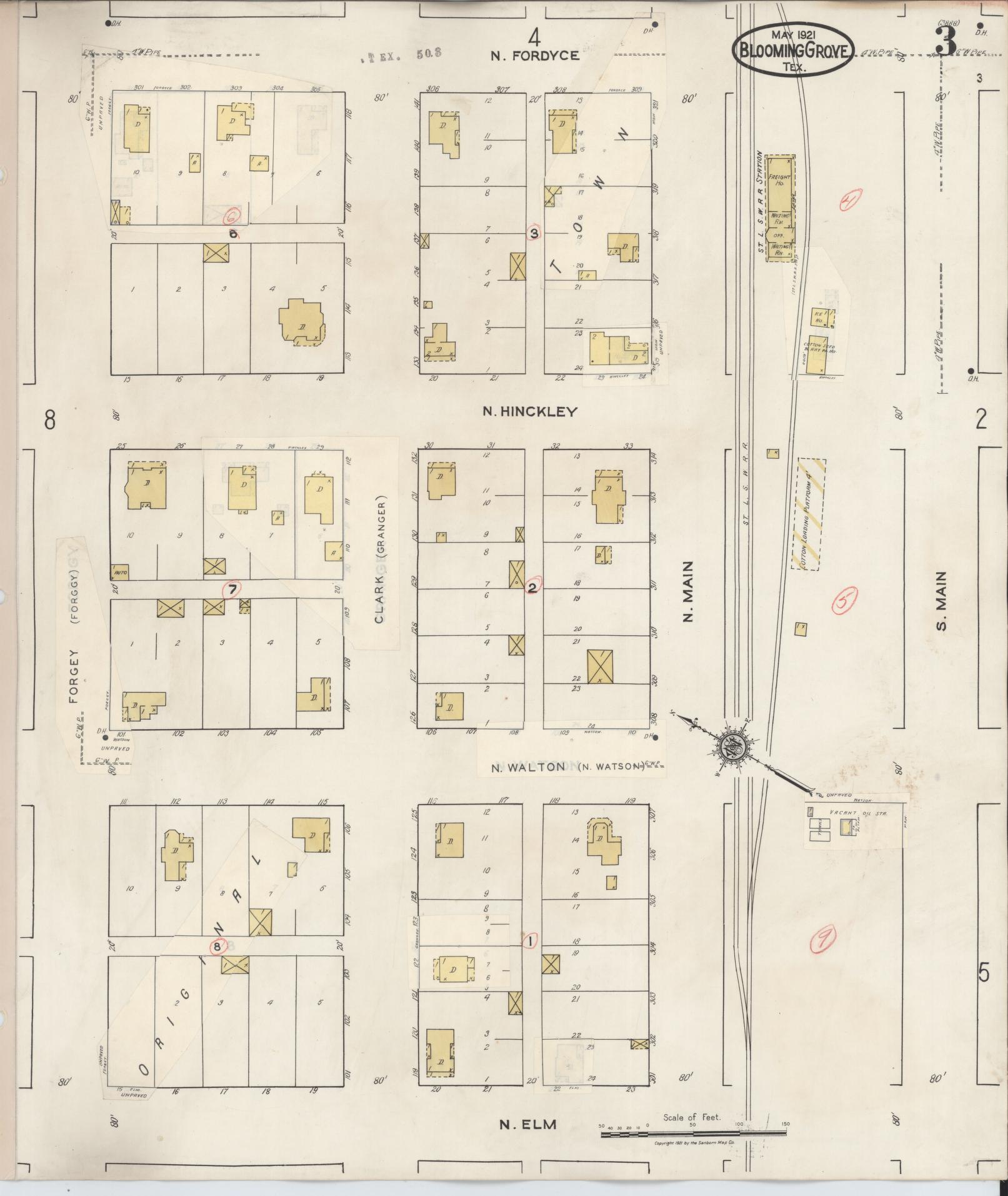
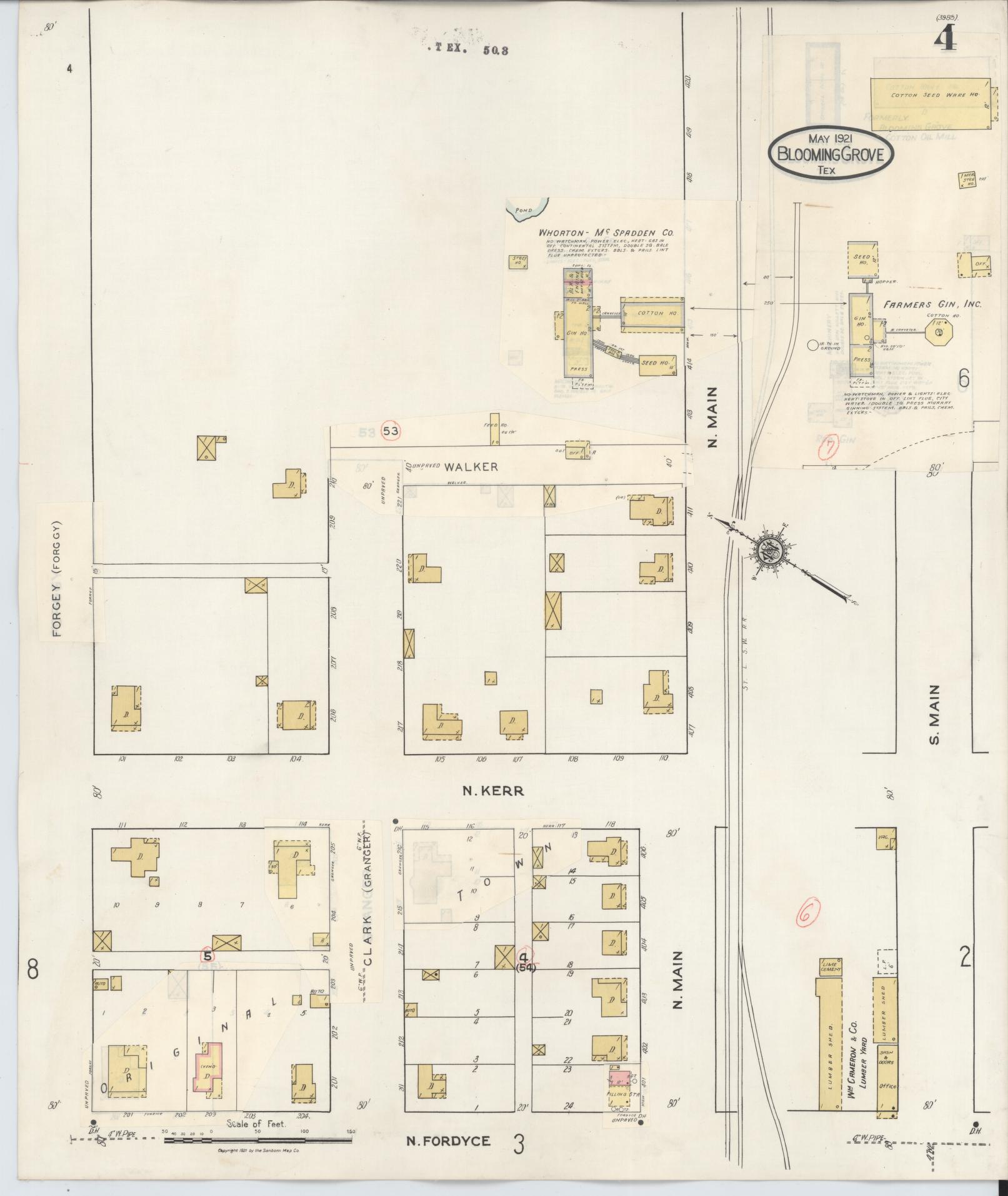
A November 1934 correction pass over the 1921 base map. The town had lost well over half its 1921 population by this index. Sheet 2 shows Blooming Grove Fair, Inc. for the first time — a Tabernacle, a Poultry Exhibit, a Stock Exhibit and a Lodge Hall — on the same block as the Bank, Post Office and Fire Department. Sheet 5 names Olive Grove Baptist Church (Colored), settling a naming question the 2005 pictorial history and the live site had disagreed on. Sheet 6 carries the Gillen Bros. buildings. Streets were renumbered this edition, old names kept alongside: Armstrong became 5th, College became 6th, Grady became 7th.
What the sheets confirm and don't, checked against the 1966 Fordyce Street photograph, the town's modern business roster and Field Note 006
What closes clean
- The Masonic Lodge building at 110 Fordyce, named in a 1966 photograph, matches Lodge 497's own listed meeting address today — a connection never drawn until this read.
- Central Texas College's site closes a five-source loop: the 1905 University Training School, the 1910 and 1921 sheets, a street-name echo surviving on the 1934 sheet, and the 1966 photograph's own memory of "the home that at one time was Central Texas College."
- The Post Office and Central Baptist Church sit on the same block from at least 1921 through the 1966 photograph.
- A bank stands on or near South Fordyce Street in every edition from 1900 to 1934, the same street Field Note 006 traces from Farmers & Merchants Bank through to Prosperity Bank, still open at 109 South Fordyce today.
What does not match
- The 1934 sheet's "Bank" label may mark a building standing empty rather than an open bank — Field Note 006's own record has no operating bank in town in November 1934, between one failure in 1933 and the next bank's opening in 1936. Not settled.
- The Fire Department sits on the 1934 bank block and is absent from the 1966 photograph of the same street — which lines up with, but does not prove, mayor R. W. McGaha donating land for a new fire department during his 1966–74 term.
Source: Library of Congress, Sanborn Fire Insurance Map Collection, read 2026-09-19. Public domain.