Blackland TX · Historic maps
Hubbard
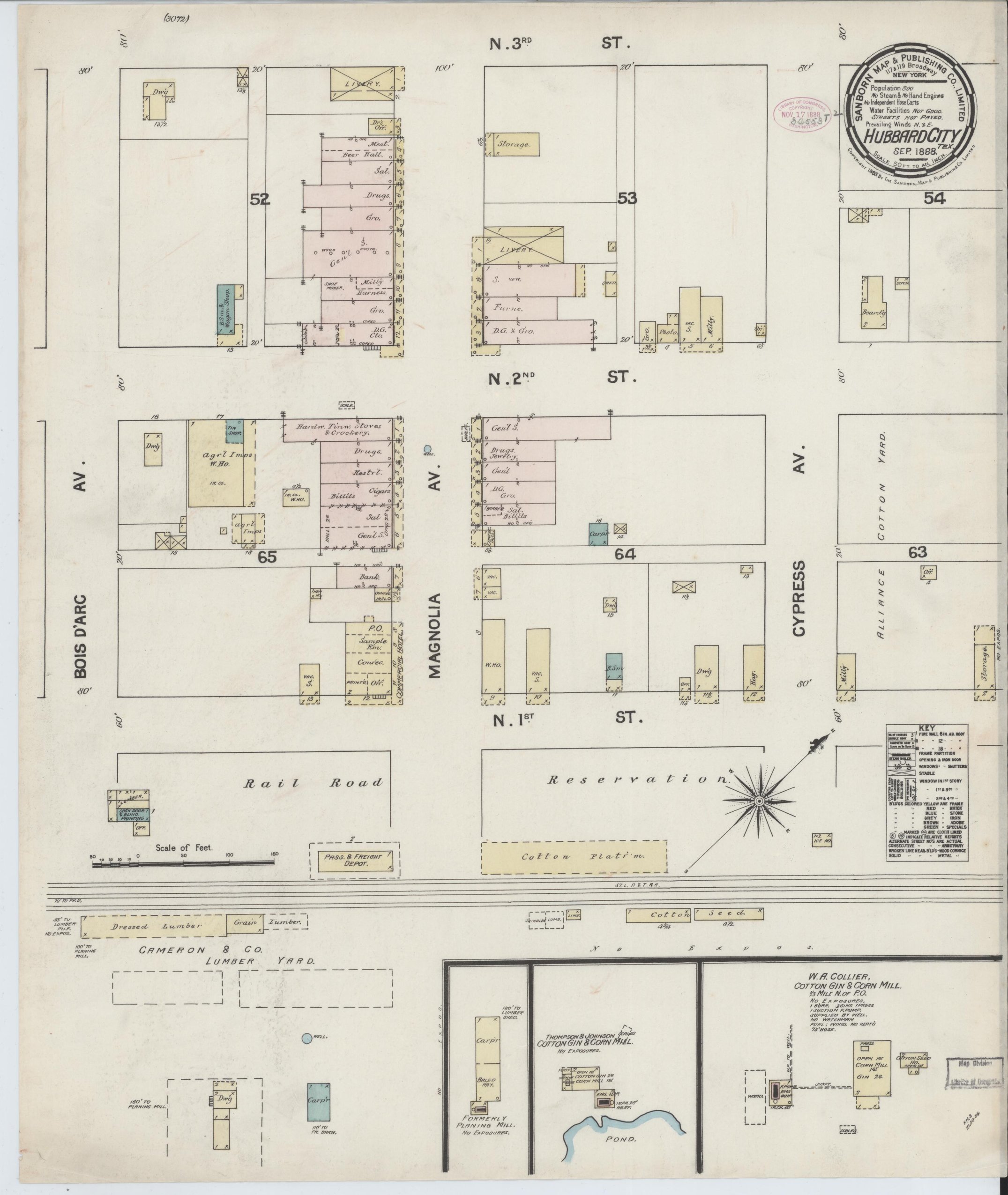
1888
Population 800
The town is "Hubbard City" on its first sheet. Two blocks of commercial buildings on Magnolia Avenue between First and Third: general stores, drugs, groceries, saloons, a bank, the post office, a photographer and a millinery. South of the tracks, Cameron & Co.'s lumber yard, W. A. Collier's cotton gin and corn mill and Thompson & Johnson's gin and corn mill. Water facilities are "not good" and the streets are not paved.
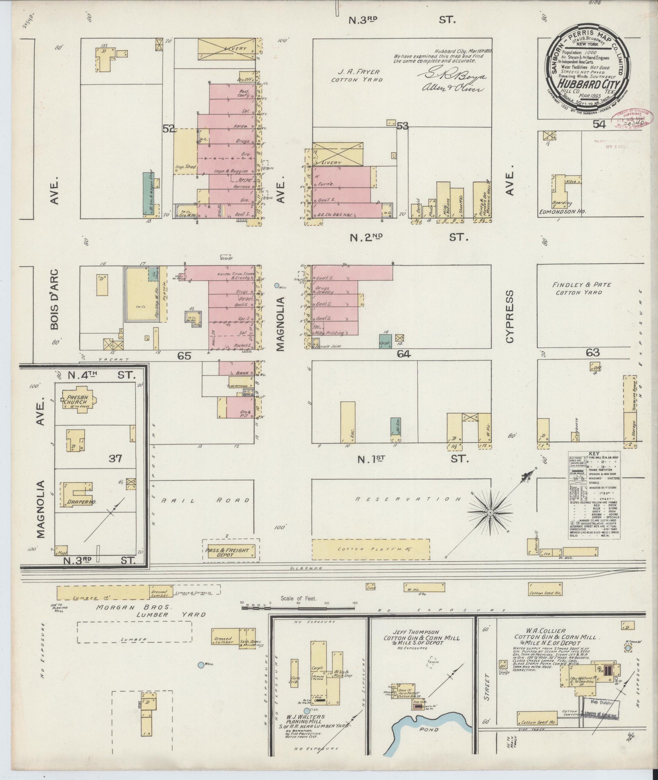
1893
Population 1,000
Five years on, population 1,000. The Magnolia Avenue row has filled in, with a Masonic hall, a printing office and a Presbyterian church a block over. Morgan Bros. now run the lumber yard, W. J. Walters a planing mill, and Jeff Thompson and W. A. Collier each a cotton gin and corn mill.
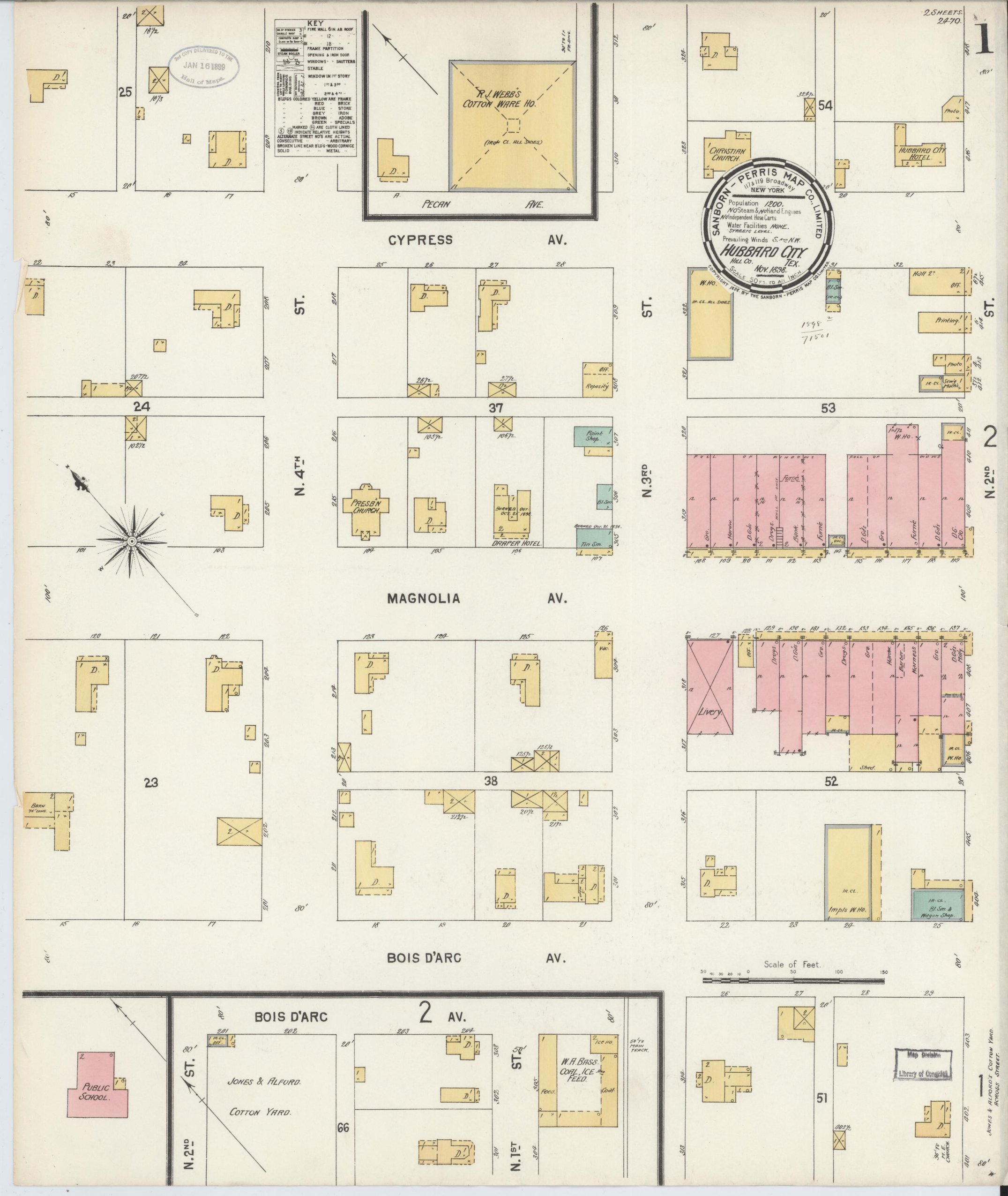
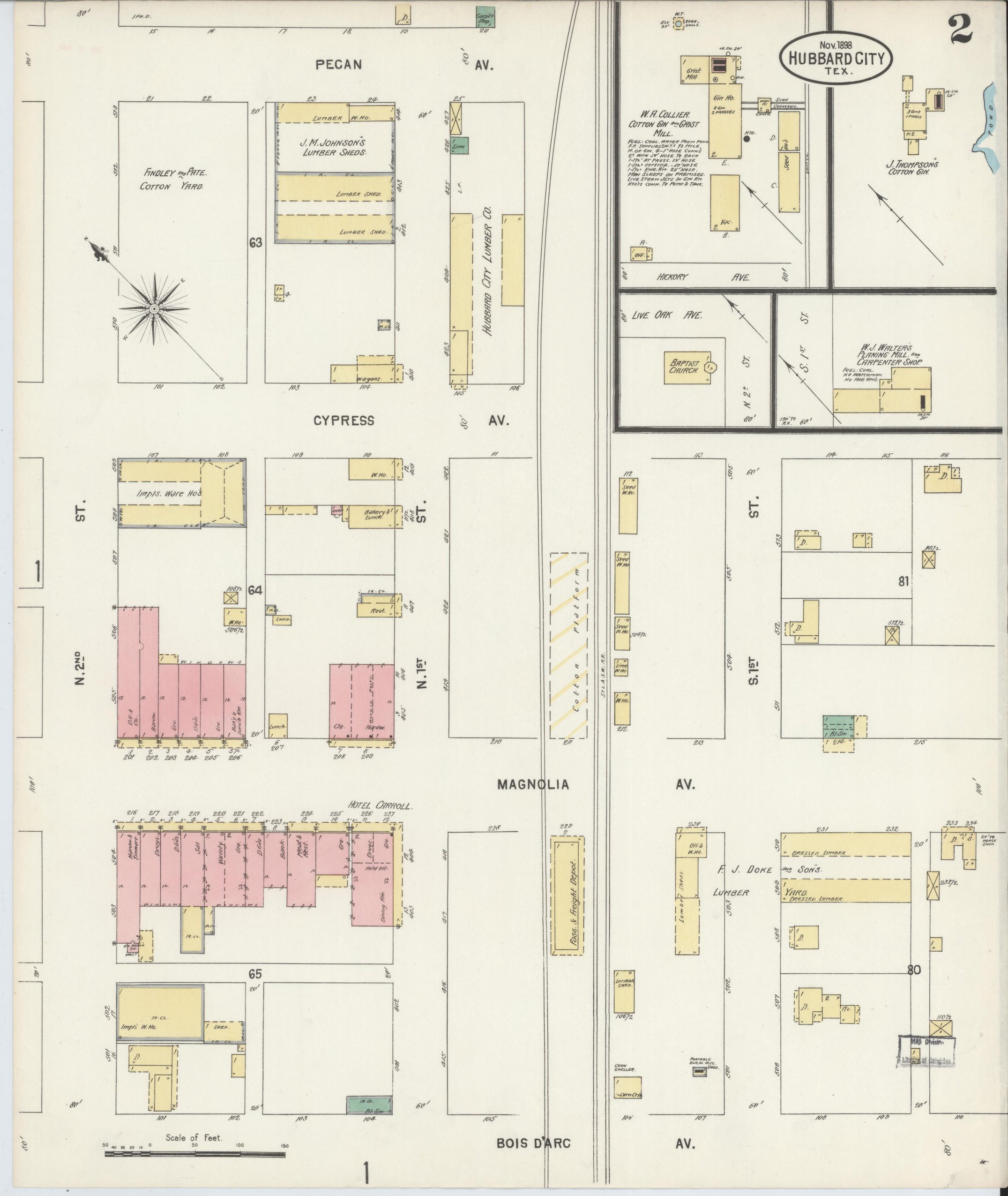
1898
Population 1,200
Population 1,200. The Hubbard City Hotel and the Draper Hotel, Christian and Presbyterian churches, a Public School, R. J. Webb's cotton warehouse, Jones & Alford's cotton yard and W. H. Bass's coal, ice and feed yard.
1904
Population 2,500
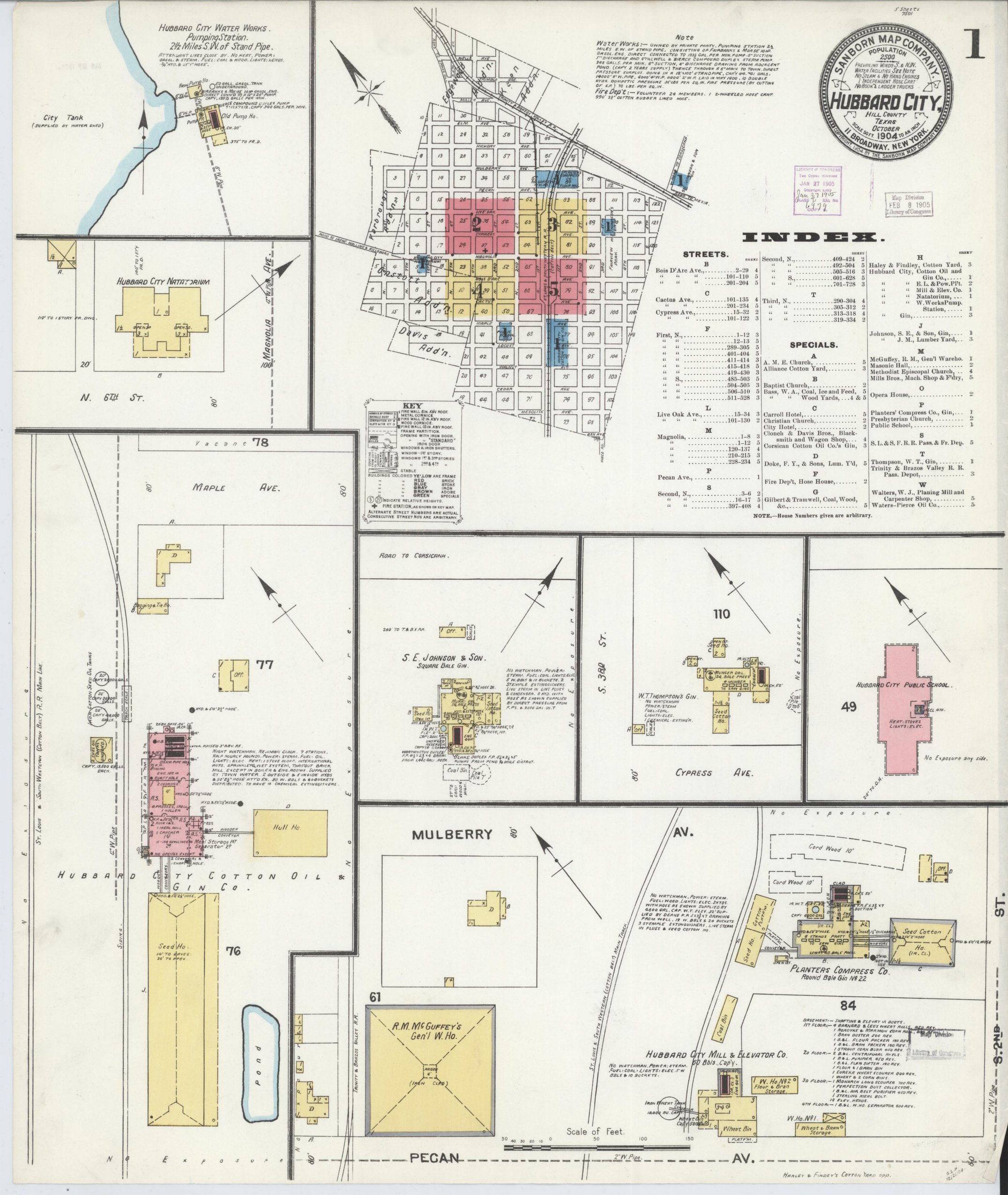
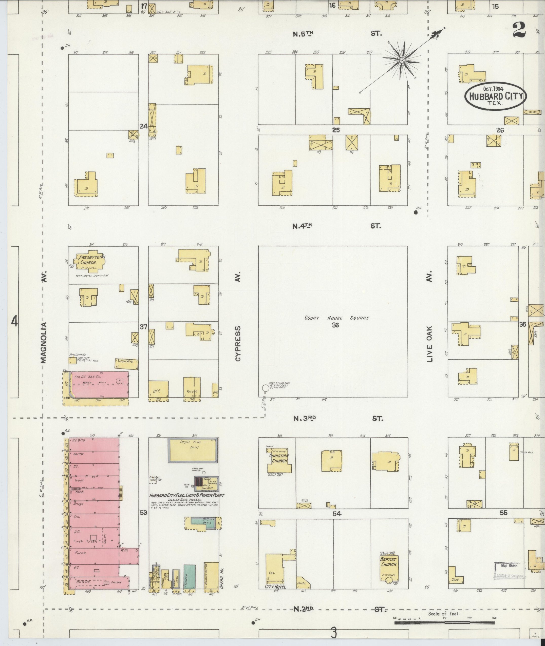
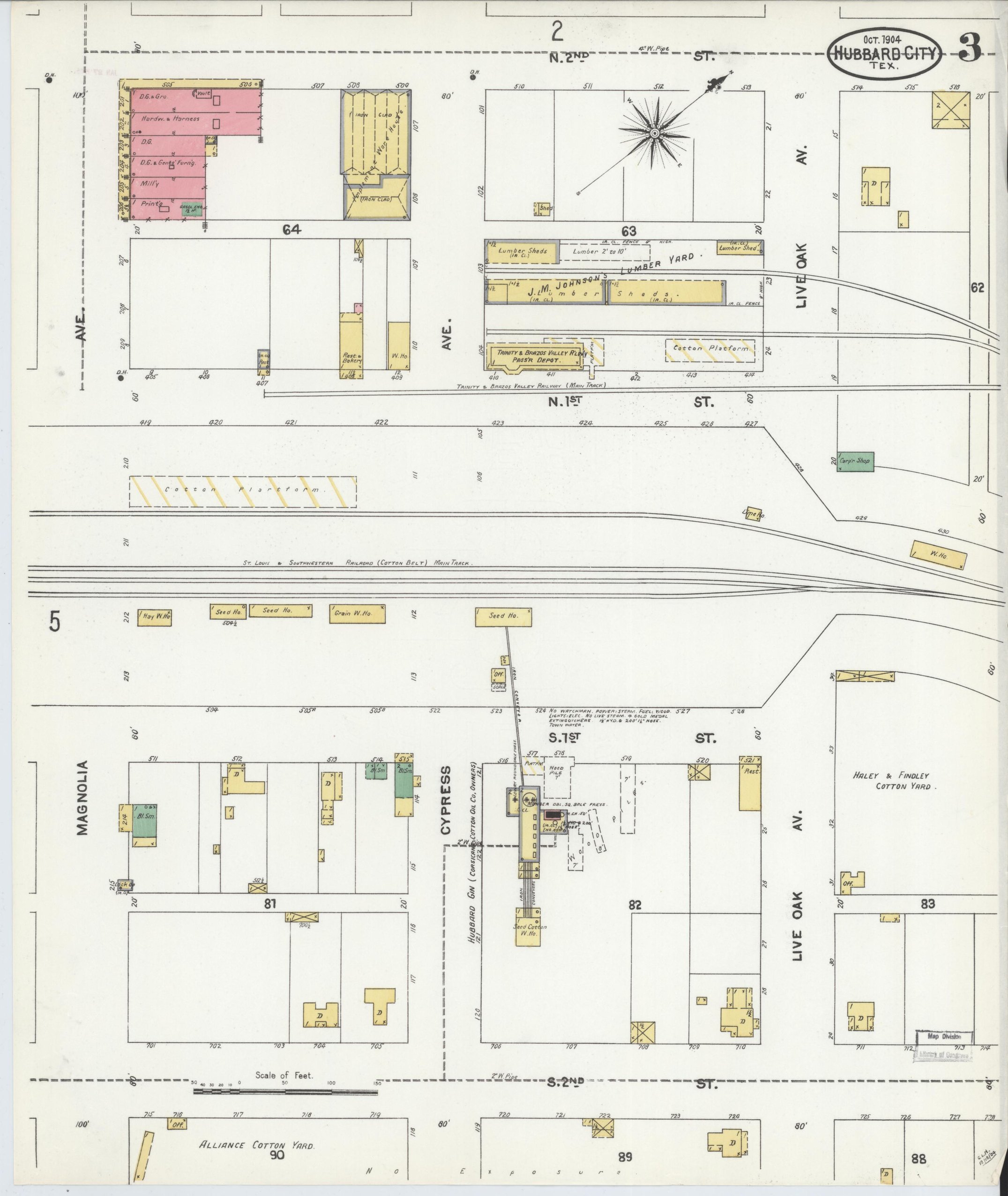
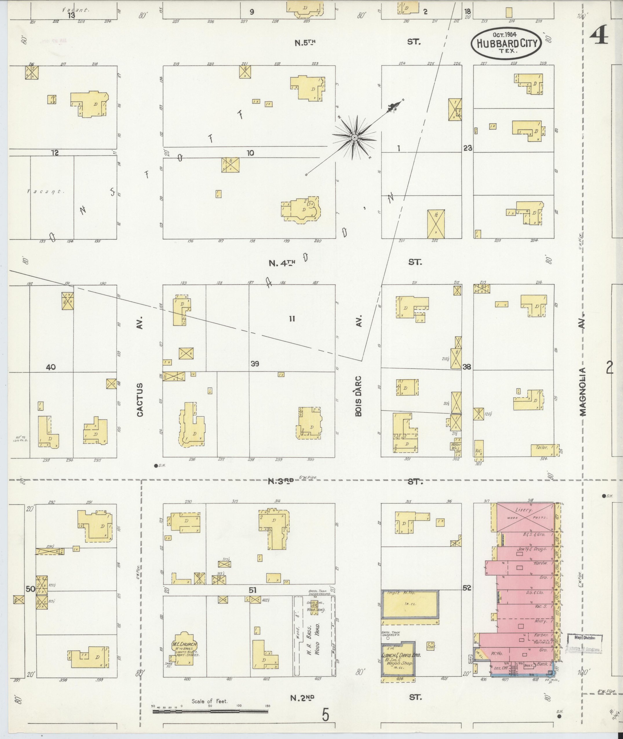
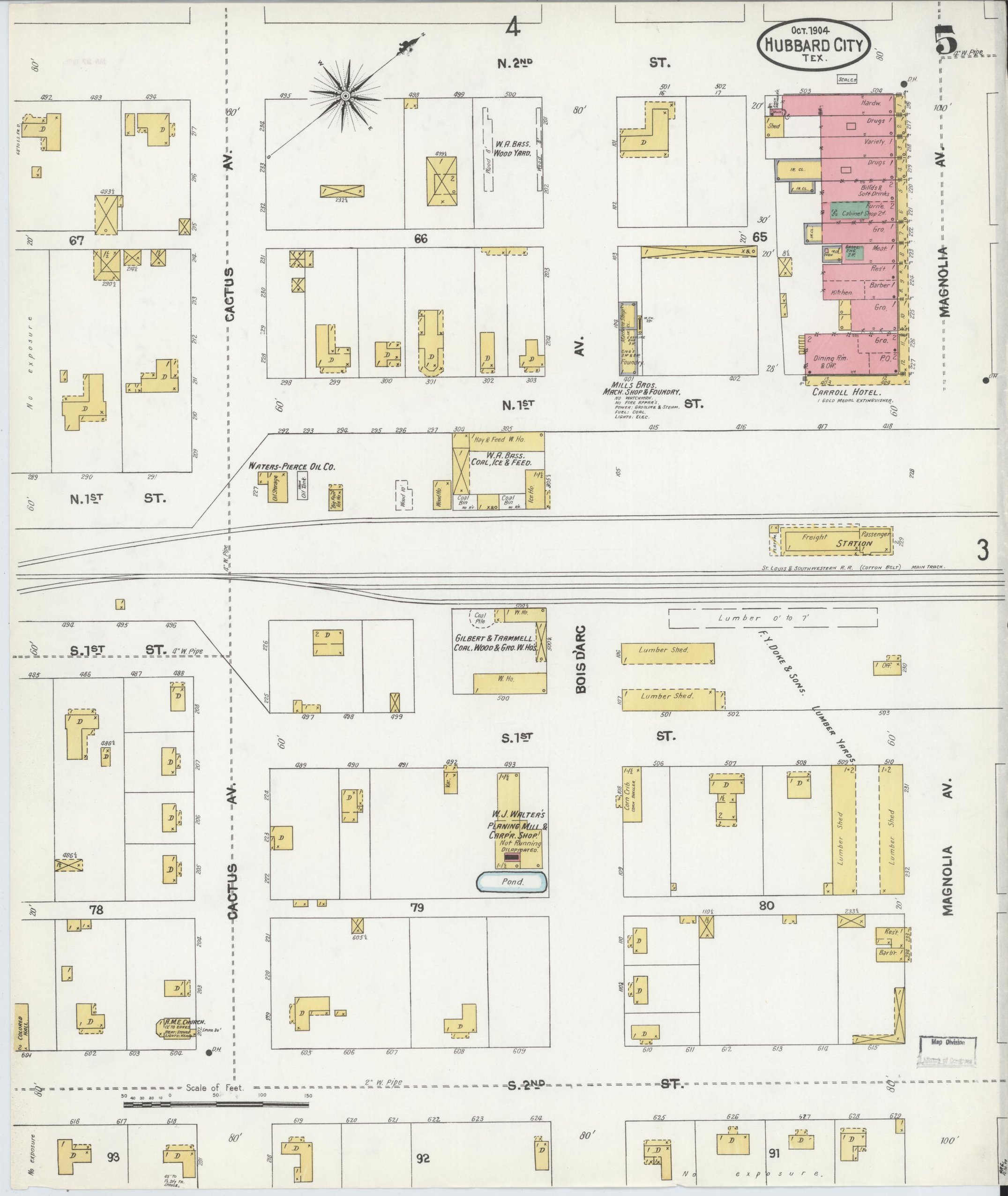
Population has doubled to 2,500. The index adds Hubbard City Water Works, a volunteer fire department with a two-wheeled hose cart, two railroad depots, the Carroll and City hotels, a Masonic hall, an A.M.E. church, and the Hubbard City Natatorium, an indoor pool, the first sign on these sheets of the hot-well trade that follows. Five named gins and the Hubbard City Cotton Oil & Gin Co.
1909
Population 2,500
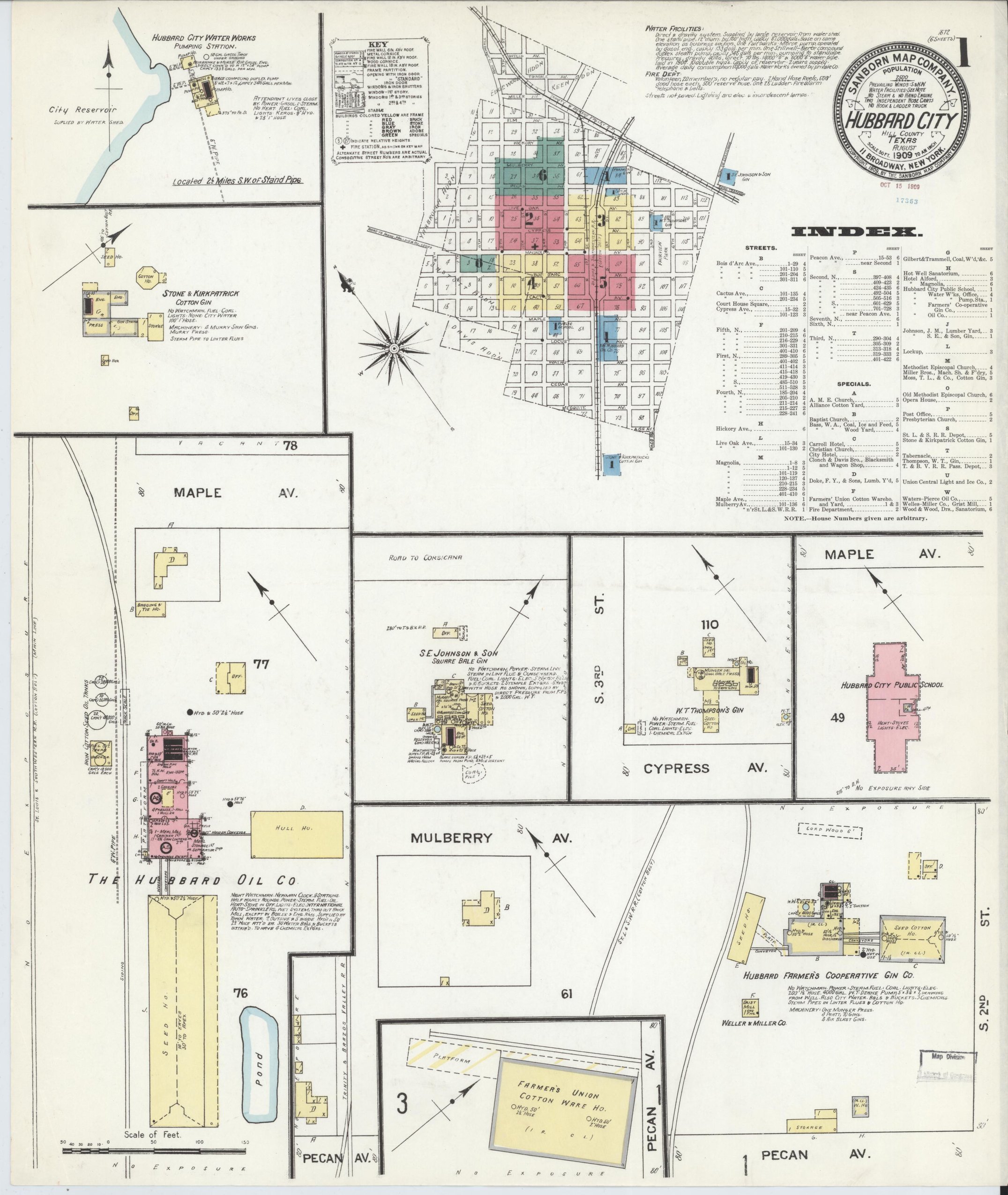
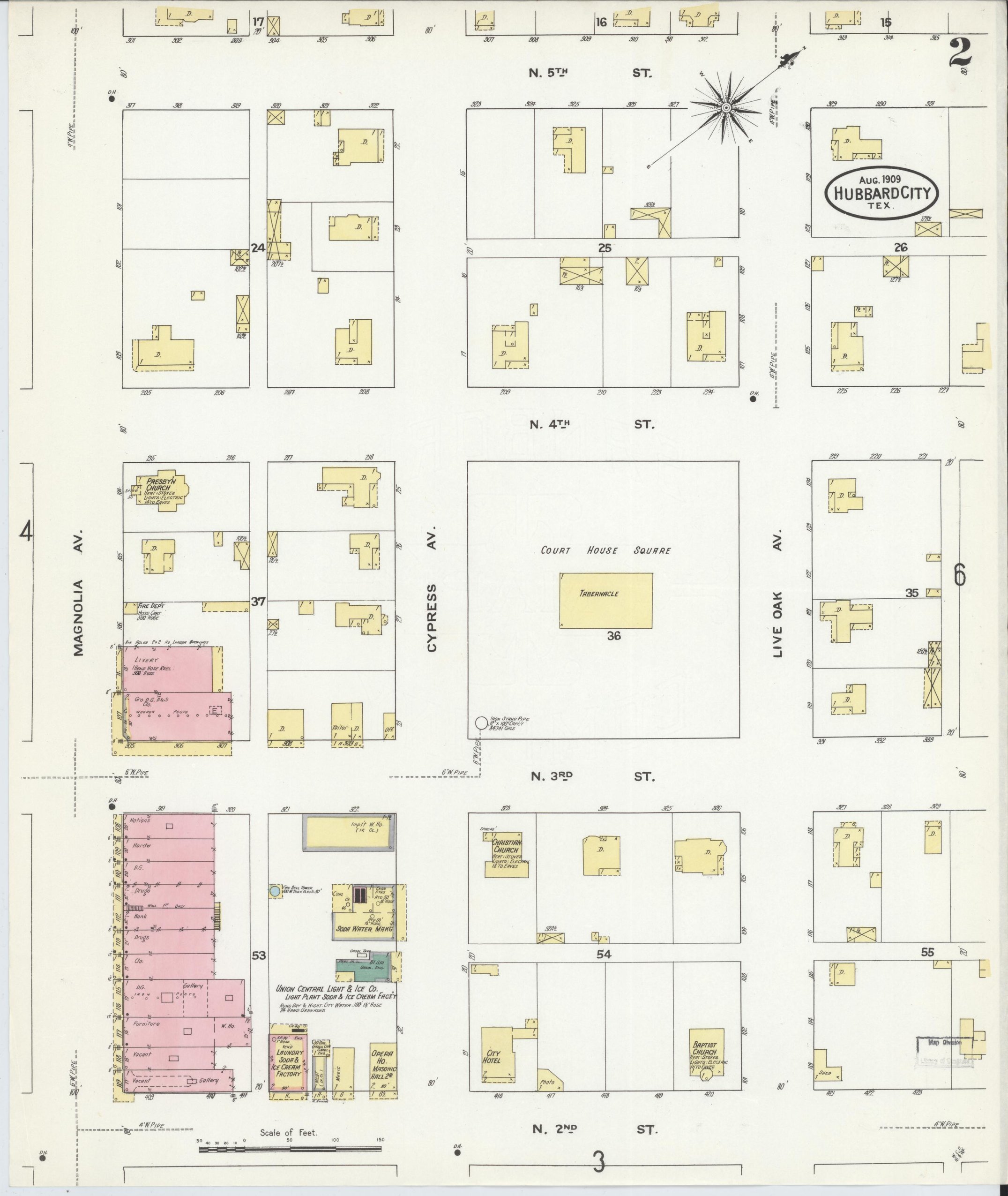
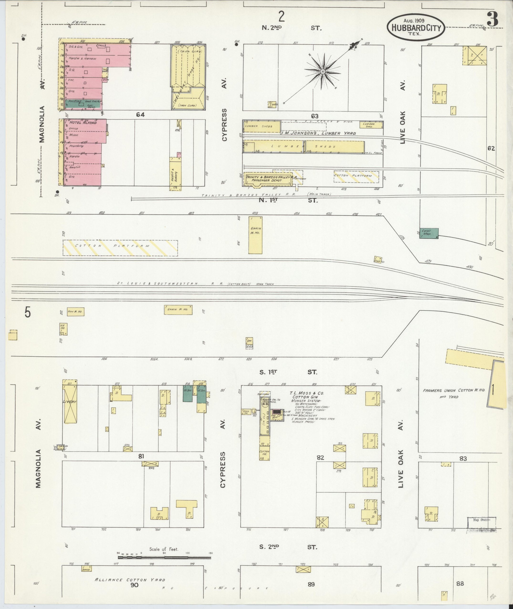
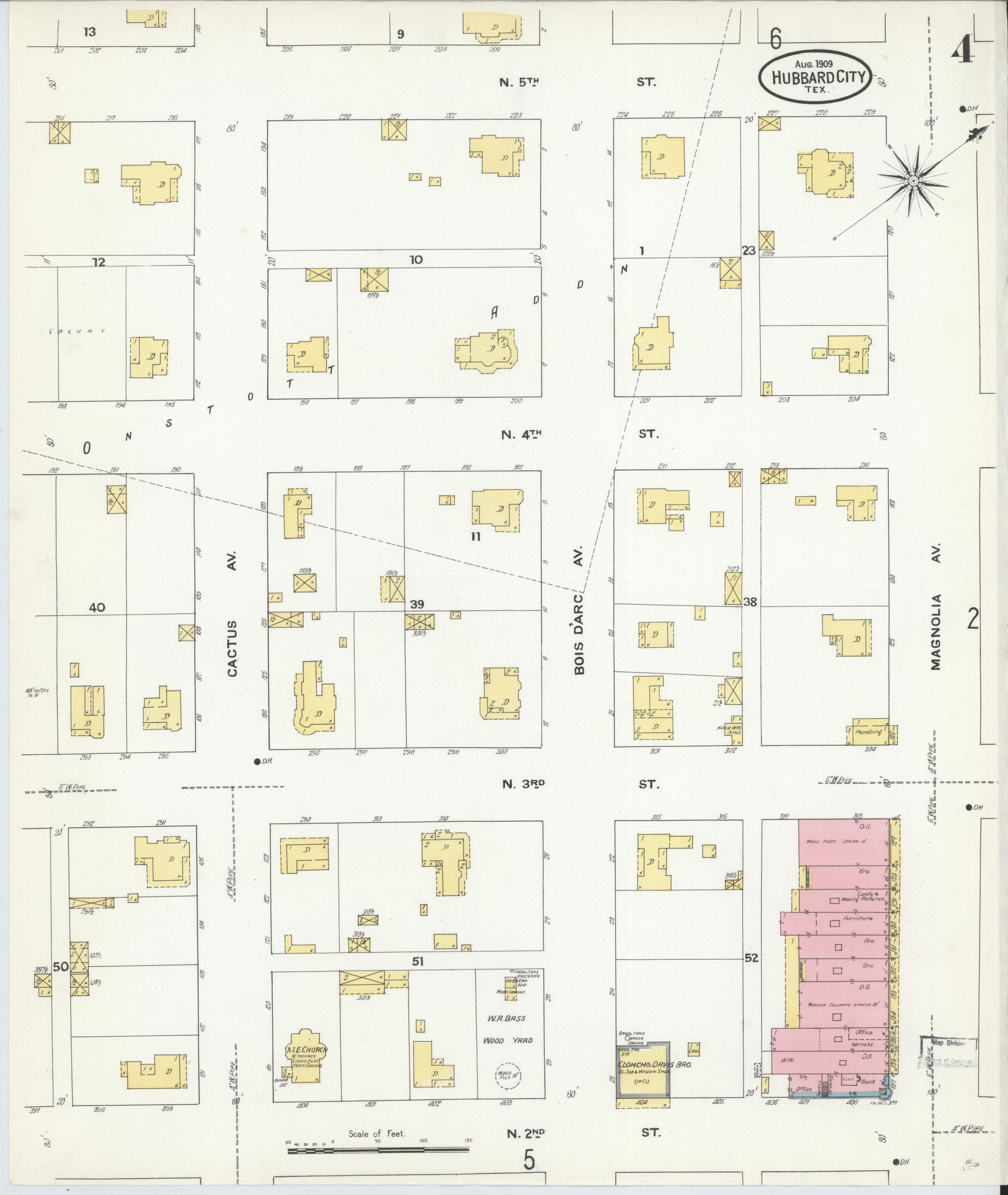
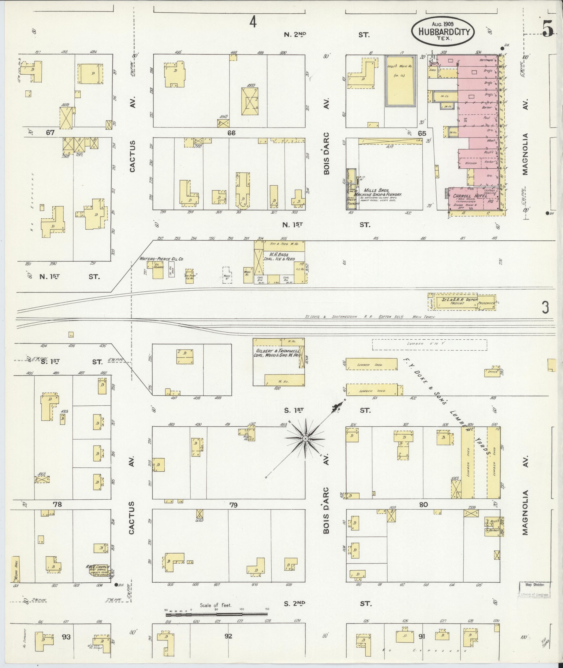
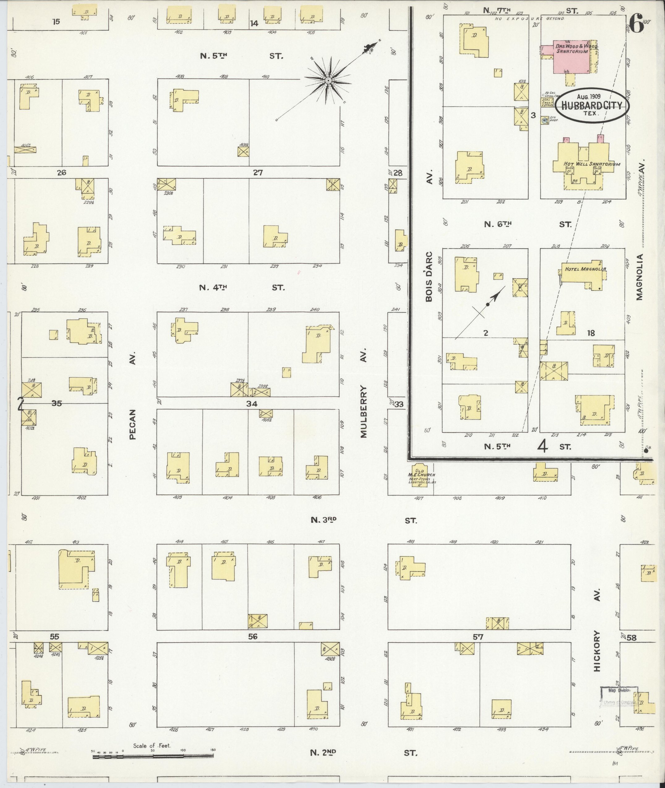
The Hot Well Sanatorium and Wood & Wood, Drs., Sanatorium are both on the index: a mineral-water health-resort town as well as a cotton town. The water works pump from a city reservoir 2½ miles out. The Hubbard Oil Co.'s mill, the Farmers' Co-operative Gin, S. E. Johnson & Son's gin and the Farmers' Union cotton warehouse. An Opera House, a bank on the commercial row, and a "Court House Square" with a tabernacle on it, although the Hill County seat is Hillsboro.
1916
Population 2,300
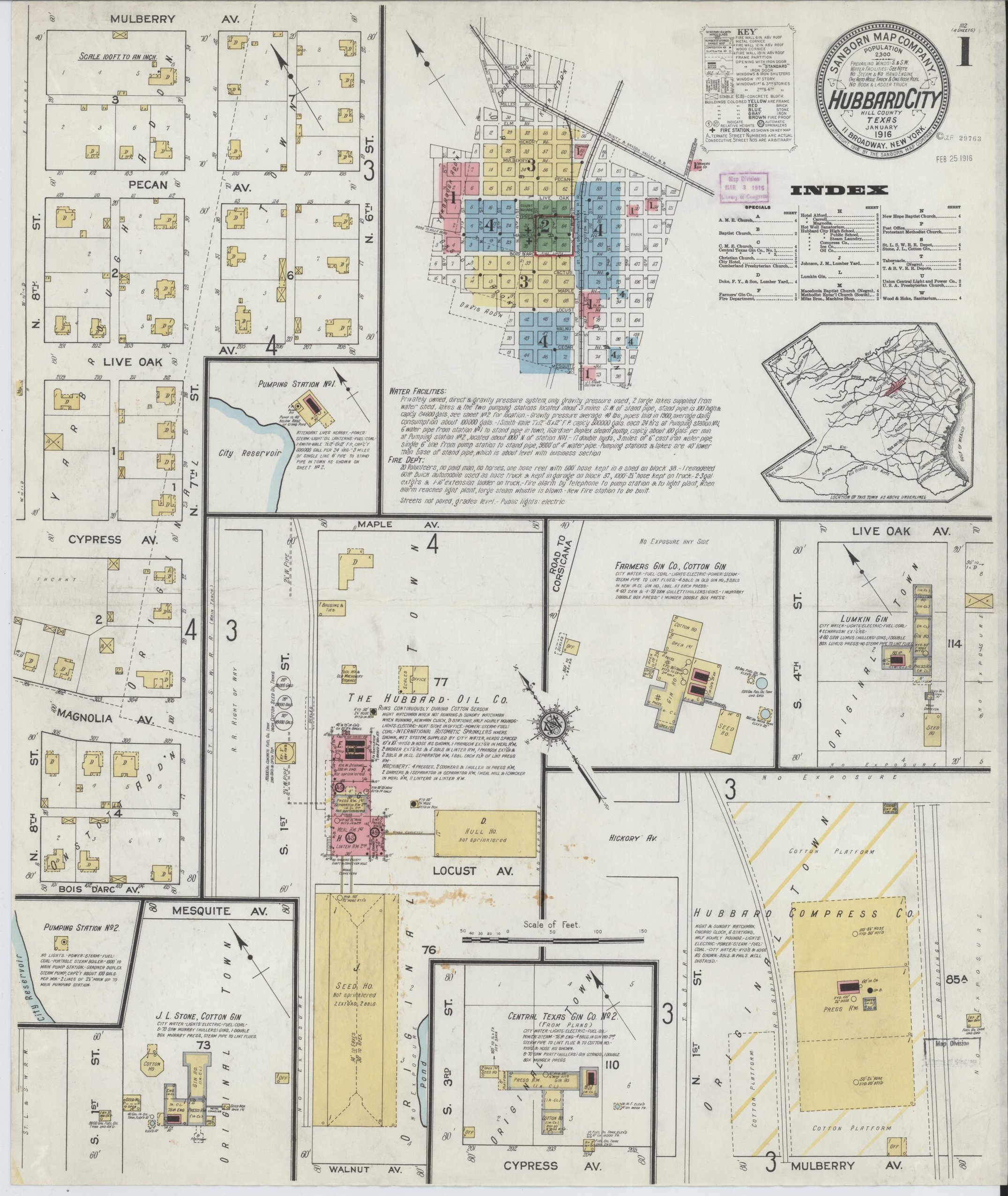
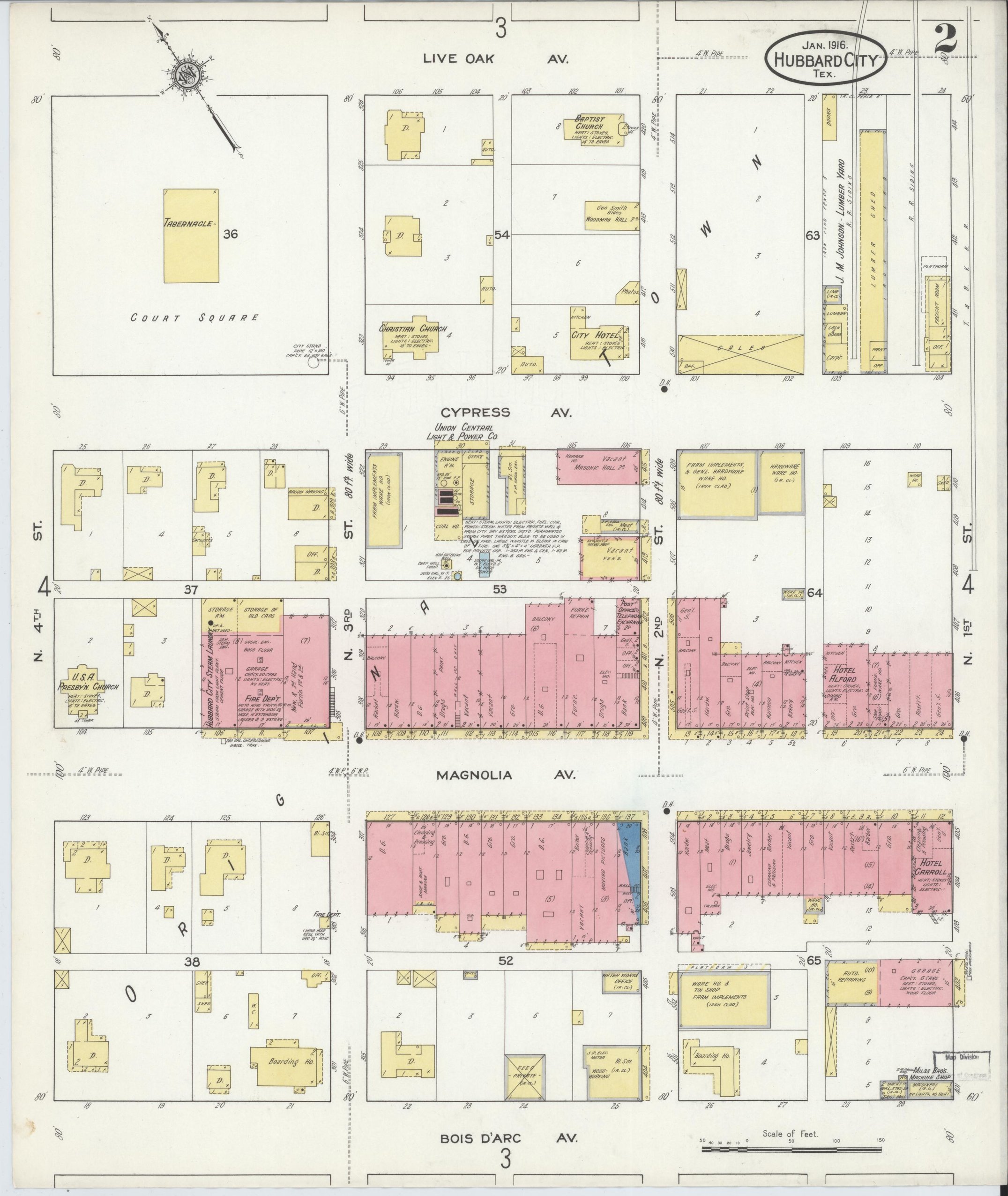
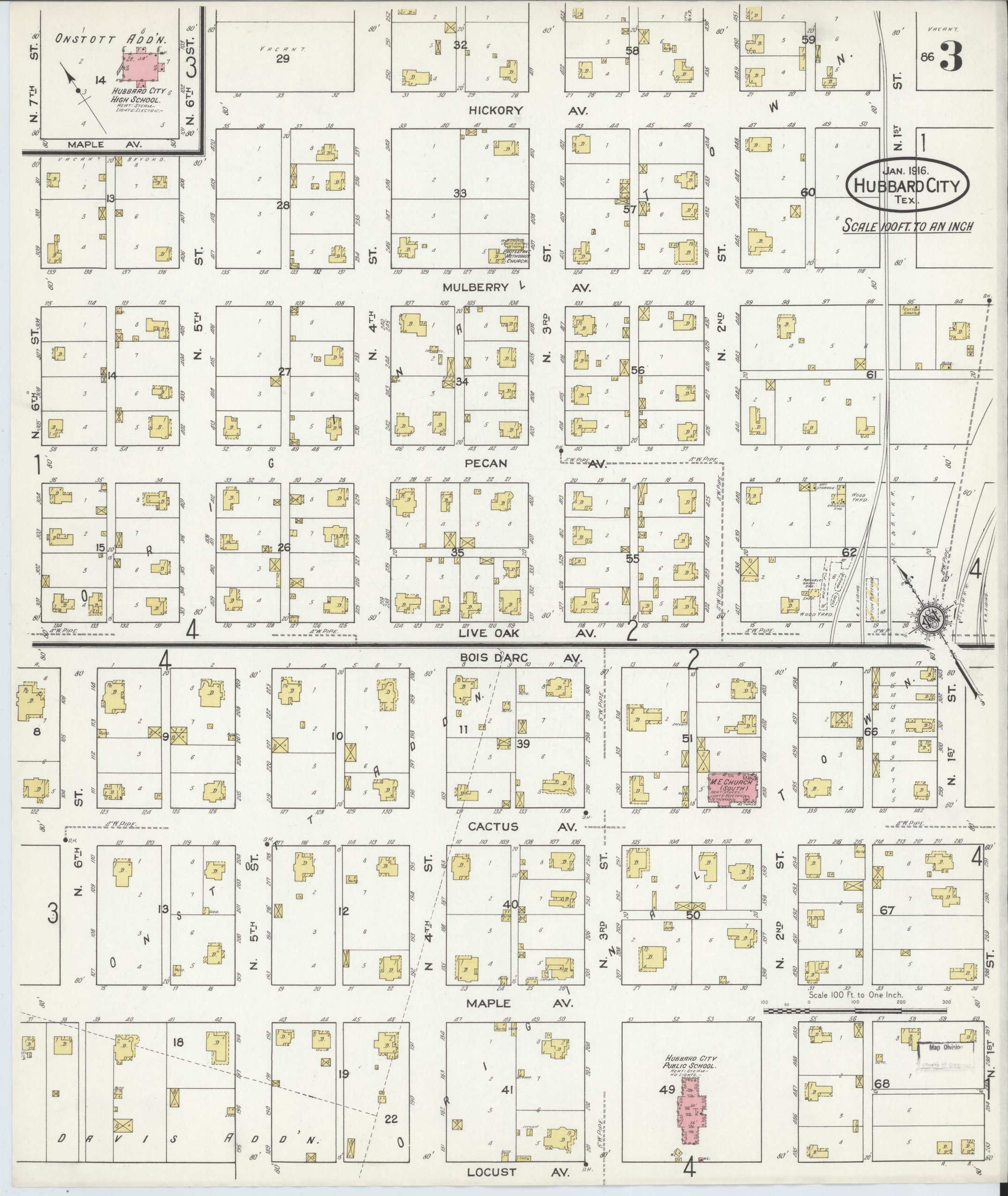
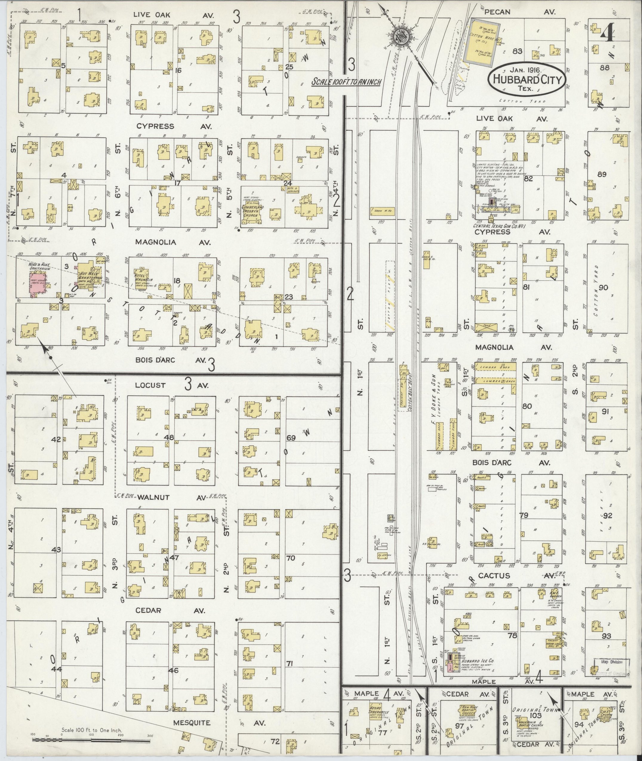
Population 2,300. Two pumping stations and a city reservoir, a 20-man volunteer fire department, and the Hubbard Oil Co., which "runs continuously during cotton season." The Hot Well Sanatorium is still listed. The index names at least seven congregations, among them a Tabernacle and Macedonia Baptist Church, both marked Negro, and New Hope Baptist.
1935
Population 1,900
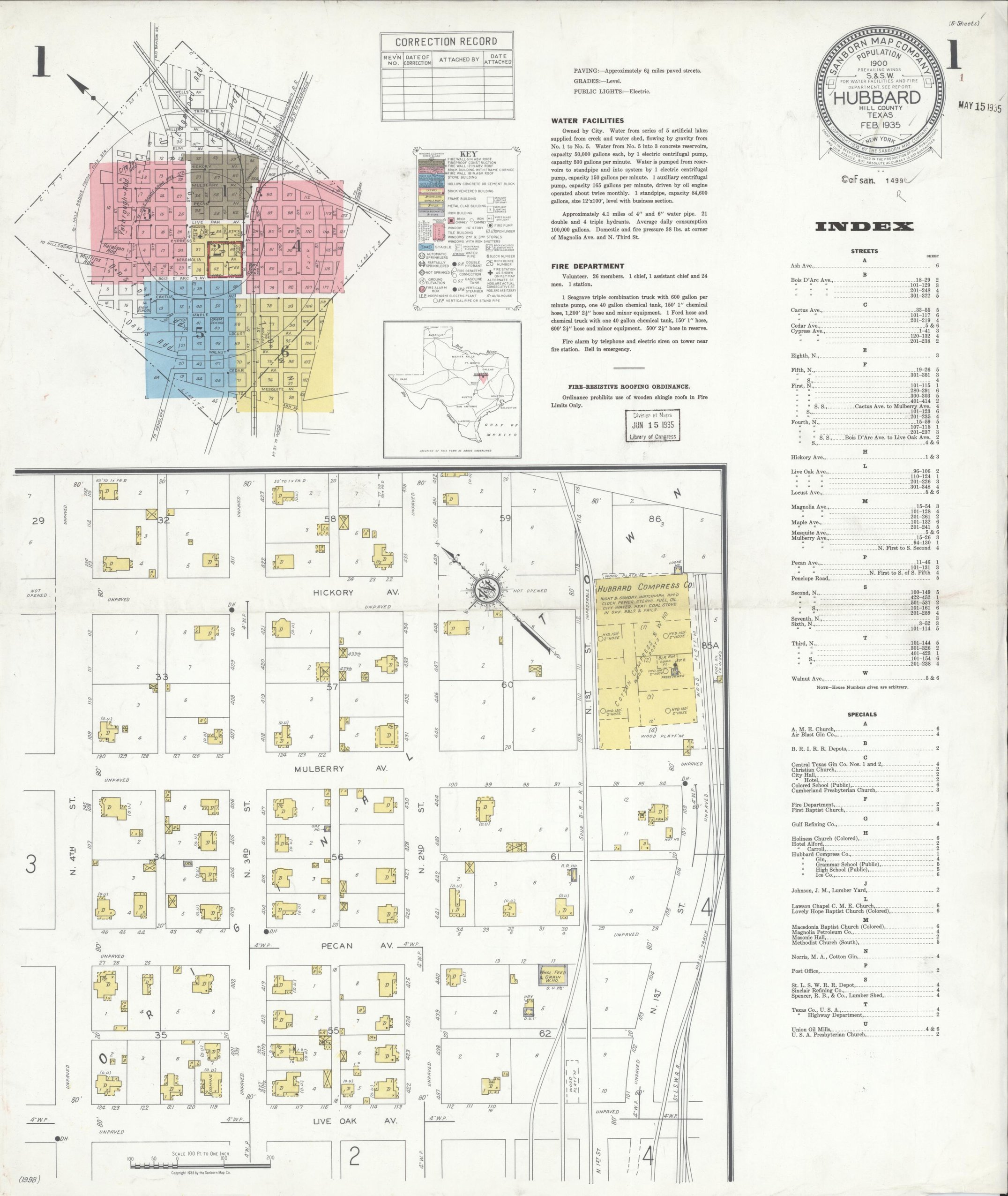
A new survey, and the town is plain "Hubbard" now, population 1,900. About six miles of paved streets, a Seagrave pumper and a Ford hose truck, and filling stations for Texaco, Sinclair, Gulf and Magnolia. The index lists Lawson Chapel C.M.E. Church, a Holiness Church, Macedonia Baptist and Lovely Hope Baptist, those three marked Colored, and a Colored public school alongside the Grammar and High schools.
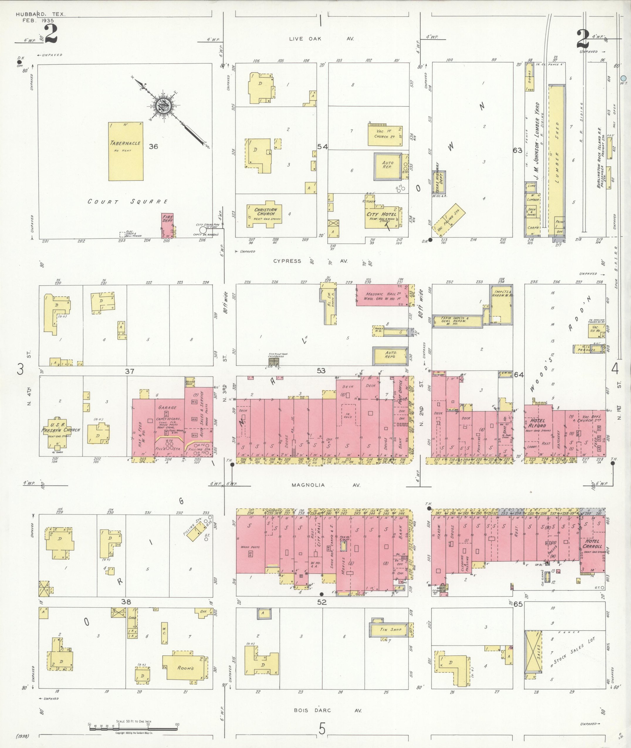
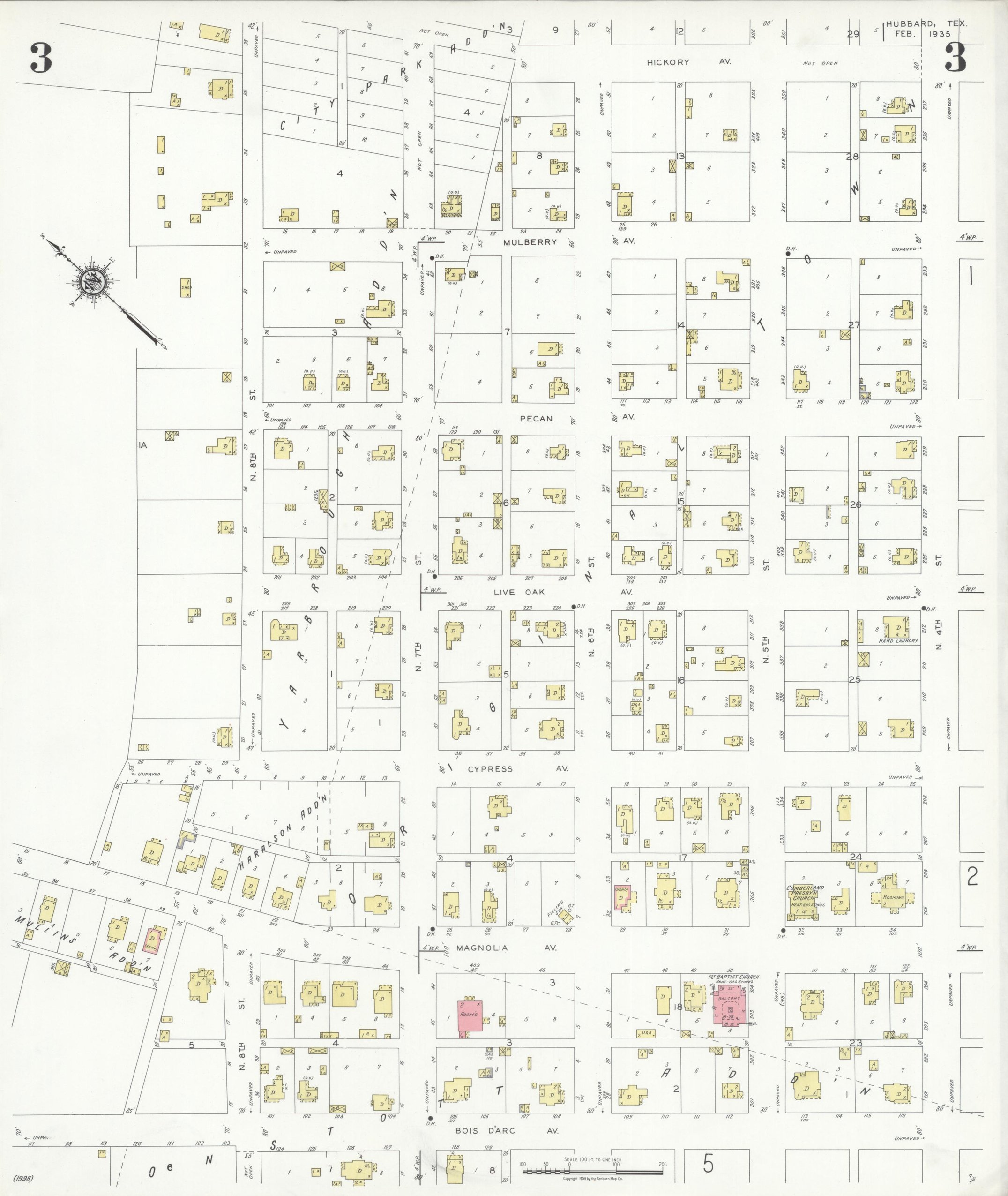
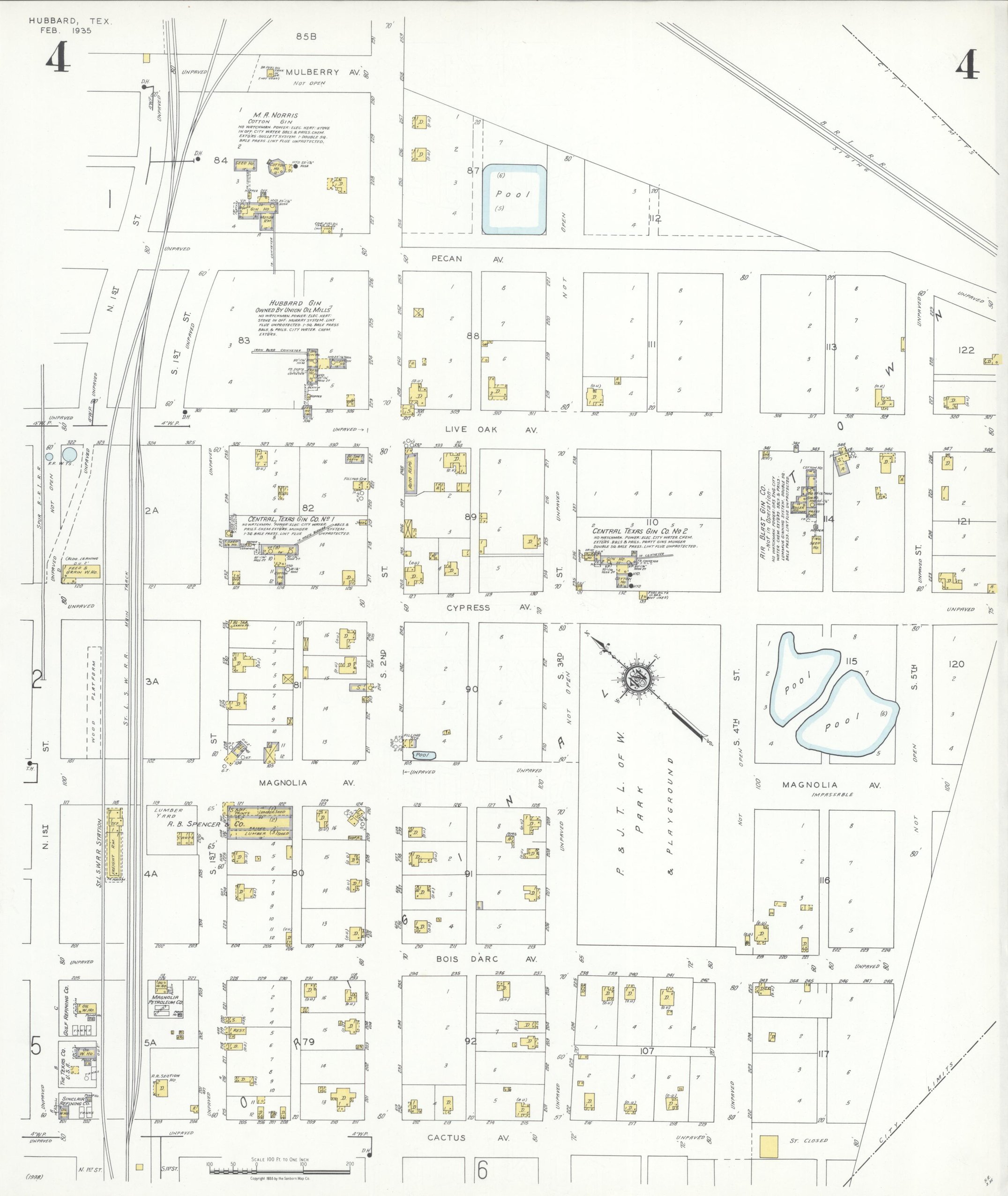
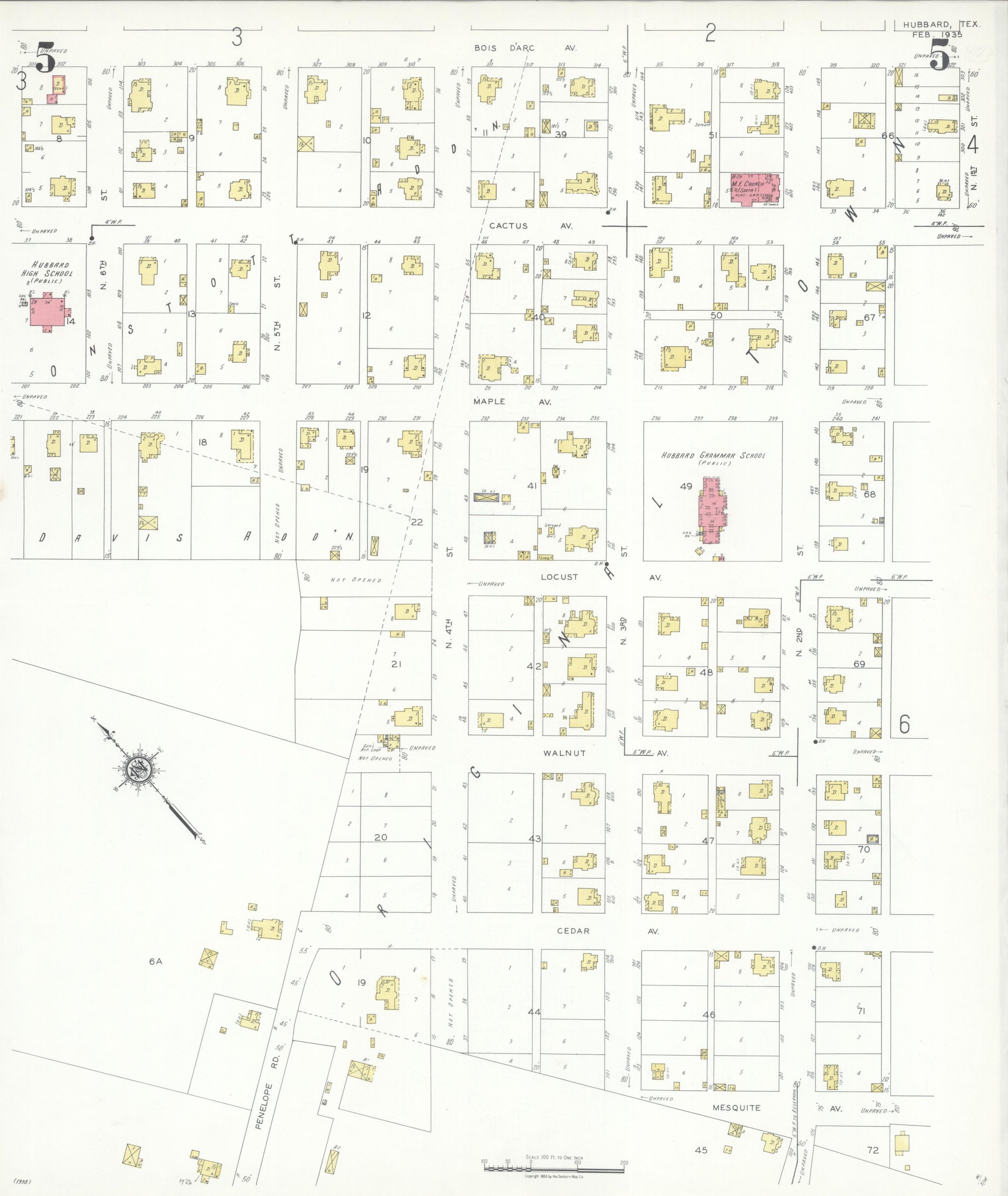
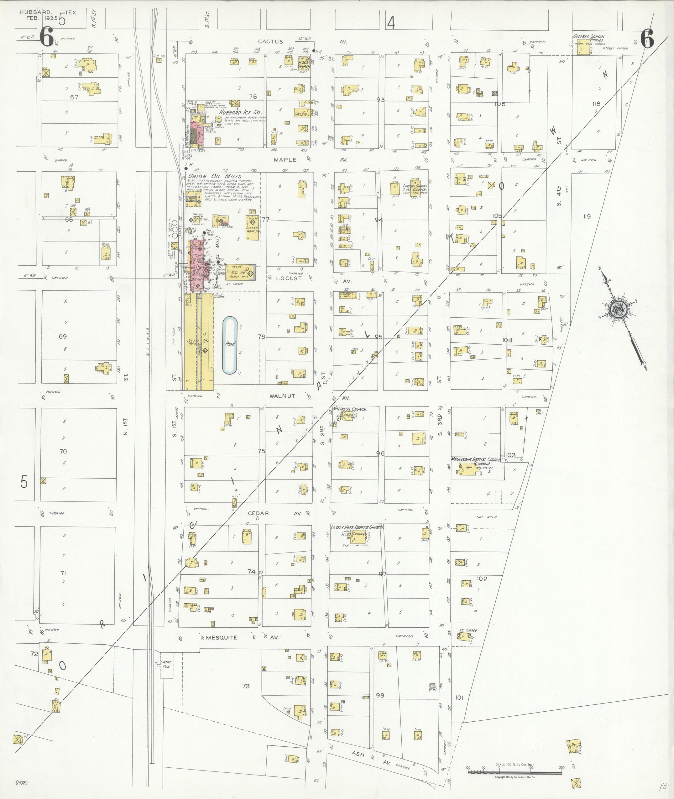
Source: Library of Congress, Sanborn Fire Insurance Map Collection, read 2026-09-24. Public domain.